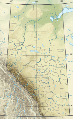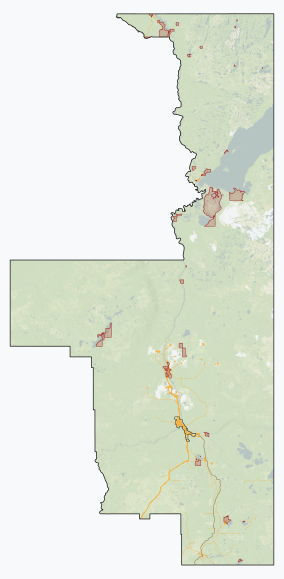
The Athabasca River is a river in Alberta, Canada, which originates at the Columbia Icefield in Jasper National Park and flows more than 1,231 km (765 mi) before emptying into Lake Athabasca. Much of the land along its banks is protected in national and provincial parks, and the river is designated a Canadian Heritage River for its historical and cultural importance. The scenic Athabasca Falls is located about 30 km (19 mi) upstream from Jasper.

Lake Athabasca is in the north-west corner of Saskatchewan and the north-east corner of Alberta between 58° and 60° N in Canada. The lake is 26% in Alberta and 74% in Saskatchewan.
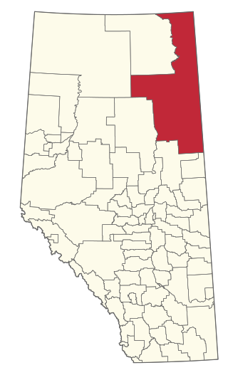
The Regional Municipality of Wood Buffalo is a specialized municipality in northeast Alberta, Canada. It is the largest regional municipality in Canada by area and is home to oil sand deposits known as the Athabasca oil sands.

Mer Bleue Bog is a 33.43 km2 (12.91 sq mi) protected area in Gloucester, Ontario, an eastern suburb of Ottawa in Eastern Ontario, Canada. Its main feature is a sphagnum bog that is situated in an ancient channel of the Ottawa River and is a remarkable boreal-like ecosystem normally not found this far south. Stunted black spruce, tamarack, bog rosemary, blueberry, and cottongrass are some of the unusual species that have adapted to the acidic waters of the bog.
Birch Mountains Wildland Provincial Park is a wildland provincial park in northern Alberta, Canada. The park was established on 20 December 2000 with an area of 144,505 hectares. On 14 May 2018, the park was enlarged slightly to an area of 145,969 hectares. Thye park was created as part of Alberta's "Special Places" initiative. The park is contained in the Lower Athabasca Region Land Use Framework finalized in 2012. It contains a free roaming wood bison herd. The park is named for the Birch Mountains that are partially contained within the boundaries of the park.
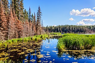
The Mid-Canada Boreal Plains Forests is a taiga ecoregion of Western Canada, designated by One Earth. It was previously defined as the Mid-Continental Canadian Forests by the World Wildlife Fund (WWF) categorization system, before it was modified by One Earth, the successor to WWF.
Kazan Wildland Provincial Park is a wildland provincial park in northern Alberta, Canada. It was established on 14 May 2018 and is a large park with an area of 659,397 hectares (2,546 sq mi). As of January 2023, Kazan is the largest park under Alberta provincial authority. The park was initiated by and is contained in the Lower Athabasca Regional Plan Land Use Framework in August 2012. Two smaller parks, La Butte Creek and Colin-Cornwall Lakes Wildland Provincial Parks, were disestablished and incorporated into Kazan.
Richardson Wildland Park is a wildland provincial park in the Regional Municipality of Wood Buffalo, northern Alberta, Canada. It was established 14 May 2018 and has an area of 312,068 hectares (1,204.90 sq mi). Two previous parks, Maybelle River Wildland Provincial Park and Richardson River Dunes Wildland Provincial Park, established in 1998, were disestablished on 14 May 2018 and the area was incorporated into Richardson Wildland Park. The park is within the Lower Athabasca Region Land Use Framework and managed within the Lower Athabasca Regional Plan.

The Alfred Bog is a domed peat bog in Eastern Ontario, Canada, about 7 kilometres (4.3 mi) south of Alfred and 70 kilometres (43 mi) east of Ottawa. The bog is considered the largest high-quality bog in Southern Ontario, and was designated by the Ontario Ministry of Natural Resources as a "Class 1 Wetland" and an "Area of Natural and Scientific Interest (ANSI)" in 1984. It is home to rare animal species and a healthy moose population.
Bustard Island is Alberta's largest sand island, It is located in Lake Athabasca in the part of the Fidler-Greywillow Wildland Provincial Park. The Lucas Islands lie northeast from the island, the other major island in the park; Burntwood Island lays 11.8 kilometres (7.3 mi) to the north.
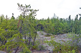
Northern Canadian Shield taiga is a taiga ecoregion located in northern Canada, stretching from Great Bear Lake in the Northwest Territories to Hudson Bay in eastern Nunavut. The region supports conifer forests to its northern edge, where the territory grades into tundra. The open forest in this transition zone is characterized by widely scattered, stunted stands of black spruce and tamarack, with some white spruce. The ecoregion lies over the northwestern extent of the Canadian Shield.
Kitaskino Nuwenëné Wildland Provincial Park is a wildland provincial park in Wood Buffalo, northern Alberta, Canada. Kitaskino, means “our land” in Cree and Nuwenëné means “our land” in Dene; the two languages are spoken by the First Nation communities in the area. The park as created on 8 March 2019 had an area of 161,880 hectares. It was expanded on 26 January 2022 to 314,510 hectares. The park is a successful collaboration between the Mikisew Cree First Nation, the governments of Alberta and Canada, and petroleum industry partners in the area. Teck Resources, Imperial Oil, and Cenovus Energy returned oil leases to the Athabasca oil sands which underlay the area. This enabled the land to be turned into a park. After the initial creation of the park in 2019, the Milisew First Nation worked with Burgess Canadian Resources to relinquished their oilsands leases which led to the addition of 152,000 hectares to the park.
Whitemud Falls Wildland Provincial Park is a wildland provincial park in Wood Buffalo, northern Alberta, Canada. The park was established on 15 November 2000 and has an area of 3,842.55 hectares. The park is part of the Lower Athabasca Regional Plan.
Marguerite River Wildland Provincial Park is a wildland provincial park in Wood Buffalo, northern Alberta, Canada. The park was established on 20 December 2000 and has an area of 196,301.9 hectares (757.9 sq mi). The park is part of the Lower Athabasca Regional Plan. The park was named for the Marguerite River that flows thru the park and forms a portion of the park's western boundary. The park was originally created in 1998 as Marguerite Crag and Tail Wildland Provincial Park. It was reformed and renamed in 2000.
Fort Assiniboine Sandhills Wildland Provincial Park is a wildland provincial park in Woodlands County, Alberta, Canada. The park is 7,903 hectares in area and was established in 1997. The park is contained in the Upper Athabasca Land Use Framework. The park is managed through the Fort Assiniboine Sandhills Wildland Provincial Park Management Plan. The Klondike Trail passes through the western section of the park for about five kilometres (3 mi). This trail was first established in 1824–1825 as a portage between Fort Edmonton on the North Saskatchewan River and Fort Assiniboine on the Athabasca River. The portage was part of the York Factory Express, a 19th-century fur brigade route of the Hudson's Bay Company from Fort Vancouver on the Columbia River to York Factory on Hudson Bay. The trail was revived again during the Klondike Gold Rush in 1897–1899 as part of the overland route to the Klondike gold fields near Dawson City, Yukon. Today, the section of the Klondike Trail within the park extends north of the Klondike Trail Staging Area and includes the ruins of a trapper's cabin and the gravesite of a child who died during trek.
Grizzly Ridge Wildland Provincial Park is a wildland provincial park in northern Alberta, Canada. The park was established on 14 April 1999 and has an area of 10,706.07 hectares. The park is included in the Upper Athabasca Region Land Use Framework.
La Biche River Wildland Provincial Park is a wildland provincial park in northern Alberta, Canada. The park was established on 6 June 2000 and had an area of 16,843.975 hectares. It was expanded on 8 August 2001 to an area of 17,545.251 hectares. The park is included in the Upper Athabasca Region Land Use Framework.
Otter-Orloff Lakes Wildland Provincial Park is a wildland provincial park in northern Alberta, Canada. The park was established on 15 December 2000 and has an area of 6,948 hectares. The park is included in the Upper Athabasca Region Land Use Framework. The park surrounds Orloff Lake and Otter Lake is named for the two lakes contained within the park.

