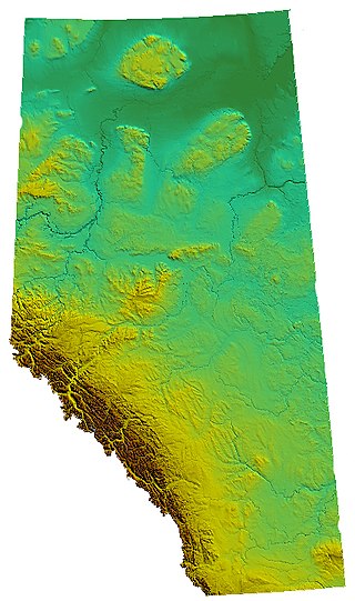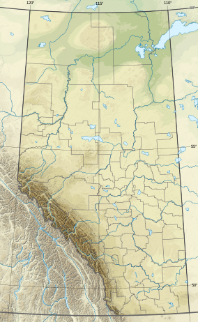
Alberta is one of the thirteen provinces and territories of Canada. Located in Western Canada, the province has an area of 661,190 km2 (255,290 sq mi) and is bounded to the south by the United States state of Montana along 49° north for 298 km (185 mi); to the east at 110° west by the province of Saskatchewan for 1,223 km (760 mi); and at 60° north the Northwest Territories for 644 km (400 mi). The southern half of the province borders British Columbia along the Continental Divide of the Americas on the peaks of the Rocky Mountains, while the northern half borders British Columbia along the 120th meridian west. Along with Saskatchewan it is one of only two landlocked provinces or territories.

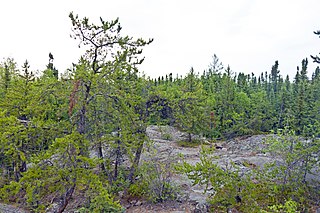
The Boreal Shield Ecozone, as defined by the Commission for Environmental Cooperation (CEC), is the largest ecozone in Canada. Covering 1.8 million square kilometres it covers almost 20% of Canada's landmass, stretching from northern Saskatchewan to Newfoundland.
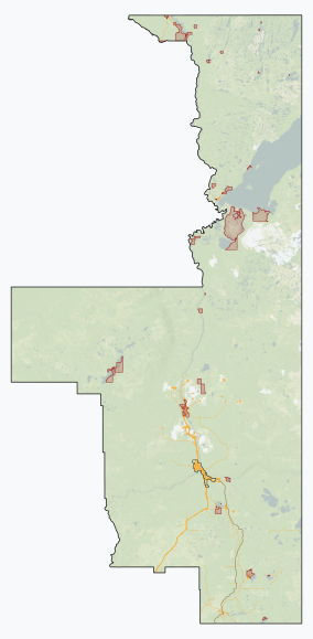
Chinchaga Wildland Provincial Park is a wildland provincial park in northwestern Alberta, Canada. The park is a 802.7 square kilometres (310 sq mi) environmentally protected tract of land within the 5,000 km2 (1,900 sq mi) of the greater Chinchaga wilderness area. It is a disjunct outlier of the Foothills Natural Region of Alberta. It was established on 15 December 1999. The greater Chinchaga area was identified in 1995 as an Environmentally Significant Area. It was designated by the Alberta Government as a protected area under the "Special Places" program. The park is administered by the Upper Peace Land Use Framework.

The Boreal Plains Ecozone, as defined by the Commission for Environmental Cooperation (CEC), is a terrestrial ecozone in the western Canadian provinces of Manitoba, Saskatchewan and Alberta. It also has minor extensions into northeastern British Columbia and south-central Northwest Territories. The region extends over 779,471 km2, of which 58,981 km2 is conserved.
Birch Mountains Wildland Provincial Park is a wildland provincial park in northern Alberta, Canada. The park was established on 20 December 2000 with an area of 144,505 hectares. On 14 May 2018, the park was enlarged slightly to an area of 145,969 hectares. The park is contained in the Lower Athabasca Region Land Use Framework finalized in 2012. It contains a free roaming wood bison herd. The park is named for the Birch Mountains that are partially contained within the boundaries of the park.
Kazan Wildland Provincial Park is a wildland provincial park in northern Alberta, Canada. It was established on 14 May 2018 and is a large park with an area of 659,397 hectares (2,546 sq mi). As of January 2023, Kazan is the largest park under Alberta provincial authority. The park was initiated by and is contained in the Lower Athabasca Regional Plan Land Use Framework in August 2012. Two smaller parks, La Butte Creek and Colin-Cornwall Lakes Wildland Provincial Parks, were disestablished and incorporated into Kazan.
Richardson Wildland Park is a wildland provincial park in the Regional Municipality of Wood Buffalo, northern Alberta, Canada. It was established 14 May 2018 and has an area of 312,068 hectares (1,204.90 sq mi). Two previous parks, Maybelle River Wildland Provincial Park and Richardson River Dunes Wildland Provincial Park, established in 1998, were disestablished on 14 May 2018 and the area was incorporated into Richardson Wildland Park. The park is within the Lower Athabasca Region Land Use Framework and managed within the Lower Athabasca Regional Plan.
Hubert Lake Wildland Provincial Park is a wildland provincial park in central Alberta, Canada. The park was established on 4 October 2000 and has an area of 9,665.46 hectares. The park is included in the Upper Athabasca Region Land Use Framework.

Northern Canadian Shield taiga is a taiga ecoregion located in northern Canada, stretching from Great Bear Lake in the Northwest Territories to Hudson Bay in eastern Nunavut. The region supports conifer forests to its northern edge, where the territory grades into tundra. The open forest in this transition zone is characterized by widely scattered, stunted stands of black spruce and tamarack, with some white spruce. The ecoregion lies over the northwestern extent of the Canadian Shield.

Bluerock Wildland Provincial Park is a wildland provincial park located in Kananaskis Improvement District, Alberta, Canada. It was established on 24 July 2001 and has an area of 12,719.59 hectares. The park was named for the Bluerock Creek that flows through and forms part of the western boundary of the park and Bluerock Mountain which is the creek's source. The park is included in the South Saskatchewan Region land use framework and administered by the South Saskatchewan Regional Plan. Sheep River Provincial Park and Bluerock Wildland Provincial Park are managed under the same Management Plan.
Birch River Wildland Provincial Park is a wildland provincial park in northern Alberta, Canada. It was established on 14 May 2018 and covers 331,832 hectares (1,281.2 sq mi).The park is contained in the Lower Athabasca Region Land Use Framework finalized in 2012. The park is named for the Birch River that flows through it.
Bob Creek Wildland Provincial Park is a wildland provincial park located in the Municipal District of Ranchland, in southern Alberta, Canada. It was established on 12 May 1999, modified slightly on 24 June 2003, and is 20,777.69 hectares in area. The park is included in the South Saskatchewan Region Land Use Framework and administered by the South Saskatchewan Regional Plan. Because they are so intertwined, Bob Creek Wildland and Black Creek Heritage Rangeland are managed through the same Management Plan. The park gets its name from the Bob Creek that runs through the center of the park and drains the surrounding hills.
Brazeau Canyon Wildland Provincial Park is a wildland provincial park in Yellowhead County, central Alberta, Canada. The park has an area of 5,039.32 hectares and was created on 20 December 2000. The park is named for the valley in which flows the Brazeau River.
Grizzly Ridge Wildland Provincial Park is a wildland provincial park in northern Alberta, Canada. The park was established on 14 April 1999 and has an area of 10,706.07 hectares. The park is included in the Upper Athabasca Region Land Use Framework.
La Biche River Wildland Provincial Park is a wildland provincial park in northern Alberta, Canada. The park was established on 6 June 2000 and had an area of 16,843.975 hectares. It was expanded on 8 August 2001 to an area of 17,545.251 hectares. The park is included in the Upper Athabasca Region Land Use Framework.
Lesser Slave Lake Wildland Provincial Park is a wildland provincial park in central Alberta, Canada. The park was established on 7 February 2001 and has an area of 3,581.450 hectares. The park is included in the Upper Athabasca Region Land Use Framework.
Otter-Orloff Lakes Wildland Provincial Park is a wildland provincial park in northern Alberta, Canada. The park was established on 15 December 2000 and has an area of 6,948 hectares. The park is included in the Upper Athabasca Region Land Use Framework. The park surrounds Orloff Lake and Otter Lake is named for the two lakes contained within the park.
Rock Lake–Solomon Creek Wildland Provincial Park is a wildland provincial park in west-central Alberta, Canada. The park was established on 20 December 2000 and has an area of 34,682.9 hectares. The park is included in the Upper Athabasca Region Land Use Framework. The park is named for the local lake and creek within the boundaries of the park.
Whitehorse Wildland Provincial Park is a wildland provincial park in west-central Alberta, Canada. The park was established on 26 August 1998 and had an area of 17,439.886 hectares. On 23 July 2002, the area was changed slightly to 17,325.54 ha. The park is included in the Upper Athabasca Region Land Use Framework. The park is named for the creek within the boundaries of the park.
Winagami Wildland Provincial Park is a wildland provincial park in northern Alberta, Canada. The park was established on 26 August 1998 and has an area of 17,439.886 hectares. The park is included in the Upper Athabasca Region Land Use Framework. The park is named for Winagami Lake which is adjacent to the park.


