
Wabamun is a hamlet in central Alberta, Canada within Parkland County. It is approximately 67 kilometres (42 mi) west of Edmonton on Highway 16. It held village status prior to 2021.

Division No. 13 is a census division in Alberta, Canada. The majority of the division is located in the north-central portion of central Alberta, while the northeast portion of the division is located within northern Alberta. The division's largest urban community is the Town of Whitecourt.
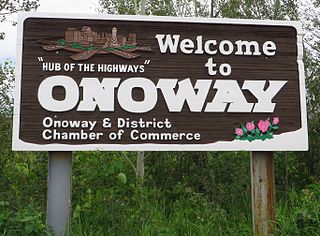
Onoway is a small town in central Alberta, Canada. It is approximately 60 km (37 mi) northwest of Edmonton at the junction of Highway 37 and Highway 43. The mayor is Len Krasny.
Alberta Beach is a village in central Alberta, Canada, west of Edmonton. It is located on the southeast shore of Lac Ste. Anne, approximately 8 km (5.0 mi) west of Highway 43 and 2 km (1.2 mi) north of Highway 633.

Donnelly is a village in northern Alberta, Canada within the Municipal District of Smoky River No. 130. It is located near the intersection of Highway 2 and Highway 49, located approximately 65 km (40 mi) south of Peace River and 427 km (265 mi) northwest of Edmonton.

Lac Ste. Anne County is a municipal district in central Alberta, Canada.

Wildwood is a hamlet in west-central Alberta, Canada within Yellowhead County. It is on the Yellowhead Highway, approximately 112 kilometres (70 mi) west of Edmonton and 82 kilometres (51 mi) east of Edson. The Yellowhead Highway's intersection with Cowboy Trail is 9 kilometres (5.6 mi) east of the hamlet. The Lobstick River, which flows from Chip Lake to the west, runs through the hamlet.
Ross Haven is a summer village in Alberta, Canada. It is located on the northern shore of Lac Ste. Anne, south of Highway 43.
Birch Cove is a summer village in Alberta, Canada. It is located between Highway 33 and Lac la Nonne, 99 kilometres (62 mi) northwest of Edmonton.
Bondiss is a summer village in Alberta, Canada. It is located at the eastern tip of Skeleton Lake, between Boyle and Lac La Biche.
Sunset Point is a summer village in Alberta, Canada. It is located on the eastern shore of Lac Ste. Anne and north of Alberta Beach.
Val Quentin is a summer village in Alberta, Canada. It is located on the southern shore of Lac Ste. Anne.
West Cove is a summer village in Alberta, Canada. It is located on the southern shore of Lac Ste. Anne.
Yellowstone is a summer village in Alberta, Canada. It is developed on the northern shore of Lac Ste. Anne, south of Alberta Highway 43, between Ross Haven and Gunn, 78 kilometres (48 mi) from Edmonton.

Betula Beach is a summer village on Wabamun Lake in Alberta, Canada.

Bonnyville Beach is a summer village in Alberta, Canada. It is located in the Municipal District of Bonnyville No. 87.
Island Lake is a summer village in Alberta, Canada. It is located on the western shore of Island Lake, along Highway 2, northwest of Athabasca.
Island Lake South is a summer village in Alberta, Canada. It is located on the southern shore of Island Lake, along Highway 2, northwest of Athabasca.
Silver Beach is a summer village in Alberta, Canada. It is located on the eastern shore of Pigeon Lake, west from Wetaskiwin.
Gunn is a hamlet in Alberta, Canada within Lac Ste. Anne County. It is located west of the junction of Highway 43 and Highway 33 on the northeast shore of Lac Ste. Anne. It is approximately 58 kilometres (36 mi) northwest of Edmonton and has an elevation of 740 metres (2,430 ft).
