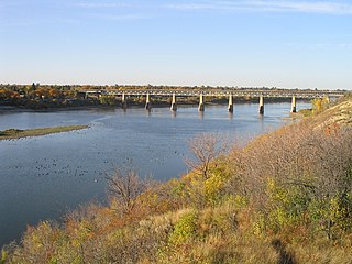
The Saskatchewan River is a major river in Canada. It stretches about 550 kilometres (340 mi) from where it is formed by the joining together of the North Saskatchewan River and South Saskatchewan River just east of Prince Albert, Saskatchewan, to Lake Winnipeg. It flows roughly eastward across Saskatchewan and Manitoba to empty into Lake Winnipeg. Through its tributaries the North Saskatchewan and South Saskatchewan, its watershed encompasses much of the prairie regions of Canada, stretching westward to the Rocky Mountains in Alberta and north-western Montana in the United States.

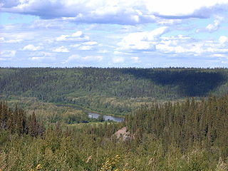
The Athabasca River is a river in Alberta, Canada, which originates at the Columbia Icefield in Jasper National Park and flows more than 1,231 km (765 mi) before emptying into Lake Athabasca. Much of the land along its banks is protected in national and provincial parks, and the river is designated a Canadian Heritage River for its historical and cultural importance. The scenic Athabasca Falls is located about 30 km (19 mi) upstream from Jasper.

Lake Athabasca is in the north-west corner of Saskatchewan and the north-east corner of Alberta between 58° and 60° N in Canada. The lake is 26% in Alberta and 74% in Saskatchewan.
Peter Pond was an American explorer, cartographer, merchant and soldier who was a founding member of the North West Company and the Beaver Club. Though he was born and died in Milford, Connecticut, most of his life was spent in northwestern North America, on the upper Mississippi and in western Canada.

Athabasca, originally named Athabasca Landing, is a town in northern Alberta, Canada. It is located 145 km (90 mi) north of Edmonton at the intersection of Highway 2 and Highway 55, on the banks of the Athabasca River. It is the centre of Athabasca County. It was known as Athabasca Landing prior to August 4, 1913.

The Peace River is a 1,923-kilometre-long (1,195 mi) river in Canada that originates in the Rocky Mountains of northern British Columbia and flows to the northeast through northern Alberta. The Peace River joins the Athabasca River in the Peace-Athabasca Delta to form the Slave River, a tributary of the Mackenzie River. The Finlay River, the main headwater of the Peace River, is regarded as the ultimate source of the Mackenzie River. The combined Finlay–Peace–Slave–Mackenzie river system is the 13th longest river system in the world.

The Clearwater River is located in the Canadian provinces of Saskatchewan and Alberta. It rises in the northern forest region of north-western Saskatchewan and joins the Athabasca River in north-eastern Alberta. It was part of an important trade route during the fur trade era and has been designated as a Canadian Heritage River.

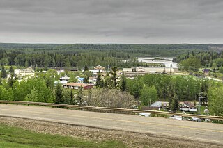
Fort Assiniboine is a hamlet in northwest Alberta, Canada, within Woodlands County. It is located along the north shore of the Athabasca River at the junction of Highway 33 and Highway 661. It is approximately 39 kilometres (24 mi) northwest of Barrhead, 62 kilometres (39 mi) southeast of Swan Hills and 91 kilometres (57 mi) northeast of Whitecourt.
The Methye Portage or Portage La Loche in northwestern Saskatchewan was one of the most important portages in the old fur trade route across Canada. The 19 km (12 mi) portage connected the Mackenzie River basin to rivers that ran east to the Atlantic. It was reached by Peter Pond in 1778 and abandoned in 1883 when steamboats began running on the Athabasca River with links to the railroad. It ranks with Grand Portage as one of the two most important and difficult portages used during the fur trade era.

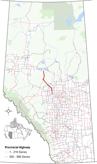
Alberta Provincial Highway No. 33, commonly referred to as Highway 33 and officially named Grizzly Trail, is a north–south highway in west–central Alberta, Canada.
Lac la Nonne is a lake in northern Alberta, Canada. It is located between Lac Ste. Anne County and the County of Barrhead No. 11, 85 km north-west from Edmonton, east of the Grizzly Trail.

The Fort McKay First Nation (FMFN) is a First Nations government in northeast Alberta comprising five Indian reserves – Fort McKay 174, Fort McKay 174C, Fort McKay 174D, Namur Lake 174B and Namur River 174A. The FMFN, signed to Treaty 8, is affiliated with the Athabasca Tribal Council and its members are of Cree, Metis and Dene heritage. The FMFN's traditional lands include portions of the Athabasca oil sands.

The York Factory Express, usually called "the Express" and also the Columbia Express and the Communication, was a 19th-century fur brigade operated by the Hudson's Bay Company (HBC). Roughly 4,200 kilometres (2,600 mi) in length, it was the main overland connection between HBC headquarters at York Factory and the principal depot of the Columbia Department, Fort Vancouver.

The Mackenzie River in Canada's Northwest Territories is a historic waterway, used for centuries by Indigenous peoples, specifically the Dene, as a travel and hunting corridor. Also known as the Deh Cho, it is part of a larger watershed that includes the Slave, Athabasca, and Peace rivers extending from northern Alberta. In the 1780s, Peter Pond, a trader with the North West Company became the first known European to visit this watershed and begin viable trade with the Athapascan-speaking Dene of these rivers. The Mackenzie River itself, the great waterway extending to the Arctic Ocean, was first put on European maps by Alexander Mackenzie in 1789, the Scottish trader who explored the river. The watershed thus became a vital part of the North American fur trade, and before the advent of the airplane or road networks, the river was the only communication link between northern trading posts and the south. Water travel increased in the late 19th century as traders, dominated primarily by the Hudson's Bay Company (HBC), looked to increase water services in the Mackenzie River District.

This article covers the water based Canadian canoe routes used by early explorers of Canada with special emphasis on the fur trade.

Saskatchewan River fur trade The Saskatchewan River was one of the two main axes of Canadian expansion west of Lake Winnipeg. The other and more important one was northwest to the Athabasca Country. For background see Canadian canoe routes (early). The main trade route followed the North Saskatchewan River and Saskatchewan River, which were just south of the forested beaver country. The South Saskatchewan River was a prairie river with few furs.
Fur trading on the Assiniboine River and the general area west of Lake Winnipeg, in what is now Manitoba, Canada, began as early as 1731.
Fort Assiniboine Sandhills Wildland Provincial Park is a wildland provincial park in Woodlands County, Alberta, Canada. The park is 7,903 hectares in area and was established in 1997. The park is contained in the Upper Athabasca Land Use Framework. The park is managed through the Fort Assiniboine Sandhills Wildland Provincial Park Management Plan. The Klondike Trail passes through the western section of the park for about five kilometres (3 mi). This trail was first established in 1824–1825 as a portage between Fort Edmonton on the North Saskatchewan River and Fort Assiniboine on the Athabasca River. The portage was part of the York Factory Express, a 19th-century fur brigade route of the Hudson's Bay Company from Fort Vancouver on the Columbia River to York Factory on Hudson Bay. The trail was revived again during the Klondike Gold Rush in 1897–1899 as part of the overland route to the Klondike gold fields near Dawson City, Yukon. Today, the section of the Klondike Trail within the park extends north of the Klondike Trail Staging Area and includes the ruins of a trapper's cabin and the gravesite of a child who died during trek.


