Sucker Creek 150A

Last updated
Sucker Creek 150A
Sucker Creek Indian Reserve No. 150A
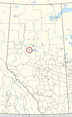
CAN AB 216 SUCKER CREEK INDIAN RESERVE -150A.svg
Location in Alberta
First Nation Sucker Creek
Treaty 8
Country Canada
Province Alberta
Municipal district Big Lakes
Area
[1]
  Total5,987 ha (14,794 acres)
Population
 (2016) [2]
  Total689
  Density12/km2 (30/sq mi)

Sucker Creek 150A is an Indian reserve of the Sucker Creek First Nation in Alberta, located within Big Lakes County. [3] It is 22 kilometres south of High Prairie. [1] In the 2016 Canadian Census, it recorded a population of 689 living in 235 of its 274 total private dwellings. [2]

Related Research Articles

<span class="mw-page-title-main">Division No. 17, Alberta</span> Census division in Alberta, Canada

Division No. 17 is a census division in Alberta, Canada. It spans the central and northwest portions of northern Alberta and its largest urban community is the Town of Slave Lake. Division No. 17 is the largest census division in Alberta according to area and also has the lowest population density.

<span class="mw-page-title-main">Alexis Elk River 233</span> Indian reserve in Alexis Nakota Sioux

Alexis Elk River 233 is an Indian reserve of the Alexis Nakota Sioux Nation in Alberta, located within Yellowhead County. It is 87 kilometers southeast of Hinton.

<span class="mw-page-title-main">Assineau River 150F</span> Indian reserve in Swan River

Assineau River 150F is an Indian reserve of the Swan River First Nation in Alberta, located within the Municipal District of Lesser Slave River No. 124.

<span class="mw-page-title-main">Boyer 164</span> Indian reserve in Beaver

Boyer River 164 is an Indian reserve of the Beaver First Nation in Alberta, located within Mackenzie County. It is 16 kilometers northwest of Fort Vermilion. In the 2016 Canadian Census, it recorded a population of 218 living in 63 of its 67 total private dwellings.

<span class="mw-page-title-main">Bushe River 207</span> Indian reserve in Dene Tha

Bushe River 207 is an Indian reserve of the Dene Tha' First Nation in Alberta, located within Mackenzie County. To the west, it is adjacent to the town of High Level. In the 2016 Canadian Census, it recorded a population of 503 living in 134 of its 142 total private dwellings.

<span class="mw-page-title-main">Child Lake 164A</span> Indian reserve in Beaver

Child Lake 164A is an Indian reserve of the Beaver First Nation in Alberta, located within Mackenzie County. It is 32 kilometers northwest of Fort Vermilion. The reserve takes its name from a nearby lake where a child once drowned.

<span class="mw-page-title-main">Drift Pile River 150</span> Indian reserve in Driftpile Cree

Drift Pile River 150 is an Indian reserve of the Driftpile Cree Nation in Alberta, located within Big Lakes County. It is 6 kilometers southeast of Lesser Slave Lake. In the 2016 Canadian Census, it recorded a population of 828 living in 258 of its 277 total private dwellings.

<span class="mw-page-title-main">Kapawe'no 150B</span> Indian reserve in Kapaweno

Kapawe'no 150B, historically known as Freeman 150B, is an Indian reserve of the Kapawe'no First Nation in Alberta, located within Big Lakes County. It is 8 kilometers northwest of Lesser Slave Lake. In the 2016 Canadian Census, it recorded a population of 154 living in of its 45 total private dwellings.

<span class="mw-page-title-main">Sawridge 150H</span> Indian reserve in Sawridge First Nation

Sawridge 150H is an Indian reserve of the Sawridge First Nation in Alberta, located within the Municipal District of Lesser Slave River No. 124. It is west of the town of Slave Lake.

<span class="mw-page-title-main">Sawridge 150G</span> Indian reserve in Sawridge First Nation

Sawridge 150G is an Indian reserve of the Sawridge First Nation in Alberta, located within the Municipal District of Lesser Slave River No. 124. It is adjacent to the eastern boundary of the town of Slave Lake.

<span class="mw-page-title-main">Alexander 134A</span> Indian reserve in Alexander

Alexander 134A is an Indian reserve of the Alexander First Nation in Alberta. Located within the Municipal District of Greenview No. 16, it is 25 kilometres southeast of Fox Creek.

<span class="mw-page-title-main">Kapawe'no 150C</span> Indian reserve in Kapaweno

Kapawe'no 150C, formerly known as Halcro 150C, is an Indian reserve of the Kapawe'no First Nation in Alberta, located within Big Lakes County. It is 17 kilometres northeast of High Prairie.

<span class="mw-page-title-main">Kapawe'no 150D</span> Indian reserve in Kapaweno

Kapawe'no 150D, formerly known as Pakashan 150D, is an Indian reserve of the Kapawe'no First Nation in Alberta, located within Big Lakes County. It is 13 kilometres northwest of Lesser Slave Lake. In the 2016 Canadian Census, it recorded a population of 5 living in 4 of its 7 total private dwellings.

<span class="mw-page-title-main">Kapawe'no 229</span> Indian reserve in Kapaweno

Kapawe'no 229 is an Indian reserve of the Kapawe'no First Nation in Alberta, located within Big Lakes County. It is 27 kilometres northeast of High Prairie.

<span class="mw-page-title-main">Kapawe'no 230</span> Indian reserve in Kapaweno

Kapawe'no 230 is an Indian reserve of the Kapawe'no First Nation in Alberta, located within Big Lakes County. It is 25 kilometres northeast of High Prairie.

<span class="mw-page-title-main">William McKenzie 151K</span> Indian reserve in Duncans

William McKenzie 151K is an Indian reserve of the Duncan's First Nation in Alberta, located within Northern Sunrise County. It is 33 kilometres north of McLennan.

<span class="mw-page-title-main">Woodland Cree 226</span> Indian reserve in Woodland Cree

Woodland Cree 226 is an Indian reserve of the Woodland Cree First Nation in Alberta, located within Northern Sunrise County. It is 48 kilometres northeast of Peace River. In the 2016 Canadian Census, it recorded a population of 723 living in 188 of its 211 total private dwellings.

<span class="mw-page-title-main">Woodland Cree 227</span> Indian reserve in Woodland Cree

Woodland Cree 227 is an Indian reserve of the Woodland Cree First Nation in Alberta, located within Northern Sunrise County. It is 60 kilometres northeast of Peace River.

<span class="mw-page-title-main">Woodland Cree 228</span> Indian reserve in Woodland Cree

Woodland Cree 228 is an Indian reserve of the Woodland Cree First Nation in Alberta, located within Northern Sunrise County. It is 75 kilometres northeast of Peace River. In the 2016 Canadian Census, it recorded a population of 150 living in 33 of its 36 total private dwellings.

<span class="mw-page-title-main">Sucker River 156C</span> Indian reserve in Canada, Lac La Ronge Indian Band

Sucker River 156C is an Indian reserve of the Lac La Ronge Indian Band in Saskatchewan. It is 230 kilometres north of Prince Albert. In the 2016 Canadian Census, it recorded a population of 416 living in 109 of its 124 total private dwellings. In the same year, its Community Well-Being index was calculated at 49 of 100, compared to 58.4 for the average First Nations community and 77.5 for the average non-Indigenous community.

References

  1. 1 2 "Reserve/Settlement/Village Detail". Crown–Indigenous Relations and Northern Affairs Canada . Government of Canada. Retrieved August 12, 2019.
  2. 1 2 "Census Profile, 2016 Census". Statistics Canada. February 8, 2017. Retrieved 2019-08-10.
  3. Government of Alberta (May 25, 2019). Municipal Boundaries (Map). AltaLIS.

55°26′27″N116°08′29″W / 55.4409°N 116.1415°W / 55.4409; -116.1415 (Sucker Creek 150A)