Peace Point 222 | |
---|---|
Peace Point Indian Reserve No. 222 | |
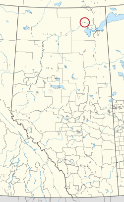
First Nation | Mikisew Cree |
Treaty | 8 |
Country | Canada |
Province | Alberta |
Improvement district | 24 |
Area | |
• Total | 518 ha (1,280 acres) |
Peace Point 222 is an Indian reserve of the Mikisew Cree First Nation in Alberta, located within Improvement District No. 24 (Wood Buffalo National Park). [2] [1]
Bistcho Lake 213 is an Indian reserve of the Dene Tha' First Nation in Alberta, located within Mackenzie County.
Charles Lake 225 is an Indian reserve of the Mikisew Cree First Nation in Alberta, located within Regional Municipality of Wood Buffalo.
Cold Lake 149 is an Indian reserve of the Cold Lake First Nations in Alberta, located within the Municipal District of Bonnyville No. 87. It is 26 kilometers east of Bonnyville. In the 2016 Canadian Census, it recorded a population of 671 living in 208 of its 222 total private dwellings.
Collin Lake 223 is an Indian reserve of the Mikisew Cree First Nation in Alberta, located within the Regional Municipality of Wood Buffalo.
Cornwall Lake 224 is an Indian reserve of the Mikisew Cree First Nation in Alberta, located within the Regional Municipality of Wood Buffalo.
Duncan's 151A is an Indian reserve of the Duncan's First Nation in Alberta, located within the Municipal District of Peace No. 135. It is 39 kilometers southwest of Peace River. In the 2016 Canadian Census, it recorded a population of 150 living in 52 of its 56 total private dwellings.
Jackfish Point 214 is an Indian reserve of the Dene Tha' First Nation in Alberta, located within Mackenzie County.
Blue Quills First Nation is an Indian reserve shared by the Beaver Lake Cree, Cold Lake, Frog Lake, Heart Lake, Kehewin Cree, and Saddle Lake Cree First Nations in Alberta, located within the County of St. Paul No. 19. It is 3 kilometers west of St. Paul.
Namur Lake 174B is an Indian reserve of the Fort McKay First Nation in Alberta, located within the Regional Municipality of Wood Buffalo. It is 105 kilometres northwest of Fort McMurray.
Namur River 174A is an Indian reserve of the Fort McKay First Nation in Alberta, located within the Regional Municipality of Wood Buffalo. It is 65 kilometres northwest of Fort McMurray.
Tthebacha Náre 196, also known as Border Town, is an Indian reserve of the Smith's Landing First Nation in Alberta, located within the Regional Municipality of Wood Buffalo. In the 2016 Canadian Census, it recorded a population of 28 living in 8 of its 16 total private dwellings.
Tthebatthıe 196, formerly known as Fitzgerald 196, is an Indian reserve of the Smith's Landing First Nation in Alberta, located within the Regional Municipality of Wood Buffalo.
Hokédhe Kué 196E, also known as Myers Lake, is an Indian reserve of the Smith's Landing First Nation in Alberta, located within the Regional Municipality of Wood Buffalo.
Kʼı Kué 196D, also known as Birch Lake, is an Indian reserve of the Smith's Landing First Nation in Alberta, located within the Regional Municipality of Wood Buffalo.
Łı̨ Dezé 196C is an Indian reserve of the Smith's Landing First Nation in Alberta, located within the Regional Municipality of Wood Buffalo.
Tsʼu Nedhé 196H is an Indian reserve of the Smith's Landing First Nation in Alberta, located within Improvement District No. 24.
Tthejëre Ghaı̨lı̨ 196B, also known as Salt River, is an Indian reserve of the Smith's Landing First Nation in Alberta, located within the Regional Municipality of Wood Buffalo.
Upper Hay River 212 is an Indian reserve of the Dene Tha' First Nation in Alberta, located within Mackenzie County. It is 80 kilometres northwest of High Level. In the 2016 Canadian Census, it recorded a population of 294 living in 98 of its 115 total private dwellings.
Woodland Cree 226 is an Indian reserve of the Woodland Cree First Nation in Alberta, located within Northern Sunrise County. It is 48 kilometres northeast of Peace River. In the 2016 Canadian Census, it recorded a population of 723 living in 188 of its 211 total private dwellings.
Woodland Cree 227 is an Indian reserve of the Woodland Cree First Nation in Alberta, located within Northern Sunrise County. It is 60 kilometres northeast of Peace River.
59°08′14″N112°25′53″W / 59.1371°N 112.4314°W