Big Horn 144A

Last updated
Big Horn 144A
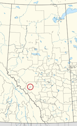
Big Horn Indian Reserve No. 144A
CAN AB 56 BIG HORN INDIAN RESERVE -144A.svg
Location in Alberta
First Nations Stoney Nakoda
Treaty 6
Country Canada
Province Alberta
Municipal district Clearwater
Area
[1]
  Total
2,127.4 ha (5,257 acres)
Population
 (2016) [2]
  Total
237
  Density11.1/km2 (28.9/sq mi)

Big Horn 144A is an Indian reserve of the Stoney Nakoda First Nation, comprising Bearspaw, Chiniki, and Wesley First Nations in Alberta, located within Clearwater County. [3] [1] In the 2016 Canadian Census, it recorded a population of 237 living in 44 of its 59 total private dwellings. [2] [4]

Formed in 1948, Big Horn 144A is roughly 100 miles north of the main Stoney reserve at Morley. [5]

According to the 2011 national Community Well Being Index, it is the poorest First Nations community in Canada. [6]

References

  1. 1 2 "Reserve/Settlement/Village Detail". Crown–Indigenous Relations and Northern Affairs Canada . Government of Canada. Retrieved August 12, 2019.
  2. 1 2 "Census Profile, 2016 Census". Statistics Canada. February 8, 2017. Retrieved 2019-08-10.
  3. Government of Alberta (May 25, 2019). Municipal Boundaries (Map). AltaLIS.
  4. Sturtevant, William C.; DeMallie, Raymond J. (2001). Handbook of North American Indians, V. 13, Plains, Pt. 1-2 (Two Books). Government Printing Office. p. 596. ISBN   9780160504006 . Retrieved 12 December 2017.
  5. Mason, Courtney W. (2014). Spirits of the Rockies: Reasserting an Indigenous Presence in Banff National Park. University of Toronto Press. p. 164. ISBN   9781442626683 . Retrieved 12 December 2017.
  6. Canada, Government of Canada; Indigenous and Northern Affairs. "The Community Well-Being (CWB) Index, 1981-2011". www.aadnc-aandc.gc.ca. Archived from the original on 2018-07-16. Retrieved 2018-07-24.{{cite web}}: CS1 maint: multiple names: authors list (link)

52°22′45″N116°15′08″W / 52.3793°N 116.2522°W / 52.3793; -116.2522 (Big Horn 144A)