Wabasca 166

Last updated
Wabasca 166
Wabasca Indian Reserve No. 166
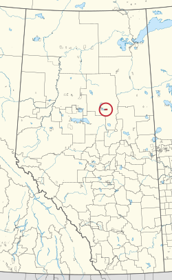
CAN AB 239 WABASCA INDIAN RESERVE -166.svg
Location in Alberta
First Nation Bigstone Cree
Treaty 8
Country Canada
Province Alberta
Municipal district Opportunity
Area
[1]
  Total8,452.4 ha (20,886.3 acres)
Population
 (2016) [2]
  Total160
  Density1.9/km2 (4.9/sq mi)

Wabasca 166 is an Indian reserve of the Bigstone Cree Nation in Alberta, located within the Municipal District of Opportunity No. 17. [3] It is 80 kilometres north of Slave Lake. [1] In the 2016 Canadian Census, it recorded a population of 160 living in 42 of its 49 total private dwellings. [2]

Related Research Articles

<span class="mw-page-title-main">Division No. 17, Alberta</span> Census division in Alberta, Canada

Division No. 17 is a census division in Alberta, Canada. It spans the central and northwest portions of northern Alberta and its largest urban community is the Town of Slave Lake. Division No. 17 is the largest census division in Alberta according to area and also has the lowest population density.

Wabasca, also known as Wabasca-Desmarais, is a hamlet in northern Alberta, Canada within the Municipal District (MD) of Opportunity No. 17. It is located between and along the South and North Wabasca Lakes, at the intersection of Highway 813 and Highway 754. It is approximately 123 km (76 mi) northeast of Slave Lake.

<span class="mw-page-title-main">Bigstone Cree Nation</span> First Nations band government in Canada

The Bigstone Cree Nation is a First Nations band government in Alberta, Canada. As Woodland Cree, they are a western branch of the larger Cree nation, and are a party to Treaty 8 with Canada. The Bigstone Cree Nation was divided into two bands in 2010, with one group continuing under the former name, and the other becoming the Peerless Trout First Nation.

<span class="mw-page-title-main">Jean Baptiste Gambler 183</span> Indian reserve in Bigstone Cree

Jean Baptiste Gambler 183 is an Indian reserve of the Bigstone Cree Nation in Alberta, located within the Municipal District of Opportunity No. 17. In the 2016 Canadian Census, it recorded a population of 253 living in 68 of its 86 total private dwellings.

<span class="mw-page-title-main">Ermineskin 138</span> Indian reserve in Ermineskin Cree

Ermineskin 138 is an Indian reserve of the Ermineskin Cree Nation in Alberta, located between Ponoka County and the County of Wetaskiwin No. 10. Part of the Maskwacis community, it is 13 kilometres south of Wetaskiwin.

<span class="mw-page-title-main">Wabasca 166D</span> Indian reserve in Bigstone Cree

Wabasca 166D is an Indian reserve of the Bigstone Cree Nation in Alberta, located within the Municipal District of Opportunity No. 17. It is 78 kilometres north of Slave Lake. In the 2016 Canadian Census, it recorded a population of 188 living in 47 of its 58 total private dwellings.

<span class="mw-page-title-main">Wabasca 166C</span> Indian reserve in Bigstone Cree

Wabasca 166C is an Indian reserve of the Bigstone Cree Nation in Alberta, located within the Municipal District of Opportunity No. 17. In the 2016 Canadian Census, it recorded a population of 188 living in 47 of its 58 total private dwellings. The community is located along the northeast shore of North Wabasca Lake.

<span class="mw-page-title-main">Wabasca 166B</span> Indian reserve in Bigstone Cree

Wabasca 166B is an Indian reserve of the Bigstone Cree Nation in Alberta, located within the Municipal District of Opportunity No. 17. In the 2016 Canadian Census, it recorded a population of 190 living in 43 of its 52 total private dwellings. The community is located on the southern shore of North Wabasca Lake and to the west of the hamlet of Wabasca.

<span class="mw-page-title-main">Wabasca 166A</span> Indian reserve in Bigstone Cree

Wabasca 166A is an Indian reserve of the Bigstone Cree Nation in Alberta, located within the Municipal District of Opportunity No. 17. In the 2016 Canadian Census, it recorded a population of 658 living in 183 of its 213 total private dwellings.

<span class="mw-page-title-main">Assineau River 150F</span> Indian reserve in Swan River

Assineau River 150F is an Indian reserve of the Swan River First Nation in Alberta, located within the Municipal District of Lesser Slave River No. 124.

<span class="mw-page-title-main">Drift Pile River 150</span> Indian reserve in Driftpile Cree

Drift Pile River 150 is an Indian reserve of the Driftpile Cree Nation in Alberta, located within Big Lakes County. It is 6 kilometers southeast of Lesser Slave Lake. In the 2016 Canadian Census, it recorded a population of 828 living in 258 of its 277 total private dwellings.

<span class="mw-page-title-main">Louis Bull 138B</span> Indian reserve in Louis Bull

Louis Bull 138B is an Indian reserve of the Louis Bull First Nation in Alberta, located within County of Wetaskiwin No. 10. One of four reserves making up the Maskwacis community, it is 16 kilometers southwest of Wetaskiwin. In the 2016 Canadian Census, it recorded a population of 1177 living in 226 of its 276 total private dwellings.

<span class="mw-page-title-main">Montana 139</span> Indian reserve in Montana

Montana 139 is an Indian reserve of the Montana First Nation in Alberta, located within Ponoka County. Part of the Maskwacis community, it is 24 kilometers south of Wetaskiwin. In the 2016 Canadian Census, it recorded a population of 630 living in 137 of its 143 total private dwellings.

<span class="mw-page-title-main">Kapawe'no 150B</span> Indian reserve in Kapaweno

Kapawe'no 150B, historically known as Freeman 150B, is an Indian reserve of the Kapawe'no First Nation in Alberta, located within Big Lakes County. It is 8 kilometers northwest of Lesser Slave Lake. In the 2016 Canadian Census, it recorded a population of 154 living in of its 45 total private dwellings.

<span class="mw-page-title-main">Sucker Creek 150A</span> Indian reserve in Sucker Creek

Sucker Creek 150A is an Indian reserve of the Sucker Creek First Nation in Alberta, located within Big Lakes County. It is 22 kilometres south of High Prairie. In the 2016 Canadian Census, it recorded a population of 689 living in 235 of its 274 total private dwellings.

<span class="mw-page-title-main">Utikoomak Lake 155A</span> Indian reserve in Whitefish Lake

Utikoomak Lake 155A is an Indian reserve of the Whitefish Lake First Nation in Alberta, located within Northern Sunrise County. In the 2016 Canadian Census, it recorded a population of 127 living in 29 of its 34 total private dwellings.

<span class="mw-page-title-main">Kapawe'no 150D</span> Indian reserve in Kapaweno

Kapawe'no 150D, formerly known as Pakashan 150D, is an Indian reserve of the Kapawe'no First Nation in Alberta, located within Big Lakes County. It is 13 kilometres northwest of Lesser Slave Lake. In the 2016 Canadian Census, it recorded a population of 5 living in 4 of its 7 total private dwellings.

<span class="mw-page-title-main">Peigan Timber Limit B</span> Indian reserve in Piikani

Peigan Timber Limit 147B is an Indian reserve of the Piikani Nation in Alberta, located within the Municipal District of Willow Creek No. 26.

<span class="mw-page-title-main">Samson 137A</span> Indian reserve in Samson Cree

Samson 137A is an Indian reserve of the Samson Cree Nation in Alberta, located within Ponoka County. In the 2016 Canadian Census, it recorded a population of 26 living in 6 of its 6 total private dwellings.

References

  1. 1 2 "Reserve/Settlement/Village Detail". Crown–Indigenous Relations and Northern Affairs Canada . Government of Canada. 14 November 2008. Retrieved August 12, 2019.
  2. 1 2 "Census Profile, 2016 Census". Statistics Canada. February 8, 2017. Retrieved 2019-08-10.
  3. Government of Alberta (2019). Municipal Boundaries (Map). AltaLIS.

55°52′54″N113°31′18″W / 55.8818°N 113.5218°W / 55.8818; -113.5218 (Wabasca 166)