Eden Valley 216

Last updated
Eden Valley 216
Eden Valley Indian Reserve No. 216
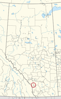
CAN AB 97 EDEN VALLEY INDIAN RESERVE -216.svg
Location in Alberta
First Nations Stoney Nakoda
Country Canada
Province Alberta
Municipal district Foothills
Area
[1]
  Land17.65 km2 (6.81 sq mi)
Population
 (2016) [1]
  Total596
  Density33.8/km2 (88/sq mi)
Website edenvalleyreserve.ca

Eden Valley 216 is an Indian reserve of the Stoney Nakoda First Nation, comprising Bearspaw, Chiniki, and Wesley First Nations, located near Longview, Alberta. [2]

Related Research Articles

<span class="mw-page-title-main">Division No. 6, Alberta</span> Census division in Alberta, Canada

Division No. 6 is a census division in Alberta, Canada. It includes the City of Calgary and surrounding areas. The majority of the division consists of Alberta's Calgary Region, while the northern portion of the division includes parts of central Alberta. The division also forms the southern segment of the Calgary–Edmonton Corridor. Division No. 6 is the largest census division in Alberta according to population and also has the highest population density.

<span class="mw-page-title-main">Division No. 17, Alberta</span> Census division in Alberta, Canada

Division No. 17 is a census division in Alberta, Canada. It spans the central and northwest portions of northern Alberta and its largest urban community is the Town of Slave Lake. Division No. 17 is the largest census division in Alberta according to area and also has the lowest population density.

<span class="mw-page-title-main">Fox Valley, Saskatchewan</span> Village in Saskatchewan, Canada

Fox Valley is a village in the Canadian province of Saskatchewan within the Rural Municipality of Fox Valley No. 171 and Census Division No. 8. Fox Valley is located just off Highway 21, approximately 64 kilometres north of Maple Creek and 51 kilometres south of Leader in the southwest region of the province. The early settlers of the village and surrounding area included many Germans from Russia. The local economy is heavily dependent on agriculture and natural gas.

<span class="mw-page-title-main">Division No. 6, Saskatchewan</span> Census division of Saskatchewan, Canada

Division No. 6 is one of eighteen census divisions in the province of Saskatchewan, Canada, as defined by Statistics Canada. It is located in the south-central part of the province. The most populous community in this division is Regina, the provincial capital.

<span class="mw-page-title-main">Division No. 14, Saskatchewan</span> Census division of Saskatchewan, Canada

Division No. 14 is one of eighteen census divisions in the province of Saskatchewan, Canada, as defined by Statistics Canada. It is located on the northern portion of Southeast Saskatchewan, bordering Manitoba. The most populous community in this division is the city of Melfort. Other important communities are the towns of Nipawin and Tisdale.

Waldeck is a village in the Canadian province of Saskatchewan within the Rural Municipality of Excelsior No. 166 and Census Division No. 7. Waldeck is 18 kilometres (11 mi) northeast of the city of Swift Current on the Trans-Canada Highway. Waldeck is situated in the Swift Current River Valley.

<span class="mw-page-title-main">Lil'wat First Nation</span> First Nation band government

The Lil'wat First Nation, a.k.a. the Lil'wat Nation or the Mount Currie Indian Band, is a First Nation band government located in the southern Coast Mountains region of the Interior of the Canadian province of British Columbia. It is a member of the Lillooet Tribal Council, which is the largest grouping of band governments of the St'at'imc or Stl'atl'imx people. Other St'at'imc governments include the smaller In-SHUCK-ch Nation on the lower Lillooet River to the southwest, and the independent N'quatqua First Nation at the near end of Anderson Lake from Mount Currie, which is the main reserve of the Lil'wat First Nation, and also one of the largest Indian reserves by population in Canada.

Bjorkdale is a village in the Canadian province of Saskatchewan within the Rural Municipality of Bjorkdale No. 426 and Census Division No. 14. The village is located at the junctions of Highway 23, 679 & 776, approximately 78 kilometres (48 mi) east of the City of Melfort.

Mistatim is a village in the Canadian province of Saskatchewan within the Rural Municipality of Bjorkdale No. 426 and Census Division No. 14. It is just north of Highway 3. Mistatim is 35 miles (56 km) east of the Town of Tisdale and 40 miles (64 km) west of Hudson Bay. The Greenwater Lake Provincial Park is 30 miles (48 km) to the south.

<span class="mw-page-title-main">Division No. 16, Manitoba</span> Census division in Manitoba, Canada

Census Division No. 16 is a census division located within the Parklands Region of the province of Manitoba, Canada. Unlike in some other provinces, census divisions do not reflect the organization of local government in Manitoba. These areas exist solely for the purposes of statistical analysis and presentation; they have no government of their own.

<span class="mw-page-title-main">Buck Lake 133C</span> Indian reserve in Paul

Buck Lake 133C is an Indian reserve of the Paul First Nation in Alberta, located within the County of Wetaskiwin No. 10. It is 87 kilometers west of Wetaskiwin.

<span class="mw-page-title-main">Piikani 147</span> Indian reserve of the Piikani in Alberta, Canada

Piikani 147, formerly Peigan 147, is an Indian reserve of the Piikani Nation in Alberta. It is located 61 km (38 mi) west of the City of Lethbridge. It has a land area of 426.992 km2 (164.863 sq mi), making it the fourth-largest Indian reserve in Canada, and lies at an elevation of 1,046 m (3,432 ft). The Canada 2011 Census reported a population of 1,217 inhabitants. It is bordered by the Municipal District of Willow Creek No. 26 on its north and east, and by the Municipal District of Pincher Creek No. 9 on its west and south. The nearest outside communities are Fort Macleod and Pincher Creek.

The Leq'á:mel First Nation, formerly known as Lakahahmen First Nation, is a First Nations band government whose community and offices are located in the area near Deroche, British Columbia in the Fraser Valley region in Canada, about 12 kilometres east of the District of Mission. They are a member government of the Sto:lo Nation Chiefs Council, which is one of two tribal councils of the Sto:lo.

<span class="mw-page-title-main">Stoney 142B</span> Indian reserve in Stoney Nakoda *Bearspaw *Chiniki *Wesley

Stoney 142B is an Indian reserve of the Stoney Nakoda First Nation, comprising Bearspaw, Chiniki, and Wesley First Nations in Alberta, located within the Municipal District of Bighorn No. 8. It is 48 kilometres northwest of Calgary, Alberta, Canada.

<span class="mw-page-title-main">Peerless Trout 238</span> Indian reserve in Peerless Trout

Peerless Trout 238 is an Indian reserve of the Peerless Trout First Nation in Alberta, located within the Municipal District of Opportunity No. 17.

<span class="mw-page-title-main">Muskowekwan 85</span> Indian reserve in Saskatchewan, Canada

Muskowekwan 85 is an Indian reserve of the Muskowekwan First Nation in Saskatchewan. It is about 64 kilometres (40 mi) north-west of Fort Qu'Appelle. In the 2016 Canadian Census, it recorded a population of 436 living in 150 of its 170 total private dwellings. In the same year, its Community Well-Being index was calculated at 52 of 100, compared to 58.4 for the average First Nations community and 77.5 for the average non-Indigenous community.

<span class="mw-page-title-main">Ochapowace 71</span> Indian reserve in Canada, Ochapowace

Ochapowace 71 is an Indian reserve of the Ochapowace Nation in Saskatchewan. It is 8 kilometres northeast of Broadview. In the 2016 Canadian Census, it recorded a population of 426 living in 126 of its 138 total private dwellings. In the same year, its Community Well-Being index was calculated at 61 of 100, compared to 58.4 for the average First Nations community and 77.5 for the average non-Indigenous community.

<span class="mw-page-title-main">Pasqua 79</span> Indian reserve in Saskatchewan, Canada

Pasqua 79 is an Indian reserve of the Pasqua First Nation in Saskatchewan. It is about 16 kilometres (9.9 mi) west of Fort Qu'Appelle. In the 2016 Canadian Census, it recorded a population of 517 living in 173 of its 200 total private dwellings. In the same year, its Community Well-Being index was calculated at 56 of 100, compared to 58.4 for the average First Nations community and 77.5 for the average non-Indigenous community.

<span class="mw-page-title-main">Standing Buffalo 78</span> Indian reserve in Saskatchewan, Canada

Standing Buffalo 78 is an Indian reserve of the Standing Buffalo Dakota Nation in Saskatchewan. It is about 8 kilometres (5.0 mi) north-west of Fort Qu'Appelle. In the 2016 Canadian Census, it recorded a population of 569 living in 184 of its 198 total private dwellings. In the same year, its Community Well-Being index was calculated at 59 of 100, compared to 58.4 for the average First Nations community and 77.5 for the average non-Indigenous community.

Stoney Nakoda First Nation is a Nakoda First Nations band government Alberta, Canada. It is located West of Calgary, in the foot of the Rocky Mountains.

References

  1. 1 2 "Census Profile, 2016 Census". Statistics Canada. February 8, 2017. Retrieved 2019-08-10.
  2. "Eden Valley 216". Statistics Canada. 2001. Retrieved 27 December 2009.[ permanent dead link ]

50°26′10″N114°25′34″W / 50.436°N 114.426°W / 50.436; -114.426 (Eden Valley 216)