Kehewin 123

Last updated
Kehewin 123
Kehewin Indian Reserve No. 123
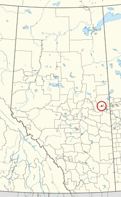
CAN AB 142 KEHEWIN INDIAN RESERVE -123.svg
Location in Alberta
First Nation Kehewin Cree
Treaty 6
Country Canada
Province Alberta
Municipal district Bonnyville No. 87
Area
[1]
  Total8,225 ha (20,324 acres)
Population
 (2016) [2]
  Total976
  Density12/km2 (31/sq mi)

Kehewin 123 is an Indian reserve of the Kehewin Cree Nation in Alberta, located within the Municipal District of Bonnyville No. 87. [3] It is 20 kilometers south of Bonnyville. [1]

Contents

Geography

The locality of Kehewin is on the Kehewin 123 reserve. [4]

Demographics

In the 2016 Canadian Census, it recorded a population of 976 living in 233 of its 256 total private dwellings. [2]

Economy

The unemployment rate as of 2022 was approximately 30%. [5] and average incomes among those with full-time work are approximately $12,000 lower than the provincial.

Education

This reserve has a 95.5% high school completion rate, in comparison to the average secondary schooling rate of 88%.[ citation needed ]

Related Research Articles

<span class="mw-page-title-main">Municipal District of Bonnyville No. 87</span> Municipal district in Alberta, Canada

The Municipal District of Bonnyville No. 87 is a municipal district (MD) in northeastern Alberta, Canada in Division No. 12. On the east, it is adjacent to the province of Saskatchewan.

<span class="mw-page-title-main">Enoch Cree Nation 135</span> Indian reserve in Enoch Cree

Enoch Cree Nation 135, previously known as Stony Plain No. 135, is an Indian reserve of the Enoch Cree Nation #440 in Alberta. It is adjacent to the City of Edmonton to the east and Parkland County to the north, west, and south.

<span class="mw-page-title-main">Division No. 12, Alberta</span> Census division in Alberta, Canada

Division No. 12 is a census division in Alberta, Canada. Including the City of Cold Lake, the majority of the division is located in the northeast corner of central Alberta. The northern portion of the division is located within northern Alberta.

<span class="mw-page-title-main">Wabasca 166D</span> Indian reserve in Bigstone Cree

Wabasca 166D is an Indian reserve of the Bigstone Cree Nation in Alberta, located within the Municipal District of Opportunity No. 17. It is 78 kilometres north of Slave Lake. In the 2016 Canadian Census, it recorded a population of 188 living in 47 of its 58 total private dwellings.

<span class="mw-page-title-main">Wabasca 166A</span> Indian reserve in Bigstone Cree

Wabasca 166A is an Indian reserve of the Bigstone Cree Nation in Alberta, located within the Municipal District of Opportunity No. 17. In the 2016 Canadian Census, it recorded a population of 658 living in 183 of its 213 total private dwellings.

<span class="mw-page-title-main">Child Lake 164A</span> Indian reserve in Beaver

Child Lake 164A is an Indian reserve of the Beaver First Nation in Alberta, located within Mackenzie County. It is 32 kilometers northwest of Fort Vermilion. The reserve takes its name from a nearby lake where a child once drowned.

<span class="mw-page-title-main">Cold Lake 149</span> Indian reserve in Cold Lake

Cold Lake 149 is an Indian reserve of the Cold Lake First Nations in Alberta, located within the Municipal District of Bonnyville No. 87. It is 26 kilometers east of Bonnyville. In the 2016 Canadian Census, it recorded a population of 671 living in 208 of its 222 total private dwellings.

<span class="mw-page-title-main">Cowper Lake 194A</span> Indian reserve in Chipewyan Prairie

Cowper Lake 194A is an Indian reserve of the Chipewyan Prairie First Nation in Alberta, located within the Regional Municipality of Wood Buffalo.

<span class="mw-page-title-main">Fort Vermilion 173B</span> Indian reserve in Tallcree

Fort Vermilion 173B is an Indian reserve of the Tallcree First Nation in Alberta, located within Mackenzie County. It is 1 kilometre southwest of Fort Vermilion. In the 2016 Canadian Census, it recorded a population of 96 living in 23 of its 25 total private dwellings.

<span class="mw-page-title-main">Janvier 194</span> Indian reserve in Chipewyan Prairie

Janvier 194 is an Indian reserve of the Chipewyan Prairie First Nation in Alberta, Canada that is surrounded by the Regional Municipality of Wood Buffalo. It is 97 km (60 mi) southwest of Fort McMurray.

<span class="mw-page-title-main">Louis Bull 138B</span> Indian reserve in Louis Bull

Louis Bull 138B is an Indian reserve of the Louis Bull First Nation in Alberta, located within County of Wetaskiwin No. 10. One of four reserves making up the Maskwacis community, it is 16 kilometers southwest of Wetaskiwin. In the 2016 Canadian Census, it recorded a population of 1177 living in 226 of its 276 total private dwellings.

<span class="mw-page-title-main">Makaoo 120</span> Indian reserve in Onion Lake Cree

Makaoo 120 is an Indian reserve of the Onion Lake Cree Nation in Alberta and Saskatchewan, located between the County of Vermilion River and the Rural Municipality of Frenchman Butte No. 501. It is 42 kilometres north of Lloydminster. In the 2016 Canadian Census, it recorded a population of 726 living in 165 of its 179 total private dwellings.

<span class="mw-page-title-main">Kapawe'no 150B</span> Indian reserve in Kapaweno

Kapawe'no 150B, historically known as Freeman 150B, is an Indian reserve of the Kapawe'no First Nation in Alberta, located within Big Lakes County. It is 8 kilometers northwest of Lesser Slave Lake. In the 2016 Canadian Census, it recorded a population of 154 living in of its 45 total private dwellings.

<span class="mw-page-title-main">Blue Quills First Nation Indian Reserve</span> First Nations reserve in Alberta, Canada

Blue Quills First Nation is an Indian reserve shared by the Beaver Lake Cree, Cold Lake, Frog Lake, Heart Lake, Kehewin Cree, and Saddle Lake Cree First Nations in Alberta, located within the County of St. Paul No. 19. It is 3 kilometers west of St. Paul.

<span class="mw-page-title-main">Unipouheos 121</span> Indian reserve in Frog Lake

Unipouheos 121 is an Indian reserve of the Frog Lake First Nation in Alberta, located within the Municipal District of Bonnyville No. 87 and the County of St. Paul No. 19. It is 32 kilometres southeast of Bonnyville. In the 2016 Canadian Census, it recorded a population of 909 living in 205 of its 232 total private dwellings.

<span class="mw-page-title-main">Cold Lake 149A</span> Indian reserve in Cold Lake

Cold Lake 149A is an Indian reserve of the Cold Lake First Nations in Alberta, located within the Municipal District of Bonnyville No. 87. It is on the south shore of Cold Lake, immediately adjacent to the city of Cold Lake.

<span class="mw-page-title-main">Cold Lake 149B</span> Indian reserve in Cold Lake

Cold Lake 149B is an Indian reserve of the Cold Lake First Nations in Alberta, located within the Municipal District of Bonnyville No. 87. It is south of the Beaver River, a short distance northwest of the city of Cold Lake.

<span class="mw-page-title-main">Cold Lake 149C</span> Indian reserve in Cold Lake

Cold Lake 149C is an Indian reserve of the Cold Lake First Nations in Alberta, located within the Municipal District of Bonnyville No. 87.

<span class="mw-page-title-main">Tallcree 173</span> Indian reserve in Tallcree

Tallcree 173, also known as South Tallcree, is an Indian reserve of the Tallcree First Nation in Alberta, located within Mackenzie County. In the 2016 Canadian Census, it recorded a population of 250 living in 51 of its 53 total private dwellings.

<span class="mw-page-title-main">Whitefish Lake 128</span> Indian reserve in Saddle Lake Cree

Whitefish Lake 128 is an Indian reserve of the Saddle Lake Cree Nation in Alberta, located between Smoky Lake County and the County of St. Paul No. 19. It is 68 kilometres west of Bonnyville. In the 2016 Canadian Census, it recorded a population of 1310 living in 291 of its 319 total private dwellings.

References

  1. 1 2 "Reserve/Settlement/Village Detail". Crown–Indigenous Relations and Northern Affairs Canada . Government of Canada. Retrieved August 12, 2019.
  2. 1 2 "Census Profile, 2016 Census". Statistics Canada. February 8, 2017. Retrieved 2019-08-10.
  3. Government of Alberta (May 25, 2019). Municipal Boundaries (Map). AltaLIS.
  4. Geo-Administrative Areas (Hamlet, Locality and Townsite Culture Points) (Geodatabase layer) (Map). AltaLIS. October 26, 2020. Retrieved October 2, 2021.{{cite map}}: CS1 maint: date and year (link)
  5. "2001 Census Aboriginal Population Profiles" . Retrieved 14 February 2016.

54°06′05″N110°50′10″W / 54.1015°N 110.836°W / 54.1015; -110.836 (Kehewin 123)