
Alberta is one of the thirteen provinces and territories of Canada. Located in Western Canada, the province has an area of 661,190 km2 (255,290 sq mi) and is bounded to the south by the United States state of Montana along 49° north for 298 km (185 mi); to the east at 110° west by the province of Saskatchewan for 1,223 km (760 mi); and at 60° north the Northwest Territories for 644 km (400 mi). The southern half of the province borders British Columbia along the Continental Divide of the Americas on the peaks of the Rocky Mountains, while the northern half borders British Columbia along the 120th meridian west. Along with Saskatchewan it is one of only two landlocked provinces or territories.

The Peace River is a 1,923-kilometre-long (1,195 mi) river in Canada that originates in the Rocky Mountains of northern British Columbia and flows to the northeast through northern Alberta. The Peace River joins the Athabasca River in the Peace-Athabasca Delta to form the Slave River, a tributary of the Mackenzie River. The Finlay River, the main headwater of the Peace River, is regarded as the ultimate source of the Mackenzie River. The combined Finlay–Peace–Slave–Mackenzie river system is the 13th longest river system in the world.
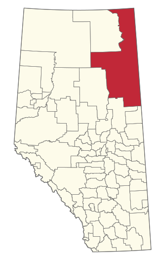
The Regional Municipality of Wood Buffalo is a specialized municipality in northeast Alberta, Canada. It is the second largest municipality in Alberta by area and is home to oil sand deposits known as the Athabasca oil sands.
The Clearwater River is located in the Canadian provinces of Saskatchewan and Alberta. It rises in the northern forest region of north-western Saskatchewan and joins the Athabasca River in north-eastern Alberta. It was part of an important trade route during the fur trade era and has been designated as a Canadian Heritage River.

The Boreal Shield Ecozone, as defined by the Commission for Environmental Cooperation (CEC), is the largest ecozone in Canada. Covering 1.8 million square kilometres it covers almost 20% of Canada's landmass, stretching from northern Saskatchewan to Newfoundland.
Chinchaga Wildland Park is a protected 800 km2 (310 sq mi) tract of land in the 5,000 km2 (1,900 sq mi) of the greater Chinchaga wilderness area in a disjunct outlier of the Foothills Natural Region of Alberta, in a remote area of northwest Alberta, Canada, about 140 kilometres (87 mi) west of Manning. It was designated as a Wildlife Park in December 1999. The greater Chinchaga area was identified in 1995 as an Environmentally Significant Area. It was designated by the Alberta Government as a protected area in 2000, under the "Special Places" program. "Elevations in the Park range from 650 m adjacent to the Chinchaga River to 915 m at the height of land atop Halverson Ridge."

The Boreal Plains Ecozone, as defined by the Commission for Environmental Cooperation (CEC), is a terrestrial ecozone in the western Canadian provinces of Manitoba, Saskatchewan and Alberta. It also has minor extensions into northeastern British Columbia and south-central Northwest Territories. The region extends over 779,471 km2, of which 58,981 km2 is conserved.
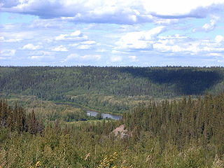
Richardson Wildland Park is a wildland provincial park in the Regional Municipality of Wood Buffalo, northern Alberta, Canada. It was established 14 May 2018 and has an area of 312,068 hectares (1,204.90 sq mi). Two previous parks, Maybelle River Wildland Provincial Park and Richardson River Dunes Wildland Provincial Park, established in 1998, were disestablished on 14 May 2018 and the area was incorporated into Richardson Wildland Park. The park is within the Lower Athabasca Region Land Use Framework and managed within the Lower Athabasca Regional Plan.
Hubert Lake Wildland Provincial Park is a wildland provincial park in central Alberta, Canada. The park was established on 4 October 2000 and has an area of 9,665.46 hectares. The park is included in the Upper Athabasca Region Land Use Framework.

Bluerock Wildland Provincial Park is a wildland provincial park located in Kananaskis Improvement District, Alberta, Canada. It was established on 24 July 2001 and has an area of 12,719.59 hectares. The park was named for the Bluerock Creek that flows through and forms part of the western boundary of the park and Bluerock Mountain which is the creek's source. The park is included in the South Saskatchewan Region Land-use framework region and managed by the South Saskatchewan Regional Plan. And because they are so intertwined, Sheep River Provincial Park and Bluerock Wildland Provincial Park are managed under the same Management Plan.
Kitaskino Nuwenëné Wildland Provincial Park is a wildland provincial park in Wood Buffalo, northern Alberta, Canada. Kitaskino, means “our land” in Cree and Nuwenëné means “our land” in Dene; the two languages are spoken by the First Nation communities in the area. The park as created on 8 March 2019 had an area of 161,880 hectares. It was expanded on 26 January 2022 to 314,510 hectares. The park is a successful collaboration between the Mikisew Cree First Nation, the governments of Alberta and Canada, and petroleum industry partners in the area. Teck Resources, Imperial Oil, and Cenovus Energy returned oil leases to the Athabasca oil sands which underlay the area. This enabled the land to be turned into a park. After the initial creation of the park in 2019, the Milisew First Nation worked with Burgess Canadian Resources to relinquished their oilsands leases which led to the addition of 152,000 hectares to the park.
Dunvegan West Wildland Provincial Park is a wildland provincial park in Saddle Hills County, Alberta, Canada. The park was created on 20 December 2000 and has an area of 20,967.8 hectares. The park consists of several separated parcels of land along the south bank of the Peace River from Dunvegan west to the British Columbia border.
Stony Mountain Wildland Provincial Park is a wildland provincial park in Wood Buffalo, northern Alberta, Canada. The park was established on 20 December 2000 and has an area of 13,974 hectares. The park is part of the Lower Athabasca Regional Plan.
Gipsy Lake Wildland Provincial Park is a wildland provincial park in Wood Buffalo, northern Alberta, Canada. The park was established on 20 December 2000 and has an area of 35,766.3 hectares. In the Lower Athabasca Regional Plan, Gipsy Lake is planned to be significantly extended into the new Gipsy-Gordon Wildland Provincial Park with an area of 158,542 hectares (612.13 sq mi). Although the Lower Athabasca Regional Plan has been adopted, as of January 2023 the new Gipsy-Gordon park has not been created.
Marguerite River Wildland Provincial Park is a wildland provincial park in Wood Buffalo, northern Alberta, Canada. The park was established on 20 December 2000 and has an area of 196,301.9 hectares (757.9 sq mi). The park is part of the Lower Athabasca Regional Plan. The park was named for the Marguerite River that flows thru the park and forms a portion of the park's western boundary. The park was originally created in 1998 as Marguerite Crag and Tail Wildland Provincial Park. It was reformed and renamed in 2000.
Grand Rapids Wildland Provincial Park is a wildland provincial park in Wood Buffalo and Municipal District of Opportunity, northern Alberta, Canada. The park was established on 20 December 2000 with an area of 25,666.61 hectares. The area was adjusted slightly in 2004 to 24,178.02 hectares and again on 20 December 2004 to its current area of 26,331.643 hectares. The park is part of the Lower Athabasca Regional Plan. The park is named for the Grand Rapids on the Athabasca River that are within the park.
Fort Assiniboine Sandhills Wildland Provincial Park is a wildland provincial park in Woodlands County, Alberta, Canada. The park is 7,903 hectares in area and was established in 1997. The park is contained in the Upper Athabasca Land Use Framework. The park is managed through the Fort Assiniboine Sandhills Wildland Provincial Park Management Plan. The Klondike Trail passes through the western section of the park for about five kilometres (3 mi). This trail was first established in 1824–1825 as a portage between Fort Edmonton on the North Saskatchewan River and Fort Assiniboine on the Athabasca River. The portage was part of the York Factory Express, a 19th-century fur brigade route of the Hudson's Bay Company from Fort Vancouver on the Columbia River to York Factory on Hudson Bay. The trail was revived again during the Klondike Gold Rush in 1897–1899 as part of the overland route to the Klondike gold fields near Dawson City, Yukon. Today, the section of the Klondike Trail within the park extends north of the Klondike Trail Staging Area and includes the ruins of a trapper's cabin and the gravesite of a child who died during trek.
Grizzly Ridge Wildland Provincial Park is a wildland provincial park in northern Alberta, Canada. The park was established on 14 April 1999 and has an area of 10,706.07 hectares. The park is included in the Upper Athabasca Region Land Use Framework.
La Biche River Wildland Provincial Park is a wildland provincial park in northern Alberta, Canada. The park was established on 6 June 2000 and had an area of 16,843.975 hectares. It was expanded on 8 August 2001 to an area of 17,545.251 hectares. The park is included in the Upper Athabasca Region Land Use Framework.
Lesser Slave Lake Wildland Provincial Park is a wildland provincial park in central Alberta, Canada. The park was established on 7 February 2001 and has an area of 3,581.450 hectares. The park is included in the Upper Athabasca Region Land Use Framework.


