Sylvan Lake | |
---|---|
Town | |
Town of Sylvan Lake | |
Location of Sylvan Lake in Alberta | |
Coordinates: 52°18′30″N114°05′47″W / 52.30833°N 114.09639°W | |
Country | Canada |
Province | Alberta |
Region | Central Alberta |
Census division | 8 |
Municipal district | Red Deer County |
Founded | 1898 |
Incorporated [1] | |
• Village | December 30, 1912 |
• Town | May 20, 1946 |
Government | |
• Mayor | Megan Hanson |
• Governing body | Sylvan Lake Town Council
|
• CAO | Sean Durkin |
• MP | Blaine Calkins |
• MLA | Devin Dreeshen |
Area (2021) [3] | |
• Land | 23.09 km2 (8.92 sq mi) |
Elevation | 945 m (3,100 ft) |
Population | |
• Total | 15,995 |
• Density | 692.8/km2 (1,794/sq mi) |
• Municipal census (2015) | 14,310 [7] |
• Estimate (2020) | 16,351 [8] |
Time zone | UTC−7 (MST) |
• Summer (DST) | UTC−6 (MDT) |
Forward sortation area | |
Area code(s) | 403, 587, 825 |
Waterways | Sylvan Lake |
Highways | Highway 11 Highway 11A Highway 20 |
Website | sylvanlake |
Sylvan Lake is a town in central Alberta, Canada. It is located approximately 25 kilometres (16 mi) west of the City of Red Deer along Highway 11 or Highway 11A. It is on the southeast edge of Sylvan Lake, a 15-kilometre-long (9.3 mi) freshwater lake that straddles the boundary between Red Deer County and Lacombe County.
The lake is a popular destination for tourists from around Alberta, with around 1 million visitors each year. [9] Popular tourist activities include sunbathing, swimming, water-skiing, and visiting Camp Woods. Camp Woods in Sylvan Lake hosted the 12th Canadian Scout Jamboree in July 2013. [10]
The land that would later become the town was ceded to the Crown by the First Nations with Treaty 6 in 1877.
Sylvan Lake was originally settled by French-speaking immigrants from Quebec and the United States. Arriving in 1898 from Michigan, Alexandre Loiselle and his family homesteaded the quarter section that later became the west side of today's Main (50th) Street and the businesses and homes immediately to the west. When the first settlers arrived at Sylvan Lake in 1899, the lake was named Snake Lake from the Cree name kinepik (ᑭᓀᐱᐠ) which referred to the numerous garter snakes in the area. The name was officially changed to Sylvan Lake in 1903 (Gaetz 1948). "Sylvan" is from the Latin sylvanus, which means "of a forest".
Palliser's map of 1859 gives the name Swan Lake for the location. [11]
In the early twentieth century, groups of Estonian [12] and then Finnish settlers moved to homesteads to the south and west of the fledgling settlement at Sylvan Lake. With their arrival came the early business community, a general store, a blacksmith, a hardware store, post office, barber, and restaurants. The completion of the Canadian Northern line to Rocky Mountain House and Nordegg in 1912 and the parallel Canadian Pacific in 1914 opened the west country to settlement and resulted in the incorporation of Sylvan Lake in 1913 under Mayor E. S. Grimson, a local hardware store owner. The anniversary of the founding of the town is celebrated every year in Sylvan Lake as "1913 Days".
Farming quickly became a mainstay in the area and in 1923 an Alberta Pacific Grain Company grain elevator was built on the CPR line immediately north of what is now Cottonwood Estates. The elevator was torn down in the 1970s and the CPR line was abandoned in 1983 and removed in 1986. Since then, the right of way has survived as a natural area and walking path through Sylvan Lake.
Elevators were also constructed along the CN line and were used by local farmers in the mid-century decades. They were torn down in the late 1990s.
Even prior to the building of the railways, Sylvan Lake was becoming a summer resort for families in Red Deer. With the coming of the trains, "the Lake" became a favourite of families from both Edmonton and Calgary. The summer visitors camped in tents, but soon the "Cottage Area" east of 46 Street and in "Lower Camp" on the southeast shore began to fill with summer cottages. In the 1930s and 1940s people began arriving by car and the areas around Norglenwold, Sylvan Lake Provincial Park and Jarvis Bay Provincial Park began to fill up with summer visitors.
The influx of summer residents and visitors also brought businesses and services that catered to the ever-increasing number of tourists. In 1913, the first motor launch took paying passengers on tours around the lake. A large boathouse was constructed in 1926, allowing visitors to rent a boat, canoe, swimsuit, or buy ice cream, pop and other items necessary to a summer day at the lake. Regattas were held on the lake for a number of years beginning in 1923.
In 1928, the Dominion Government, assisted by the Sylvan Lake Women's Institute (WI), built the long pier that jutted out into the lake from the bottom of Main Street. This pier was connected to the earlier WI Pier and formed a square area used for swimming and mooring boats. The first "waterslide" at Sylvan Lake was part of this facility. The piers were prone to ice damage over the winter and were replaced by the existing "landfill" that now hosts beach volleyball tournaments, dragon boat racing and the lake tour on the "Zoo Cruise".
In 1983, the original waterslide was replaced by the Wild Rapids Waterslides, which was the largest facility of its kind in western Canada until its closure in 2016. [13]
Another byproduct of losing the piers and later the government boat launch was the construction of the Sylvan Lake Marina, home of many of the permanent boats on the lake, boating facilities, and the Sylvan Lake lighthouse.
In 2014, Sylvan Lake won the Kraft Hockeyville contest, which included a large cash prize and the rights to host an NHL pre-season game between the Calgary Flames and the Arizona Coyotes. [14]
The Town of Sylvan Lake is located on the southeast shore of Sylvan Lake. The summer villages of Norglenwold and Jarvis Bay border the town to the northwest and northeast respectively. [15]
Sylvan Lake has a subarctic climate (Dfc) with long, cold winters and short, mild summers. [16]
Climate data for Sylvan Lake, Alberta | |||||||||||||
---|---|---|---|---|---|---|---|---|---|---|---|---|---|
Month | Jan | Feb | Mar | Apr | May | Jun | Jul | Aug | Sep | Oct | Nov | Dec | Year |
Record high °C (°F) | 13.3 (55.9) | 14.8 (58.6) | 15.4 (59.7) | 28.6 (83.5) | 32.5 (90.5) | 33.3 (91.9) | 32.2 (90.0) | 31.8 (89.2) | 29.6 (85.3) | 28.1 (82.6) | 19.1 (66.4) | 12.7 (54.9) | 33.3 (91.9) |
Mean daily maximum °C (°F) | −9.5 (14.9) | −6.4 (20.5) | 0.7 (33.3) | 9.3 (48.7) | 15.9 (60.6) | 19.5 (67.1) | 21.3 (70.3) | 20.1 (68.2) | 14.8 (58.6) | 9.2 (48.6) | −2.1 (28.2) | −8.7 (16.3) | 7.0 (44.6) |
Daily mean °C (°F) | −14.6 (5.7) | −11.8 (10.8) | −5.1 (22.8) | 3.1 (37.6) | 9.5 (49.1) | 13.7 (56.7) | 15.7 (60.3) | 14.4 (57.9) | 9.2 (48.6) | 3.9 (39.0) | −6.4 (20.5) | −13.4 (7.9) | 1.5 (34.7) |
Mean daily minimum °C (°F) | −19.8 (−3.6) | −17.6 (0.3) | −11 (12) | −3.1 (26.4) | 3.1 (37.6) | 7.8 (46.0) | 10.0 (50.0) | 8.6 (47.5) | 3.6 (38.5) | −1.4 (29.5) | −10.9 (12.4) | −18.2 (−0.8) | −4.1 (24.6) |
Record low °C (°F) | −42.8 (−45.0) | −40.0 (−40.0) | −38.3 (−36.9) | −26.1 (−15.0) | −7.2 (19.0) | −2.7 (27.1) | 3.1 (37.6) | −2.1 (28.2) | −7.8 (18.0) | −21.8 (−7.2) | −36.1 (−33.0) | −41.7 (−43.1) | −42.8 (−45.0) |
Average precipitation mm (inches) | 25.8 (1.02) | 20.7 (0.81) | 25.5 (1.00) | 29.0 (1.14) | 67.0 (2.64) | 91.6 (3.61) | 97.2 (3.83) | 73.7 (2.90) | 55.9 (2.20) | 24.2 (0.95) | 21.3 (0.84) | 24.5 (0.96) | 556.0 (21.89) |
Source 1: 1961-1990 Environment Canada [17] | |||||||||||||
Source 2: 1971-2000 Environment Canada Precipitation Only [18] |
Seasonal mean temperatures: [17]
Annual precipitation: [18]
Average hours of sunshine: 2,125 hours
Year | Pop. | ±% |
---|---|---|
1916 | 115 | — |
1921 | 180 | +56.5% |
1926 | 295 | +63.9% |
1931 | 416 | +41.0% |
1936 | 652 | +56.7% |
1941 | 805 | +23.5% |
1946 | 971 | +20.6% |
1951 | 985 | +1.4% |
1956 | 1,114 | +13.1% |
1961 | 1,381 | +24.0% |
1966 | 1,332 | −3.5% |
1971 | 1,597 | +19.9% |
1976 | 1,837 | +15.0% |
1981 | 3,779 | +105.7% |
1986 | 3,937 | +4.2% |
1991 | 4,197 | +6.6% |
1996 | 5,178 | +23.4% |
2001 | 7,493 | +44.7% |
2006 | 10,208 | +36.2% |
2011 | 12,327 | +20.8% |
2016 | 14,816 | +20.2% |
Source: Statistics Canada [19] [20] [21] [22] [23] [24] [25] [26] [27] [28] [29] [30] [31] [32] [33] [34] [35] [36] [37] [38] [39] |
In the 2021 Census of Population conducted by Statistics Canada, the Town of Sylvan Lake had a population of 15,995 living in 6,396 of its 7,141 total private dwellings, a change of
In the 2016 Census of Population conducted by Statistics Canada, the Town of Sylvan Lake recorded a population of 14,816 living in 5,616 of its 6,567 total private dwellings, a
The population of the Town of Sylvan Lake according to its 2015 municipal census is 14,310, [7] a
Panethnic group | 2021 [42] | 2016 [43] | 2011 [44] | 2006 [45] | 2001 [46] | |||||
---|---|---|---|---|---|---|---|---|---|---|
Pop. | % | Pop. | % | Pop. | % | Pop. | % | Pop. | % | |
European [lower-alpha 1] | 13,800 | 13,220 | 11,270 | 9,460 | 7,010 | |||||
Indigenous | 1,295 | 895 | 610 | 500 | 330 | |||||
Southeast Asian [lower-alpha 2] | 360 | 120 | 155 | 10 | 10 | |||||
East Asian [lower-alpha 3] | 155 | 125 | 15 | 45 | 60 | |||||
African | 115 | 125 | 35 | 0 | 20 | |||||
Latin American | 95 | 60 | 85 | 35 | 10 | |||||
South Asian | 85 | 60 | 0 | 30 | 0 | |||||
Middle Eastern [lower-alpha 4] | 20 | 15 | 0 | 0 | 10 | |||||
Other/multiracial [lower-alpha 5] | 35 | 35 | 0 | 0 | 10 | |||||
Total responses | 15,955 | 14,660 | 12,225 | 10,085 | 7,445 | |||||
Total population | 15,995 | 14,816 | 12,362 | 10,208 | 7,503 | |||||
Note: Totals greater than 100% due to multiple origin responses |
|
Sylvan Lake is within the Red Deer—Lacombe federal electoral district. It is represented by Blaine Calkins of the Conservative Party. [48]
Sylvan Lake is within the Innisfail-Sylvan Lake provincial electoral district. It is represented by Devin Dreeshen of the United Conservative Party. [49]
Sylvan Lake Town Council consists of one Mayor and six Councillors that are elected every four years. The current mayor is Megan Hanson, who was first elected as a Councillor in 2013 and as mayor in the 2021 municipal election. Councillors elected in the 2021 municipal election were Kjeryn Dakin, Jas Payne, Teresa Rilling, Tim Mearns, Graham Parsons, and Kendall Kloss. [50] Ian Oostindie was elected in a by election when Kendall Kloss resigned his seat in 2022.
The town has six public schools in the Chinook's Edge School District. [51]
Two Catholic Schools in the Red Deer Catholic Regional Schools Division. [52]
Also, Lighthouse Christian Academy [53] and Sylvan Meadows Adventist School [54] are two private schools that operate in Sylvan Lake.
Sylvan Lake is served by one local newspaper, The Sylvan Lake News. [55]
The Sylvan Lake Gulls of the Western Canadian Baseball League play at Pogadl Park.
The Sylvan Lake Wranglers of the Heritage Junior Hockey League play at the NexSource Centre.
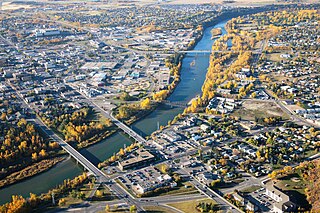
Red Deer is a city in Alberta, Canada, located midway on the Calgary–Edmonton Corridor. Red Deer serves central Alberta, and its key industries include health care, retail trade, construction, oil and gas, hospitality, manufacturing and education. It is surrounded by Red Deer County and borders on Lacombe County. The city is in aspen parkland, a region of rolling hills, alongside the Red Deer River.
Camrose is a city in central Alberta, Canada that is surrounded by Camrose County. Located along Highway 13 it had its beginnings as a railroad hub.
Spruce Grove is a city that is 11 km (6.8 mi) west of Edmonton, Alberta, in Canada. The city is adjacent to the Town of Stony Plain and is surrounded by Parkland County.
Leduc is a city in the province of Alberta, Canada. It is 33 km (21 mi) south of the provincial capital of Edmonton and is part of the Edmonton Metropolitan Region.
Lloydminster is a city in Canada which has the unusual geographic distinction of straddling the provincial border between Alberta and Saskatchewan. The city is incorporated by both provinces as a single city with a single municipal administration.
Okotoks is a town in the Calgary Region of Alberta, Canada. It is on the Sheep River, approximately 38 km (24 mi) south of Downtown Calgary. Okotoks has emerged as a bedroom community of Calgary. According to the 2021 Federal Census, the town has a population of 30,214 making it the largest town in Alberta.
Cochrane is a town in the Calgary Metropolitan Region of Alberta, Canada. The town is located 18 km (11 mi) west of the Calgary city limits along Highway 1A. Cochrane is one of the fastest-growing communities in Canada, and with a population of 32,199 in 2021, it is one of the largest towns in Alberta. It is part of Calgary's census metropolitan area and a member community of the Calgary Metropolitan Region Board (CMRB). The town is surrounded by Rocky View County.
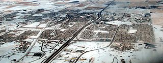
Airdrie is a city in Alberta, Canada, within the Calgary Region. It is located north of Calgary within the Calgary–Edmonton Corridor at the intersection of Queen Elizabeth II Highway and Highway 567.
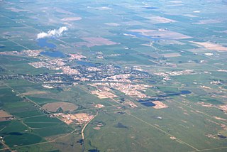
Brooks is a city in southeast Alberta, Canada in the County of Newell. It is on Highway 1 and the Canadian Pacific Kansas City railway, approximately 186 km (116 mi) southeast of Calgary, and 110 km (68 mi) northwest of Medicine Hat. The city has an elevation of 760 m (2,490 ft).
Whitecourt is a town in Northern Alberta, Canada that is surrounded by Woodlands County. It is approximately 177 km (110 mi) northwest of Edmonton and 279 km (173 mi) southeast of Grande Prairie at the junction of Highway 43 and Highway 32. It has an elevation of 690 m (2,260 ft).
Strathcona County is a specialized municipality in the Edmonton Metropolitan Region within Alberta, Canada between Edmonton and Elk Island National Park. It forms part of Census Division No. 11.
Stony Plain is a town in the Edmonton Metropolitan Region of Alberta, Canada that is surrounded by Parkland County. It is west of Edmonton adjacent to the City of Spruce Grove and sits on Treaty 6 land.
Lac La Biche is a hamlet in Lac La Biche County within northeast Alberta, Canada. It is located approximately 220 km (140 mi) northeast of the provincial capital of Edmonton. Previously incorporated as a town, Lac La Biche amalgamated with Lakeland County to form Lac La Biche County on August 1, 2007.
Strathmore is a town located in southern Alberta, Canada that is surrounded by Wheatland County. It is along the Trans-Canada Highway approximately 50 kilometres (30 mi) east of Calgary.
Beaumont is a city in Leduc County within the Edmonton Metropolitan Region of Alberta, Canada. It is located at the intersection of Highway 625 and Highway 814, adjacent to the City of Edmonton and 6.0 kilometres (3.7 mi) northeast of the City of Leduc. The Nisku Industrial Park and the Edmonton International Airport are located 4.0 kilometres (2.5 mi) to the west and 8.0 kilometres (5.0 mi) to the southwest respectively.
Chestermere, originally named Chestermere Lake is a city in the Canadian province of Alberta, within Rocky View County. It is largely a commuter town of Calgary and is a member municipality of the Calgary Region. The city, which surrounds Chestermere Lake, was known as Chestermere Lake from 1977 to 1993.
Slave Lake is a town in northern Alberta, Canada that is surrounded by the Municipal District of Lesser Slave River No. 124. It is approximately 255 km (158 mi) northwest of Edmonton. It is located on the southeast shore of Lesser Slave Lake at the junction of Highway 2 and Highway 88.
Alberta has experienced a relatively high rate of growth in recent years, due in large part to its economy. Between 2003 and 2004, the province saw high birthrates, relatively high immigration, and a high rate of interprovincial migration when compared to other provinces. Approximately 81% of the population live in urban areas and only about 19% live in rural areas. The Calgary–Edmonton Corridor is the most urbanized area in Alberta and is one of Canada's four most urban regions. Many of Alberta's cities and towns have also experienced high rates of growth in recent history. From a population of 73,022 in 1901, Alberta has grown to 4,262,635 in 2021 and in the process has gone from less than 1.5% of Canada's population to 11.5%. It is the fourth most populated province in Canada. Between the 2016 and 2021 censuses, the Alberta population grew by 4.8%.
According to the 2021 census, the City of Edmonton had a population of 1,010,899 residents, compared to 4,262,635 for all of Alberta, Canada. The total population of the Edmonton census metropolitan area (CMA) was 1,418,118, making it the sixth-largest CMA in Canada.
In the 2021 Census, the City of Calgary had a population of 1,306,784 residents, representing 30.7% of the 4,262,635 residents in all of Alberta, and 3.5% compared to a population of 36,991,981 in all of Canada. The total population of the Calgary census metropolitan area (CMA) was 1,481,806. Calgary is the largest city in Alberta, and the third-largest municipality and fifth-largest metropolitan area in Canada, as of 2021.