Fairview is a town in Peace Country, Alberta, Canada. It is located 82 km (51 mi) southwest of Peace River and 115 km (71 mi) north of Grande Prairie at the intersection of Highway 2 and Highway 64A.

Manning is a town in northern Alberta, Canada. It is known as the "Land of the Mighty Moose". It is located on Highway 35 on the Notikewin River, approximately 73 km (45 mi) north of Peace River.

Stettler is a town in east-central Alberta, Canada that is surrounded by the County of Stettler No. 6.

Strathmore is a town located in southern Alberta, Canada that is surrounded by Wheatland County. It is along the Trans-Canada Highway approximately 50 kilometres (30 mi) east of Calgary.
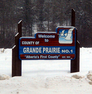
The County of Grande Prairie No. 1 is a municipal district in northwestern Alberta, Canada in Census Division No. 19.

Grande Cache is a hamlet in West-Central Alberta, Canada within and administered by the Municipal District of Greenview No. 16. It is located on Highway 40 approximately 145 kilometres (90 mi) northwest of Hinton and 435 kilometres (270 mi) west of Edmonton. Grande Cache overlooks the Smoky River, is at the northern edge of Alberta's Rockies, and serves as a gateway to the Willmore Wilderness Park. The hamlet held town status prior to 2019.

Grimshaw is a town in northern Alberta, Canada. It is approximately 25 km (16 mi) west of the Town of Peace River at the junction of Highway 2 and Highway 2A and along Mackenzie Northern Railway. By virtue of being the original starting point of Highway 35, which leads to the Northwest Territories, Grimshaw is referred to as Mile Zero of the Mackenzie Highway.

Legal is a town in the Edmonton Metropolitan Region of Alberta, Canada within Sturgeon County. It is 2.4 km (1.5 mi) east of Highway 2 on Highway 651, approximately 42 km (26 mi) north of Edmonton.

McLennan is a town in northern Alberta, Canada. It is approximately 50 km (31 mi) north of High Prairie on Highway 2.

Two Hills is a town in central Alberta, Canada. It is approximately 137 km (85 mi) east of Edmonton at the junction of Highway 45 and Highway 36. Two Hills is primarily an agriculture-based community. It was named from the presence of two hills located near the town. Post office established in 1914.

Valleyview is a town in northwest Alberta, Canada. It is surrounded by the Municipal District of Greenview No. 16 and in Census Division No. 18.
Wembley is a town in northern Alberta, Canada. It is approximately 23 km (14 mi) west of Grande Prairie at the junction of Highway 43 and Highway 724.
Berwyn is a village in northwestern Alberta, Canada. It is located approximately 37 km (23 mi) west of the Town of Peace River, 10 km (6.2 mi) southwest of the Town of Grimshaw, and 15 km (9.3 mi) northeast of the Duncan's First Nation reserve.

Westlock County is a municipal district in central Alberta, Canada that is north of Edmonton. The county was formerly known as the Municipal District of Westlock No. 92, and was created in 1943 from the merger of five smaller municipal districts.

The Municipal District of Greenview No. 16 is a municipal district (MD) in northwest Alberta, Canada. It covers the full extent of Census Division 18, and with an area of 32,984 km2 (12,735 sq mi), it is the largest municipal district in Alberta. Its administrative office is located in the Town of Valleyview.

Mackenzie County is a specialized municipality in northern Alberta, Canada. It is located in Census Division 17, along the Mackenzie Highway. The municipal office is located in the hamlet of Fort Vermilion.

The County of Northern Lights is a municipal district in northwest Alberta, Canada. Located in Census Division 17, its municipal office is located in the Town of Manning.
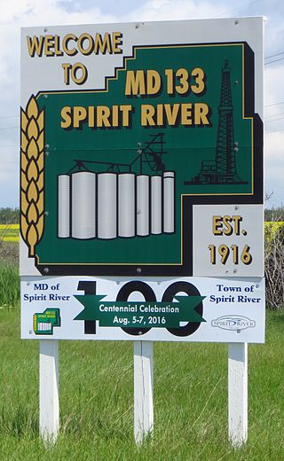
The Municipal District of Spirit River No. 133 is a municipal district (MD) in northwest Alberta, Canada, north of Grande Prairie. Located in the Upper Peace Region, its municipal office is located in the Town of Spirit River. With an area of 683.6 km2 (263.9 sq mi), it is the smallest municipal district in Alberta.
Swalwell is a hamlet in southern Alberta, Canada within Kneehill County. Previously an incorporated municipality, Swalwell dissolved from village status on January 1, 1946, to become part of the Municipal District of Norquay No. 279.

East Prairie Metis Settlement is a Metis settlement in northern Alberta, Canada within Big Lakes County. It is located approximately 20 km (12 mi) south of Highway 2 and 168 km (104 mi) east of Grande Prairie. It was founded in 1939.