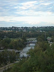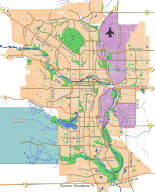
The Bow River is a river in Alberta, Canada. It begins within the Canadian Rocky Mountains and winds through the Alberta foothills onto the prairies, where it meets the Oldman River, the two then forming the South Saskatchewan River. These waters ultimately flow through the Nelson River into Hudson Bay. The Bow River runs through the city of Calgary, taking in the Elbow River at the historic site of Fort Calgary near downtown. The Bow River pathway, developed along the river's banks, is considered a part of Calgary's self-image.

The Glenmore Reservoir is a large reservoir on the Elbow River in the southwest quadrant of Calgary, Alberta. It is controlled by the Glenmore Dam, a concrete gravity dam on the Elbow River. The Glenmore Reservoir is a primary source of drinking water to the city of Calgary. Built in 1932, with a cost of $3.8 million, the dam controls the downstream flow of the Elbow River, thus allowing the city to develop property near the river's banks with less risk of flooding.

Fish Creek Park is an urban provincial park that preserves the valley of Fish Creek in the southern part of Calgary, Alberta, Canada. It is bordered on three sides by the city, and on the west by the territory of the Tsuu T’ina Nation (Sarcee), a First Nation.

The Tsuutʼina Nation, also spelled Tsuu Tʼina or Tsu Tʼina, is a First Nation band government in Alberta, Canada. The Tsuu T'ina Nation 145 reserve is located directly west of Calgary, with its eastern edge directly adjacent to the southwest city limits. Their traditional territory spans a much larger area in southern Alberta. The land area of the current reserve is 283.14 km2, and it had a population of 1,982 in the 2001 Canadian census. The northeast portion of the reserve was used as part of CFB Calgary, a Canadian Army base, from 1910 to 1998. In 2006, the land was returned to the Nation by the Government of Canada.

The Elbow River is a river in southern Alberta, Canada. It flows from the Canadian Rockies to the city of Calgary, where it merges into the Bow River.

Highway 201, better known by its official names of Stoney Trail and Tsuut'ina Trail, is a 101-kilometre (63 mi) freeway that encircles Calgary, Alberta. It serves as a bypass for the congested routes of 16 Avenue N and Deerfoot Trail through Calgary. At its busiest point near Beddington Trail in north Calgary, the six-lane freeway carried nearly 70,000 vehicles per day in 2023, and forms part of the CANAMEX Corridor which connects Calgary to Edmonton and Interstate 15 in the United States via Highways 2, 3, and 4.

Tsuu T'ina Nation 145 is an Indian reserve of the Tsuut'ina Nation in southern Alberta, Canada, created by Treaty 7.
Lakeview is a residential community in the southwestern quadrant of Calgary, Alberta, Canada.
Highway 8 is a highway in Southern Alberta that connects Highway 22 in Rocky View County, just north of Redwood Meadows, to Calgary.

Battalion Park is a geoglyph site in southwest Calgary, Alberta, Canada. It is on Signal Hill, overlooking the Tsuu T'ina Nation, as well as lands formerly known as Camp Sarcee and later Sarcee Training Area, a military reserve used by the Canadian Forces from before the First World War up until the 1990s. The park extends over an area of 93 hectares, north of the Elbow River. Its heritage value is associated with its dedication to the heroic efforts of Albertan soldiers during the First World War.
Crowchild Trail is a major expressway in western Calgary, Alberta. The segment from the 12 Mile Coulee Road at the edge of the city to 16 Avenue NW is designated as Highway 1A by Alberta Transportation. The road is a critical north–south link in West Calgary for both downtown-bound traffic and travel between the two quadrants of the city it passes through. Although planned to be one single freeway from Glenmore Trail to the city limits, the route is divided by a section of slow-moving arterial road with four signalized intersections between 24 Avenue and Memorial Drive. This separates the freeway in the northwest from the freeway south of the Bow River. Filling the gap and making the whole route a minimum six-lane freeway is planned for construction beyond 2027.
The city of Calgary, Alberta, has a large transportation network that encompasses a variety of road, rail, air, public transit, and pedestrian infrastructure. Calgary is also a major Canadian transportation centre and a central cargo hub for freight in and out of north-western North America. The city sits at the junction between the "Canamex" highway system and the Trans-Canada Highway.
Glenmore Trail is a 22-kilometre (14 mi) expressway in Calgary, Alberta, Canada, named after the reservoir which it crosses. It is a freeway between Sarcee Trail in southwest Calgary to Ogden Road in the southeast, carrying nearly 160,000 vehicles per weekday at its busiest point placing it second only to Deerfoot Trail as the busiest road in Alberta. East of Calgary, Glenmore Trail becomes Highway 560 en route to Langdon.
Discovery Ridge is a residential neighbourhood in the southwest quadrant of Calgary, Alberta. It is located at the western edge of the city and is bounded by Stoney Trail to the north, 69 Street W to the east, Rocky View County and the city limits to the west and the Elbow River and Tsuu T'ina first nation reserve to the south.
Eagle Ridge is an affluent residential neighbourhood situated on a peninsula in the Glenmore Reservoir in the southwest quadrant of Calgary, Alberta, Canada. The community is known for its unique proximity to green spaces and parks, recreational waterways, and Calgary's multi-use urban pathway system despite its relative proximity to the city's denser downtown core and adjoining communities. In 2014, Eagle Ridge was ranked the 18th wealthiest neighbourhood in Canada and 3rd wealthiest in Calgary. One of Calgary's smallest neighbourhoods by population, Eagle Ridge is physically secluded from other nearby communities due to the Glenmore Reservoir acting as natural boundary to its north, west, and south, while 14 Street W bounds the community to the east.
Sarcee Trail is a major limited-access road in Calgary, Alberta. It is divided into two portions, one in the south end of the city, and one in the north end of the city. Originally planned as one continuous route, plans to connect the two halves have been shelved as it would involve the demolition of homes in Bowness and the disruption of the Bowmont Natural Area park. The urban arterial road is named for the Tsuu T'ina, who were also known as the Sarcee.

16 Avenue N is a major road in Calgary, Alberta, that forms a 26.5-kilometre (16.5 mi) segment of Highway 1 and connects Calgary to Banff and Medicine Hat. It is a four to six-lane principal arterial expressway at its extremities, but is an urban arterial road between the Bow River and Bowness Road, and also between Crowchild Trail and Deerfoot Trail. Due to Calgary's quadrant system, it is known as 16 Avenue NW west of Centre Street and 16 Avenue NE to the east.
The Taza Water Reservoir is a proposed water reservoir and pump house build in Taza Park's Tsuut'ina Nation, Calgary, Alberta. It is projected to be completed in August 2023, and was designed by the firm Zeidler Architecture; costing about $18M in construction, in collaboration with WSP Global.

Griffith Woods Park is a city park in southwest Calgary, Alberta. It is a popular place for hiking and other recreation in the city.


