Investigator Group Conservation Park

Last updated

.

Investigator Group Conservation Park
South Australia
View of Southern Pearson Island, Investigator Group Conservation Park, South Australia.JPG
Looking at the 'Southern End' of Pearson Island
Australia South Australia location map.svg
Red pog.svg
Investigator Group Conservation Park
Nearest town or city Elliston [2]
Coordinates 33°57′14″S134°16′06″E / 33.953792737°S 134.2682429°E / -33.953792737; 134.2682429 Coordinates: 33°57′14″S134°16′06″E / 33.953792737°S 134.2682429°E / -33.953792737; 134.2682429 [1]
Established16 March 1967 (1967-03-16) [3]
Abolished25 August 2011. [4]
Area3.88 km2 (1.5 sq mi) [1]
Managing authorities Department of Environment and Natural Resources (2011) [5]
See also Protected areas of South Australia

Investigator Group Conservation Park was a protected area in the Australian state of South Australia located on islands within the Investigator Group of islands off the west coast of Eyre Peninsula about 562 kilometres (349 mi) north-west of the state capital of Adelaide and about 50 kilometres (31 mi) south-west of the town of Elliston. [2] [6]

Contents

Land tenure and designation

The conservation park consisted of land on the following islands within the Investigator Group - Dorothee Island, Pearson Island, the Topgallant Islands, the Veteran Isles and the Ward Islands [7] As of 2010, the conservation park covered an area of 3.88 square kilometres (1.50 sq mi). [1] The conservation park was categorized in 2010 as being an IUCN Category Ia protected area. [1]

History

The land first received protected area status as fauna conservation reserves proclaimed on 16 March 1967 under the Crown Lands Act 1929 in respect to Topgallant Island, Ward Islands and Pearson Island with exception to land in sections 12 and 13 which were under the control of the Australian government. [3]

On 27 April 1972, all of the land proclaimed as a fauna conservation reserve was reconstituted as the Investigator Group Conservation Park under the National Parks and Wildlife Act 1972 . [8]

In 1980, the conservation park was listed on the now-defunct Register of the National Estate. [6]

On 19 December 1991, additional land was added to the conservation park to extend protection over land located between high tide and low tide. [2] [9]

On 29 August 2002, additional land was added to the conservation park. [10]

On 25 August 2011, all of the land within the conservation park was constituted as part of the Investigator Group Wilderness Protection Area with the result that the conservation park ceased to exist. [4]

A description of the conservation park published in 1980

On 21 October 1980, the conservation park was placed (i.e. “registered”) on the Register of the National Estate. The following is the description and the statement of significance published at the time of placement. [6]

Description

A group of approximately twelve oceanic islands and associated submerged rocks from 22km-74km from the coast. Includes the Waldegrave islands (sic), [lower-alpha 1] Topgallant islands and Ward islands (but excludes Pearson (sic) [lower-alpha 2] and Flinders islands).

The islands are granite inselbergs up to 100m above sea level, and some are capped with calcarenite, a rock type of aeolian origin as windblown dunes. The islands feature precipitous cliffs to 75m tall, deep overhangs, sea caves, crevasses, talus slopes and summit platforms.

The larger islands have some soil development and mostly support low shrubland communities dominated by nitre bush ( Nitraria billardierei ), gallweed ( Zygophyllum apiculatum ), saltbush ( Atriplex paludosa ), grey saltbush ( A. cinerea ) and a daisy bush ( Olearia ramulosa )…

The islands are largely undisturbed because of the difficulty of access from the sea; Topgallant island contains some infestations of African boxthorn and common ice plant…

Statement of Significance

The registered islands in this group, namely Waldegrave Islands (sic), [lower-alpha 3] Topgallant Islands, Ward Islands and Pearson Islands, are true inselbergs or island mountains, rising abruptly to a maximum of 240m above sea level from the eastern section of the Great Australian Bight. Other important landforms within the Group are of marine origin, including old coastal foredune deposits and formations indicating a higher sea level than presently exists…

The islands of the Group are some of the most scenically spectacular of all South Australia's offshore islands. Many birds utilise the Investigator Group islands, which may be significant as intermediate points for birds migrating from Flinders Island to the Australian mainland, or as extended feeding territories for Flinders Island species…

Several rare or threatened bird taxa, or species with disjunct populations, utilise the islands for breeding, including osprey ( Pandion haliaetus ), white-breasted sea-eagle ( Haliaeetus leucogaster ), cape barren goose ( Cereopsis novaehollandiae ), white faced storm-petrel ( Pelagodroma marina ) and short-tailed shearwater ( Puffinus tenuirostris )…

A small colony of Australian sea-lions ( Neophoca cinerea ), one of the world's rarest marine mammals, breeds on Ward Island…

Groups of the New Zealand fur seal ( Arctocephalus forsteri ) shelter on the rock platforms of several islands and may breed on them…

See also

Notes and references

Notes

  1. It is not known why the Waldegrave Islands are included in the Register of the National Estate listing for the Investigator Group Conservation Park because these islands, although described as being part of the Investigator Group, have a similar history of protection commencing as a fauna protection reserve in 1967 followed in 1972 with the re-proclamation of the protected land as the Waldegrave Islands Conservation Park which has its own listing on the Register of the National Estate. [11]
  2. The exclusion of Pearson Island is not correct as the management plan does specifically include this island [7] :56
  3. Refer footnote 1 above

Related Research Articles

Flinders Chase National Park Protected area in South Australia

Flinders Chase National Park is a protected area in the Australian state of South Australia located at the west end of Kangaroo Island about 177 kilometres west-south west of the state capital of Adelaide and 110 kilometres west of the municipal seat of Kingscote. It is a sanctuary for endangered species and home to a few geological phenomena. It was the second national park to be declared in South Australia.

Seal Bay Conservation Park Protected area in South Australia

Seal Bay Conservation Park is a protected area located on the south coast of Kangaroo Island in the Australian state of South Australia. It is the home of the third largest Australian sea lion colony in Australia.

Investigator Group Archipelago off the western coast of the Eyre Peninsula, South Australia

The Investigator Group is an archipelago in South Australia that consists of Flinders Island and five island groups located off the western coast of the Eyre Peninsula. It is named after HMS Investigator by her commander, Matthew Flinders when he explored the area in 1802. The Group lies within the Great Australian Bight. All the islands except Flinders Island, and a part of Pearson Island, are within the Investigator Group Wilderness Protection Area and the Waldegrave Islands Conservation Park.

Nuyts Archipelago Conservation Park Protected area in South Australia

Nuyts Archipelago Conservation Park is a protected area in the Australian state of South Australia located on Eyre Island and St Peter Island in the Nuyts Archipelago located off the west coast of Eyre Peninsula about 10 kilometres south and 25 kilometres south-east respectively of Ceduna.

Isles of St Francis Conservation Park Protected area in South Australia

.

The Pages

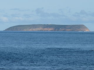
The Pages is an island group in the Australian state of South Australia consisting of two small islands and a reef located in Backstairs Passage, a strait separating Kangaroo Island and the Fleurieu Peninsula. The island group has been located with the protected area known as The Pages Conservation Park since 1972.

The Pages Conservation Park Protected area in South Australia

The Pages Conservation Park is a protected area in the Australian state of South Australia which is associated with the island group known as The Pages located in Backstairs Passage about 25 kilometres south-east of Cape Jervis and about 98 kilometres south south-west of the state capital of Adelaide.

Althorpe Islands Conservation Park Protected area in South Australia

Althorpe Islands Conservation Park is a protected area in the Australian state of South Australia occupying the Althorpe Island, Haystack Island and Seal Island in Investigator Strait near the town of Stenhouse Bay.

Whidbey Isles Conservation Park Protected area in South Australia

The Whidbey Isles Conservation Park is a protected area in the Australian state of South Australia which consists of seven islands located about 15 kilometres (9.3 mi) west-southwest of Coffin Bay on the lower Eyre Peninsula.

Investigator Group Wilderness Protection Area Protected area in South Australia

Investigator Group Wilderness Protection Area is a protected area in South Australia, located in the Investigator Group of islands off the west coast of Eyre Peninsula, between 25 kilometres and 70 kilometres south-west of Elliston.

Waldegrave Islands Conservation Park Protected area in South Australia

Waldegrave Islands Conservation Park is a protected area located on the following islands within the Investigator Group in South Australia: the Waldegrave Island, Little Waldegrave Island and the Watchers.

Baird Bay Islands Conservation Park Protected area in South Australia

Baird Bay Islands Conservation Park is a protected area in the Australian state of South Australia associated with two islands located in Baird Bay on the west coast of Eyre Peninsula respectively about 32 kilometres and 45 kilometres west south-west of Streaky Bay.

Olive Island Conservation Park Protected area in South Australia

Olive Island Conservation Park is a protected area in the Australian state of South Australia associated with Olive Island off the west coast of Eyre Peninsula and which is located about 25 kilometres west-northwest of the town of Streaky Bay.

Tumby Island Conservation Park Protected area in South Australia

Tumby Island Conservation Park is a protected area in the Australian state of South Australia associated with Tumby Island in Spencer Gulf and located about 5 kilometres southeast of the town of Tumby Bay.

Mount Dutton Bay Conservation Park Protected area in South Australia

Mount Dutton Bay Conservation Park is a protected area in the Australian state of South Australia located on the west coast of Eyre Peninsula on islands located on waters in the sector between the north west to the east of the town of Coffin Bay.

Topgallant Islands

Topgallant Islands is an island group in the Australian state of South Australia located in the Investigator Group about 22 kilometres south west of Cape Finniss on the west coast of Eyre Peninsula. The group was discovered and named by Matthew Flinders on 13 February 1802. The island group has enjoyed protected area status since the 1960s and since 2011, it has been part of the Investigator Group Wilderness Protection Area.

Waldegrave Islands

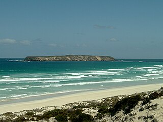
Waldegrave Islands is an island group in the Australian state of South Australia located in the Investigator Group about 2.5 kilometres northwest by west of Cape Finniss on the west coast of Eyre Peninsula. The group consists of Waldegrave Island, Little Waldegrave Island and according to some sources, a pair of rocks known as the Watchers. The group is notable as a breeding site for Australian sea lions and Cape Barren geese. The group has enjoyed protected area status since the 1960s and as of 1972 has been part of the Waldegrave Islands Conservation Park.

Katarapko Game Reserve Protected area in South Australia

.

Investigator Marine Park Protected area in South Australia

Investigator Marine Park is a marine protected area in the Australian state of South Australia located in the state's coastal waters in its west adjoining the west coast of Eyre Peninsula and islands in the Investigator Group respectively to the south-east and south-west of the town of Elliston.

Maize Island Lagoon Conservation Park Protected area in South Australia

Maize Island Lagoon Conservation Park is a protected area in the Australian state of South Australia located in the locality of Holder about 155 kilometres (96 mi) north-east of the state capital of Adelaide and about 2 kilometres (1.2 mi) east of the Waikerie.

References

  1. 1 2 3 4 5 "CAPAD 2010 South Australia summary (terrestrial) (refer 'SA Reserve List' tab )". Australian government. Retrieved 7 April 2019.
  2. 1 2 3 "Search results for 'Investigator Group Conservation Park' with the following datasets selected – 'NPW and Conservation Properties' and 'Gazetteer'". Location SA Map Viewer. South Australian Government. Retrieved 7 April 2019.
  3. 1 2 Shard, A.J. (16 March 1967). "CROWN LANDS ACT, 1929-1966: FAUNA CONSERVATION RESERVES DEDICATED" (PDF). THE SOUTH AUSTRALIAN GOVERNMENT GAZETTE. Government of South Australia. pp. 961–962. Retrieved 7 April 2019.
  4. 1 2 "Wilderness Protection (Investigator Group Wilderness Protection Area) Proclamation 2011". The South Australian Government Gazette. Government of South Australia. 25 August 2011. p. 3624. Retrieved 7 April 2019.
  5. "Public Sector (Administrative Units of Public Service—Variation 1) Proclamation 2010". The South Australian Government Gazette. South Australian Government. 1 July 2010. p. 3342. Retrieved 14 April 2018.
  6. 1 2 3 "Investigator Group Conservation Park, Elliston (sic), SA, Australia - listing on the now-defunct Register of the National Estate (Place ID 6678)". Australian Heritage Database . Department of the Environment. 21 October 1980. Retrieved 7 April 2019.
  7. Anon (2006). Island Parks of Western Eyre Peninsula Management Plan (PDF). Adelaide: Department for Environment and Heritage, South Australia. pp. 5–6. ISBN   1-921238-18-6 . Retrieved 7 April 2019.
  8. "No. 56 of 1972 (National Parks and Wildlife Act, 1972)". The South Australian Government Gazette. Government of South Australia: 660 & 702. 27 April 1972. Retrieved 26 January 2019. Investigator Group Conservation Park, Topgallant Island, Ward Island, Pearson Island. (excluding Section 12 and 13, North out of Hundreds)
  9. Blevins, F.T. (19 December 1991). "NATIONAL PARKS AND WILDLIFE ACT 1972 SECTIONS 29 (3) AND 30 (2): VARIOUS CONSERVATION PARKS— ALTERATION OF BOUNDARIES" (PDF). The South Australian Government Gazette. Government of South Australia. p. 1907. Retrieved 16 January 2019. Investigator Group Conservation Park, Allotments 1-7 inclusive (Deposited Plan No. 31590), Out of Hundreds (Elliston)
  10. Weatherill, J. W. (29 August 2002). "NATIONAL PARKS AND WILDLIFE ACT 1972 SECTION 29 (3): INVESTIGATOR GROUP CONSERVATION PARK—ALTERATION OF BOUNDARIES" (PDF). The South Australian Government Gazette. Government of South Australia. p. 3212. Retrieved 8 April 2019. Allotment 2 of Deposited Plan 19499 and Section 12 (Pearson Isles), Out of Hundreds (Elliston).
  11. "Waldegrave Islands Conservation Park, Cape Finnis via Elliston, SA, Australia - listing on the now-defunct Register of the National Estate (Place ID 6679)". Australian Heritage Database . Department of the Environment. 21 October 1980. Retrieved 10 May 2019.

Attribution