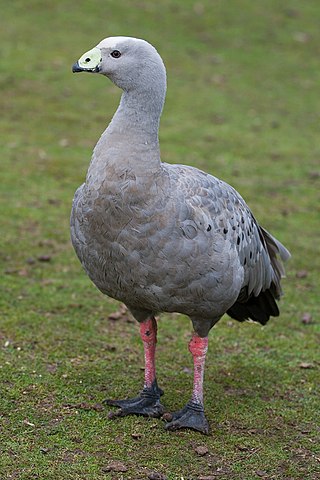
The Investigator Group is an archipelago in South Australia that consists of Flinders Island and five island groups located off the western coast of the Eyre Peninsula. It is named after HMS Investigator by her commander, Matthew Flinders when he explored the area in 1802. The Group lies within the Great Australian Bight. All the islands except Flinders Island, and a part of Pearson Island, are within the Investigator Group Wilderness Protection Area and the Waldegrave Islands Conservation Park.

The Nuyts Archipelago is an island group in South Australia in the Great Australian Bight, to the south of the town of Ceduna on the west coast of the Eyre Peninsula. It consists of mostly granitic islands and reefs that provide breeding sites for Australian sea lions and support colonies of short-tailed shearwater. It also includes the island group known as the Isles of St Francis. All the islands, with the exception of a part of Evans Island, are located within the protected areas of the Nuyts Archipelago Wilderness Protection Area and the Nuyts Archipelago Conservation Park.

Troubridge Island is an island located in the south west corner of Gulf St Vincent in South Australia near the eastern edge of the Troubridge Shoals off the east coast of Yorke Peninsula about 8 kilometres (5.0 mi) southeast by east of the town of Edithburgh It is notable for being a site of an operating lighthouse from 1856 until 2002 and as a site for a sea bird rookery. Since 1982, the island has been part of the Troubridge Island Conservation Park.

Anxious Bay is a bay in the Australian state of South Australia located on the west coast of Eyre Peninsula about 275 kilometres west north-west of Adelaide. It was named by Matthew Flinders on 21 February 1802. It is one of four ‘historic bays’ located on the South Australian coast.
Baudin Rocks, also previously known as the Godfrey Islands, is a group of islets on the south east coast of in the Australian state of South Australia about 8.3 kilometres North-northwest of Robe. The islet group was discovered and named by Matthew Flinders in 1802 after Nicolas Baudin. The group has had protected area status since 1965 and since 1972, the group has been part of the Baudin Rocks Conservation Park.

Penguin Island is an island in the Australian state of South Australia located in Rivoli Bay on the state's south east coast of approximately 1.5 kilometres south of Beachport. From 1878 to 1960, it was the site of an operating lighthouse. Since at least 1972, it has been part of the Penguin Island Conservation Park.
Waldegrave Islands Conservation Park is a protected area located on the following islands within the Investigator Group in South Australia: the Waldegrave Island, Little Waldegrave Island and the Watchers.
Smooth Island is an island in the Australian state of South Australia located off the west coast of Eyre Peninsula about 52 kilometres south west of the town of Ceduna. It is both part of a local group of islands known as the Isles of St Francis group and a larger group known as the Nuyts Archipelago. It has enjoyed protected area status since the 1960s and since 2011, it has been part of the Nuyts Archipelago Wilderness Protection Area.
Nicolas Baudin Island is an island in the Australian state of South Australia about 500 metres west of Cape Blanche on the west coast of Eyre Peninsula about 25 kilometres south south-west of the town of Streaky Bay. The island is notable as a breeding site for Australian sea lions. The island has enjoyed protected area status since 2003 when it became part of the Nicolas Baudin Island Conservation Park.
Ward Islands is an island group in the Australian state of South Australia located in the Investigator Group about 53 kilometres west by south of Cape Finniss on the west coast of Eyre Peninsula. The group was discovered and named by Matthew Flinders on 13 February 1802. The island group has enjoyed protected area status since the 1960s and since 2011, it been part of the Investigator Group Wilderness Protection Area.
Topgallant Islands is an island group in the Australian state of South Australia located in the Investigator Group about 22 kilometres south west of Cape Finniss on the west coast of Eyre Peninsula. The group was discovered and named by Matthew Flinders on 13 February 1802. The island group has enjoyed protected area status since the 1960s and since 2011, it has been part of the Investigator Group Wilderness Protection Area.
Cape Finniss is a headland located at the southern extremity of Anxious Bay on the west coast of Eyre Peninsula in South Australia about 6 kilometres Northwest by west of the town of Elliston. It is described as being ‘a rocky headland with a rounded top, 47 metres high.’ Cape Finniss is linked by a submerged reef which is considered to be ‘remnants of a once more prominent Cape Finnis(s)’ to the Waldegrave Islands which are located to the cape's north west.
Jones Island is an island in the Australian state of South Australia located at the mouth of Baird Bay in the north end of Anxious Bay about 45 kilometres south-southeast of the town of Streaky Bay on the west coast of Eyre Peninsula. The island is notable as a breeding site for Australian sea lions and Australian pelicans. The island has enjoyed protected area status since 1967 and as of 1972, it has been part of the Baird Bay Islands Conservation Park.
Pearson Isles is an island group located in the Australian state of South Australia about 65 kilometres to 72 kilometres west south-west of Cape Finniss on the west coast of Eyre Peninsula within the larger island group, the Investigator Group. The group was discovered and named by Matthew Flinders on 13 February 1802. The group has four members - Pearson Island, a pair of islands known as the Veteran Isles and Dorothee Island. The island group has enjoyed protected area status starting in 1916 and since 2011, it has been part of the Investigator Group Wilderness Protection Area. The island group is notable as a venue for scientific research.
Dorothee Island is an island in the Australian state of South Australia which is part of the Pearson Isles which itself is part of the larger island grouping known as the Investigator Group. It is located about 69 kilometres west south-west of Cape Finniss on the west coast of Eyre Peninsula. It was discovered as part of the Pearson Isles by Matthew Flinders on 13 February 1802. The island was given its name in August 1969 in order to preserve a name used within the locality by the Baudin expedition. The island has enjoyed protected area status since at least 1972 and since 2011, it been part of the Investigator Group Wilderness Protection Area.
Veteran Isles is a pair of islands in the Australian state of South Australia which is part of the Pearson Isles which itself is part of the larger island group known as the Investigator Group. It is located about 69 kilometres west south-west of Cape Finniss on the west coast of Eyre Peninsula. It was discovered as part of the Pearson Isles by Matthew Flinders on 13 February 1802. The island was given its name in August 1969 in order to preserve a name used within the locality by the Baudin expedition. The island has enjoyed protected area status since at least 1972 and since 2011, it been part of the Investigator Group Wilderness Protection Area.

Pearson Island is an island located in the Australian state of South Australia within the Pearson Isles an island group located in the larger group known as the Investigator Group about 63 kilometres southwest by west of Cape Finniss on the west coast of Eyre Peninsula. The group was discovered and named by Matthew Flinders on 13 February 1802. The island group has enjoyed protected area status since the 1960s and since 2011, it has been part of the Investigator Group Wilderness Protection Area. Pearson Island is notable both for its colony of Pearson Island Rock wallaby and for being a destination for scientific research.
Royston Island is an island in the Australian state of South Australia at the northern end of Pondalowie Bay on the south-west extremity of Yorke Peninsula about 13 kilometres north-west of the town of Stenhouse Bay. The island has enjoyed protected area status since 1967 and since 1972, it has been part of the Innes National Park.

South Island is an island located in the Australian state of South Australia at the south end of Pondalowie Bay on the south-west extremity of Yorke Peninsula about 11 kilometres north-west by west of the town of Stenhouse Bay. The island has enjoyed protected area status since 1970 and since 1977, it has been part of the Innes National Park.
Dangerous Reef is an island and reef system located in the Spencer Gulf in the Australian state of South Australia about 32.5 kilometres (20.2 mi) east-southeast of the city, Port Lincoln. It is the southernmost member of the Sir Joseph Banks Group. It has been the site of a navigation aid since 1911. It is notable as the site of a breeding colony of Australian sea lions. The waters adjoining its shore are notable as a place to view great white sharks to the extent that it was both a popular gamefishing and shark cage diving venue during the twentieth century, and was used to film footage for the following motion pictures – Blue Water White Death and Jaws. The island has enjoyed protected area status since 1900 and it has been part of the Sir Joseph Banks Group Conservation Park since 1989.

