Extent & description
Nepean Bay lies between Point Marsden and Kangaroo Head on the north-east coast of Kangaroo Island facing into Investigator Strait. Nepean Bay itself includes the following coastal inlets from west to east - Bay of Shoals, Western Cove and Eastern Cove. Eastern Cove itself includes an inlet consisting of a channel known as American River and a lagoon system known as Pelican Lagoon. [3]
Bay of Shoals
The Bay of Shoals is a body of water which is located immediately north of the settlement of Kingscote and whose mouth is located between Cape Rouge in the north and Beatrice Point in the south over a distance of about 5 kilometres (3.1 mi). The bay has a maximum charted depth of 2.7 metres (8 ft 10 in). Its mouth is bounded by a spit known as 'The Spit' which extends from Cape Rouge to within 0.5 nautical miles (0.93 km; 0.58 mi) of Beatrice Point, includes the islets of Busby and Beatrice and is reported as being exposed during local tides, i.e. ‘drying.’ Access for watercraft into the bay is via a natural channel at its southern end near Beatrice Point. [3] [4] [2]
Kingscote Harbour
Kingscote Harbour is the sheltered water between Bay of Shoals and Western Cove. The harbour is sheltered by the Beatrice Islets, and it faces the northern part of the town of Kingscote. [5]
Western Cove
Western Cove is a body of water whose mouth is located between Beare Point in the west and Morrison Point in the east separated by a distance of about 8 nautical miles (15 km; 9.2 mi). The cove has a maximum depth of about 10 metres (33 ft) at its mouth. Its shoreline is described as (distances in nautical miles): [3] [2] [6]
The S(outh) shore, between Morrison Point and a red cliffy point about 3 miles W, is high and rocky. A range of wooded hills along the S(outh) shore falls gradually to the W(est). Red cliffs extend about 1.5 miles W(est) from the red cliffy point, and from there to the head of the cove is a continuous sandy beach. The land at the head of the cove is low and swampy and continues so to Beare Point…
Eastern Cove
Eastern Cove is the body of water whose mouth is located between Morrison Point in the west and Kangaroo Head in the east separated by a distance of about 6 nautical miles (11 km; 6.9 mi). The cove has a maximum depth of 14 metres (46 ft) at its mouth. Its shoreline is described as (distances in nautical miles): [3] [2] [6]
The shore of Eastern Cove, between Kangaroo Head and American Beach, 2.5 miles S(outh), is rugged and rocky. Between the SW end of American Beach and Rocky Point, it consists of alternate beaches and low, rocky points. A sandy beach forms the S(outh) shore between Rocky Point and Strawbridge Point, 2.75 miles WNW. The S(outh) side of the cove is low with wooded hills at the back.
Eastern Cove includes Ballast Head Harbor on the western side near Ballast Head. [7]

Flinders Chase National Park is a protected area in the Australian state of South Australia located at the west end of Kangaroo Island about 177 kilometres west-south west of the state capital of Adelaide and 110 kilometres west of the municipal seat of Kingscote. It is a sanctuary for endangered species and home to a few geological phenomena. It was the second national park to be declared in South Australia.

Seal Bay Conservation Park is a protected area located on the south coast of Kangaroo Island in the Australian state of South Australia. It is the home of the third largest Australian sea lion colony in Australia.
Cape du Couedic is a headland in the Australian state of South Australia located on the southwest tip of Kangaroo Island in the locality of Flinders Chase. It was named after a French naval officer, Charles Louis du Couëdic de Kergoualer, by the Baudin expedition to Australia during January 1803. It is the site for the Cape du Couedic Lighthouse. It is currently located within the Flinders Chase National Park.

The Kangaroo Island Council is a local government area in South Australia that covers the entirety of Kangaroo Island, 13 km off the coast of the mainland. The council was formed on the 28 November 1996 by the amalgamation of the District Council of Kingscote and the District Council of Dudley. Its first meeting held on 11 December 1996.

Vivonne Bay is a bay in the Australian state of South Australia located on the south coast of Kangaroo Island about 61 kilometres (38 mi) from Kingscote, the island's main town, and which was named by the members of Baudin expedition to Australia who visited the bay in January 1803. In a survey of 10,000 beaches by Professor Andrew Short, director of Sydney University's marine studies centre, the beach at Vivonne Bay was adjudged as one of the best in Australia.

D'Estrees Bay is a bay in the Australian state of South Australia located on the southern coast of Kangaroo Island about 39 kilometres south of Kingscote, the Island's principal centre.

The Backstairs Passage is a strait in South Australia lying between Fleurieu Peninsula on the Australian mainland and Dudley Peninsula on the eastern end of Kangaroo Island. The western edge of the passage is a line from Cape Jervis on Fleurieu Peninsula to Kangaroo Head on Kangaroo Island. The Pages, a group of islets, lie in the eastern entrance to the strait. About 14 km wide at its narrowest, it was formed by the rising sea around 13,000 years ago, at the end of the Pleistocene era, when it submerged the land connecting what is now Kangaroo Island with the Fleurieu Peninsula. Backstairs Passage was named by Matthew Flinders whilst he and his crew on HMS Investigator were exploring and mapping the coastline of South Australia in 1802.
Stokes Bay is a bay in South Australia on the northern coast of Kangaroo Island located about 38 kilometres (24 mi) west of the town of Kingscote. It is described as being the largest of a number of coves located along the coast between Cape Dutton about 3 nautical miles (5.6 km) to the west and Cape Cassini about 7 nautical miles (13 km) to the east. The source of the bay's name is reported as taking its names from "supposedly takes its name from the first mate of the Hartley which arrived in South Australia in October 1837" and is not to be confused with a Henry Stokes (c.1808-1898), a sealer who lived on Kangaroo Island prior to 1836 or a John Stokes who arrived on the island in 1817 and who is reported as residing at Stokes Bay.
Beatrice Islet Conservation Park is a protected area occupying the Beatrice Islets and adjoining intertidal areas in Nepean Bay on Kangaroo Island, South Australia. It is located about 4 kilometres east of the town of Kingscote.

Pelican Lagoon is a seawater lagoon in the Australian state of South Australia located on the north coast of Kangaroo Island about 18.7 kilometres south east of Kingscote. It was named by Matthew Flinders on 4 April 1802 after the large population of pelicans present in its waters and adjoining shorelines. Its role as fishery hatchery had been identified by the early 20th century with the result that fishing in its waters has been restricted in varying degrees.
Nepean Bay is a locality in the Australian state of South Australia located on the southern shore of Western Cove in Nepean Bay on the north coast of Kangaroo Island and about 128 kilometres south-west of the state capital of Adelaide and about 10 kilometres south-south-west of the municipal seat of Kingscote.
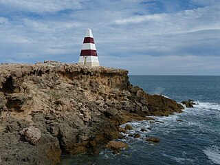
Point Marsden is a headland located on the north coast of Kangaroo Island in South Australia. It was named after William Marsden, Second Secretary to the Admiralty by Matthew Flinders in 1802. It is the western extremity of Nepean Bay and has been the site of a navigation aid since 1915.
Kangaroo Head is a headland in the Australian state of South Australia located at the north-west tip of Dudley Peninsula on Kangaroo Island. It was named by the British explorer, Matthew Flinders, on 23 March 1802.
Guichen Bay, is a bay located on the south-east coast of the Australian state of South Australia about 115 kilometres northwest of the regional city of Mount Gambier and about 270 kilometres south-southeast of the state capital of Adelaide. It was named in 1802 by the Baudin expedition of 1800-03 after Luc Urbain de Bouëxic, comte de Guichen. The town of Robe is located at the southern end of the bay.

Pondalowie Bay is a bay in the Australian state of South Australia located on the west coast of the south-west tip of Yorke Peninsula in Spencer Gulf about 12 kilometres west of Marion Bay. The coastline of Pondalowie Bay is both within the gazetted locality of Inneston and the Innes National Park.
Beatrice Islets are pair of islets in the Australian state of South Australia located in Nepean Bay on the north coast of Kangaroo Island about 4 kilometres east of Kingscote. The islets and adjoining intertidal areas are notable as habitat for bird life. The islet pair has enjoyed protected area status since 1909 and since at least 1972, have been part of the Beatrice Islet Conservation Park. During either the 1960s or the 1970s, the islets were extensively damaged by an exercise to remove an infestation of South African boxthorn.
Busby Islet is an islet in the Australian state of South Australia located in Nepean Bay on the north coast of Kangaroo Island about 2 kilometres north of the municipal seat of Kingscote. The islet and adjoining areas are notable as habitat for bird life. The islet has enjoyed protected area status since 1909 and since at least 1972, have been part of the Busby Islet Conservation Park.

Dudley Peninsula is the peninsula forming the eastern end of Kangaroo Island in the Australian state of South Australia. It was occupied by Aboriginal Australians as recently as 3,100 years BP but was found to be unoccupied by the first European explorers to visit it in the early 19th century. It was first settled by Europeans as early as the 1830s. As of 2011, it had a population of 595 people.
Hardwicke Bay is a bay in the Australian state of South Australia located on the west coast of Yorke Peninsula in Spencer Gulf.
Ballast Head is a locality in the Australian state of South Australia located on the north coast of Kangaroo Island overlooking Nepean Bay about 118 kilometres south of the state capital of Adelaide and about 19 kilometres southeast of the municipal seat of Kingscote.
This page is based on this
Wikipedia article Text is available under the
CC BY-SA 4.0 license; additional terms may apply.
Images, videos and audio are available under their respective licenses.

