Ceduna is a town in South Australia located on the shores of Murat Bay on the west coast of Eyre Peninsula. It lies west of the junction of the Flinders and Eyre Highways around 786 km northwest of the capital Adelaide. The port town/suburb of Thevenard lies 3 km to the west on Cape Thevenard. It is in the District Council of Ceduna, the federal Division of Grey, and the state electoral district of Flinders.
Taplan is a town in the Murray Mallee region of South Australia near the border with Victoria. Taplan is an aboriginal word meaning grass tree. The town was laid out by Henry George in 1914. The railway from Adelaide to Paringa was laid past the site of the future township in 1913, 183.25 miles (294.91 km) by rail from Adelaide. The Taplan Post Office was open from 1 July 1914 to 14 May 1982.
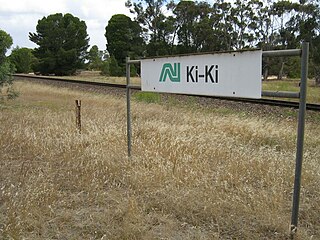
Ki Ki is a small town in South Australia. It is on the Dukes Highway (A8) adjacent to the Adelaide-Melbourne railway, the main links between Adelaide and Melbourne. The town is the primary settlement for the Hundred of Livingston.

The District Council of Ceduna is a local government area located on the far west coast of the Eyre Peninsula in South Australia. The district has a diverse business and industry with an estimated 240,000 tourists passing through every year. The township of Ceduna is the focal point of the district.
Denial Bay is a town and an associated locality in the Australian state of South Australia located on the state's west coast about 562 kilometres (349 mi) north-west of the state capital of Adelaide and about 10 kilometres (6.2 mi) west of the municipal seat of Ceduna.The town which is located on the western side of Murat Bay has extensive European history, first built on in 1889, and now hosts a large expanse of oyster farms, one of the largest on the Eyre Peninsula.

Penong is a town and locality on the Nullarbor Plain, in the far west of the state of South Australia located about 616 kilometres (383 mi) north-west of the state capital of Adelaide. With no settlements between it and Border Village on the border with Western Australia, 400 km (250 mi) away on the Eyre Highway, it is a popular rest-stop for travellers.
Cooltong is a town and locality in the Australian state of South Australia. At the 2011 census, Cooltong had a population of 317.
Cungena is a settlement in South Australia. It is in the District Council of Streaky Bay, on the Eyre Highway between Kyancutta and Ceduna. The town was surveyed and proclaimed in 1917, named after the Hundred of Cungena proclaimed in 1913. Cungena also includes the former town of Capietha.

Moorak is a southern suburb of Mount Gambier - a city in South Australia.
Hart is a locality in the Mid North region of South Australia. The boundaries were formalised in January 2000 for the long established name for the area. There was a railway siding at Hart on the Gladstone railway line. The major industry in the area is cereal crop growing.
Gifford Hill is a semi-rural locality approximately 9 kilometres (5.6 mi) south west of the centre of Murray Bridge by road. It is named for the geographical feature of the same name which is thought to be named for South Australian pioneer, John Gifford.
The Hundred of Dalrymple is a cadastral unit of hundred in South Australia on the southern Yorke Peninsula. It is one of the 16 hundreds of the County of Fergusson. Proclaimed on 20 June 1872, it is officially thought to be named after Dalrymple, East Ayrshire, Scotland.
Laura Bay is a locality in the Australian state of South Australia located on the west coast of the Eyre Peninsula overlooking the Great Australian Bight about 533 kilometres north-west of the Adelaide city centre and about 19 kilometres south east of the town centre of Ceduna.
Nadia is a locality in the Australian state of South Australia located on the state's west coast overlooking a bay associated with Great Australian Bight about 567 kilometres north-west of the Adelaide city centre and about 17 kilometres west of the town centre of Ceduna.

The County of Jervois is a cadastral unit in the Australian state of South Australia that covers land on the east coast of the Eyre Peninsula. It was proclaimed on 24 January 1878 and named after William Jervois, the Governor of South Australia from October 1877 to January 1883.
Mitchell is a locality on Eyre Peninsula in South Australia. Its boundaries were set to roughly the northern two thirds of the Hundred of Mitchell, from which it draws its name, in 2003. Mitchell includes the former locality of Lake Brimpton, adjacent to a lake by the same name. The Lake Brimpton school opened in 1932 but has now closed.
Mangalo is a locality on Eyre Peninsula in South Australia. It has a Memorial Hall, CFS and bulk grain silos but has never had a railway line to service them. The name is believed to be derived from an Aboriginal word for sand.

The Hundred of Bartlett is a cadastral hundred of South Australia located in the remote County of Way. It was created in 1889.
Maude is a locality on the Goyder Highway in the Mid North region of South Australia.

Hay Valley is a small locality in South Australia, 2.7 kilometres (1.7 mi) north of Nairne. It overlies the geographical feature of the same name and was originally established as a named subsection within the Hundred of Kanmantoo. In 2016 the population was 25.