Loveday Bay (South Australia)

Last updated

Loveday Bay
Australia South Australia relief location map.png
Red pog.svg
Loveday Bay
Location in South Australia
Location Lake Alexandrina, South Australia
Coordinates 35°35′06″S139°05′22″E / 35.585077°S 139.08937°E / -35.585077; 139.08937 Coordinates: 35°35′06″S139°05′22″E / 35.585077°S 139.08937°E / -35.585077; 139.08937 [1]
Type Bay
Primary inflows Lake Alexandrina
Basin  countries Australia

Loveday Bay is an inlet in the Australian state of South Australia located at the south-eastern end of Lake Alexandrina on the west coast of the Narrung Peninsula. [2]

South Australia State of Australia

South Australia is a state in the southern central part of Australia. It covers some of the most arid parts of the country. With a total land area of 983,482 square kilometres (379,725 sq mi), it is the fourth-largest of Australia's states and territories by area, and fifth largest by population. It has a total of 1.7 million people, and its population is the second most highly centralised in Australia, after Western Australia, with more than 77 percent of South Australians living in the capital, Adelaide, or its environs. Other population centres in the state are relatively small; Mount Gambier, the second largest centre, has a population of 28,684.
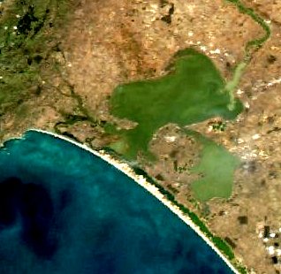
Lake Alexandrina (South Australia) lake in South Australia, and the mouth of the Murray River

Lake Alexandrina is a freshwater lake located in the Fleurieu and Kangaroo Island and Murray Mallee regions of South Australia, adjacent to the coast of the Southern Ocean, about 100 kilometres (62 mi) south-east of Adelaide. The lake adjoins the smaller Lake Albert; together they are known as the Lower Lakes.

Narrung Peninsula South Australia

Nurrang Peninsula is a peninsula in the Australian state of South Australia located at the south east end of Lake Alexandrina. It is bounded by Lake Alexandrina to the west, by Lake Albert to the north and to the east, and by The Coorong to the south. While the name appears to have been in use since the 19th century and by all levels of government in South Australia, the name is not listed in the state government’s official list of placenames. Its extent is within the localities of Meningie West and Narrung.

It is located within the locality of Narrung. [1] The bay has a subsidiary inlet on its south coast which is known as Salt Lagoon which includes the protected area, the Salt Lagoon Islands Conservation Park. [3]

Narrung, South Australia Town in South Australia

Narrung is a town and locality in the Australian state of South Australia. It is situated at the northern extent of the Narrung Peninsula, which separates The Coorong from Lake Albert adjacent to The Narrows which separates Lake Albert from the larger Lake Alexandrina.

Salt Lagoon Islands Conservation Park Protected area in South Australia

Salt Lagoon Islands Conservation Park is a protected area covering two islands and some adjoining waters in Salt Lagoon at the south east extent of Lake Alexandrina in South Australia about 14 kilometres south-west of Narrung.

It was named after early South Australian government surveyor Richard John Loveday. [4] The indigenous name for the head of Loveday Bay was Ngiakkung. [5] The southern end of the bay was traditionally used as a meeting place for intertribal trade. [6]

Richard John Loveday (1818–1883) was a government surveyor during the early settlement of South Australia.

A jetty was built in Loveday Bay in 1923 and was demolished in 1949. [7] [6]

Related Research Articles

Lake Albert (South Australia) lake in South Australia

Lake Albert is a notionally fresh water lake near the mouth of the Murray River in South Australia. It is filled by water flowing in from the larger Lake Alexandrina at its mouth near Narrung. It is separated on the south by the Narrung Peninsula from the salt-water Coorong. The only major town on the lake is Meningie. Lakes Alexandrina and Albert are together known as the Lower Lakes.

Paratoo, South Australia Suburb of District Council of Peterborough, South Australia

Paratoo is a locality in the Australian state of South Australia located about 254 kilometres (158 mi) north-east of the state capital of Adelaide and about 52 kilometres (32 mi) north-east of the municipal seat in Peterborough.

Dorset Vale, South Australia Town in South Australia

Dorset Vale is a rural locality near Adelaide, South Australia. It straddles three local government areas adjacent to the Onkaparinga River, being within the Adelaide Hills, Mount Barker and the Onkaparinga council areas. The precise boundaries were set in April 1994 and extended in November 2003 for the long-established name. The first post office in the area was given the English name Dorset Vale circa 1850, but it was locally known as "Scotts Bottom" as it was downstream from Scott Creek. Scotts Bottom School opened in 1930, its name was changed to Dorset Vale in 1937 and it closed in 1944.

Encounter Bay, South Australia Suburb of Victor Harbor, South Australia

Encounter Bay is a locality in the Australian state of South Australia located about 87 kilometres (54 mi) south of the state capital of Adelaide and about 4 kilometres (2.5 mi) south-west of the municipal seat of Victor Harbor.

County of Flinders Cadastral in South Australia

The County of Flinders is one of the 49 cadastral counties of South Australia. The county covers the southern part of the Eyre Peninsula “bounded on the north by a line connecting Point Drummond with Cape Burr, and on all other sides by the seacoast, including all islands adjacent to the main land.”

OB Flat Town in South Australia

OB Flat is a rural locality near Mount Gambier in South Australia.

Cape Banks South Australia

Cape Banks is a headland in the Australian state of South Australia located in the gazetted locality of Carpenter Rocks at the south end of Bucks Bay and the north end of Bungaloo Bay on the state's south east coast about 36 kilometres west south west of the city of Mount Gambier.

Belton, South Australia Town in South Australia

Belton is a rural locality in South Australia, located in the District Council of Orroroo Carrieton. It is traversed by the Carrieton-Barata Road, the Carrieton-Belton Road and the Weira Creek. The locality was established on 26 April 2013 in respect to “the long established local name.”

West Range, South Australia Suburb of Kingston District Council, South Australia

West Range is a locality in the Australian state of South Australia located on the state’s south-east coast overlooking Lacepede Bay which is part of the body of water known in Australia as the Southern Ocean and by international authorities as the Great Australian Bight. It is about 232 kilometres south-east of the Adelaide city centre and 145 kilometres south of the centre of Mount Gambier.

Stewart Range, South Australia Suburb of Naracoorte Lucindale Council, South Australia

Stewart Range is a locality in the Australian state of South Australia located about 289 kilometres (180 mi) south-east of the state capital of Adelaide and about 12 kilometres (7.5 mi) west of the municipal seat of Naracoorte.

Petherick, South Australia Suburb of Tatiara District Council , South Australia

Petherick is a locality in the Australian state of South Australia located in the state’s south-east about 211 kilometres (131 mi) south-east of the state capital of Adelaide and about 55 kilometres (34 mi) west of the municipal seat in Bordertown.

Laffer, South Australia Suburb of Tatiara District Council , South Australia

Laffer is a locality in the Australian state of South Australia located in the state’s south-east about 199 kilometres (124 mi) south-east of the state capital of Adelaide and about 57 kilometres (35 mi) west of the municipal seat in Bordertown.

Moncrieff Bay bight in Australia

Moncrieff Bay is a bay in the Australian state of South Australia located at the east end of the Dudley Peninsula on Kangaroo Island in the gazetted locality of Willoughby overlooking Backstairs Passage about 106 kilometres (66 mi) south-west of the state capital of Adelaide and about 47 kilometres (29 mi) south-east of the municipal seat of Kingscote.

Meningie West, South Australia Suburb of Coorong District Council , South Australia

Meningie West is a locality in the Australian state of South Australia located in the state’s south-east about 99 kilometres (62 mi) south-east of the state capital of Adelaide and about 50 kilometres (31 mi) south-west of the municipal seat in Tailem Bend.

Kyeema, South Australia Suburb of Alexandrina Council, South Australia

Kyeema is a locality in the Australian state of South Australia located about 39 kilometres (24 mi) south of the state capital of Adelaide and about and 27 kilometres (17 mi) north-west of the municipal seat of Goolwa.

Nene Valley, South Australia Suburb of District Council of Grant, South Australia

Nene Valley is a locality in the Australian state of South Australia located on the state’s south-east coast overlooking the body of water known in Australia as the Southern Ocean and by international authorities as the Great Australian Bight about 377 kilometres (234 mi) south east of the state capital of Adelaide and about 23 kilometres (14 mi) south-west of the municipal seat of Mount Gambier.

Carcuma, South Australia Suburb of Coorong District Council, South Australia

Carcuma is a locality in the Australian state of South Australia located about 150 kilometres (93 mi) south-east of the state capital of Adelaide and about 67 kilometres (42 mi) south-east of the municipal seat in Tailem Bend.

Coombe, South Australia Suburb of Coorong District Council, South Australia

Coombe is a locality in the Australian state of South Australia located about 186 kilometres (116 mi) south-east of the state capital of Adelaide and about 105 kilometres (65 mi) south-east of the municipal seat in Tailem Bend.

References

  1. 1 2 "Search results for 'Loveday Bay' with following datasets selected -'Suburbs and Localities' and 'Gazetteer'". Location SA Map Viewer. Government of South Australia. Retrieved 10 January 2018.
  2. "Barker (Geological Survey of South Australia)" (PDF). Mapping - PIRSA. Department for Manufacturing, Innovation, Trade, Resources and Energy. Retrieved 19 January 2017.
  3. "Search results for 'Salt Lagoon' with following datasets selected -'Suburbs and Localities' and 'Gazetteer'". Location SA Map Viewer. Government of South Australia. Retrieved 10 January 2018.
  4. Cockburn, Rodney (1990). South Australia: What's in a Name? (Third ed.). Axiom Publishing. p. 131.
  5. "Save the Murray: Restore the Estuary" (PDF). Australian Environment Foundation. Retrieved 19 January 2017.
  6. 1 2 "Place Names of South Australia" (PDF). State Library of South Australia. Retrieved 19 January 2017.
  7. Khan, Amer. "Pier Reviewed: A Study of Port-related Structures in South Australia" (PDF). Flinders University. Retrieved 26 February 2017.