Arno Bay, South Australia

Last updated

Arno Bay
South Australia
Australia South Australia relief location map.png
Red pog.svg
Arno Bay
Coordinates 33°55′S136°35′E / 33.917°S 136.583°E / -33.917; 136.583 Coordinates: 33°55′S136°35′E / 33.917°S 136.583°E / -33.917; 136.583
Population227 (2011 census) [1]
Established1882 [2]
Postcode(s) 5603
Elevation1 m (3 ft)[ citation needed ]
Time zone ACST (UTC+9:30)
 • Summer (DST) ACST (UTC+10:30)
Location437 km (272 mi) NW of Adelaide
LGA(s) District Council of Cleve [2]
Region Eyre Western [3]
County Jervois [2]
State electorate(s) Flinders [4]
Federal division(s) Grey [5]
Localities around Arno Bay:
Cleve Cleve Cowell
Verran
Port Neill
Arno Bay Cowell
Port Neill
Spencer Gulf
Spencer Gulf Spencer Gulf
FootnotesAdjoining localities [2]

Arno Bay is a small fishing and tourist town on the east coast of Eyre Peninsula in South Australia, located on the Lincoln Highway about halfway between Whyalla and Port Lincoln. First proclaimed under the name Bligh in 1883, the current name dates back to 1940. It is a recreational town with a number of marine and nature based attractions, including fishing, surfing and swimming.

Contents

History

The area which is now known as Arno Bay was opened up by pastoralists in 1863, with the area being named 'Salt Creek Cove' in these early days. [6] Of the variety of ventures that occurred before the town was built, the sinking of 'The Arno Bay Mine' was possibly the least successful, with water halting all operations. [6] The small town was initially proclaimed in 1882 by G. H. Ayliffe under the name of 'Bligh', after Captain William Bligh, although locals resisted the name change, continually referring to the town as 'Arno Bay' until the official name change. [7] [8]

The town was expected to become a port and a jetty was built in 1880 in anticipation of this. The port was not huge, but nonetheless continued importing fertilisers and exporting cereal crops that were being grown in the district. [9] By 1911, the town had grown substantially, with a school, post office, hotel and new hall established in this period. [6]

The town continued to grow as a port until the point where it was exporting 11,000 tonnes of grain in 1940. In the same year, the decision was finally made to alter the town's official name to 'Arno Bay', named after a sandhill well and not the Italian 'Arno River' as had been suggested. [6] The period of high export came to an abrupt end in 1963 when the storage silos were built, and ocean shipping became redundant to the large trucks that were now the main mechanism of transport. [7]

This signalled the end of Arno Bay as a port, causing the population to drop slowly, eventually leading to its current position as a tourist fishing town.

Geography

Arno bay lies on the eastern Eyre Peninsula, and sits on the Spencer Gulf, a body of water that stretches up to Port Augusta in the north. The town itself lies on the bay of the same name, which is dominated by a mixture of white, sandy beaches, cliffs, and mangrove systems. Of particular note is 'Redbanks', a sedimentary cliff structure which is designated a geological monument by the Geological Society of Australia. [10]

The climate is much like that of Port Lincoln, which is only 118 km to South. The Mediterranean-like climate, with its hot, dry summers and cool, wet winters is typical for most of the Eyre Peninsula. [11]

Economy

The town still retains it position as a minor service centre for the surrounding agricultural communities, but in nowhere near the capacity of the mid-1900s. Cereal crops and sheep are still the major produce of the inland area, as well as minor amounts of other produce. [12]

Fishing has been a minor part of the economy in the past, and recently, aquaculture has come to prominence in the bay, with Yellowtail Kingfish, mulloway and tuna held in large cages. These are farmed on 7 licenses covering 130 hectares in the bay. The aquaculture in the bay is still in development, and further expansions are expected in the future. [13]

Tourism is now one of the largest components of the town's economy, with tourists typically drawn by the areas fishing, water sport and seaside atmosphere. A boat ramp is located in the town, with whiting, snapper, tommy ruff, garfish, salmon and may other popular species caught in the bay, with most of these also available off the town jetty and beach. For boat anglers, the 'Redbanks' region has been known to produce large Mulloway and Snapper, as well as offering scenery in the form of the imposing cliffs. The local aquaculture industry also promotes tourism, with tours through facilities where finfish are raised. [14]

Community

Facilities

For tourist facilities, Arno Bay has a beachfront caravan park, hotel, general stores, post office, playground and motor garage outlet, however no fuel station. An all-weather boat ramp, with floating pontoon and a refurbished town jetty launching facilities for boat based fishermen. [12]

A number of sporting venues and clubs include a dried-up swamp that serves as a golf course, bowling green, oval, tennis, netball, and squash courts, dirt circuit and in summer yacht racing each Sunday.

Demographics

In the 2006 census, there were 428 persons (273 in the town proper) [1] usually resident in Arno Bay: 55.4% being males and 44.6% females. Of the total population in Arno Bay there were no Indigenous persons. [15]

It was found that 18.0% of the population usually resident in Arno Bay were children aged between 0–14 years, and 29.7% were persons aged 55 years and over. The median age of persons in Arno Bay was 41 years, compared with 37 years for persons in Australia. [15]

In the Census, 92.1% of persons usually resident in Arno Bay were Australian citizens, 5.6% were born overseas and none were overseas visitors. Of those who were in permanent residence, 87.9% of them stated they were born in Australia. Other common responses were: England 1.4%, Seychelles 1.4%, New Zealand 1.2%, United States of America 0.7% and Papua New Guinea 0.7%. [15]

The most common responses for religious affiliation for persons usually resident in Arno Bay were: No Religion 29.9%, Uniting Church 24.5%, Anglican 11.7%, Catholic 9.8% and Lutheran 7.9%. [15]

Related Research Articles

Eyre Peninsula Place in South Australia

The Eyre Peninsula is a triangular peninsula in South Australia. It is bounded on the east by Spencer Gulf, the west by the Great Australian Bight, and the north by the Gawler Ranges.

District Council of Lower Eyre Peninsula Local government area in South Australia

The District Council of Lower Eyre Peninsula is a local government area located on Eyre Peninsula in South Australia. The district covers the southern tip of the peninsula, except for the small area taken up by the City of Port Lincoln.

Port Broughton, South Australia Town in South Australia

Port Broughton is a small South Australian town located at the northern extent of the Yorke Peninsula on the east coast of Spencer Gulf. It is situated about 170 km north-west of Adelaide, and 56 km south of Port Pirie. At the 2011 census, the town of Port Broughton had a population of 1,034.

Edithburgh Coastal town in South Australia

Edithburgh is a small town on the south-east corner of Yorke Peninsula situated on the coastline of Salt Creek Bay, in the state of South Australia. Edithburgh is about 50 km (31 mi) west of Adelaide across Gulf St Vincent, but 226 km (140 mi) away by road. At the 2016 census, the locality had a population of 516 of which 454 lived in its town centre.

Tumby Bay, South Australia Town in South Australia

Tumby Bay is a coastal town situated on the Spencer Gulf, on the eastern coast of Eyre Peninsula in South Australia, 45 kilometres (28 mi) north of Port Lincoln. The town of Tumby Bay is the major population centre of the District Council of Tumby Bay, and the centre of an agricultural district farming cereal crops and sheep, as well as having established fishing and tourism industries.

Elliston, South Australia Town in South Australia

Elliston is a small coastal town in the Australian state of South Australia on the west coast of Eyre Peninsula 169 km northwest of Port Lincoln and 641 km west of Adelaide. The township is located on Waterloo Bay. At the 2006 census, Elliston had a population of 377.

Cleve, South Australia Town in South Australia

Cleve is a small agriculturally based town on Central Eyre Peninsula in South Australia. It is 226 km southwest of Port Augusta and 143 km north of Port Lincoln. At the 2006 census, Cleve had a population of 738. The town has its origins in the 1850s, with the town established some twenty years later.

District Council of Cleve Local government area in South Australia

The District Council of Cleve is a local government area on the eastern Eyre Peninsula in South Australia. The district is mostly agricultural in nature, but also encompasses the popular coastal tourist town of Arno Bay.

Port Neill, South Australia Town in South Australia

Port Neill is a small coastal town on the eastern side of the Eyre Peninsula, in South Australia about 3 km off the Lincoln Highway between the major towns of Whyalla and Port Lincoln. It is 576 km by road from Adelaide.

Cowell, South Australia Town in South Australia

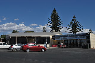
Cowell is a coastal town on Franklin Harbor on the eastern side of the Eyre Peninsula, in South Australia on the Lincoln Highway 111 km south of the major town of Whyalla. It is 493 km by road from Adelaide.

Streaky Bay, South Australia Town in South Australia

Streaky Bay is a coastal town on the western side of the Eyre Peninsula, in South Australia just off the Flinders Highway, 303 km (188 mi) north-west of Port Lincoln and 727 km (452 mi) by road from Adelaide. At the 2016 census, Streaky Bay recorded a population of 1, 378.

Port Hughes, South Australia Coastal town in South Australia

Port Hughes is a town and locality in the Australian state of South Australia located on northern Yorke Peninsula about 135 kilometres (84 mi) north-west of the state capital of Adelaide. It is considered part of the Moonta urban area by the Australian Bureau of Statistics. At the 2016 census, Port Hughes had a population of 571.

District Council of Ceduna Local government area in South Australia

The District Council of Ceduna is a local government area located on the far west coast of the Eyre Peninsula in South Australia. The district has a diverse business and industry with an estimated 240,000 tourists passing through every year. The township of Ceduna is the focal point of the district.

Lipson, South Australia Town in South Australia

Lipson is an historic farming town on the Eyre Peninsula, located only 12 km from Tumby Bay, South Australia. At the 2006 census, Lipson had a population of 209.

Venus Bay, South Australia Town in South Australia

Venus Bay is a small tourist and fishing town sited on the bay of the same name, on the Eyre Peninsula in South Australia. The town population numbers in the twenties for most of the year, but its numbers greatly increase during the summer holidays. At the 2006 census, Venus Bay had a population of 139. The town also serves professional fishermen who fish the Southern Ocean.

Port Kenny, South Australia Town in South Australia

Port Kenny is a small town located on the Eyre Peninsula in South Australia. It serves as a central point for the surrounding agricultural district, as well as professional fishermen and tourists. It currently has a very small population.

Smoky Bay, South Australia Town in South Australia

Smoky Bay is a town and locality located in the Australian state of South Australia on the west coast of the Eyre Peninsula. Previously used as a port, the town is now a residential settlement and popular tourist destination known for its recreational fishing, with a boat ramp and jetty located in the town.

Denial Bay Town in South Australia

Denial Bay is a town and an associated locality in the Australian state of South Australia located on the state's west coast about 562 kilometres (349 mi) north-west of the state capital of Adelaide and about 10 kilometres (6.2 mi) west of the municipal seat of Ceduna. The town which is located on the western side of Murat Bay has extensive European history, first built on in 1889, and now hosts a large expanse of oyster farms, one of the largest on the Eyre Peninsula.

Louth Bay, South Australia Town in South Australia

Louth Bay is a town and locality in the Australian state of South Australia. It is named after the bay named by Matthew Flinders on 26 February 1802 which itself is derived from a place in Lincolnshire. At the 2006 census, Louth Bay had a population of 408.

Point Lowly Suburb of City of Whyalla, South Australia

Point Lowly is the tip of a small peninsula north north-east of Whyalla in the Upper Spencer Gulf region of South Australia. The wider peninsula is shared by a combination of defence, industrial, residential, recreational and tourism interests. Port Bonython lies immediately to the north-west and is marked for future industrial expansion, driven by anticipated growth in the State's mining industry. The icons of the peninsula are the historic Point Lowly Lighthouse and the mass breeding aggregation of giant Australian cuttlefish which occurs inshore each winter.

References

  1. 1 2 Australian Bureau of Statistics (31 October 2012). "Arno Bay (Urban Centre/Locality)". 2011 Census QuickStats. Retrieved 11 April 2017. OOjs UI icon edit-ltr-progressive.svg
  2. 1 2 3 4 "Search result for "Arno Bay (Locality Bounded)" (Record no SA0003186) with the following layers being selected - "Suburbs and Localities", "Local Government Areas", "Development Plan Layers", "Place names (gazetteer)" and "Hundreds"". Property Location Browser. Government of South Australia. Archived from the original on 12 October 2016. Retrieved 11 April 2017.
  3. "Eyre Western SA Government region" (PDF). The Government of South Australia. Archived from the original (PDF) on 16 December 2014. Retrieved 10 October 2014.
  4. "District of Flinders Background Profile". Electoral Commission SA. Retrieved 9 September 2015.
  5. "Federal electoral division of Grey" (PDF). Australian Electoral Commission. Retrieved 24 July 2015.
  6. 1 2 3 4 Manning Index of South Australia, Arno Bay, archived from the original on 2 September 2007, retrieved 27 June 2007
  7. 1 2 Sydney Morning Herald Travel, "Arno Bay", Sydney Morning Herald , retrieved 27 June 2007
  8. "NEW TOWN NAMES APPROVED". The Chronicle . Vol. LXXXIII, no. 4, 728. South Australia. 1 August 1940. p. 13. Retrieved 31 August 2016 via National Library of Australia.
  9. Tourism Eyre Peninsula, Arno Bay, archived from the original on 16 June 2007, retrieved 27 June 2007
  10. Arno Bay Tourism Site, Fishing, archived from the original on 30 September 2007, retrieved 27 June 2007
  11. North Shields, Bureau of Meteorology, archived from the original on 10 June 2007, retrieved 27 June 2007
  12. 1 2 District Council of Cleve, General Information, archived from the original on 29 August 2007, retrieved 27 June 2007
  13. PIRSA, Arno Bay Aquaculture Management Program (PDF), retrieved 27 June 2007[ dead link ]
  14. Travelmate, Arno Bay , retrieved 27 June 2007
  15. 1 2 3 4 Australian Bureau of Statistics (25 October 2007). "Arno Bay (State Suburb)". 2006 Census QuickStats. Retrieved 28 February 2008.