
The Eyre Peninsula is a triangular peninsula in South Australia. It is bounded by the Spencer Gulf on the east, the Great Australian Bight on the west, and the Gawler Ranges to the north.

The District Council of Lower Eyre Peninsula is a local government area located on Eyre Peninsula in South Australia. The district covers the southern tip of the peninsula, except for the small area taken up by the City of Port Lincoln.
Arno Bay is a small fishing and tourist town on the east coast of Eyre Peninsula in South Australia, located on the Lincoln Highway about halfway between Whyalla and Port Lincoln. First proclaimed under the name Bligh in 1883, the current name dates back to 1940. It is a recreational town with a number of marine and nature based attractions, including fishing, surfing and swimming.

Tumby Bay is a coastal town situated on the Spencer Gulf, on the eastern coast of Eyre Peninsula in South Australia, 45 kilometres (28 mi) north of Port Lincoln. The town of Tumby Bay is the major population centre of the District Council of Tumby Bay, and the centre of an agricultural district farming cereal crops and sheep, as well as having established fishing and tourism industries.
Cleve is a small agriculturally based town on Central Eyre Peninsula in South Australia. It is 226 km southwest of Port Augusta and 143 km north of Port Lincoln. At the 2006 census, Cleve had a population of 738. The town has its origins in the 1850s, with the town established some twenty years later.

Port Neill is a small coastal town on the eastern side of the Eyre Peninsula, in South Australia about 3 km off the Lincoln Highway between the major towns of Whyalla and Port Lincoln. It is 576 km by road from Adelaide.

Cowell is a coastal town on Franklin Harbor on the eastern side of the Eyre Peninsula, in South Australia on the Lincoln Highway 111 km south of the major town of Whyalla. It is 493 km by road from Adelaide.

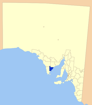
The District Council of Franklin Harbour is a local government area in South Australia on the Eyre Peninsula. Cowell is the major population centre of an agricultural district based on farming wheat and sheep, supplemented by a fishing and oyster farming industries. The district's coastal towns including Cowell and Lucky Bay attract large numbers of tourists during school holidays, with the new Spencer Gulf ferry service increasing traffic to these areas since 2006.

Streaky Bay is a coastal town on the western side of the Eyre Peninsula, in South Australia just off the Flinders Highway, 303 km (188 mi) north-west of Port Lincoln and 727 km (452 mi) by road from Adelaide. At the 2016 census, Streaky Bay recorded a population of 1, 378.

The Eastern Eyre Football League (EEFL) is an Australian rules football competition based in the Eyre Peninsula region of South Australia. It was formed in 1989 from the merger of the Kimba Districts Football League and the County Jervois Football League. The league's foundation clubs were Cleve, Cowell, Darke Peak-Waddikee, Kimba Districts, Ports and Rudall.
The Tumby Bay District Council is a local government area of South Australia covering an area of the North Eastern Eyre Peninsula. It was established in 1906, only six years after the town of Tumby Bay was established, when the district was severed from the former District Council of Lincoln to form the present council.

Wudinna District Council is a rural local government area on central Eyre Peninsula, South Australia. Its seat is Wudinna, on the Eyre Highway, 580 kilometres (360 mi) west of Adelaide. The district's economy is largely driven by agriculture, mainly cereal crops, with beef and sheep commonly farmed as well.

Smoky Bay is a town and locality located in the Australian state of South Australia on the west coast of the Eyre Peninsula. Previously used as a port, the town is now a residential settlement and popular tourist destination known for its recreational fishing, with a boat ramp and jetty located in the town.
Darke Peak is a small agricultural town located in central Eyre Peninsula, South Australia. The town is the population centre for the surrounding agricultural district and has become a minor historical tourist town. It is situated on Barngarla lands. The J. C. Darke Memorial and Grave, commemorating early European explorer John Charles Darke, is located near the township and is located on the South Australian Heritage Register.

Lucky Bay is a locality in the District Council of Franklin Harbour, on the Spencer Gulf coast of Eyre Peninsula in South Australia. It is a terminus for SeaSA's Spencer Gulf passenger ferry and a transshipping port for grain export operated by T-Ports. Lucky Bay is located immediately north-east of the Franklin Harbour wetlands. Its adjacent waters lie within the outer boundary of the Franklin Harbor Marine Park. A ferry service crossing Spencer Gulf from Lucky Bay to Wallaroo commenced in 2006, and the dirt road connecting Lucky Bay with the Lincoln Highway was sealed in 2008.
In South Australia, one of the states of Australia, there are many areas which are commonly known by regional names. Regions are areas that share similar characteristics. These characteristics may be natural such as the Murray River, the coastline, desert or mountains. Alternatively, the characteristics may be cultural, such as common land use. South Australia is divided by numerous sets of regional boundaries, based on different characteristics. In many cases boundaries defined by different agencies are coterminous.

The County of Jervois is a cadastral unit in the Australian state of South Australia that covers land on the east coast of the Eyre Peninsula. It was proclaimed on 24 January 1878 and named after William Jervois, the Governor of South Australia from October 1877 to January 1883.
Mitchellville is a locality in the Australian state of South Australia located on the east coast of Eyre Peninsula about 198 kilometres north-west of the state capital of Adelaide and about 23 kilometres north of the municipal seat of Cowell.
The Eyre Peninsula Tribune was a weekly newspaper published in Cleve, South Australia, founded in late 1910 and published from March 1911 to April 9, 2020. From 1911 to 1950 it was titled Eyre's Peninsula Tribune, reflecting a time when South Australia's peninsulas were referred to using possessives. It was later sold to Rural Press, previously owned by Fairfax Media, but now an Australian media company trading as Australian Community Media.
The Port Lincoln Times is a newspaper published weekly in Port Lincoln, South Australia. It was first printed in August 1927, and has been published continuously ever since. It was later sold to Rural Press, previously owned by Fairfax Media, but now an Australian media company trading as Australian Community Media.
