City of Port Lincoln

Last updated

City of Port Lincoln
South Australia
Port Lincoln Civic Hall, 2017 (01).jpg
Port Lincoln Civic Hall
Port Lincoln LGA.png
Location of the City of Port Lincoln LGA
Coordinates 34°43′13″S135°51′29″E / 34.7203°S 135.858°E / -34.7203; 135.858
Population14,404 (LGA 2021) [1]
 • Density435.30/km2 (1,127.4/sq mi)
Established1880
Area30.4 km2 (11.7 sq mi)
MayorDiana Mislov [2]
Council seat Port Lincoln
Region Eyre Western [3]
State electorate(s) Flinders [4]
Federal division(s) Grey [4]
Portlincolnlogo.png
Website City of Port Lincoln
LGAs around City of Port Lincoln:
District Council of Lower Eyre Peninsula
City of Port Lincoln

The City of Port Lincoln is a local government area located on the southern tip of the Eyre Peninsula in South Australia. It consists of one suburb - Port Lincoln. [5] It is surrounded on land by the District Council of Lower Eyre Peninsula, which also has offices in Port Lincoln. [6] [7]

Contents

History

The area was discovered and mapped by Matthew Flinders in 1802, who named the body of water Port Lincoln after his home county of Lincolnshire in England. [8]

The first white settlers in the area arrived in 1839, travelling from Port Adelaide on the Abeona. The settlement at Port Lincoln grew from 150 in the immediate aftermath of their arrival to 270 by 1840, and on 29 June 1839, Port Lincoln was designated as an official port for trade. [9] The town experienced strong development, and by 1936 was regarded as "the principal seaport town of the Eyre Peninsula, as well as being a "favourite holiday resort" with sea connections from Port Adelaide. [10]

The district first gained local government in 1880, when the District Council of Lincoln was created for the Port Lincoln area, holding its first meeting in the Pier Hotel in July. [11] It was variously referred to in period newspapers as either the "Port Lincoln" or "Lincoln" council, but the landmark District Councils Act 1887 , which undertook a major reorganisation of South Australian local government, referred to it as the District Council of Lincoln. [12]

The City of Port Lincoln municipality was created when the town of Port Lincoln incorporated and seceded from the district council in 1921, becoming the Corporate Town of Port Lincoln. It gained its present name when it was granted city status on 21 January 1971. [10] [13] The former District Council of Lincoln was renamed the District Council of Lower Eyre Peninsula in 1988, and continues to serve the rural areas surrounding Port Lincoln.

Localities

The boundaries of the City of Port Lincoln are almost contiguous with the town of Port Lincoln itself; a small portion of western Port Lincoln falls into the District Council of Lower Eyre Peninsula, while a very small section of adjacent Boston falls within the Port Lincoln municipality. [6]

Elected Members

WardCouncillorNotes
Mayor [2]  Diana Mislov [14]
Unsubdivided [2]  Andrea Broadfoot [15]
 Dylan Cowley [16]
 Karen Hollamby [17]
 Peter Linn [18]
 Lillian Poynter [19]
 Shania Richards [20]
 Jack Ritchie [21] Deputy Mayor 2022-Present
 Robyn Rowsell [22]
 Valerie Staunton [23]

The City of Port Lincoln has a directly-elected mayor. [24]

Mayors of Port Lincoln

Related Research Articles

<span class="mw-page-title-main">Port Lincoln</span> City in South Australia

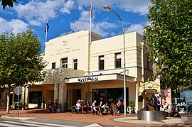
Port Lincoln is a city on the Lower Eyre Peninsula in the Australian state of South Australia. It is situated on the shore of Boston Bay, which opens eastward into Spencer Gulf. It is the largest city in the West Coast region, and is located approximately 280 km as the crow flies from the State's capital city of Adelaide. In June 2019 Port Lincoln had an estimated population of 16,418, having grown at an average annual rate of 0.55% year-on-year over the preceding five years. The city is reputed to have the most millionaires per capita in Australia, as well as claiming to be Australia's "Seafood Capital".

<span class="mw-page-title-main">Eyre Peninsula</span> Place in South Australia

The Eyre Peninsula is a triangular peninsula in South Australia. It is bounded by the Spencer Gulf on the east, the Great Australian Bight on the west, and the Gawler Ranges to the north.

<span class="mw-page-title-main">Cummins, South Australia</span> Town in South Australia

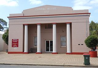
Cummins is a town on Eyre Peninsula in South Australia, 67 km north of Port Lincoln and 60 m above sea level. At the 2011 census, the town had a population of 719.

<span class="mw-page-title-main">District Council of Lower Eyre Peninsula</span> Local government area in South Australia

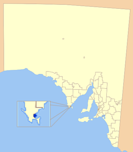
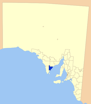
The District Council of Lower Eyre Peninsula is a local government area located on Eyre Peninsula in South Australia. The district covers the southern tip of the peninsula, except for the small area taken up by the City of Port Lincoln.
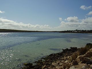
<span class="mw-page-title-main">Kimba, South Australia</span> Town in South Australia

Kimba is a rural service town on the Eyre Highway at the top of Eyre Peninsula in the Australian state of South Australia. At the 2016 census, Kimba had a population of 629 and it has an annual rainfall of 348 millimetres (13.7 in). There is an 8-metre (26 ft) tall statue of a galah beside the highway, marking halfway between the east and west coasts of Australia. The Gawler Ranges are north of the highway near the town.

<span class="mw-page-title-main">Buckleboo</span> Town in South Australia

Buckleboo is a locality in the Australian state of South Australia on the Eyre Peninsula located about 313 kilometres (194 mi) northwest of the state capital of Adelaide and about 31 kilometres (19 mi) northwest of the municipal seat of Kimba.

<span class="mw-page-title-main">Streaky Bay, South Australia</span> Town in South Australia

Streaky Bay is a coastal town on the western side of the Eyre Peninsula, in South Australia just off the Flinders Highway, 303 km (188 mi) north-west of Port Lincoln and 727 km (452 mi) by road from Adelaide. At the 2016 census, Streaky Bay recorded a population of 1, 378.

<span class="mw-page-title-main">District Council of Tumby Bay</span> Local government area in South Australia

The Tumby Bay District Council is a local government area of South Australia covering an area of the North Eastern Eyre Peninsula. It was established in 1906, only six years after the town of Tumby Bay was established, when the district was severed from the former District Council of Lincoln to form the present council.

Ungarra is a small swamp town located on the Eyre Peninsula, in the Australian state of South Australia about 248 kilometres (154 mi) from the state's capital, Adelaide and around 80 kilometres (50 mi) north of Port Lincoln. At the 2006 census, Ungarra had a population of 241.

<span class="mw-page-title-main">Port Augusta West, South Australia</span> Suburb of Port Augusta, South Australia

Port Augusta West is a suburb of Port Augusta, South Australia.

Wanilla is a locality in the Australian state of South Australia located on the southern end of Eyre Peninsula about 271 kilometres (168 mi) west of the state capital of Adelaide and about 25 kilometres (16 mi) north-west of the city of Port Lincoln.

Koppio is a locality in the Australian state of South Australia located on the Eyre Peninsula about 256 kilometres (159 mi) west of the state capital of Adelaide and about 32 kilometres (20 mi) north of Port Lincoln, and within the Tod River catchment area. While long-established agricultural activities dominate the region is also prospective for graphite and iron ore. The Koppio Smithy Museum is a local tourist attraction replete with buildings and artifacts representing the early pioneer heritage of Eyre Peninsula.

In South Australia, one of the states of Australia, there are many areas which are commonly known by regional names. Regions are areas that share similar characteristics. These characteristics may be natural such as the Murray River, the coastline, desert or mountains. Alternatively, the characteristics may be cultural, such as common land use. South Australia is divided by numerous sets of regional boundaries, based on different characteristics. In many cases boundaries defined by different agencies are coterminous.

Edillilie is a small town on Eyre Peninsula in South Australia. It is on the Tod Highway and Eyre Peninsula Railway north of Port Lincoln.

Tooligie is a small town in South Australia on the Eyre Peninsula about 290 kilometres west of the Adelaide city centre and about 84 kilometres north of the city of Port Lincoln.

<span class="mw-page-title-main">Sleaford, South Australia</span> Suburb of District Council of Lower Eyre Peninsula, South Australia

Sleaford is a locality in the Australian state of South Australia located at the southern tip of the Eyre Peninsula overlooking the Great Australian Bight about 260 kilometres west of the state capital of Adelaide and about 17 kilometres west of the municipal seat of Port Lincoln.

<span class="mw-page-title-main">Lincoln National Park (locality)</span> Suburb of District Council of Lower Eyre Peninsula, South Australia

Lincoln National Park is a locality located on the Jussieu Peninsula at the southern tip of the Eyre Peninsula in the Australian state of South Australia about 250 kilometres west of the state capital of Adelaide and about 13 kilometres south of the city of Port Lincoln.

Tulka is a locality in the Australian state of South Australia located on the southern tip of Eyre Peninsula overlooking the western end of the body of water known as Port Lincoln and which is located 259 kilometres west of the state capital of Adelaide and about 10 kilometres west of the city of Port Lincoln.

Uley is a locality in the Australian state of South Australia located at the southern tip of the Eyre Peninsula overlooking the body of water known as the Great Australian Bight about 273 kilometres (170 mi) west of the state capital of Adelaide and about 22 kilometres (14 mi) west of the city of Port Lincoln.

Duck Ponds is a locality in the Australian state of South Australia located on the Eyre Peninsula in the state's west about 258 kilometres (160 mi) west of the state capital of Adelaide, about 51 kilometres (32 mi) south of the municipal seat of Cummins and about 6 kilometres (3.7 mi) west of the city of Port Lincoln.

References

  1. Australian Bureau of Statistics (28 June 2022). "Port Lincoln (Local Government Area)". Australian Census 2021 QuickStats. Retrieved 28 June 2022.  OOjs UI icon edit-ltr-progressive.svg
  2. 1 2 3 "Current Elected Members". City of Port Lincoln. Retrieved 14 February 2016.
  3. "Eyre Western SA Government region" (PDF). The Government of South Australia. Archived from the original (PDF) on 16 December 2014. Retrieved 10 October 2014.
  4. 1 2 "2014 Suburbs, Districts, and Postcodes List". South Australian Electoral Commission. Retrieved 15 February 2016.
  5. "Search result(s) for Port Lincoln LOCB (Record No.SA0040601) with the following layers being selected - "Suburbs and Localities", "Local Government Areas", "Counties" and "Place names (gazetteer)"". Property Location Browser. Government of South Australia. Archived from the original on 12 October 2016. Retrieved 11 December 2016.
  6. 1 2 "Location SA Map Viewer". Government of South Australia. Retrieved 14 February 2016.
  7. "Contact Us". District Council of Lower Eyre Peninsula. Retrieved 15 February 2016.
  8. Flinders, Matthew (1814). "A Voyage To Terra Australias". G. and W. Nichol. Retrieved 15 February 2016.
  9. "Port Lincoln Celebrates its Centenary". The Mail (Adelaide, SA : 1912 - 1954) . Adelaide, SA: National Library of Australia. 11 March 1939. p. 16. Retrieved 15 February 2016.
  10. 1 2 3 4 5 6 Hosking, P. (1936). The Official civic record of South Australia : centenary year, 1936. Adelaide: Universal Publicity Company. pp. 370, 654.
  11. "COUNTRY TELEGRAMS". The South Australian Advertiser (Adelaide, SA : 1858 - 1889) . Adelaide, SA: National Library of Australia. 9 July 1880. p. 6. Retrieved 15 February 2016.
  12. "District Councils Act 1887". Flinders University. Retrieved 15 February 2016.
  13. "Council History". City of Port Lincoln. Archived from the original on 4 August 2017. Retrieved 15 February 2016.
  14. "Council Member Profile- Mislov, Diana". City of Port Lincoln. Retrieved 22 August 2022.
  15. "Council Member Profile- Broadfoot, Andrea". City of Port Lincoln. Retrieved 22 August 2022.
  16. "Council Member Profile- Cowley, Dylan". City of Port Lincoln. Retrieved 22 August 2022.
  17. "Council Member Profile- Hollamby, Karen". City of Port Lincoln. Retrieved 22 August 2022.
  18. "Council Member Profile- Linn, Peter". City of Port Lincoln. Retrieved 22 August 2022.
  19. "Council Member Profile- Poynter, Lillian". City of Port Lincoln. Retrieved 22 August 2022.
  20. "Council Member Profile- Richards, Shania". City of Port Lincoln. Retrieved 22 August 2022.
  21. "Council Member Profile- Ritchie, Jack". City of Port Lincoln. Retrieved 22 August 2022.
  22. "Council Member Profile- Rowsell, Robyn". City of Port Lincoln. Retrieved 22 August 2022.
  23. "Council Member Profile- Staunton, Valerie". City of Port Lincoln. Retrieved 22 August 2022.
  24. "Election Results 2014" (PDF). Local Government Association of South Australia. Archived from the original (PDF) on 30 June 2007. Retrieved 14 February 2016.
  25. 1 2 3 4 5 6 7 8 9 10 11 12 13 14 15 16 17 18 19 20 "Elected Members of Council As at November 2022" (PDF). City of Port Lincoln. Retrieved 22 August 2022.