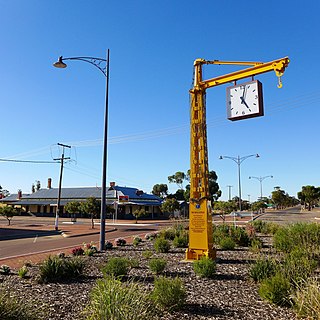
Narembeen is a town in the Wheatbelt region of Western Australia. It is 286 km, almost due east, from Perth, the capital of WA. It is the major settlement in the Shire of Narembeen, in which the major industries are growing cereal crops and raising cattle and sheep. The surrounding areas produce wheat and other cereal crops. The town is a receival site for Cooperative Bulk Handling.
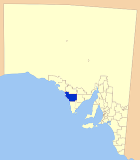
The Eyre Peninsula is a triangular peninsula in South Australia. It is bounded on the east by Spencer Gulf, the west by the Great Australian Bight, and the north by the Gawler Ranges.
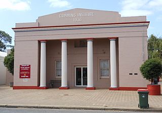
Cummins is a town on Eyre Peninsula in South Australia, 67 km north of Port Lincoln and 60 m above sea level. At the 2011 census, the town had a population of 719.
Arno Bay is a small fishing and tourist town on the east coast of Eyre Peninsula in South Australia, located on the Lincoln Highway about halfway between Whyalla and Port Lincoln. First proclaimed under the name Bligh in 1883, the current name dates back to 1940. It is a recreational town with a number of marine and nature based attractions, including fishing, surfing and swimming.

Tumby Bay is a coastal town situated on the Spencer Gulf, on the eastern coast of Eyre Peninsula in South Australia, 45 kilometres (28 mi) north of Port Lincoln. The town of Tumby Bay is the major population centre of the District Council of Tumby Bay, and the centre of an agricultural district farming cereal crops and sheep, as well as having established fishing and tourism industries.

Elliston is a small coastal town in the Australian state of South Australia on the west coast of Eyre Peninsula 169 km northwest of Port Lincoln and 641 km west of Adelaide. The township is located on Waterloo Bay. At the 2006 census, Elliston had a population of 377.
Cleve is a small agriculturally based town on Central Eyre Peninsula in South Australia. It is 226 km southwest of Port Augusta and 143 km north of Port Lincoln. At the 2006 census, Cleve had a population of 738. The town has its origins in the 1850s, with the town established some twenty years later.

Cowell is a coastal town on Franklin Harbor on the eastern side of the Eyre Peninsula, in South Australia on the Lincoln Highway 111 km south of the major town of Whyalla. It is 493 km by road from Adelaide.

Streaky Bay is a coastal town on the western side of the Eyre Peninsula, in South Australia just off the Flinders Highway, 303 km (188 mi) north-west of Port Lincoln and 727 km (452 mi) by road from Adelaide. At the 2016 census, Streaky Bay recorded a population of 1, 378.
The District Council of Elliston is a local government area covering around 6500 km2 on the Western Eyre Peninsula in South Australia. Established in 1888, the district has a diverse economy, with agriculture, commercial fishing and tourism making up the majority of the local economy.
Lipson is an historic farming town on the Eyre Peninsula, located only 12 km from Tumby Bay, South Australia. At the 2006 census, Lipson had a population of 209.

Venus Bay is a small tourist and fishing town sited on the bay of the same name, on the Eyre Peninsula in South Australia. The town population numbers in the twenties for most of the year, but its numbers greatly increase during the summer holidays. At the 2006 census, Venus Bay had a population of 139. The town also serves professional fishermen who fish the Southern Ocean.
Darke Peak is a small agricultural town located in central Eyre Peninsula, South Australia. The town is the population centre for the surrounding agricultural district and has become a minor historical tourist town. It is situated on Barngarla lands. The J. C. Darke Memorial and Grave, commemorating early European explorer John Charles Darke, is located near the township and is located on the South Australian Heritage Register.

Kyancutta is a small wheatbelt town at the junction of the Eyre and Tod Highways on the Eyre Peninsula in South Australia. Once a busy town with an airport, Kyancutta is now nearly a ghost town, acting only as a centre for the agricultural districts surrounding it, as well as passing tourists.

Karkoo is a small rural centre located 20 km to the north of Cummins in the centre of Eyre Peninsula, South Australia. It is located in an agricultural district where the main economic activities are cereal growing and sheep grazing, and most of the district's small population live on surrounding farms.

Warramboo (wɔrˑræmˑbʉː) is a locality in the Australian state of South Australia located on the Eyre Peninsula about 334 kilometres (208 mi) north-west of the state capital of Adelaide and about 26 kilometres (16 mi) south-east of the municipal seat of Wudinna. It is 189 kilometres (117 mi) north of Port Lincoln on the Tod Highway and is the north-western terminus of the wheat haulage lines radiating from Port Lincoln on the Eyre Peninsula Railway. The railway line was built from 1907–1915 to develop the cereal industry. The grain silos are a distinctive local landmark of the town.
Yeelanna is a town on the Lower Eyre Peninsula in South Australia located 77 kilometres (48 mi) north of Port Lincoln. It is on the Tod Highway and Eyre Peninsula Railway between Lock and Cummins. The Yeelanna district is known for its extremely fertile farming land, where nearly all farms in the district are continuously cropped.
Koppio is a locality in the Australian state of South Australia located on the Eyre Peninsula about 256 kilometres (159 mi) west of the state capital of Adelaide and about 32 kilometres (20 mi) north of Port Lincoln, and within the Tod River catchment area. While long-established agricultural activities dominate the region is also prospective for graphite and iron ore. The Koppio Smithy Museum is a local tourist attraction replete with buildings and artifacts representing the early pioneer heritage of Eyre Peninsula.
Murdinga is a locality in South Australia located on the Eyre Peninsula about 297 kilometres (185 mi) west of the state capital of Adelaide. The name reportedly stems from an Aboriginal word for "cold".
Tooligie is a small town in South Australia on the Eyre Peninsula about 290 kilometres west of the Adelaide city centre and about 84 kilometres north of the city of Port Lincoln.
