
Lincoln National Park is a protected area in the Australian state of South Australia located about 249 kilometres (155 mi) west of the state capital of Adelaide and about 9.5 kilometres (5.9 mi) south of the municipal seat of Port Lincoln. It consists of a mainland area on the Jussieu Peninsula on the south eastern tip of Eyre Peninsula and a number of nearby islands. The national park contains significant sites of natural, indigenous and early European heritage.

Port Augusta is a small city in South Australia. Formerly a seaport, it is now a road traffic and railway junction city mainly located on the east coast of the Spencer Gulf immediately south of the gulf's head and about 322 kilometres (200 mi) north of the state capital, Adelaide. The suburb of Port Augusta West is located on the west side of the gulf on the Eyre Peninsula. Other major industries included, up until the mid-2010s, electricity generation. At June 2018, the estimated urban population was 13,799, having declined at an average annual rate of -0.53% over the preceding five years.

The District Council of Lower Eyre Peninsula is a local government area located on Eyre Peninsula in South Australia. The district covers the southern tip of the peninsula, except for the small area taken up by the City of Port Lincoln.

Elliston is a small coastal town in the Australian state of South Australia on the west coast of Eyre Peninsula 169 km northwest of Port Lincoln and 641 km west of Adelaide. The township is located on Waterloo Bay. At the 2006 census, Elliston had a population of 377.

Wudinna is a town in South Australia. The area was first settled by Europeans in 1861 when Robert George Standley lodged a claim for 10 square miles (26 km2) of land surrounding Weedna Hill. It was proclaimed a town in 1916. It is on the Eyre Highway across the top of Eyre Peninsula. It is the seat of the Wudinna District Council.
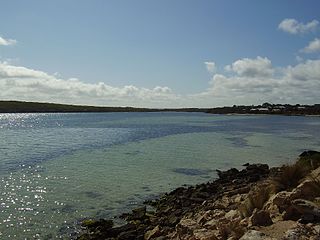
Coffin Bay, originally Coffin's Bay, is a town at the southern extremity of the Eyre Peninsula, a wheat growing area of South Australia. At the 2016 census, Coffin Bay had a population of 611.

Port Neill is a small coastal town on the eastern side of the Eyre Peninsula, in South Australia about 3 km off the Lincoln Highway between the major towns of Whyalla and Port Lincoln. It is 576 km by road from Adelaide.

Cowell is a coastal town on Franklin Harbor on the eastern side of the Eyre Peninsula, in South Australia on the Lincoln Highway 111 km south of the major town of Whyalla. It is 493 km by road from Adelaide.

Wool Bay is a locality and a former government town in the Australian state of South Australia on the east coast of southern Yorke Peninsula. It is located between Stansbury and Coobowie on Yorke Peninsula, approximately 220 kilometres from Adelaide by road, but only just over 60 km due west across Gulf St Vincent.

Beachport is a small coastal town in the Australian state of South Australia about 311 kilometres (193 mi) south-east of the state capital of Adelaide and about 34 kilometres (21 mi) north-west of the municipal seat in Millicent, located at the northern end of Rivoli Bay. Beachport has a large crayfishing fleet, and is known for its 772-metre (2,533 ft)-long jetty, the second-longest in South Australia after the one at Port Germein. The towns Norfolk pines, white sand beach and alluring clear waters are alluring to visitors

Smoky Bay is a town and locality located in the Australian state of South Australia on the west coast of the Eyre Peninsula. Previously used as a port, the town is now a residential settlement and popular tourist destination known for its recreational fishing, with a boat ramp and jetty located in the town.
Darke Peak is a small agricultural town located in central Eyre Peninsula, South Australia. The town is the population centre for the surrounding agricultural district and has become a minor historical tourist town. It is situated on Barngarla lands. The J. C. Darke Memorial and Grave, commemorating early European explorer John Charles Darke, is located near the township and is located on the South Australian Heritage Register.
Thistle Island / Noondala is in the Spencer Gulf, South Australia, some 200 kilometres (120 mi) west of Adelaide, and northwest of the Gambier Islands. The city of Port Lincoln lies to the northwest of the island. Between them, the Gambier Islands and Thistle form a chain across the mouth of the gulf between the southern tips of the Yorke and Eyre Peninsulas, sometimes referred to as the Taylor Islands group.
Booborowie is a locality in South Australia. It is located 200 km (124 mi) north of Adelaide. At the 2016 census, the Booborowie district had a population of 218.
Lipson Cove is a tranquil sandy bay in the Australian state of South Australia on the east coast of Eyre Peninsula overlooking Spencer Gulf. It features in the 2012 book 101 Best Australian Beaches by Andy Short and Brad Farmer.
Poonindie is a small township near Port Lincoln on the Eyre Peninsula, South Australia. The land upon which it sits was originally the land of the Barngarla people.
Charles Christian Dutton was a pastoralist in the Colony of South Australia who disappeared, believed murdered by Aboriginal people, while driving cattle from Port Lincoln to Adelaide in July 1842.

Kiana is a coastal locality on the Eyre Peninsula of South Australia, situated within the District Council of Lower Eyre Peninsula. The modern boundaries were formally established in October 2003, with it being named after the cadastral Hundred of Kiana. The modern locality only covers the northern half of the hundred; the southern half is the locality of Mount Hope. The hundred itself was given an Aboriginal name by Governor William Jervois in 1879.

Sleaford Bay is a bay located in the Australian state of South Australia on the southern coast of Eyre Peninsula. It was named by the British navigator, Matthew Flinders in 1802.
The Tod River is the only stream on Eyre Peninsula in South Australia with a reliable water flow. Its main tributary is Pillaworta Creek. The Tod River Reservoir was built across the river between 1918 and 1922.

