
Coffin Bay National Park is a protected area in on the Eyre Peninsula of South Australia, Australia, which is located about 301 km west of Adelaide and about 46 km west of Port Lincoln. The town of Coffin Bay is near the entrance to the national park. The national park occupies the Coffin Bay Peninsula - a long peninsula with a sheltered bay to its north, coastal dunes, swamps and a coastline which overlooks islands, reefs, limestone cliffs and white surf beaches.

Lincoln National Park is a protected area in the Australian state of South Australia located about 249 kilometres (155 mi) west of the state capital of Adelaide and about 9.5 kilometres (5.9 mi) south of the municipal seat of Port Lincoln. It consists of a mainland area on the Jussieu Peninsula on the south eastern tip of Eyre Peninsula and a number of nearby islands. The national park contains significant sites of natural, indigenous and early European heritage.

The Spencer Gulf is the westernmost and larger of two large inlets on the southern coast of Australia, in the state of South Australia, facing the Great Australian Bight. It spans from the Cape Catastrophe and Eyre Peninsula in the west to Cape Spencer and Yorke Peninsula in the east.

Port Lincoln is a city on the Lower Eyre Peninsula in the Australian state of South Australia. Known as Galinyala by the traditional owners, the Barngarla people, it is situated on the shore of Boston Bay, which opens eastward into Spencer Gulf. It is the largest city in the West Coast region, and is located approximately 280 km (170 mi) from the state's capital city of Adelaide.

Port Augusta is a small coastal city in South Australia about 310 kilometres (190 mi) by road from the state capital, Adelaide. Most of the city is on the eastern shores of Spencer Gulf, immediately south of the gulf's head, comprising the city's centre and surrounding suburbs, Stirling North, and seaside homes at Commissariat Point, Blanche Harbor and Miranda. The suburb of Port Augusta West is on the western side of the gulf on the Eyre Peninsula. Together, these localities had a population of 13,515 people in the 2021 census.

Gulf St Vincent, sometimes referred to as St Vincent Gulf, St Vincent's Gulf or Gulf of St Vincent, is the eastern of two large inlets of water on the southern coast of Australia, in the state of South Australia, the other being the larger Spencer Gulf, from which it is separated by Yorke Peninsula. On its eastern side the gulf is bordered by the Adelaide Plains and the Fleurieu Peninsula.

The Eyre Peninsula is a triangular peninsula in South Australia. It is bounded by the Spencer Gulf on the east, the Great Australian Bight on the west, and the Gawler Ranges to the north.

Wudinna is a town of about 500 people on the Eyre Highway in the wheat-growing region of Eyre Peninsula, South Australia.
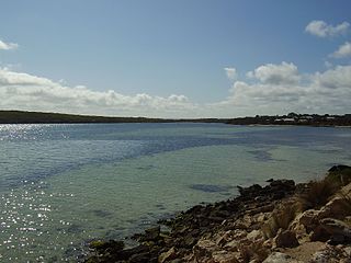
Coffin Bay, originally Coffin's Bay, is a town at the southern extremity of the Eyre Peninsula, a wheat growing area of South Australia.
Thistle Island / Noondala is in the Spencer Gulf, South Australia, some 200 kilometres (120 mi) west of Adelaide, and northwest of the Gambier Islands. The city of Port Lincoln lies to the northwest of the island. Between them, the Gambier Islands and Thistle form a chain across the mouth of the gulf between the southern tips of the Yorke and Eyre Peninsulas, sometimes referred to as the Taylor Islands group.

Barngarla, formerly known as Parnkalla, is an Aboriginal language of Eyre Peninsula, South Australia. It was formerly extinct, but has undergone a process of revival since 2012.
Lipson Cove is a tranquil sandy bay in the Australian state of South Australia on the east coast of Eyre Peninsula overlooking Spencer Gulf. It features in the 2012 book 101 Best Australian Beaches by Andy Short and Brad Farmer.

Jussieu Peninsula is a peninsula located at the south east end of Eyre Peninsula in South Australia. It is bounded by Proper Bay and Spalding Cove within the natural harbour known as Port Lincoln to the north, Spencer Gulf to the east and the Great Australian Bight to the south. While it was first explored and mapped by Matthew Flinders during February 1802, Flinders did not name it. In 1913, the name proposed by François Péron and Louis de Freycinet from Baudin's expedition when it visited later in 1802 was declared as the peninsula's official name by the Government of South Australia. Jussieu refers to the French botanist, Antoine Laurent de Jussieu. While parts of its surface have been cleared and used for agricultural purposes in the past, it is currently occupied by two protected areas: the Lincoln National Park and the Memory Cove Wilderness Protection Area.
Sleaford Mere is a permanent saline lake, located on the Jussieu Peninsula on the south eastern tip of Eyre Peninsula in South Australia about 15 kilometres south west of Port Lincoln. The lake was given its modern name by the British explorer, Matthew Flinders, on 26 February 1802. Since 1969, the lake has been part of the Sleaford Mere Conservation Park and since 2005, it has been listed as a nationally important wetland. The lake and its environs are notable as a venue for recreational pursuits such as canoeing.

Cape Carnot is a headland in the Australian state of South Australia located on the west side of the southern tip of Eyre Peninsula about 30 kilometres south west of the city of Port Lincoln. The Eyre Peninsula has a double tip; the other tip, 3 nautical miles to the east, is Cape Wiles. Cape Carnot is one of a number of coastal features first discovered but not subsequently named by Matthew Flinders in February 1802 and which remained unnamed. In 1913, the Government of South Australia gave the unnamed feature the name proposed by the Baudin expedition when it visited in April 1802. The name Cape Carnot honours Lazare Carnot who is notable as a "French mathematician, general and statesman, who played a prominent part in the French Revolution and the Napoleonic era".
Cape Wiles is a headland located on the west side of the southern tip of Eyre Peninsula in South Australia about 27 kilometres south west of the city of Port Lincoln. The cape is described by one source as being the south east extremity of “a broad promontory” of which Cape Carnot is the south west extremity at a distance of 3 nautical miles to the west. The cape also is the western extremity of Sleaford Bay.

Mount Dutton Bay is a coastal locality in the Eyre and Western region of South Australia, situated in the District Council of Lower Eyre Peninsula. The name and boundaries were formalised in October 2003 in respect of the long established local name which is derived from the body of water known as Mount Dutton Bay. The locality incorporates three older residential "shack sites": Mount Dutton Bay West, on Dolphin Drive, Mount Dutton Bay East, on Woolshed Drive, and Shelley Beach/Salt Creek, on Shelly Beach Road. It is part of the cadastral Hundred of Lake Wangary.

Sleaford is a locality in the Australian state of South Australia located at the southern tip of the Eyre Peninsula overlooking the Great Australian Bight about 260 kilometres west of the state capital of Adelaide and about 17 kilometres west of the municipal seat of Port Lincoln.
Fishery Bay whaling station was a whaling station located in the Colony of South Australia on the coast of Fishery Bay, a subsidiary of the larger Sleaford Bay, on Eyre Peninsula about 32 kilometres (20 mi) south-west of Port Lincoln. It operated in the 1830s and 1840s and helped to provide the colony with one of its first export commodities.
The Tod River is the only stream on Eyre Peninsula in South Australia with a reliable water flow. Its main tributary is Pillaworta Creek. The Tod River Reservoir was built across the river between 1918 and 1922.

