Louth Bay, South Australia

Last updated

Louth Bay
South Australia
Louth Island.jpg
Australia South Australia location map.svg
Red pog.svg
Louth Bay
Coordinates 34°32′41″S135°55′47″E / 34.544636°S 135.929811°E / -34.544636; 135.929811 [1]
Population125 (SAL 2016) [2] [3]
Established24 June 1909 (town)
16 October 2003 (locality) [4] [1]
Postcode(s) 5607 [5]
Time zone ACST (UTC+9:30)
 • Summer (DST) ACST (UTC+10:30)
Location
LGA(s) District Council of Lower Eyre Peninsula [1]
Region Eyre Western [1]
County Flinders [1]
State electorate(s) Flinders [6]
Federal division(s) Grey [7]
Mean max temp [8] Mean min temp [8] Annual rainfall [8]
21.2 °C
70 °F
11.3 °C
52 °F
383.2 mm
15.1 in
Localities around Louth Bay:
Whites Flat Whites River Whites River
Whites Flat Louth Bay Spencer Gulf
Poonindie Poonindie Spencer Gulf
FootnotesLocation [5]
Adjoining localities [1]

Louth Bay (formerly Laurence) is a town and locality in the Australian state of South Australia. [1] It is named after the bay named by Matthew Flinders on 26 February 1802 which itself is derived from a place in Lincolnshire. [1] At the 2006 census, Louth Bay had a population of 408. [9]

Contents

A town was surveyed in March 1909 and proclaimed on 24 June 1909. [4] It was named 'Laurence' after Laurence O'Loughlin, a South Australian politician. In November 1940, the District Council of Lincoln formally endorsed a recommendation to rename the town 'Louth Bay' in order to be in line with common use. [10] The name change was gazetted on 20 February 1941. [11] Boundaries were created in October 2003 for a locality with the name 'Louth Bay and which included the site of Government Town of Louth Bay. [12] [1] [13]

Louth Island is a large privately owned island located within Louth Bay. 3 km to the south east of Louth Island lies the smaller Rabbit Island, which is part of the Lincoln National Park.

History

The bay was a popular picnic destination in the early 20th century, [14] [15] [16] [17] but retained its serenity and wildness throughout. [18]

In the early 20th century, the bay was dredged for oysters. [19]

A jetty was proposed for Louth Bay in the 1878, [20] and was constructed around that time. In 1908, the structure was damaged, allegedly by a ship. [21] In 1949, the Government announced that it was seeking to demolish the Louth Bay jetty, and called for tenders. [22] This was met by objections and a petition, leading to a delayed decision. [23]

In the late 20th century, aquaculture became an important industry for Louth Bay, though fishermen and local residents have expressed concerned about stock escapees and pollution impacts from existing operations. Concerns included algal growth and seagrass degradation, plastic pollution and the loss of amenity. [24] [25]

Incidents

On 12 February 2007 Phillip Kerkhof wrestled a 1.3 metre long Bronze whaler shark in Louth Bay, catching it and dragging it onto the jetty before cheering fishermen. He admitted to being drunk at the time and recommended that others not engage in such activities. [26] [27] [28] [29]

On 21 August 2014 the decapitated bodies of two New Zealand fur seals were found near Louth Bay. The circumstances surrounding their death were considered suspicious and an investigation was undertaken. [30]

See also

Related Research Articles

<span class="mw-page-title-main">Port Lincoln</span> City in South Australia

Port Lincoln is a city on the Lower Eyre Peninsula in the Australian state of South Australia. It is situated on the shore of Boston Bay, which opens eastward into Spencer Gulf. It is the largest city in the West Coast region, and is located approximately 280 km as the crow flies from the State's capital city of Adelaide. In June 2019 Port Lincoln had an estimated population of 16,418, having grown at an average annual rate of 0.55% year-on-year over the preceding five years. The city is reputed to have the most millionaires per capita in Australia, as well as claiming to be Australia's "Seafood Capital".

<span class="mw-page-title-main">Eyre Peninsula</span> Place in South Australia

The Eyre Peninsula is a triangular peninsula in South Australia. It is bounded by the Spencer Gulf on the east, the Great Australian Bight on the west, and the Gawler Ranges to the north.

<span class="mw-page-title-main">Glenelg, South Australia</span> Suburb of Adelaide, South Australia

Glenelg is a beach-side suburb of the South Australian capital of Adelaide. Located on the shore of Holdfast Bay in Gulf St Vincent, it has become a tourist destination due to its beach and many attractions, home to several hotels and dozens of restaurants.

<span class="mw-page-title-main">District Council of Lower Eyre Peninsula</span> Local government area in South Australia

The District Council of Lower Eyre Peninsula is a local government area located on Eyre Peninsula in South Australia. The district covers the southern tip of the peninsula, except for the small area taken up by the City of Port Lincoln.

<span class="mw-page-title-main">Port Elliot, South Australia</span> Town in South Australia

Port Elliot is a town in South Australia toward the eastern end of the south coast of the Fleurieu Peninsula. It is situated on the sheltered Horseshoe Bay, a small bay off the much larger Encounter Bay. Pullen Island lies outside the mouth of the bay. At the 2006 census, Port Elliot had a population of 1,754, although this section of the coast is now built up almost all the way from Goolwa to Victor Harbor.

<span class="mw-page-title-main">Port Broughton, South Australia</span> Town in South Australia

Port Broughton is a small South Australian town located at the northern extent of the Yorke Peninsula on the east coast of Spencer Gulf. It is situated about 170 km north-west of Adelaide, and 56 km south of Port Pirie. At the 2016 census, the town of Port Broughton had a population of 1,034.

Arno Bay is a small fishing and tourist town on the east coast of Eyre Peninsula in South Australia, located on the Lincoln Highway about halfway between Whyalla and Port Lincoln. First proclaimed under the name Bligh in 1883, the current name dates back to 1940. It is a recreational town with a number of marine and nature based attractions, including fishing, surfing and swimming.

<span class="mw-page-title-main">Tumby Bay, South Australia</span> Town in South Australia

Tumby Bay is a coastal town situated on the Spencer Gulf, on the eastern coast of Eyre Peninsula in South Australia, 45 kilometres (28 mi) north of Port Lincoln. The town of Tumby Bay is the major population centre of the District Council of Tumby Bay, and the centre of an agricultural district farming cereal crops and sheep, as well as having established fishing and tourism industries.

<span class="mw-page-title-main">Port Noarlunga, South Australia</span> Coastal suburb of Adelaide, South Australia

Port Noarlunga is a suburb in the City of Onkaparinga, South Australia. It is a small sea-side suburb, with a population of 2,918, about 30 kilometres to the south of the Adelaide city centre and was originally created as a sea port. This area is now popular as a holiday destination or for permanent residents wishing to commute to Adelaide or work locally. There is a jetty that connects to a 1.6 kilometres natural reef that is exposed at low tide.

<span class="mw-page-title-main">Penneshaw, South Australia</span> Town in South Australia

Penneshaw is a township in the Australian state of South Australia located on the northeast coast of the Dudley Peninsula on Kangaroo Island about 107 kilometres (66 mi) south of the state capital of Adelaide. It is the island's main ferry port with regular services from Cape Jervis. Penneshaw features a Maritime and Folk Museum, and evening tours to a colony of little penguin, the only species of penguin to breed in Australian waters. At the 2011 census, Penneshaw had a population of 276.

<span class="mw-page-title-main">Port Neill, South Australia</span> Town in South Australia

Port Neill is a small coastal town on the eastern side of the Eyre Peninsula, in South Australia about 3 km off the Lincoln Highway between the major towns of Whyalla and Port Lincoln. It is 576 km by road from Adelaide.

<span class="mw-page-title-main">Cowell, South Australia</span> Town in South Australia

Cowell is a coastal town on Franklin Harbor on the eastern side of the Eyre Peninsula, in South Australia on the Lincoln Highway 111 km south of the major town of Whyalla. It is 493 km by road from Adelaide.

<span class="mw-page-title-main">Wool Bay, South Australia</span> Town in South Australia

Wool Bay is a locality and a former government town in the Australian state of South Australia on the east coast of southern Yorke Peninsula. It is located between Stansbury and Coobowie on Yorke Peninsula, approximately 220 kilometres from Adelaide by road, but only just over 60 km due west across Gulf St Vincent.
<span class="mw-page-title-main">Rapid Bay, South Australia</span> Coastal town in South Australia

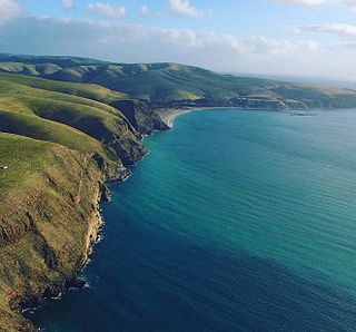
Rapid Bay is a locality that includes a small seaside town and bay on the west coast of the Fleurieu Peninsula, South Australia. It lies within the District Council of Yankalilla and its township is approximately 100 km south of the state capital, Adelaide. A pair of jetties are popular attractions for recreational fishing, scuba diving and snorkelling. The bay particularly known as a site for observing leafy seadragons in the wild. Its postcode is 5204.

<span class="mw-page-title-main">Smoky Bay, South Australia</span> Town in South Australia

Smoky Bay is a town and locality located in the Australian state of South Australia on the west coast of the Eyre Peninsula. Previously used as a port, the town is now a residential settlement and popular tourist destination known for its recreational fishing, with a boat ramp and jetty located in the town.

Denial Bay is a town and an associated locality in the Australian state of South Australia located on the state's west coast about 562 kilometres (349 mi) north-west of the state capital of Adelaide and about 10 kilometres (6.2 mi) west of the municipal seat of Ceduna.The town which is located on the western side of Murat Bay has extensive European history, first built on in 1889, and now hosts a large expanse of oyster farms, one of the largest on the Eyre Peninsula.

<span class="mw-page-title-main">Port Willunga, South Australia</span> Suburb of Adelaide, South Australia

Port Willunga is a semi-rural suburb of Adelaide, South Australia. It is known as Wirruwarrungga or Ruwarunga by the traditional owners, the Kaurna people, and is of significance as being the site of a freshwater spring said to be created by the tears of Tjilbruke, the creator being.

Lipson Cove is a tranquil sandy bay in the Australian state of South Australia on the east coast of Eyre Peninsula overlooking Spencer Gulf. It features in the 2012 book 101 Best Australian Beaches by Andy Short and Brad Farmer.
<span class="mw-page-title-main">Klein Point</span> Place in South Australia

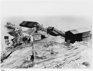
Klein Point is a headland in the Australian state of South Australia located about 7 kilometres south of Stansbury in the locality of Wool Bay on Yorke Peninsula. It is the site of a port facility established to handle shipments of limestone for Adelaide Brighton Cement. The port is managed by Flinders Ports. Prior to 1965 it was known as Farquhar Jetty.
<span class="mw-page-title-main">Dangerous Reef</span>

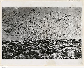
Dangerous Reef is an island and reef system located in the Spencer Gulf in the Australian state of South Australia about 32.5 kilometres (20.2 mi) east-southeast of the city, Port Lincoln. It is the southernmost member of the Sir Joseph Banks Group. It has been the site of a navigation aid since 1911. It is notable as the site of a breeding colony of Australian sea lions. The waters adjoining its shore are notable as a place to view great white sharks to the extent that it was both a popular gamefishing and shark cage diving venue during the twentieth century, and was used to film footage for the following motion pictures – Blue Water White Death and Jaws. The island has enjoyed protected area status since 1900 and it has been part of the Sir Joseph Banks Group Conservation Park since 1989.

References

  1. 1 2 3 4 5 6 7 8 9 "Search results for 'Louth Bay, LOCB' with the following datasets selected - 'Suburbs and localities', 'Counties', 'Hundreds', 'Local Government Areas', 'SA Government Regions' and 'Gazetteer'". Location SA Map Viewer. South Australian Government. Retrieved 16 February 2019.
  2. Australian Bureau of Statistics (27 June 2017). "Louth Bay (suburb and locality)". Australian Census 2016.  OOjs UI icon edit-ltr-progressive.svg
  3. Australian Bureau of Statistics (27 June 2017). "Louth Bay (suburb and locality)". Australian Census 2016 QuickStats. Retrieved 28 June 2022.  OOjs UI icon edit-ltr-progressive.svg
  4. 1 2 Mitchell, S.J. (24 June 1909). "Town of Laurence" (PDF). The South Australian Government Gazette. Government of South Australia. p. 1152. Retrieved 27 June 2019.
  5. 1 2 "Postcode for Louth Bay, South Australia". Postcodes Australia. Retrieved 20 September 2016.
  6. "District of Flinders Background Profile". Electoral Commission SA. Retrieved 9 September 2015.
  7. "Federal electoral division of Grey" (PDF). Australian Electoral Commission. Retrieved 24 July 2015.
  8. 1 2 3 "Monthly climate statistics: Summary statistics NORTH SHIELDS (PORT LINCOLN AWS)". Commonwealth of Australia , Bureau of Meteorology. Retrieved 23 March 2016.
  9. Australian Bureau of Statistics (25 October 2007). "Louth Bay (State Suburb)". 2006 Census QuickStats. Retrieved 23 September 2011.
  10. "Name of Township of Lawrence To be Altered to Louth Bay". Port Lincoln Times (SA : 1927 - 1954). 21 November 1940. p. 1. Retrieved 5 May 2020.
  11. McEwin, A. Lyell (20 February 1941). "Alteration of Names of Towns and Places" (PDF). The South Australian Government Gazette. Government of South Australia. p. 225. Retrieved 27 June 2019.
  12. "Name of Township of Lawrence To be Altered to Louth Bay". Port Lincoln Times . Vol. XIV, no. 680. South Australia. 21 November 1940. p. 1. Retrieved 18 September 2016 via National Library of Australia.
  13. "Search result for "Laurence (GTWN)" (Record no. SA0038919) with the following layers selected - "Government Towns" and " Place names (gazetteer)"". Property Location Browser. Government of South Australia. Archived from the original on 12 October 2016. Retrieved 18 September 2016.
  14. "Waterside Workers". Port Lincoln Times (SA : 1927 - 1954). 23 January 1931. p. 13. Retrieved 5 May 2020.
  15. "COMBINED PICNIC AT LOUTH BAY". Port Lincoln Times (SA : 1927 - 1954). 9 December 1938. p. 9. Retrieved 5 May 2020.
  16. "Chop Picnic at Louth Bay". Port Lincoln Times (SA : 1927 - 1954). 23 January 1941. p. 1. Retrieved 5 May 2020.
  17. "Convent Picnic at Louth Bay". Port Lincoln Times (SA : 1927 - 1954). 8 December 1949. p. 1. Retrieved 5 May 2020.
  18. "Louth Bay". Chronicle (Adelaide, SA : 1895 - 1954). 8 December 1949. p. 64. Retrieved 5 May 2020.
  19. "THE [?]YST[?]R[?] FISHERIES[?]". Advertiser (Adelaide, SA : 1889 - 1931). 13 February 1902. p. 4. Retrieved 5 May 2020.
  20. "HOUSE OF ASSEMBLY". South Australian Register (Adelaide, SA : 1839 - 1900). 18 July 1878. p. 1. Retrieved 5 May 2020.
  21. "NESSELS AND DECREPIT JETTIES". Advertiser (Adelaide, SA : 1889 - 1931). 24 July 1908. p. 7. Retrieved 5 May 2020.
  22. "Louth Bay Jetty To Be Demolished". Port Lincoln Times (SA : 1927 - 1954). 26 May 1949. p. 1. Retrieved 5 May 2020.
  23. "Reprieve For Louth Bay Jetty". Port Lincoln Times (SA : 1927 - 1954). 2 June 1949. p. 1. Retrieved 5 May 2020.
  24. "Anglers worried about aquaculture" ABC News (31 January 2008). Retrieved 2014-01-19.
  25. "Aquaculture accused of causing bay pollution" ABC News (7 April 2006). Retrieved 2014-01-19.
  26. "Man catches shark with bare hands". News.com.au. 16 February 2007. Retrieved 26 August 2014.
  27. Holroyd, Jane (16 February 2007). "Shark-eating man 'just snapped'". The Age. Retrieved 26 August 2014.
  28. Jeanes, Tim (16 February 2007). "The World Today - Man attacks shark". ABC. Retrieved 26 August 2014.
  29. "Vodka, shark chaser". News.com.au. 17 February 2007. Retrieved 26 August 2014.
  30. "Headless fur seals found on beach in SA treated as suspicious by authorities". ABC. 25 August 2014. Retrieved 26 August 2014.