
Lincoln National Park is a protected area in the Australian state of South Australia located about 249 kilometres (155 mi) west of the state capital of Adelaide and about 9.5 kilometres (5.9 mi) south of the municipal seat of Port Lincoln. It consists of a mainland area on the Jussieu Peninsula on the south eastern tip of Eyre Peninsula and a number of nearby islands. The national park contains significant sites of natural, indigenous and early European heritage.

The Spencer Gulf is the westernmost and larger of two large inlets on the southern coast of Australia, in the state of South Australia, facing the Great Australian Bight. It spans from the Cape Catastrophe and Eyre Peninsula in the west to Cape Spencer and Yorke Peninsula in the east.

Penguin Island is a 12.5-hectare (31-acre) island off the coast near Perth, approximately 660 metres (722 yd) from Shoalwater. It is home to a colony of 300 little penguins, the largest population of the birds in Western Australia. Since 2007, the island had experienced an 80 percent decline in penguin numbers in 2019 from a peak of 1,600 that year.
Goose Island is a small (2 ha), rocky island lying about 550 m from the northern end of the much larger Wardang Island, off the west coast of the Yorke Peninsula, in the Spencer Gulf of South Australia. Rising to a height of 26 m, its vegetation is dominated by African boxthorn on clay and calcarenite soils. The waters surrounding the island are protected in the Goose Island Aquatic Reserve. The island is leased from the Department of Environment, Water and Natural Resources by Scotch College and is co-managed by the two parties.

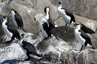
The Sir Joseph Banks Group is an archipelago in the Australian state of South Australia located in Spencer Gulf about 20 kilometres (12 mi) off the eastern coast of the Eyre Peninsula. It consists of 21 islands of which eighteen are in the Sir Joseph Banks Group Conservation Park while the surrounding waters are in the Sir Joseph Banks Group Marine Park. It is considered to be an important seabird breeding site.

Troubridge Island is an island located in the south west corner of Gulf St Vincent in South Australia near the eastern edge of the Troubridge Shoals off the east coast of Yorke Peninsula about 8 kilometres (5.0 mi) southeast by east of the town of Edithburgh It is notable for being a site of an operating lighthouse from 1856 until 2002 and as a site for a sea bird rookery. Since 1982, the island has been part of the Troubridge Island Conservation Park.

West Island is a 10 hectares granite island lying 0.8 kilometres off the southern coast of the Fleurieu Peninsula, South Australia, 7 kilometres south-west of the town of Victor Harbor. It rises to a maximum height of about 40 metres in the south-west. Its main conservation value lies in its seabird colonies.

Pelican Lagoon Conservation Park is a protected area located in the Australian state of South Australia on the Dudley Peninsula on Kangaroo Island. It was dedicated in 1967 for the protection of wildlife habitat.

Pelican Lagoon is a seawater lagoon in the Australian state of South Australia located on the north coast of Kangaroo Island about 18.7 kilometres south east of Kingscote. It was named by Matthew Flinders on 4 April 1802 after the large population of pelicans present in its waters and adjoining shorelines. Its role as fishery hatchery had been identified by the early 20th century with the result that fishing in its waters has been restricted in varying degrees.
Lipson Cove is a tranquil sandy bay in the Australian state of South Australia on the east coast of Eyre Peninsula overlooking Spencer Gulf. It features in the 2012 book 101 Best Australian Beaches by Andy Short and Brad Farmer.
Liguanea Island is an uninhabited granite island in the Australian state of South Australia located 3.7 km south of Cape Carnot at the southern, central point of Eyre Peninsula. It is approximately 2.7 km long, 180 ha in size its elevation above sea level is estimated to be 43 metres. It is approximately 35 km south-west of Port Lincoln in the Great Australian Bight. The island forms part of the Lincoln National Park.
Middle Island is an island in the Australian state of South Australia located in Spencer Gulf within Pondalowie Bay on the south-western coast of Yorke Peninsula. It is the largest of three islands within the bay with an approximate area of 28 hectares. It first obtained protected area status as a fauna conservation reserve declared under the Crown Lands Act 1929-1966 on 16 March 1967 and is currently located within the boundaries of the Innes National Park. It is also located within a habitat protection zone of the Southern Spencer Gulf Marine Park. DEWNR lists the islands as 'no access' areas for the general public.

Louth Island is a 135 ha island located in Louth Bay, Spencer Gulf, South Australia. The island is privately owned, and has previously been used for the grazing of sheep and mining of guano. The island has an old building with sleeping quarters, several beaches, inshore rocky reef and a boat anchorage. It is 17.5 km NNE of Port Lincoln and is easily accessible by boat. The indigenous name for the island is Yorunu.
Boston Island is a 960-hectare (2,400-acre) privately owned island in Boston Bay, Spencer Gulf, South Australia. It has been primarily used for grazing sheep and was also once the location of a proposed township called Kerrillyilla at the southern end of the island. In 2009, the island was rezoned to allow for future residential and tourism development. As of 2009, it is owned by the former mayor of Port Lincoln, Peter Davis. Davis' development plans include up to 1,000 residential allotments, three tourism developments and an inland marina. Prior to rezoning, there had been little interest expressed in the development plan, despite the then mayor's enthusiasm.
Owen Island, formerly known as Rabbit Island and also known as Little Taylor Island, is an island in the Australian state of South Australia located in Spencer Gulf off the east coast of Jussieu Peninsula on Eyre Peninsula approximately. 18.7 kilometres (11.6 mi) south-east of Port Lincoln. Since 1972, the island has been part of the Lincoln National Park.
Cap Island Conservation Park is a protected area in the Australian state of South Australia located about 7.5 kilometres (4.7 mi) offshore, west of Mount Misery, Eyre Peninsula. The park covers Cap Island's 8ha surface. The island consists of a granite base and a calcarenite mantle; its margins steeply over-hanging and eroded. Typical vegetation is a low Nitre Bush shrubland. Cap Island Conservation Park was constituted by statute in 1972 to conserve a sea bird breeding area and Australian Sea-lion and New Zealand Fur-seal haul-out areas.

Penguin Island is an island in the Australian state of South Australia located in Rivoli Bay on the state's south east coast of approximately 1.5 kilometres south of Beachport. From 1878 to 1960, it was the site of an operating lighthouse. Since at least 1972, it has been part of the Penguin Island Conservation Park.
Royston Island is an island in the Australian state of South Australia at the northern end of Pondalowie Bay on the south-west extremity of Yorke Peninsula about 13 kilometres north-west of the town of Stenhouse Bay. The island has enjoyed protected area status since 1967 and since 1972, it has been part of the Innes National Park.
