Rats are various medium-sized, long-tailed rodents. Species of rats are found throughout the order Rodentia, but stereotypical rats are found in the genus Rattus. Other rat genera include Neotoma, Bandicota and Dipodomys.

The black rat —also known as ship rat, roof rat, or house rat—is a common long-tailed rodent of the stereotypical rat genus Rattus, in the subfamily Murinae.

The brown rat, also known as the common rat, street rat, sewer rat, Hanover rat, Norway rat, Norwegian rat, Parisian rat, water rat or wharf rat, is one of the best known and most common rats.

Macquarie Island, a UNESCO World Heritage Site, lies in the southwest Pacific Ocean, about halfway between New Zealand and Antarctica. Regionally part of Oceania and politically a part of Tasmania, Australia since 1900, it became a Tasmanian State Reserve in 1978 and was inscribed on the World Heritage List in 1997.

Adélie Land is a claimed territory on the continent of Antarctica. It stretches from a coastline area along the Great Southern Ocean inland all the way to the South Pole. France administrates it as one of five districts of the French Southern and Antarctic Lands since 1955 and apply the Antarctic Treaty System rules since 1961. Article 4 deals with territorial claims, and although it does not renounce or diminish any preexisting claims to sovereignty, it also does not prejudice the position of Contracting Parties in their recognition or non-recognition of territorial sovereignty. France has had a permanent station in Adélie Land since April 9, 1950. The current Dumont d'Urville Station has a winter population around 33, but this goes up to about 78 during the Antarctic summer.

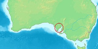
The Neptune Islands consist of two groups of islands located close to the entrance to Spencer Gulf in South Australia. They are well known as a venue for great white shark tourism.
The toros or brush-tailed rats, genus Isothrix, are a group of spiny rats found in tropical South America, particularly in the Amazon Basin.
The tuft-tailed spiny tree rat is a spiny rat species from South America. It is known from Brazil south of the Amazon River, where it has been found in grassland and gallery forest. It is the only species in the genus Lonchothrix. Very little is known about this rodent. It is small with an average adult weight of about 138 grams. It is nocturnal and solitary in habits.

Mesomys is a genus of South American spiny rats in the family Echimyidae.

Willem Janszoon made the first recorded European landing on the Australian continent in 1606, sailing from Bantam, Java, in the Duyfken. As an employee of the Dutch East India Company, Janszoon had been instructed to explore the coast of New Guinea in search of economic opportunities. He had originally arrived in Dutch East Indies from the Netherlands in 1598 and became an officer of the VOC on its establishment in 1602.

Munruben is a locality in Logan City, Queensland, Australia. Once a rural community, it has been developed into a low density residential community. At the 2016 Australian Census the suburb recorded a population of 2,871.

Rodents are mammals of the order Rodentia, which are characterized by a single pair of continuously growing incisors in each of the upper and lower jaws. About 40% of all mammal species are rodents ; they are found in vast numbers on all continents except Antarctica. They are the most diversified mammalian order and live in a variety of terrestrial habitats, including human-made environments.

Loch Sloy was a Scottish sailing barque that operated between Great Britain and Australia from the late 19th century until 1899. Her name was drawn from Loch Sloy, a freshwater loch which lies to the north of the Burgh of Helensburgh, in the region of Argyll and Bute, Scotland. Ships Captains: 1877 - 1885 James Horne, 1885 – 1890 John McLean, 1890 – 1895 Charles Lehman, 1895 – 1896 James R. George, 1896 – 1899 William J. Wade, 1899 Peter Nicol.

The borders of the oceans are the limits of the Earth's oceanic waters. The definition and number of oceans can vary depending on the adopted criteria.

Echimyidae is the family of neotropical spiny rats and their fossil relatives. This is the most species-rich family of hystricognath rodents. It is probably also the most ecologically diverse, with members ranging from fully arboreal to terrestrial to fossorial habits. They presently exist mainly in South America; three members of the family also range into Central America. Species of the extinct subfamily Heteropsomyinae formerly lived on Cuba, Hispaniola, and Puerto Rico in the Antilles, probably until the arrival of Europeans. Some authorities consider the nutria from southern and central South America to be a part of this family.

Tumby Island is a low bedrock island located 500 m east of the southern tip of Tumby Bay in Spencer Gulf, South Australia. The island is a conservation park comprising 35 hectares. The island can be accessed on foot at low tide by traversing shallow water-covered rock flats and curving sand. Visitors should request access permission from DEWNR before visiting and be mindful of the presence of Death adders.

Entrance Island is a low island located inside the mouth of Franklin Harbor, Eyre Peninsula in South Australia. The island comprises approximately 100 hectares, and falls within the boundaries of the Franklin Harbor Conservation Park and Franklin Harbor Marine Park. Its maximum elevation is approximately 4 metres. The island provides roosting and nesting habitat for a variety of sea and shorebird species.

The County of Jervois is a cadastral unit in the Australian state of South Australia that covers land on the east coast of the Eyre Peninsula. It was proclaimed on 24 January 1878 and named after William Jervois, the Governor of South Australia from October 1877 to January 1883.

Myocastorini is a tribe of echimyid rodents, proposed in 2017, and containing the five extant genera Callistomys, Hoplomys, Myocastor, Proechimys, and Thrichomys.

Echimyinae is a subfamily of rodents belonging to the spiny rats family Echimyidae. It contains 14 arboreal genera—all the members of the tribe Echimyini, plus Callistomys—a few terrestrial genera, and a subaquatic genus (Myocastor).


