A seaside resort is a town, village, or hotel that serves as a vacation resort and is located on a coast. Sometimes the concept includes an aspect of official accreditation based on the satisfaction of certain requirements, such as in the German Seebad. Where a beach is the primary focus for tourists, it may be called a beach resort.

The Mornington Peninsula is a peninsula located south of Melbourne, Victoria, Australia. It is surrounded by Port Phillip to the west, Western Port to the east and Bass Strait to the south, and is connected to the mainland in the north. Geographically, the peninsula begins its protrusion from the mainland in the area between Pearcedale and an area north of Frankston. The area was originally home to the Mayone-bulluk and Boonwurrung-Balluk clans and formed part of the Boonwurrung nation's territory prior to European settlement.

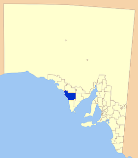
The Yorke Peninsula is a peninsula located north-west and west of Adelaide in South Australia, between Spencer Gulf on the west and Gulf St Vincent on the east. The peninsula is separated from Kangaroo Island to the south by Investigator Strait. The most populous town in the region is Kadina.
The Eyre Peninsula is a triangular peninsula in South Australia. It is bounded by the Spencer Gulf on the east, by the Great Australian Bight on the west, and by the Gawler Ranges on the north.

Orford is a village on the east coast of Tasmania, Australia 73 kilometres north-east of Hobart. It is the home of the joint champions of T20 Cricket in Tasmania. The village is centred on the mouth of the Prosser River, on the southern margin of a substantial coastal inlet called Prosser Bay. Beyond this bay are the waters of the Mercury Passage. At the 2006 census, Orford had a population of 553.

Port Broughton is a small South Australian town located at the northern extent of the Yorke Peninsula on the east coast of Spencer Gulf. It is situated about 170 km north-west of Adelaide, and 56 km south of Port Pirie. At the 2011 census, the town of Port Broughton had a population of 1,034.
Arno Bay is a small fishing and tourist town on the east coast of Eyre Peninsula in South Australia, located on the Lincoln Highway about halfway between Whyalla and Port Lincoln. First proclaimed under the name Bligh in 1883, the current name dates back to 1940. It is a recreational town with a number of marine and nature based attractions, including fishing, surfing and swimming.

Coral Bay is a small coastal settlement located 1,200 kilometres (750 mi) north of Perth, in the Shire of Carnarvon in the Gascoyne region of Western Australia.

Tumby Bay is a coastal town situated on the Spencer Gulf, on the eastern coast of Eyre Peninsula in South Australia, 45 kilometres (28 mi) north of Port Lincoln. The town of Tumby Bay is the major population centre of the District Council of Tumby Bay, and the centre of an agricultural district farming cereal crops and sheep, as well as having established fishing and tourism industries.

Elliston is a small coastal town in the Australian state of South Australia on the west coast of Eyre Peninsula 169 km northwest of Port Lincoln and 641 km west of Adelaide. The township is located on Waterloo Bay. At the 2006 census, Elliston had a population of 377.
Cleve is a small agriculturally based town on Central Eyre Peninsula in South Australia. It is 226 km southwest of Port Augusta and 143 km north of Port Lincoln. At the 2006 census, Cleve had a population of 738. The town has its origins in the 1850s, with the town established some twenty years later.

Port Neill is a small coastal town on the eastern side of the Eyre Peninsula, in South Australia about 3 km off the Lincoln Highway between the major towns of Whyalla and Port Lincoln. It is 576 km by road from Adelaide.

Cowell is a coastal town on Franklin Harbor on the eastern side of the Eyre Peninsula, in South Australia on the Lincoln Highway 111 km south of the major town of Whyalla. It is 493 km by road from Adelaide.

Streaky Bay is a coastal town on the western side of the Eyre Peninsula, in South Australia just off the Flinders Highway, 303 km (188 mi) north-west of Port Lincoln and 727 km (452 mi) by road from Adelaide. At the 2016 census, Streaky Bay recorded a population of 1, 378.

Sceale Bay is a small town 32 km south of Streaky Bay on the Eyre Peninsula of South Australia. With a permanent population of only 28, the town's numbers increase by threefold over the summer holiday period. The town is primarily an isolated holiday destination, with nothing in the way of commerce or industry occurring in its bounds.
The District Council of Elliston is a local government area covering around 6500 km2 on the Western Eyre Peninsula in South Australia. Established in 1888, the district has a diverse economy, with agriculture, commercial fishing and tourism making up the majority of the local economy.

Venus Bay is a small tourist and fishing town sited on the bay of the same name, on the Eyre Peninsula in South Australia. The town population numbers in the twenties for most of the year, but its numbers greatly increase during the summer holidays. At the 2006 census, Venus Bay had a population of 139. The town also serves professional fishermen who fish the Southern Ocean.

The District Council of Grant is a local government area located in the Limestone Coast region of South Australia, and is the southernmost council in the state.

Smoky Bay is a town and locality located in the Australian state of South Australia on the west coast of the Eyre Peninsula. Previously used as a port, the town is now a residential settlement and popular tourist destination known for its recreational fishing, with a boat ramp and jetty located in the town.

Kyancutta is a small wheatbelt town at the junction of the Eyre and Tod Highways on the Eyre Peninsula in South Australia. Once a busy town with an airport, Kyancutta is now nearly a ghost town, acting only as a centre for the agricultural districts surrounding it, as well as passing tourists.

