The settlement was originally established as Nepabunna Mission in 1931, becoming the local government area (LGA) of Nepabunna Community Council with the establishment of a council in 1998. Iga Warta is a separate, independently run small cultural tourism enterprise within the LGA. The Nipabanha Community Aboriginal Corporation runs the Indigenous Protected Area (IPA) over land known as Nantawarrina, once a station for mixed livestock.
The land upon which Nepabunna is situation lies within the traditional lands of the Adnyamathanha people.[3]
Nepabunna Mission
Nepabunna Mission, c.1937
The Adnyamathanha people were displaced from their traditional lands in the 1850s by pastoralists,[4] no longer able to travel around their lands as before owing to the establishment of pastoral leases. They had been used to moving around the land because of the lack of a reliable water source, but since European settlement, they had been forced to camp in groups. One of these camps was near a place known as Damper Hill, and another, Ram Paddock. Many of them worked on the stations.[5]
Nepabunna Mission was established in 1931 by the United Aborigines Mission, created on 52km2 (20sqmi) of land[6] that was then part of Balcoona Station, given by the owner Roy Thomas.[4] Jim Page and Fred Eaton were instrumental in the creation of the mission,[7] and Page was remembered many years later for his kindness and for his encouragement of the continuance of traditional practices. However, this was frowned upon by others in the organisation and there were plans to investigate him, before he committed suicide at Nepabunna, where he was buried.[8] A school was built, which was also used for church services. A dormitory was built in the 1940s, although not used for many years, but sometime after 1948 it was used to house children of parents who worked elsewhere. A government school was built in 1963.[6]
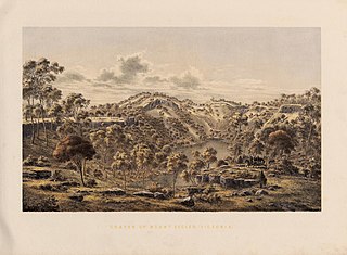
Aerial view of the Campbell Bald Hill Range, just south of Nepabunna
The LGA, established in 1998, is managed by Nepabunna Community Inc., under an ALT lease with an expiry date of 2081.[12] The council provides housing maintenance and general municipal services as well as organising cultural tours and education and an annual gymkhana and family day.[13]
Nantawarrina
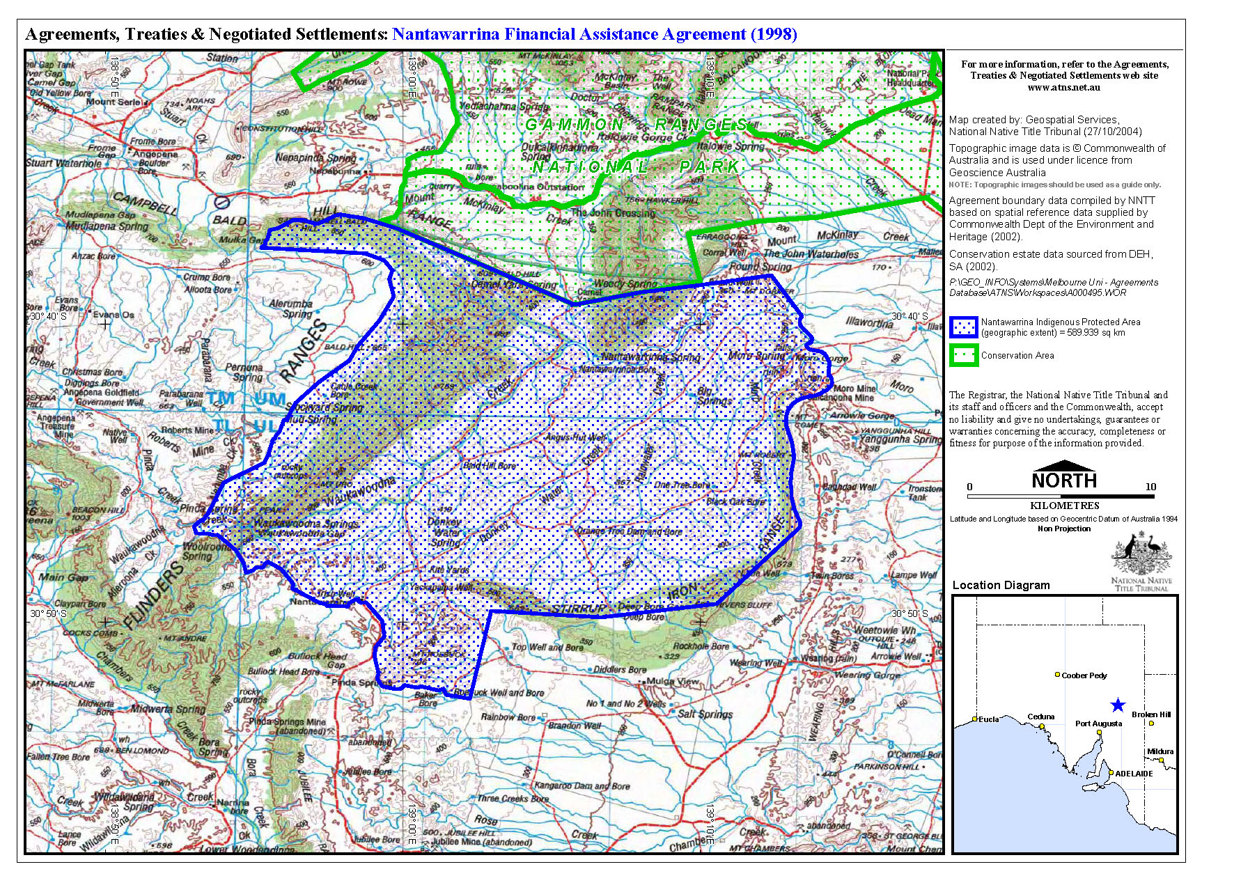
The Nipabanha Community Aboriginal Corporation[14] runs the Indigenous Protected Area (IPA) over land known as Nantawarrina, once a pastoral station.[15] It was the first IPA established in Australia, in 1998.[16]
In 1982[16] or 1987, more than 58,000 hectares (140,000 acres) of Adnyamathanha traditional land was purchased from a pastoralist by the South Australian Aboriginal Lands Trust (SAALT). It was first leased out for grazing, until it became obvious that the land was so degraded by overgrazing and other factors[16] that it was no longer suitable grazing land. Around 1997, the IPA programme was just starting up, and the Adnyamathanha people at Nepabunna leapt at the chance to become part of a pilot project. The existing land would be converted into an IPA, which would become part of the Australian National Reserve System, but managed by the Nepabunna Community. The International Union for Conservation of Nature (IUCN) would help guide the project, while the federal government would provide funding for land management and preservation of cultural heritage, infrastructure and training for Indigenous rangers.[17]
On 1 August 1998 the area, which lies adjacent to the southern boundary of the Gammon Ranges National Park, was formally proclaimed,[18][19] as the "First Indigenous Protected Area in South Australia, Australia and internationally".[17]
Since then, the rangers have replanted native vegetation, and helped to protect native animals such as the yellow-footed rock wallaby (andu). A programme of removal of feral animals, in particular goats, has been undertaken. Bores have been built and irrigation laid. Restoration work on an old homestead, Irish Well Hut, has been undertaken, and camping sites,[17] a dormitory in a converted TAFE building, as well as separate provision for women, provide accommodation for tourists.[20] They also provide educational and cultural tours and grow bushfoods, as a destination for those interested in sustainable tourism.[21]
Iga Warta is a cultural tourism enterprise, run independently by Terrence Coulthard and his family, about 1 square kilometre (0.39sqmi) in size.[12] Terrence and his wife Josephine compiled the first comprehensive bilingual dictionary of the Adnyamathanha language, which includes descriptions of cultural practices, music and other features of Adnyamathanha life.[23]
In 2011, there were only about 30 permanent residents at Nepabunna, but the older people were encouraging younger ones to return and learn about their culture. Older adults were engaging in and teaching traditional ceremonies such as the smoking ceremony, skills such as the creation of boomerangs by woodcarving, identifying and cooking bush tucker in traditional ways, and they were passing on the dreamtime stories of the Adnyamathanha people.[8]
At the 2006 census, 49 people were at Nepabunna,[27] but this figure had grown to 66 by the 2016 Census.[3]
Access and facilities
The community, also spelt Nipapanha, is located just west of the Gammon Ranges.[3] Access is via the main Copley to Balcanoona road.[12]
In 2011 a flag of the Adnyamathanha people was created, and raised at Nepabunna on the 80th anniversary of its establishment.[8]
There is a school, Nepabunna Aboriginal School,[8] a church, Nepabunna Community Church, and a cemetery.[10]
Aborigine News. 1984. Contains news items relating to Missions and settlements at Copley (Nepabunna), Marree, Oodnadatta and Gerard, as well as Colebrook Home, Eden Hills.{{cite book}}: |website= ignored (help) SLSA holdings of Aborigine News, published by the United Aborigines Mission. No. 56 (July 1974/Jan. 1975)-no. 84 (Sept.-Dec. 1984)
The Ikara–Flinders Ranges National Park, formerly Flinders Ranges National Park, is a national park situated approximately 430 km (270 mi) north of Adelaide. It lies northeast of the small town of Hawker, in the northern central part of South Australia's largest mountain range, the Flinders Ranges, and covers an area of 95,000 ha (370 sq mi) between Hawker and Blinman. It is known for the land formation known as Wilpena Pound, while other well-known features include the Heysen Range and the Brachina and Bunyeroo gorges. The Heysen Trail and Mawson Trail pass through the park.
The Flinders Ranges are the largest mountain ranges in South Australia, which starts about 200 km (125 mi) north of Adelaide. The ranges stretch for over 430 km (265 mi) from Port Pirie to Lake Callabonna.
The South Australian Museum is a natural history museum and research institution in Adelaide, South Australia, founded in 1856 and owned by the Government of South Australia. It occupies a complex of buildings on North Terrace in the cultural precinct of the Adelaide Parklands. Plans are under way to move much of its Australian Aboriginal cultural collection, into a new National Gallery for Aboriginal Art and Cultures.
The Adnyamathanha are a contemporarily formed grouping of several distinct Aboriginal Australian peoples of the northern Flinders Ranges, South Australia. The ethnonym Adnyamathanha was an alternative name for the Wailpi but the contemporary grouping also includes the Guyani, Jadliaura, Pilatapa and sometimes the Barngarla peoples. The origin of the name is in the words "adnya" ("rock") and "matha".
Lake Frome / Munda is a large endorheic lake in the Australian state of South Australia to the east of the Northern Flinders Ranges. It is a large, shallow, unvegetated salt pan, 100 kilometres (62 mi) long and 40 kilometres (25 mi) wide, lying mostly below sea level and having a total surface area of 259,615 hectares. It only rarely fills with brackish water flowing down usually dry creeks in the Northern Flinders Ranges from the west, or exceptional flows down the Strzelecki Creek from the north.
The yellow-footed rock-wallaby, formerly known as the ring-tailed rock-wallaby, is a member of the macropod family.
The Adnyamathanha language, also known as yura ngarwala and other names, and Kuyani, also known as Guyani and other variants, are two closely related Australian Aboriginal languages. They are traditional languages of the Adnyamathanha of and the Kuyani peoples, of the Flinders Ranges and to the west of the Flinders respectively, in South Australia.
Yalata is an Aboriginal community located 200 kilometres (120 mi) west of Ceduna and 140 km (87 mi) south of Ooldea on the edge of the Nullarbor Plain in South Australia. It lies on the traditional lands of the Wirangu people, but the settlement began as Yalata Mission in the early 1950s when Pila Nguru people were moved from Ooldea Mission when that closed, after previously being moved from their land in the Great Victoria Desert owing to nuclear testing by the British Government.
Charles Pearcy Mountford OBE was an Australian anthropologist and photographer. He is known for his pioneering work on Indigenous Australians and his depictions and descriptions of their art. He also led the American-Australian Scientific Expedition to Arnhem Land.
The wild orange is an Australian native plant found in dry inland areas of Australia. Its scientific name is Capparis mitchellii. It is not related to oranges, nor to the Osage-orange which is known as "wild orange" in North America, but to capers.
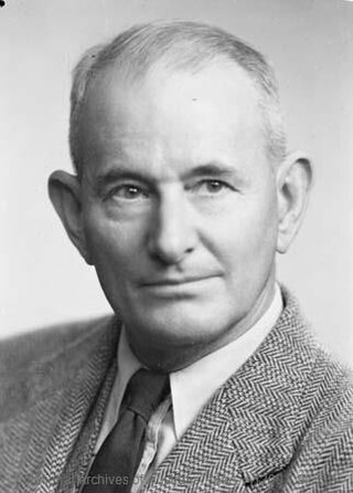
Coulthard is an English surname. It derives as an occupational surname, for somebody who works with horses, from Old English colt and hierde (herdsman). Its variations include Coulthart, Colthart, Coltart, Coltherd, Colthert.
An Indigenous Protected Area (IPA) is a class of protected area used in Australia; each is formed by voluntary agreement with Indigenous Australians, and declared by Aboriginal Australians and Torres Strait Islander representative organisations. Each is formally recognised by the Australian Government as being part of its National Reserve System. The areas may comprise land and sea, and are managed by Indigenous groups for the conservation of biodiversity. Managing IPAs also helps to protect the cultural values of their country for future generations, and has benefits for Indigenous health, education, economic and social cohesion.
The Barngarla, formerly known as Parnkalla and also known as Pangkala, are an Indigenous people of South Australia and the traditional owners of much of Eyre Peninsula. Their language, Barngarla is a Yura language and part of a revival effort by the University of Adelaide.
Faith Thomas, born Tinnipha, was an Australian cricketer and hockey player. She was also a nurse in regional South Australia. Thomas is known for being the first Indigenous woman to represent Australia in any sport as well as for her distinguished service to the Australian Indigenous community.
Koonibba is a locality and an associated Aboriginal community in South Australia located about 586 kilometres (364 mi) northwest of the state capital of Adelaide and about 38 km (24 mi) northwest of the municipal seat in Ceduna and 5 km (3.1 mi) north of the Eyre Highway.
Warratyi is the site of a rock shelter in the Flinders Ranges in South Australia. Located around 550 kilometres (340 mi) north of Adelaide and about 200 kilometres (120 mi) inland, it has been identified as the oldest known site of human habitation in inland Australia. Newspapers reported that this rock shelter was discovered by chance in 2011 by a local resident who stumbled upon it while looking for somewhere to go to the toilet. Researchers found thousands of artefacts and bone fragments, which enabled them to date the shelter's occupation to a number of periods between 49,000 and 10,000 years ago. The finds include the earliest evidence in Australia of the development of bone and stone-axe technology, the use of ochre, and interaction with megafauna such as Diprotodon.
The Kuyani people, also written Guyani and other variants, and also known as the Nganitjidi, are an Aboriginal Australian people of the state of South Australia who speak the Kuyani language. Their traditional lands are to the west of the Flinders Ranges.
The Wailpi are an indigenous people of South Australia They are also known as the Adnyamathanha, which also refers to a larger group, though they speak a dialect of the Adnyamathanha language.
R.M. Williams is an Australian footwear and clothing company. It is best known for producing chelsea boots for men and women. The company was founded by Reginald Murray "R.M." Williams. It is currently owned by Tattarang, an investment company owned by mining magnate Andrew Forrest.
Budj Bim heritage areas includes several protected areas in Victoria, Australia, the largest two being Budj Bim National Heritage Landscape and the Budj Bim Cultural Landscape. Within the latter, there are three Indigenous Protected Areas: the Tyrendarra Indigenous Protected Area, Kurtonitj Indigenous Protected Area, and the Lake Condah Indigenous Protected Area.
This page is based on this Wikipedia article Text is available under the CC BY-SA 4.0 license; additional terms may apply. Images, videos and audio are available under their respective licenses.


