City of Mitcham

Last updated

City of Mitcham
Adelaide,  South Australia
Adelaide-LGA-Mitcham-MJC.png
Population67,617 (LGA 2021) [1]
 • Density893,22/km2 (231,340/sq mi)
Established1853
Area75.70 km2 (29.2 sq mi)
Time zone Australian Central Standard Time (ACST) (UTC)
MayorHeather Holmes-Ross
Council seat Torrens Park
Region Southern Adelaide [2]
State electorate(s) Davenport, Elder, Heysen, Waite
Federal division(s) Boothby
Mitcham Logo.jpg
Website City of Mitcham
LGAs around City of Mitcham:
City of Unley City of Burnside
City of Marion City of Mitcham Adelaide Hills Council
City of Onkaparinga

The City of Mitcham is a local government area in the foothills of southern Adelaide, South Australia. Within its bounds is Flinders University, South Australia's third largest, and the notable, affluent suburb of Springfield which contains some of the city's most expensive properties.

Contents

History

Before the arrival of European settlers, the Kaurna people lived in the region. The first Europeans to settle in the area were a group of sailors who jumped ship in 1837 and founded a settlement at Coromandel Valley as a hiding place. [3] Mitcham village was established on Brown Hill Creek in 1840, named after Mitcham, a village in Surrey. [4]

The council was founded on 10 May 1853 as the District Council of Mitcham and was the first local government area formally founded in South Australia after the City of Adelaide. [5] [6] The council initially covered an area of 108 square kilometres, stretching from the Adelaide Park Lands in the north to Mount Barker Road in the east, with the Sturt River forming the southern boundary. [4] It lost the part of the council west of South Road to the District Council of Brighton (later the City of Marion) on 19 December 1854. [3] [5] In 1871, Unley and surrounding areas were severed from the Mitcham council to create the Corporate Town of Unley. [7] It lost another area on 25 October 1883, when portions of the council around Stirling were detached to form the new District Council of Stirling. [5]

From 1854 to 1869, the council rented offices in the Adelaide City Centre to conduct their business, only relocating to within the council itself in 1870. Its current council chambers in Torrens Park were first built in 1934. [4] The District Council become a Corporation in 1944, and it gained city status in 1947, becoming the City of Mitcham. [4] The state government planned to dissolve the City of Mitcham in 1989, but the council was able to lobby to prevent its dissolution. [4]

Colebrook

Colebrook Home, first established in Quorn in the Flinders Ranges in 1927, moved to Eden Hills in the 1940s to secure better water supply. [8] [9] The home was an institution for Aboriginal children, with the intention of removing them from the influence of their Aboriginal families so they could be better assimilated into white society as part of the Stolen Generations. [8] In 1972 the children were relocated to Blackwood due to low numbers and Colebrook Home was demolished in 1973. [3] [8] It was officially closed in 1981. [8]

The former location of Colebrook Home is now the Colebrook Reconciliation Park, a memorial to the children and families impacted by Colebrook Home. The Blackwood Reconciliation Group and the Colebrook Tji Tji Tjuta (a number of former residents of Colebrook Home) combined to organise community gatherings on the site starting in 1997. [8] [9] Two statues have been sculpted to commemorate the Stolen Generations (the 'Fountain of Tears' in 1998 and the 'Grieving Mother' in 1999). [9]

Environment

Mitcham is one of three suburban Adelaide councils to be awarded a "Tree Cities of the World" designation from the Food and Agriculture Organization of the United Nations (FAO) and Arbor Day Foundation, along with the City of Burnside and the City of Unley, and as of July 2020 the only three in Australia. [10]

Suburbs

The City of Mitcham includes all or part of 32 suburbs: [11]

Wards

The City of Mitcham is divided into 6 wards, each of which elect 2 or 3 representatives to the Council. [12] They cover suburbs roughly as follows. [13]

WardSuburbs
OvertonClarence Gardens, Cumberland Park, Melrose Park, Daw Park, (part of) Colonel Light Gardens
GaultWestbourne Park, Hawthorn, (most of) Colonel Light Gardens, Lower Mitcham, (part of) Clapham
BoormanKingswood, Netherby, Urrbrae, Torrens Park, Mitcham, Springfield, Brownhill Creek, Leawood Gardens, Lynton
BabbageSt Marys, Pasadena, Panorama, (part of) Clapham, Bedford Park
The Park(most of) Belair, Glenalta, (part of) Crafers West, (part of) Blackwood, Hawthorndene, (part of) Upper Sturt
CraigburnEden Hills, (part of) Belair, (most of) Blackwood, Bellevue Heights, Craigburn Farm, (part of) Coromandel Valley

Transport

The first rail service in the City Mitcham was a horse-tram track, first opened in 1879. The line was converted to electricity in 1911, and further tram lines were opened in the council in the early 20th century. From 1958, these tram lines were shut down and replaced with bus services. [14]

The City of Mitcham is currently serviced by the Belair railway line, which runs via the Adelaide–Wolseley railway line that connects Adelaide to Melbourne. This railway line was constructed from 1879 to 1887, and expanded from a single track to a double track in 1919 to manage increasing traffic. The council area includes the Mitcham, Torrens Park, Lynton, Eden Hills, Coromandel, Blackwood, Glenalta, Pinera, and Belair railway stations, as well as the former Clapham railway station. [15]

In addition to bus services operated by Adelaide Metro, the City of Mitcham operates a door-to-door community bus service for the elderly and people living with a disability. The council has two which that travel weekly to local shopping centres. [16]

In 2018/19, transport accounted for 26% of the City of Mitcham's greenhouse gas emissions, with 23% coming from cars alone, making automobile transport the second-biggest contributor to the council area's emissions. [17] The City of Mitcham has invested in six electric vehicle charging stations (four in Torrens Park and two in Blackwood) to assist the transition away from fossil fuels. [18]

See also

Related Research Articles

<span class="mw-page-title-main">Belair National Park</span> Protected area in South Australia

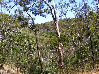
Belair National Park is a protected area in Belair, South Australia, 9 kilometres southeast of Adelaide city centre; it covers an area of 835 hectares. It was proclaimed in 1891 and was the first national park in South Australia, second in Australia and the tenth in the world. The national park lies within the Adelaide Hills and Mitcham council area, and forms part of a chain of protected areas located along the Adelaide Hills Face Zone. The national park is administered by the Department of Environment, Water and Natural Resources.

<span class="mw-page-title-main">Adelaide Metro</span> Public transport system in Adelaide, Australia

Adelaide Metro is the public transport system of Adelaide, the capital city of South Australia. It is an intermodal system offering an integrated network of bus, tram, and train services throughout the metropolitan area. The network has an annual patronage of 79.9 million, of which 51 million journeys are by bus, 15.6 million by train, and 9.4 million by tram. The system has evolved heavily over the past fifteen years, and patronage increased dramatically during the 2014–15 period, a 5.5 percent increase on the 2013 figures due to electrification of frequented lines.

<span class="mw-page-title-main">Belair, South Australia</span> Suburb of Adelaide, South Australia

Belair is a suburb in the south eastern foothills of Adelaide, South Australia at the base of the Mount Lofty Ranges.

Torrens Park is a mainly residential large inner-southern suburb of Adelaide, incorporating some of the foothills and adjacent to the original "Mitcham Village". It was named after Sir Robert Richard Torrens, the instigator of the Torrens title system of land registration and transfer, who built a large home in the area which he named Torrens Park.
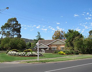
Westbourne Park is an inner southern suburb of Adelaide, the State capital of South Australia. The suburb was named after Westbourne, a village in Sussex, England, and was laid out in 1881.

<span class="mw-page-title-main">Belair line</span> Rail line in Adelaide, South Australia

<span class="mw-page-title-main">Blackwood, South Australia</span> Suburb of Adelaide, South Australia

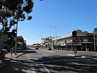
Blackwood is a south-eastern suburb located in the foothills of Adelaide, South Australia. It is part of the local government area of the City of Mitcham.

Clapham, located approximately 8 kilometres (5.0 mi) south of the Adelaide city centre, is a primarily residential suburb situated within the City of Mitcham, incorporating some of the foothills. The suburb is named after Clapham in London, England. Neighbouring suburbs are Colonel Light Gardens, Panorama, Lynton, Torrens Park and Lower Mitcham.

<span class="mw-page-title-main">Electoral district of Waite</span> South Australian state electoral district

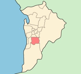
Waite is a single-member electoral district for the South Australian House of Assembly. Named after Peter Waite, a 19th century entrepreneur and philanthropist, it covers 75.4 km² of suburbs and foothills in Adelaide's inner south-east, taking in the suburbs of Belair, Blackwood, Brown Hill Creek, Coromandel East, Coromandel Valley, Crafers West, Craigburn Farm, Eden Hills, Glenalta, Hawthorndene, Kingswood, Lynton, Mitcham, Netherby, Springfield, Torrens Park, Urrbrae as well as part of Upper Sturt.

Eden Hills is a south eastern suburb located in the foothills of Adelaide, South Australia. It is part of the local government area of the City of Mitcham.

Coromandel Valley is a semirural south-eastern suburb of Adelaide, South Australia. It straddles the City of Mitcham and the City of Onkaparinga council areas, with the Sturt River being the boundary between the two council areas.

<span class="mw-page-title-main">Craigburn Farm, South Australia</span> Suburb of Adelaide, South Australia

Craigburn Farm is a suburb of Adelaide, South Australia, Australia. It is located about 17 km by road south of the city centre.

Glenalta is a suburb located in the south eastern Foothills of the Mount Lofty Ranges of Adelaide, South Australia. It is adjacent to Belair National Park.

Hawthorndene is a south-eastern suburb located in the Foothills of the Mount Lofty Ranges of Adelaide, South Australia.

<span class="mw-page-title-main">Hundred of Adelaide</span> Cadastral in South Australia

The Hundred of Adelaide is a cadastral hundred in the city of Adelaide spanning all the inner suburbs south of River Torrens. It is one of the eleven hundreds of the County of Adelaide, and was one of the first hundreds to be proclaimed. Like the city it surrounds, the Hundred was named after Queen Adelaide, and was named by Governor Frederick Robe in 1846. It is 106 square miles (270 km2); close to but not exactly one hundred square miles as with most of the other hundreds. Its north boundary is the Torrens River and the Sturt River forms the south east boundary, with the hundred extending to the Adelaide foothills.

<span class="mw-page-title-main">Sturt River</span> River in Australia

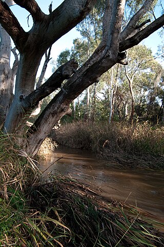
The Sturt River, also known as the Sturt Creek and Warri Parri (Warriparri) in the Kaurna language, is a river located in the Adelaide region of the Australian state of South Australia.

Mitcham was an electoral district of the House of Assembly in the Australian state of South Australia from 1938 to 1993. The district was based in the south-eastern suburbs of Adelaide.

Crafers West is a suburb of Adelaide in the Adelaide Hills Council. Located on Peramangk land, it was formally named in 1985 as a separate address from Crafers. Crafers West contains the headwaters of Brown Hill Creek and is dominated by steep terrain and native scrub. It is bounded by Mount Barker Road on the northeast and the Bridgewater railway line on the south. The Eagle Mountain Bike Park is in the north of the suburb. Popular tourist spots include Clealand Conservation Park, Mt Lofty Botanic Gardens, and Belair National Park Holiday Park.

<span class="mw-page-title-main">Unley Road</span> Road in Unley, South Australia

Unley Road is a road in the City of Unley, located south of the City of Adelaide, the capital of South Australia. It runs from South Terrace to Cross Road, where it becomes Belair Road. The road was named after the family name of the wife of Thomas Whistler, owner of land in Unley which was laid out around 1857.

References

  1. Australian Bureau of Statistics (28 June 2022). "Mitcham (Local Government Area)". Australian Census 2021 QuickStats. Retrieved 28 June 2022.  OOjs UI icon edit-ltr-progressive.svg
  2. "Southern Adelaide SA Government region" (PDF). The Government of South Australia. Archived from the original (PDF) on 27 March 2019. Retrieved 17 April 2017.
  3. 1 2 3 "Important Dates in Mitcham's History". City of Mitcham. Retrieved 12 October 2022.
  4. 1 2 3 4 5 "Our History". City of Mitcham. Retrieved 12 October 2022.
  5. 1 2 3 Marsden, Susan (2012). "Local Government Association of South Australia: A History of South Australian Councils To 1936" (PDF).
  6. "Thursday, May 12, 1853" (PDF). The Government Gazette of South Australia. Government of South Australia. Retrieved 11 December 2016.
  7. "Overview History of the Unley District" (PDF). City of Unley. Archived from the original (PDF) on 6 July 2011. Retrieved 15 February 2016.
  8. 1 2 3 4 5 "Colebrook Home". CLAN. Retrieved 12 October 2022.
  9. 1 2 3 "Colebrook Reconciliation Park". City of Mitcham. Retrieved 12 October 2022.
  10. "Recognized Communities for Australia". Tree Cities of the World. Retrieved 27 July 2020.
  11. "City of Mitcham community profile". .idcommunity. Retrieved 12 October 2022.
  12. "Elected Members". City of Mitcham. Archived from the original on 5 June 2011. Retrieved 28 May 2011.
  13. "Ward Map". City of Mitcham. Archived from the original on 5 June 2011. Retrieved 28 May 2011.
  14. "Tram Lines around Mitcham — Chronology" (PDF). City of Mitcham. Retrieved 12 October 2022.
  15. "A Hills Railway History by Train" (PDF). City of Mitcham. Retrieved 12 October 2022.
  16. "Transport Services". City of Mitcham. Retrieved 12 October 2022.
  17. "Mitcham 2018/19 municipal emissions snapshot". snapshot. Retrieved 12 October 2022.
  18. "EV charging stations". City of Mitcham. Retrieved 12 October 2022.

35°1′S138°38′E / 35.017°S 138.633°E / -35.017; 138.633