Unley, South Australia

Last updated

Unley
Adelaide,  South Australia
OIC unley duthy st shops.jpg
Population3,997 (SAL 2021) [1]
Established1840 [2]
Postcode(s) 5061
Elevation49 m (161 ft)
Location2 km (1 mi) S of Adelaide
LGA(s) City of Unley
State electorate(s) Unley
Federal division(s) Adelaide
Suburbs around Unley:
Adelaide
Parklands
Adelaide
Parklands
Adelaide
Parklands
Wayville
Goodwood
Unley Parkside
Fullarton
Millswood Hyde Park Malvern Malvern

Unley is an inner-southern suburb of Adelaide, South Australia, within the City of Unley. The suburb is the home of the Sturt Football Club in the South Australian National Football League (SANFL). Unley neighbours Adelaide Park Lands, Fullarton, Hyde Park, Malvern, Parkside and Wayville.

Contents

The boundaries of Unley are Greenhill Road (north), Unley Road, Maud Street and Windsor Street (east), Cremorne Street and Opey Avenue (south) and King William Road (west).

Unley is the family name of the wife of Thomas Whistler, owner of land in Unley which was laid out around 1857. [3]

History

Prior to British colonisation of South Australia, Unley was home to the Aboriginal nation known as the Kaurna, or Adelaide Plains tribe. Settlement by migrants began in the mid-19th century, with arrivals predominantly from United Kingdom of Great Britain and Ireland, and to a small extent German speaking lands. At this time a small number of other ethnic groups also appeared. The land was cleared of native forest to farm sheep and cattle and to plant vineyards and orchards.

Since then, it has developed into a commercial hub, just south of Adelaide's city centre. The suburb also has a significant Greek Australian population.

Unley Post Office opened on 17 January 1850. [4]

The Glenelg tram line passes the northwest corner of the suburb and another line went along Unley Road until the 1960s.

Historic buildings

The Goodwood Institute was built in 1928, and now houses the Goodwood Theatre & Studios, a multi-purpose venue for the performing arts and music. [5] Independent Theatre, an amateur theatre company run by Rob Croser, [6] uses the venue for many of its performances. [7]

The Ikaros Hall, formerly a Masonic Temple erected in 1927, is situated in Arthur Street, and home of the Pan-Ikarian Brotherhood of Australia, a Greek Australian diaspora community organisation founded by migrants from the island of Ikaria. [8]

Demographics

Population2001 [9]  %2006 [10]  % % change
Total3,4273,585+ 4.6%
by Gender
Females1,75051.1%1,85051.6%+ 5.7%
Males1,67748.9%1,73548.4%+ 3.5%
by Age Group
0–41735.0%2156.0%+24.3%
5–143249.5%3299.2%+ 1.5%
15–2450914.9%51914.5%+ 2.0%
25–541,68849.3%1,70147.4%+ 0.8%
55–643389.9%39210.9%+16.0%
65+39611.6%42711.9%+ 7.8%
by Country of Birth
Australia2,47772.3%2,53370.7%+ 2.3%
England1755.1%1835.1%+ 4.6%
Greece1323.9%1042.9%−21.2%
Italy1273.7%1243.5%– 2.4%
Scotland300.9%
Germany240.7%
China691.9%
Malaysia320.9%
Dwellings2001 [9]  %2006 [10]  % % change
Total dwellings1,7171,755+ 2.2%
Occupied dwellings1,5821,616+ 2.1%
by Dwelling Type
Separate house92458.4%90656.1%– 1.9%
Semi-detached, row34621.9%37022.9%+ 6.9%
Flat, unit, etc.30519.3%34021.0%+11.5%
by Ownership
Fully owned58637.0%49930.9%−14.8%
Purchasing35222.4%45528.2%+29.3%
Rented53033.5%57635.6%+ 8.7%

Notable residents

See also

Related Research Articles

<span class="mw-page-title-main">Goodwood, South Australia</span> Suburb of Adelaide, South Australia

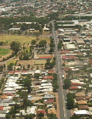
Goodwood is an inner southern suburb of the city of Adelaide, South Australia. It neighbours the Royal Adelaide Showgrounds and features several churches in its commercial district. Its major precinct is Goodwood Road, which is home to many shops, businesses and a library, as well as the local state school.

Westbourne Park is an inner southern suburb of Adelaide, the State capital of South Australia. The suburb was named after Westbourne, a village in Sussex, England, and was laid out in 1881.

<span class="mw-page-title-main">Eastwood, South Australia</span> Suburb of Adelaide, South Australia

Eastwood is a small triangular inner-southern suburb of Adelaide, South Australia in the City of Burnside.

<span class="mw-page-title-main">Parkside, South Australia</span> Suburb of Adelaide, South Australia

Parkside is an inner southern suburb of Adelaide, South Australia. It is located in the City of Unley.

<span class="mw-page-title-main">Wayville, South Australia</span> Suburb of Adelaide, South Australia

Wayville is an inner-southern suburb of Adelaide in the City of Unley. It is most notable for hosting of the Royal Adelaide Show at the Adelaide Showgrounds.

<span class="mw-page-title-main">Clarence Park, South Australia</span> Suburb of Adelaide, South Australia

Clarence Park is an inner southern suburb of Adelaide, South Australia in the City of Unley. Its borders are Mills Street (north), Goodwood Road (east), Cross Road (south) and the Seaford railway line (north-west).

<span class="mw-page-title-main">Black Forest, South Australia</span> Suburb of Adelaide, South Australia

Black Forest is an inner southern suburb of Adelaide, South Australia. It is located in the City of Unley, bounded by the Glenelg tram line (north-west), the Seaford railway line (south-east), South Road (west) and East Avenue (east).

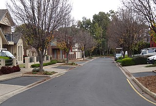
Kings Park is a very small, triangular shaped suburb of Adelaide in the City of Unley surrounded by Goodwood Road (west), Cross Road (south) and the Belair railway line (northeast).

<span class="mw-page-title-main">Millswood, South Australia</span> Suburb of Adelaide, South Australia

Millswood is an inner-southern mainly residential suburb of Adelaide in the City of Unley. It was named after Scotsman Samuel Mills, who arrived in the colony in 1839.

<span class="mw-page-title-main">Unley Park, South Australia</span> Suburb of Adelaide, South Australia

Unley Park is a southern suburb of Adelaide in the City of Unley. Its postcode is 5061.

Payneham is an eastern suburb of Adelaide in the City of Norwood Payneham St Peters. It is part of a string of suburbs in Adelaide's east with a high proportion of Adelaide's Italian-Australian and French-Australian residents, many of whom can be traced back to the large-scale migration following World War II.

<span class="mw-page-title-main">Broadview, South Australia</span> Suburb of Adelaide, South Australia

Broadview is a suburb of Adelaide, South Australia. It is located in the City of Port Adelaide Enfield and the City of Prospect.

<span class="mw-page-title-main">Tranmere, South Australia</span> Suburb of Adelaide, South Australia

Tranmere is an eastern suburb of Adelaide, South Australia. It is located in the City of Campbelltown.

Pennington is a northern suburb of Adelaide, South Australia, located about 10 km from the Adelaide city centre. It is located in the City of Charles Sturt.

Cumberland Park is an inner-southern suburb of Adelaide, South Australia in the City of Mitcham.

<span class="mw-page-title-main">Collinswood, South Australia</span> Suburb of Adelaide, South Australia

Collinswood is a suburb of Adelaide spanning the boundary of the Prospect and the Port Adelaide Enfield local government areas.

<span class="mw-page-title-main">Underdale, South Australia</span> Suburb of Adelaide, South Australia

Underdale is a western suburb of South Australia's capital city Adelaide on Kaurna land. It sits between Henley Beach Road and the River Torrens. It is largely residential with a very small industrial section on the eastern side of Holbrook's Road near the river.

<span class="mw-page-title-main">Allenby Gardens, South Australia</span> Suburb of Adelaide, South Australia

Allenby Gardens is a western suburb of Adelaide, South Australia. It is located in the City of Charles Sturt.

<span class="mw-page-title-main">Beverley, South Australia</span> Suburb of Adelaide, South Australia

Beverley is a western suburb of Adelaide, South Australia. It is located in the City of Charles Sturt.

<span class="mw-page-title-main">West Hindmarsh, South Australia</span> Suburb of Adelaide, South Australia

West Hindmarsh is a suburb of Adelaide, located in the City of Charles Sturt local government area. It is around 4 km west northwest of the Adelaide city centre. It is bounded on the south by the River Torrens, east by South Road, north by Port Road and west by streets separating it from the suburb of Welland which has the same north and south boundaries. Grange Road crosses the middle of the suburb.

References

  1. Australian Bureau of Statistics (28 June 2022). "Unley (Suburb and Locality)". Australian Census 2021 QuickStats. Retrieved 28 June 2022.  OOjs UI icon edit-ltr-progressive.svg
  2. "How Unley Developed". City of Unley. Archived from the original on 19 July 2008. Retrieved 19 February 2009.
  3. Unley: ECSA
  4. Premier Postal History. "Post Office List". Premier Postal Auctions. Retrieved 26 May 2011.
  5. "About Goodwood Theatre & Studios". Goodwood Theatre and Studios. Retrieved 22 April 2021.
  6. "About". Independent Theatre. Retrieved 8 January 2023.
  7. "Contact". Independent Theatre. Retrieved 9 January 2023.
  8. See: Yianni Cartledge, '110 years of Ikarians in South Australia', Historia, Volume 32, June 2020: &
  9. 1 2 Australian Bureau of Statistics (9 March 2006). "Unley (State Suburb)". 2001 Census QuickStats. Retrieved 18 July 2008. OOjs UI icon edit-ltr-progressive.svg
  10. 1 2 Australian Bureau of Statistics (25 October 2007). "Unley (State Suburb)". 2006 Census QuickStats. Retrieved 17 July 2008.
  11. http://content.cricinfo.com/australia/content/player/4558.html Cricinfo
  12. http://content.cricinfo.com/australia/content/player/4560.html Cricinfo
  13. Payne, G.B. (1972) History of Unley, 1871–1971, ISBN   0 959917403 p. 89.
  14. Payne, G.B. (1972) History of Unley, 1871–1971, ISBN   0 959917403 pp. 93–94, 173–174.

34°57′S138°36′E / 34.950°S 138.600°E / -34.950; 138.600