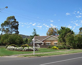
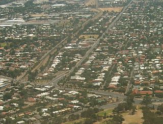
Torrens Park is a mainly residential large inner-southern suburb of Adelaide, incorporating some of the foothills and adjacent to the original "Mitcham Village". It was named after Sir Robert Richard Torrens, the instigator of the Torrens title system of land registration and transfer, who built a large home in the area which he named Torrens Park.

Colonel Light Gardens is a suburb located within the Australian City of Mitcham in the greater Adelaide region, approximately 7 km (4 mi) south of the Adelaide city centre. The area is 1.58 km2 (0.61 sq mi). Planned as a garden suburb, it is known for wide, tree-lined streets, presentable postwar bungalow homes, rounded street corners, and much manicured, well maintained open space.

Prospect is the seat of the City of Prospect and an inner northern suburb of greater Adelaide. It is located 5 km (3.1 mi) north of Adelaide's centre.

Unley is an inner-southern suburb of Adelaide, South Australia, within the City of Unley. The suburb is the home of the Sturt Football Club in the South Australian National Football League (SANFL). Unley neighbours Adelaide Park Lands, Fullarton, Hyde Park, Malvern, Parkside and Wayville.
Westbourne Park is an inner southern suburb of Adelaide, the State capital of South Australia. The suburb was named after Westbourne, a village in Sussex, England, and was laid out in 1881.
Surrey Downs is a northeastern suburb of Adelaide, South Australia. It is located in the City of Tea Tree Gully local government area, and is adjacent to Wynn Vale, Golden Grove, Fairview Park and Redwood Park.

Parkside is an inner southern suburb of Adelaide, South Australia. It is located in the City of Unley.

Wayville is an inner-southern suburb of Adelaide in the City of Unley. It is most notable for hosting of the Royal Adelaide Show at the Adelaide Showgrounds.

Black Forest is an inner southern suburb of Adelaide, South Australia. It is located in the City of Unley, bounded by the Glenelg tram line (north-west), the Seaford railway line (south-east), South Road (west) and East Avenue (east).

Millswood is an inner-southern mainly residential suburb of Adelaide in the City of Unley. It was named after Scotsman Samuel Mills, who arrived in the colony in 1839.

Unley Park is a southern suburb of Adelaide in the City of Unley. Its postcode is 5061.
Ascot Park is a suburb in the south-western part of Adelaide in the City of Marion. It was named after Ascot Racecourse in England.

Park Holme is a south-western suburb of Adelaide in the City of Marion, South Australia, located about 8 km (5 mi) from the Adelaide city centre. It is bordered to the east by Marion Road, to the west by Hendrie Street, to the south by Oaklands Road, and to the north by Tarranna Ave, which is just south of Bray Street. It is adjacent to Ascot Park, Edwardstown, South Plympton, Mitchell Park, Clovelly Park, Glengowrie, Morphettville and Oaklands Park. Park Holme covers 115 hectares, (1.15 sq km).

Goodwood Road is a major north–south arterial road, approximately 10 kilometres long, in Adelaide, South Australia. It runs between the Adelaide city centre and Adelaide's southern suburbs of Pasadena and Panorama.

Woodville North is a north-western suburb of Adelaide 10 km from the Adelaide city centre, in the state of South Australia, Australia and falls under the City of Charles Sturt. The post code for Woodville North is 5012. It is adjacent to Pennington, Athol Park, Woodville Gardens, Mansfield Park, Woodville and Kilkenny. It is bordered to the east by Hanson Road to the west by Carlton Crescent, to the south by Torrens Road and to the north by Hamilton Road. The suburb is residential, apart from an industrial pocket to the northwest.

Brompton is an inner-northern suburb of Adelaide, South Australia in the City of Charles Sturt.

Cross Road is a major arterial road that travels east–west through the inner southern suburbs of the Australian city of Adelaide. It is designated route A3.
Clarence Gardens is an inner southern suburb of Metropolitan Adelaide, South Australia in the City of Mitcham, 4.6 kilometres south of the City Centre.
Cumberland Park is an inner-southern suburb of Adelaide, South Australia in the City of Mitcham.

St Marys is a suburb of Adelaide, South Australia, located to the south of the Central Business District. It is bordered by Daws Road (north), South Road (west), Cashel Street (east) and Mill Terrace (south). The suburb is located within the City of Mitcham local government authority. St Marys Park is one of the largest reserves within the suburb and was originally the training ground of the South Adelaide Football Club.


