
Kooyong is a suburb in Melbourne, Victoria, Australia, 7 km south-east of Melbourne's Central Business District, located within the City of Stonnington local government area. Kooyong recorded a population of 842 at the 2021 census.
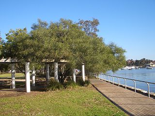
Lilyfield is a suburb in the Inner West of Sydney, in the state of New South Wales, Australia. Lilyfield is located 6 kilometres west of the Sydney central business district, in the local government area of the Inner West Council.

Belair is a suburb in the south eastern foothills of Adelaide, South Australia at the base of the Mount Lofty Ranges.

Burnside is suburb in the City of Burnside council area in the eastern suburbs of Adelaide. It is primarily a residential suburb. It was named Burnside, an amalgamation of the Scottish word for creek, "burn" and "side" because of the original property's location on the side of Second Creek. Burnside is 7.5 kilometres (4.7 mi) east of the Adelaide city centre by road.

Mitchell Park is a suburb south of Adelaide. It shares common boundaries with Marion, Bedford Park, Clovelly Park, and Ascot Park. In recent years it has undergone major redevelopments through a program of urban renewal which included the renovation of many properties owned by the former South Australian Housing Trust. These projects have won many awards.
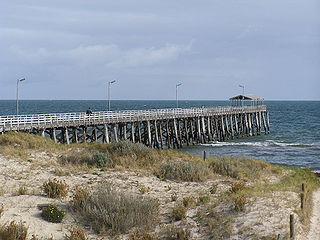
Grange is a coastal suburb of the City of Charles Sturt, in Adelaide, South Australia, located about 11 kilometres (6.8 mi) from the Adelaide city centre. The suburb is named after Captain Charles Sturt's cottage, built in 1840–41, which still stands and is now a museum. In addition to Grange Beach, the suburb has several parks and reserves, as well as the Grange Hotel, which was originally licensed in 1881.

Black Forest is an inner southern suburb of Adelaide, South Australia. It is located in the City of Unley, bounded by the Glenelg tram line (north-west), the Seaford railway line (south-east), South Road (west) and East Avenue (east).
Kent Town is an inner suburb of Adelaide, South Australia. It is located in the City of Norwood Payneham & St Peters.

Morphettville is a suburb of Adelaide, South Australia in the City of Marion.
Clapham, located approximately 8 kilometres (5.0 mi) south of the Adelaide city centre, is a primarily residential suburb situated within the City of Mitcham, incorporating some of the foothills. The suburb is named after Clapham in London, England. Neighbouring suburbs are Colonel Light Gardens, Panorama, Lynton, Torrens Park and Lower Mitcham.

Fitzroy is an inner northern suburb of Adelaide 4 km (2.5 mi) from the Adelaide city centre, in the state of South Australia, within the City of Prospect. It ranks among the most expensive suburban areas in South Australia. It is adjacent to Prospect, Ovingham, Thorngate and, across the Adelaide Park Lands, North Adelaide.
Christie Downs is a suburb in southern Metropolitan Adelaide within the city of Onkaparinga, South Australia. It has a unique postcode of 5164, and is adjacent to the suburbs of Christies Beach to the west, Noarlunga Centre to the south, Morphett Vale to the east and Lonsdale to the north.

Henley Beach is a coastal suburb of Adelaide, South Australia in the City of Charles Sturt.

Bowden is an inner northern suburb of Adelaide, South Australia. It is located in the City of Charles Sturt.

Renown Park is an inner northern suburb of Adelaide, South Australia. It is located in the City of Charles Sturt.
Albert Park is a suburb of Adelaide, South Australia. It is located in the City of Charles Sturt.

Glenelg East is a residential suburb 9 kilometres (5.6 mi) south-west of the centre of Adelaide, South Australia. It is characterised by quarter-acre blocks with heritage homes and parks intermingled with contemporary modern homes and low-rise multi-dwelling units.
Devon Park is an inner northern suburb of Adelaide, South Australia. It is located in the cities of Port Adelaide Enfield and Charles Sturt beside the Gawler railway line near, but not meeting, the intersection of Torrens Road and Churchill Road.
New Port is a north-western suburb of Adelaide.
