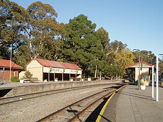
Belair railway station is located on the Adelaide to Melbourne line in the Adelaide southern foothills suburb of Belair, 21.5 kilometres from Adelaide station. It is the terminus for Adelaide Metro's Belair line service.

Goodwood railway station is the junction station for the Belair, Seaford and Flinders lines. The Belair line diverges south-east towards Millswood, while the Seaford and Flinders lines diverge south-west towards Clarence Park. The Glenelg tram line crosses over the railway lines at the south end of Goodwood station. The station services the Adelaide inner-southern suburb of Goodwood, and is 5.0 km from Adelaide station.

Unley Park railway station is located on the Belair line in suburban Adelaide. Situated seven kilometres from Adelaide station, it is on the boundary between Hawthorn and Westbourne Park, on the south side of Cross Road.

Belair is a suburb in the south eastern foothills of Adelaide, South Australia at the base of the Mount Lofty Ranges.

Torrens Park railway station is located on the Belair line in suburban Adelaide in South Australia. Located 9.3 kilometres from Adelaide station, it serves the inner southern suburb of Torrens Park.

Millswood railway station is located on the Belair line in Adelaide. Situated in the Adelaide suburb of Millswood, it is 5.9 kilometres (3.7 mi) from Adelaide station.

Hawthorn railway station was located on the Belair line, in the inner southern Adelaide suburb of Hawthorn, 7.5 kilometres from Adelaide railway station.
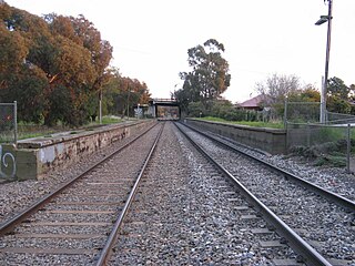
Clapham railway station was located on the Belair line in the inner southern Adelaide suburb of Clapham, 10 kilometres (6.2 mi) from Adelaide railway station.

Blackwood is a south-eastern suburb located in the foothills of Adelaide, South Australia. It is part of the local government area of the City of Mitcham.
Mile End railway station is located on the Belair, Seaford and Flinders lines adjacent to the inner western Adelaide suburb of Mile End in South Australia. It is located 2 kilometres (1.2 mi) from the Adelaide station. There is easy access from Ellis Park, Adelaide Park Lands, but access from Mile End is limited.
Lynton railway station is located on the Belair line between the Adelaide southern foothills suburbs of Lynton and Clapham, 10.7 kilometres from Adelaide station.

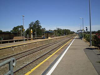
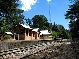
Coromandel railway station is located on the Belair line. Situated in the Adelaide southern foothills suburb of Blackwood in South Australia, it is 17.2 kilometres from Adelaide station and 254 metres above sea level.

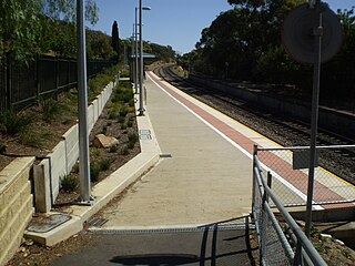
Pinera railway station is located on the Belair line in the Adelaide southern foothills suburb of Belair, 20.2 kilometres from Adelaide station.
Mount Lofty Railway Station is located on the Adelaide-Wolseley line and served the Adelaide Hills suburb of Stirling. It is located 19+1⁄4 miles (31.0 km) from Adelaide station.
The Bridgewater railway line is a former passenger railway service on the Adelaide to Wolseley line in the Adelaide Hills. It was served by suburban services from Adelaide. On 26 July 1987, the service was curtailed to Belair and renamed Belair railway line. In 1995, the Adelaide-Wolseley line was converted to standard gauge as part of the One Nation infrastructure program, disconnecting the abandoned Bridgewater line stations from the broad gauge suburban railway system.
Carripook railway station was located on the Adelaide-Wolseley line serving the Adelaide Hills suburb of Bridgewater to the east of the Kain Avenue level crossing. It was located 36.3 km from Adelaide station, at an elevation of 396 metres (1,299 ft).
Glenalta is a suburb located in the south eastern Foothills of the Mount Lofty Ranges of Adelaide, South Australia. It is adjacent to Belair National Park.

Madurta railway station was located on the Adelaide-Wolseley line serving the Adelaide Hills suburb of Aldgate to the east of the Cricklewood Road level crossing. It was located 34.1 km from Adelaide station.
The Adelaide–Wolseley railway line is a 313 kilometre line running from Adelaide to Wolseley on the Australian Rail Track Corporation network. It is the South Australian section of the Melbourne–Adelaide railway.

