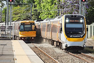
This is a list of the 89 currently operating suburban railway stations in Adelaide, South Australia , in addition to active proposals. The stations comprise six railway lines, of which two are branch lines.
Station | Served by | Distance from Adelaide | Date opened | Previous name(s) | Transport connections |
---|---|---|---|---|---|
Adelaide | 0.00 km (0 mi) | 19 April 1856 | |||
Adelaide Showground | 4.00 km (2.49 mi) | 17 February 2014 | |||
Albert Park | Grange | 9.10 km (5.65 mi) | 1882 | Bus | |
Alberton | Outer Harbor | 10.20 km (6.34 mi) | 1856 | ||
Ascot Park | Seaford | 10.20 km (6.34 mi) | 1914 | ||
Belair | Belair | 21.50 km (13.36 mi) | 1883 | ||
Blackwood | 18.10 km (11.25 mi) | Bus | |||
Bowden | 2.70 km (1.68 mi) | 1856 (original site) 15 January 2018 (present site) | |||
Brighton | Seaford | 16.00 km (9.94 mi) | 1913 (original site) 25 January 1976 (present site) | Bus | |
Broadmeadows | Gawler | 28.20 km (17.52 mi) | c. 1950 | Elizabeth North (c.1950–1961) | |
Cheltenham | Outer Harbor | 9.20 km (5.72 mi) | 1959 | ||
Chidda | Gawler | 18.60 km (11.56 mi) | n.d. | ||
Christie Downs | Seaford | 28.90 km (17.96 mi) | 25 January 1976 (original site) November 1981 (present site) | Bus | |
Clarence Park | 6.30 km (3.91 mi) | 1913 | |||
Coromandel | Belair | 17.20 km (10.69 mi) | 1883 | ||
Croydon | 4.20 km (2.61 mi) | 1888 | |||
Draper | Outer Harbor | 17.20 km (10.69 mi) | n.d. | Bus | |
Dry Creek | Gawler | 10.60 km (6.59 mi) | 1856 | ||
Dudley Park | 4.90 km (3.04 mi) | 1915 | |||
East Grange | Grange | 12.00 km (7.46 mi) | n.d. | ||
Eden Hills | Belair | 14.20 km (8.82 mi) | 1 April 1912 | ||
Edwardstown | 7.90 km (4.91 mi) | n.d. | |||
Elizabeth | Gawler | 25.80 km (16.03 mi) | 1960 | ||
Elizabeth South | 24.00 km (14.91 mi) | n.d. | |||
Emerson | 7.10 km (4.41 mi) | 16 July 1928 | |||
Ethelton | Outer Harbor | 13.10 km (8.14 mi) | 1916 | ||
Evanston | Gawler | 38.30 km (23.80 mi) | n.d. | ||
Flinders | Flinders | 13.65 km (8.48 mi) | 29 December 2020 | Bus | |
Gawler | Gawler | 39.80 km (24.73 mi) | 1857 | Bus Regional Coach | |
Gawler Central | 42.20 km (26.22 mi) | May 1911 | Willaston (May–Sept 1911) North Gawler (1911–1984) | ||
Gawler Oval | 41.40 km (25.72 mi) | n.d. | |||
Gawler Racecourse (limited services) | 39.30 km (24.42 mi) | 1913 | |||
Glanville | Outer Harbor | 13.80 km (8.57 mi) | 1878 | Bus | |
Glenalta | Belair | 19.30 km (11.99 mi) | n.d. | Belair Road (n.d.) | |
Goodwood | 5.00 km (3.11 mi) | 5 March 1883 | |||
Grange | Grange | 13.00 km (8.08 mi) | 1882 (original site) 9 March 1986 (present site) | Bus | |
Greenfields | Gawler | 15.50 km (9.63 mi) | 1969 | Green Fields (n.d.) | |
Hallett Cove | Seaford | 21.40 km (13.30 mi) | 1915 (original site) c. 1970 (present site) | Hallett's Cove (1911–1969) | Bus |
Hallett Cove Beach | 22.90 km (14.23 mi) | 30 June 1974 | |||
Hove | 14.60 km (9.07 mi) | 12 January 1914 | North Brighton (Jan–Apr 1914) Middle Brighton (1914–1920) | ||
Islington | Gawler | 6.00 km (3.73 mi) | n.d. | ||
Kilburn | 7.70 km (4.78 mi) | 1915 | |||
Kilkenny | 6.00 km (3.73 mi) | 1881 | Bus | ||
Kudla | Gawler | 34.10 km (21.19 mi) | 1959 | ||
Largs | Outer Harbor | 15.50 km (9.63 mi) | 1907 | Bus | |
Largs North | 16.40 km (10.19 mi) | 21 August 1916 | Swansea (1916–1945) | ||
Lonsdale | Seaford | 26.70 km (16.59 mi) | 1976 | ||
Lynton | Belair | 10.70 km (6.65 mi) | c. 1950 | ||
Marino | Seaford | 18.30 km (11.37 mi) | 1913 | Bus | |
Marino Rocks | 18.90 km (11.74 mi) | 1915 | |||
Marion | 11.40 km (7.08 mi) | 26 May 1954 | |||
Mawson Lakes | Gawler | 14.30 km (8.89 mi) | 26 February 2006 | ||
Midlunga | Outer Harbor | 18.80 km (11.68 mi) | 1921 | Bus | |
Mile End | 2.00 km (1.24 mi) | 1898 | |||
Millswood | Belair | 5.90 km (3.67 mi) | c. 1910 28 April 1995 (closed) 12 October 2014 (re-opened) | ||
Mitcham | 8.50 km (5.28 mi) | March 1883 | Bus | ||
Mitchell Park | Flinders | 11.50 km (7.15 mi) | 1 July 1966 | ||
Munno Para | Gawler | 32.00 km (19.88 mi) | 1978 (original site) March 2012 (present site) | Bus | |
Noarlunga Centre | Seaford | 30.20 km (18.77 mi) | 2 April 1978 | ||
North Adelaide | Gawler | 2.50 km (1.55 mi) | 1857 | ||
North Haven | Outer Harbor | 20.50 km (12.74 mi) | 13 September 1981 | ||
Nurlutta | Gawler | 21.50 km (13.36 mi) | 1950 | ||
Oaklands | Seaford | 13.00 km (8.08 mi) | 1913 (original site) 10 June 2008 (present site) | Bus | |
Osborne | Outer Harbor | 19.60 km (12.18 mi) | 30 November 1908 | ||
Outer Harbor | 21.90 km (13.61 mi) | 1907 (original site) 1926 (present site) | |||
Ovingham | Gawler | 3.60 km (2.24 mi) | c. 1880 | ||
Parafield | 17.70 km (11.00 mi) | 1928 | |||
Parafield Gardens | 16.60 km (10.31 mi) | 1 May 1968 | |||
Peterhead | Outer Harbor | 14.60 km (9.07 mi) | 1911 | ||
Pinera | Belair | 20.20 km (12.55 mi) | c. 1920 | Overway Bridge (c.1920–c.1950) | Bus |
Port Adelaide | Outer Harbor | 11.70 km (7.27 mi) | 1916 | Commercial Road (1916–1981) | |
Port Dock (under re-construction) | 12.00 km (7.46 mi) | April 1856 13 September 1981 (closed) 2024 (re-opening) | Port Adelaide (1856–1916) | ||
Salisbury | Gawler | 20.20 km (12.55 mi) | June 1857 | ||
Seacliff | Seaford | 17.00 km (10.56 mi) | 1915 | Bus | |
Seaford | 35.90 km (22.31 mi) | 23 February 2014 | |||
Seaford Meadows | 34.70 km (21.56 mi) | Bus | |||
Seaton Park | Grange | 10.30 km (6.40 mi) | n.d. | Bus | |
Smithfield | Gawler | 30.20 km (18.77 mi) | 1857 | ||
St Clair | Outer Harbor | 8.60 km (5.34 mi) | 23 February 2014 | Bus | |
Tambelin | Gawler | 37.40 km (23.24 mi) | n.d. (original site) 1986 (present site) | ||
Taperoo | Outer Harbor | 18.20 km (11.31 mi) | n.d. | Silicate Siding (n.d.–1920) | |
Torrens Park | Belair | 9.30 km (5.78 mi) | n.d. | Blythwood (n.d.–1921) | Bus |
Tonsley | Flinders | 12.20 km (7.58 mi) | 1 July 1966 (original site) 29 December 2020 (present site) | ||
Unley Park | Belair | 7.00 km (4.35 mi) | c. 1910 | Bus | |
Warradale | Seaford | 13.70 km (8.51 mi) | 1956 | ||
West Croydon | 5.10 km (3.17 mi) | 21 December 1915 | |||
Womma | Gawler | 27.30 km (16.96 mi) | c. 1950 | Bus | |
Woodlands Park | 9.10 km (5.65 mi) | 1925 | |||
Woodville | 7.50 km (4.66 mi) | April 1856 | |||
Woodville Park | 6.80 km (4.23 mi) | December 1936 |
Commuter rail, or suburban rail, is a passenger rail transport service that primarily operates within a metropolitan area, connecting commuters to a central city from adjacent suburbs or commuter towns. Commuter rail systems are considered heavy rail, using electric or diesel trains. Distance charges or zone pricing may be used.
Adelaide Metro is the public transport system of the Adelaide area, around the capital city of South Australia. It is an intermodal system offering an integrated network of bus, tram, and train services throughout the metropolitan area. The network has an annual patronage of 79.9 million, of which 51 million journeys are by bus, 15.6 million by train, and 9.4 million by tram. The system has evolved heavily over the past fifteen years, and patronage increased dramatically during the 2014–15 period, a 5.5 percent increase on the 2013 figures due to electrification of frequented lines.
Adelaide railway station is the central terminus of the Adelaide Metro railway system. All lines approach the station from the west, and it is a terminal station with no through lines, with most of the traffic on the metropolitan network either departing or terminating here. It has nine below-ground platforms, all using broad gauge track. The station is located on the north side of North Terrace, west of Parliament House.
Rail transport in Australia is a component of the Australian transport system. It is to a large extent state-based, as each state largely has its own operations, with the interstate network being developed ever since Australia's federation in 1901. As of 2022, the Australian rail network consists of a total of 32,929 kilometres (20,461 mi) of track built to three major track gauges: 18,007 kilometres (11,189 mi) of standard gauge, 2,685 kilometres (1,668 mi) of broad gauge, and 11,914 kilometres (7,403 mi) of narrow gauge lines. Additionally, about 1,400 kilometres (870 mi) of 610 mm / 2 ft gauge lines support the sugar-cane industry. 3,488 kilometres (2,167 mi), around 11 percent of the Australian heavy railways network route-kilometres are electrified.
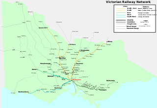
Rail transport in the Australian state of Victoria is provided by a number of railway operators who operate over the government-owned railway lines. The network consists of 2,357 km of Victorian broad gauge lines, and 1,912 km of standard gauge freight and interstate lines; the latter increasing with gauge conversion of the former. Historically, a few experimental 762 mm gauge lines were built, along with various private logging, mining and industrial railways. The rail network radiates from the state capital, Melbourne, with main interstate links to Sydney and to Adelaide, as well as major lines running to regional centres, upgraded as part of the Regional Fast Rail project.
TransAdelaide was a publicly owned corporation established in July 1994, which provided suburban train, tram and bus services in Adelaide, South Australia, under contract to the Government of South Australia. It took over these responsibilities from the State Transport Authority.
The rail network in Adelaide, South Australia, consists of four lines and 89 stations, totalling 132 km (82 mi). It is operated by Keolis Downer under contract from the Government of South Australia, and is part of the citywide Adelaide Metro public transport system.
Australians generally assumed in the 1850s that railways would be built by the private sector. Private companies built railways in the then colonies of Victoria, opened in 1854, and New South Wales, where the company was taken over by the government before completion in 1855, due to bankruptcy. South Australia's railways were government owned from the beginning, including a horse-drawn line opened in 1854 and a steam-powered line opened in 1856. In Victoria, the private railways were soon found not to be financially viable, and existing rail networks and their expansion were taken over by the colony. Government ownership also enabled railways to be built to promote development, even if not apparently viable in strictly financial terms. The railway systems spread from the colonial capitals, except for a few lines that hauled commodities to a rural port.
The SteamRanger Heritage Railway is an 82 kilometres long 1600 mm broad gauge tourist railway, formerly the Victor Harbor railway line of the South Australian Railways (SAR). It is operated by the not-for-profit South Australian Division of the Australian Railway Historical Society. As the last operating non-suburban line of the former broad-gauge network, on which Australia's first public railway was opened, the line and its associated rail assets have high historical significance.
Adelaide Parklands Terminal, formerly known as Keswick Terminal, is the interstate passenger railway station in Adelaide, South Australia. It is the only station in the world where passengers can board trains on both north–south and east–west transcontinental routes.
The Outer Harbor line is a suburban branch line in Adelaide, South Australia. It runs from Adelaide station through the north western suburbs to Port Adelaide and Outer Harbor. It is 21.9 kilometres (13.6 mi) in length, and shares part of its run with the Grange and Port Dock lines. It is operated by Adelaide Metro.
The Gawler line, also known as the Gawler Central line, is a suburban commuter railway line in the city of Adelaide, South Australia. The Gawler Line is the most frequent and heavily patronised line in the Adelaide rail network.
The Grange line is a suburban branch line in Adelaide, South Australia.
The Seaford line is a suburban commuter line in Adelaide, South Australia.
The State Transport Authority (STA) was the government agency which controlled public transport in South Australia between 1974 and 1994.
The National Railway Museum, Port Adelaide, South Australia is the largest railway museum in Australia. More than 100 major exhibits, mainly from the South Australian Railways (SAR) and Commonwealth Railways and their successor, Australian National, are displayed at its 3.5 hectares site. A very large archival collection of photographs of those railways and records created by them is also managed by the museum. The museum is operated with a large number of volunteers.
The Holdfast Bay railway line was a railway in western Adelaide, built in 1880 to compete with the Adelaide, Glenelg & Suburban Railway Company. The line started at the Adelaide railway station, on the northern edge of the central business district, and proceeded to the northern edge of Mile End, South Australia immediately to the west of the city. From there the line headed south-west to the seaside suburb of Glenelg.
Electrification of Australian railways began with the Melbourne and Sydney suburban lines. Melbourne suburban lines were electrified from 1919 using 1,500 V DC. Sydney suburban lines were electrified from 1926 using the same system.