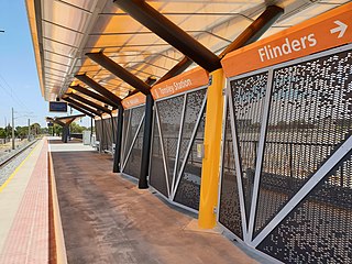
Woodlands Park railway station

Last updated

Woodlands Park
Woodlands Park Railway Station.jpg
South-west bound view from the platforms, with 2 Adelaide Metro 4000 class at the station,
April 2024
General information
LocationRailway Terrace, Edwardstown
Coordinates 34°58′59″S138°34′02″E / 34.9830098°S 138.5673182°E / -34.9830098; 138.5673182
Owned by Department for Infrastructure & Transport
Operated by Adelaide Metro
Line(s) Seaford, Flinders
Distance9.1 km from Adelaide
Platforms2
Tracks2
Bus routesN7, 241, 241A, N4
Construction
Structure typeGround
ParkingYes
Bicycle facilitiesYes
Other information
Station codeTo Seaford & Flinders - 18587
To Adelaide - 16570
History
Opened1925
Rebuilt2024
Services
Preceding station Adelaide Metro Following station
Edwardstown
towards Adelaide
Flinders line Mitchell Park
towards Flinders
Seaford line Ascot Park
towards Seaford

Woodlands Park railway station is the junction station for the Seaford and Flinders lines. [1] Situated in the inner south-western Adelaide suburb of Edwardstown, it is 9.1 kilometres from Adelaide station.

Contents

History

Woodlands Park opened in 1925, and was named after the old suburb of Woodlands Park.

The stations was originally known as ‘Woodlands’ the name was from the nearby Woodlands House near the site of the present station. The ‘Woodlands’ was named after two storeyed house built by Alfred Weaver in 1869. After Alfred Weaver’s death, ‘Woodlands’ was bought by William Maxwell in 1891, he added a tower, gargoyle and battlement, which is like a castle-shaped building built and designed by William Maxwell. It was retained and used as Castle Motor Hotel in 1960 at South Road. The site is now occupied by Coles Supermarket in Castle Plaza shopping centre.

The station had step down platform on what is now the outside of ‘down’ main. The name was changed to Woodlands Park in 1934. The single track from north of Raglan Avenue level crossing to Oaklands had it first section of welded track which was six-length during the year 1936 - 38. This is the location of the present ‘down’ track.

A raised island platform with concrete lining was constructed in 1954 in preparation for duplication with the 1950 type ticket office and waiting shelter. These buildings were the same construction as for Marion, Warradale and Hove. Double line was commenced in 1955.

Due to the number of passengers increased since the line was duplicated due to residential on the west side and light industrials on the east. Number of passengers use this station to attend the place of employment during the weekdays.

The new manufacturing plant was constructed at Tonsley Park south of Edwardstown which require a branch line from the junction north of Ascot Park to the Chrysler Manufacturing industry. A branch line was laid during 1965 and was opened in 1966. Woodlands Park becomes a junction station for Marino line with the branch line to Tonsley Park. Some passenger trains worked to Tonsley during peak hours with one service during off-peak.

The station got a modern upgrade in early 2024. During this time, Edwardstown was used as the junction station for the Seaford and Flinders lines. [2]

Services by platform

PlatformDestination/s
1Seaford/Flinders
2Adelaide

Adelaide Metro Bus

Bus Transfers: Stop Stop 17 (Adelaide Terrace)
Route No.Destination & Route Details
241 City via Beckman Street [3]
241 Westfield Marion via Oaklands Interchange [3]

Related Research Articles

<span class="mw-page-title-main">Tonsley railway station</span> Railway station in Adelaide, South Australia

Tonsley railway station is located on the Flinders line in the south-western Adelaide suburb of Tonsley, 12.2 kilometres from Adelaide station. The original station was 13 kilometres from Adelaide and was the terminus of the line from its opening in 1966 until the station's closure in 2019; the station was then relocated to its current position and opened in 2020.

<span class="mw-page-title-main">Goodwood railway station</span> Railway station in Adelaide, South Australia

Goodwood railway station is a commuter railway station and the junction station for the Belair, Seaford and Flinders lines. The Belair line diverges south-east towards Millswood, while the Seaford and Flinders lines diverge south-west towards Clarence Park. The Glenelg tram line crosses over the railway lines at the south end of Goodwood station. The station services the Adelaide inner-southern suburb of Goodwood, and is 5.0 km from Adelaide station.

<span class="mw-page-title-main">Marino railway station, Adelaide</span> Railway station in Adelaide, South Australia

Marino railway station is located on the Seaford line. Situated in the southern Adelaide suburb of Marino, it is 18.3 kilometres from Adelaide station.

<span class="mw-page-title-main">Oaklands railway station</span> Railway station in Adelaide, South Australia

Oaklands railway station is located on the Seaford railway line in Adelaide, South Australia. It is in the south-western suburb of Oaklands Park, 13 kilometres from Adelaide station.
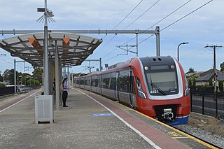
<span class="mw-page-title-main">Ascot Park railway station</span> Railway station in Adelaide, South Australia

Ascot Park railway station is located on the Seaford line. Situated in the south-western Adelaide suburb of Ascot Park, it is 10.2 kilometres from Adelaide station.

<span class="mw-page-title-main">Seaford line</span> Railway line in Adelaide, South Australia

The Seaford line is a commuter railway line in the city of Adelaide, South Australia. It is the city's second longest metropolitan railway line at 35.9 kilometres (22.3 mi).

<span class="mw-page-title-main">Belair line</span> Rail line in Adelaide, South Australia

The Belair line is a suburban rail commuter route in the city of Adelaide, South Australia, that runs from the Adelaide station to Belair in the Adelaide Hills via the Adelaide-Wolseley line using diesel 3000/3100 class railcars. Prior to 1995, this part of Adelaide-Wolseley was a two-track broad gauge line. In 1995, Adelaide-Wolseley was converted to standard gauge meaning Adelaide to Belair is now effectively two separate single-track lines running in parallel: the Belair commuter line and the Adelaide-Wolseley standard gauge freight line.

<span class="mw-page-title-main">Flinders line</span> Railway line in Adelaide, South Australia

The Flinders line is a suburban commuter line in Adelaide, South Australia, that branches off the Seaford line at Mitchell Park, and ends opposite Science Park, close to the Flinders University and the Flinders Medical Centre. The line is single track for most of its length, from Celtic Avenue, near Mitchell Park station, to its terminus.

Ascot Park is a suburb in the south-western part of Adelaide in the City of Marion. It was named after Ascot Racecourse in England.

<span class="mw-page-title-main">Clovelly Park, South Australia</span> Suburb of Adelaide, South Australia

Clovelly Park is an inner southern suburb of Adelaide in the local government area of the City of Marion. Before becoming an 'advanced' suburb, it was a farm and vineyard. The suburb is bordered by Daws Road to the north, South Road to the east, Sturt Road to the south, and a combination of Percy Avenue and the Flinders railway line to the west. It is situated approximately 20 minutes from the Adelaide city centre, and about 2 minutes from Flinders University, Flinders Medical Centre and Westfield Marion.

<span class="mw-page-title-main">Edwardstown railway station</span> Railway station in Adelaide, South Australia

Edwardstown railway station is located on the Seaford and Flinders lines. Situated in the inner south-western Adelaide suburb of Edwardstown, it is 7.9 kilometres from Adelaide station.

<span class="mw-page-title-main">Marion railway station</span> Railway station in Adelaide, South Australia

Marion railway station is located on the Seaford line. Situated in the south-western Adelaide suburb of Marion, it is 11.4 kilometres from Adelaide station.
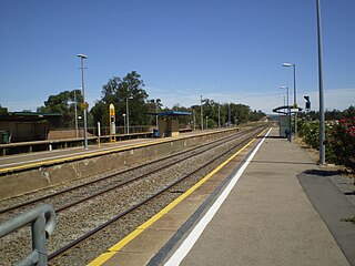
<span class="mw-page-title-main">Mile End railway station, Adelaide</span> Railway station in Adelaide, South Australia

Mile End railway station is located on the Belair, Seaford and Flinders lines adjacent to the inner western Adelaide suburb of Mile End in South Australia. It is located 2 kilometres (1.2 mi) from the Adelaide station. There is easy access from Ellis Park, Adelaide Park Lands, but access from Mile End is limited.

<span class="mw-page-title-main">Emerson railway station</span> Railway station in Adelaide, South Australia

Emerson railway station is located on the Seaford and Flinders lines. Situated in the inner south-western Adelaide suburb of Black Forest, it is 7.1 kilometres from Adelaide station.
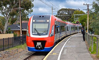
<span class="mw-page-title-main">Mitchell Park railway station</span> Railway station in Adelaide, South Australia

Mitchell Park railway station is located on the Flinders line. Situated in the south-western Adelaide suburb of Mitchell Park, it is 11.5 kilometres from Adelaide station.

<span class="mw-page-title-main">Clovelly Park railway station</span> Railway station in Adelaide, South Australia

Clovelly Park railway station was a railway station located on the Flinders line in the south-western Adelaide suburb of Mitchell Park.

<span class="mw-page-title-main">Hallett Cove railway station</span> Railway station in Adelaide, South Australia

Hallett Cove railway station is located on the Seaford line. Situated in the southern Adelaide suburb of Hallett Cove, it is 21.4 kilometres from Adelaide station.

<span class="mw-page-title-main">Christie Downs railway station</span> Railway station in Adelaide, South Australia

Christie Downs railway station is located on the Seaford line. Situated in the southern Adelaide suburb of Christie Downs, it is 28.9 kilometres from Adelaide station.

<span class="mw-page-title-main">Flinders railway station</span> Railway station in Adelaide, South Australia

Flinders railway station is the terminus of the Flinders line in the southern Adelaide suburb of Bedford Park. It serves the adjacent Flinders Medical Centre precinct and Flinders University.

References

Commons-logo.svg Media related to Woodlands Park railway station at Wikimedia Commons