Adelaide is the capital city of South Australia, the state's largest city and the fifth-most populous city in Australia. "Adelaide" may refer to either Greater Adelaide or the Adelaide city centre. The demonym Adelaidean is used to denote the city and the residents of Adelaide. The Traditional Owners of the Adelaide region are the Kaurna. The area of the city centre and surrounding Park Lands is called Tarndanya in the Kaurna language.

Flinders University is a public research university based in Adelaide, South Australia, with a footprint extending across 11 locations in South Australia and the Northern Territory. Founded in 1966, it was named in honour of British navigator Matthew Flinders, who explored and surveyed the Australian and South Australian coastline in the early 19th century.

Adelaide Metro is the public transport system of Adelaide, the capital city of South Australia. It is an intermodal system offering an integrated network of bus, tram, and train services throughout the metropolitan area. The network has an annual patronage of 79.9 million, of which 51 million journeys are by bus, 15.6 million by train, and 9.4 million by tram. The system has evolved heavily over the past fifteen years, and patronage increased dramatically during the 2014–15 period, a 5.5 percent increase on the 2013 figures due to electrification of frequented lines.

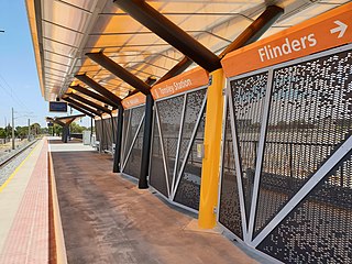
Tonsley railway station is located on the Flinders line in the south-western Adelaide suburb of Tonsley, 12.2 kilometres from Adelaide station. The original station was 13 kilometres from Adelaide and was the terminus of the line from its opening in 1966 until the station's closure in 2019; the station was then relocated to its current position and opened in 2020.

Goodwood railway station is the junction station for the Belair, Seaford and Flinders lines. The Belair line diverges south-east towards Millswood, while the Seaford and Flinders lines diverge south-west towards Clarence Park. The Glenelg tram line crosses over the railway lines at the south end of Goodwood station. The station services the Adelaide inner-southern suburb of Goodwood, and is 5.0 km from Adelaide station.
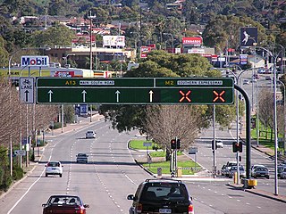
Southern Expressway is an 18.5 km (11.5 mi) freeway through the southern suburbs of Adelaide, South Australia. It is the southern part of the North–South Corridor which extends the full length of Adelaide and is being built to urban freeway standard. It is designated part of route M2.

The rail network in Adelaide, South Australia, consists of four lines and 89 stations, totalling 132 km (82 mi). It is operated by Keolis Downer under contract from the Government of South Australia, and is part of the citywide Adelaide Metro public transport system.

The Glenelg tram line is a tram/light rail line in Adelaide. Apart from a short street-running section in Glenelg, the line has its own reservation, with minimal interference from road traffic.

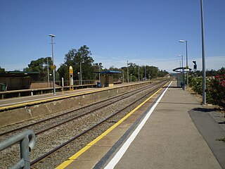
Oaklands railway station is located on the Seaford railway line in Adelaide, South Australia. It is in the south-western suburb of Oaklands Park, 13 kilometres from Adelaide station.

The Seaford line is a suburban commuter line in Adelaide, South Australia.

The Flinders line is a suburban commuter line in Adelaide, South Australia, that branches off the Seaford line at Mitchell Park, and ends opposite Science Park, close to the Flinders University and the Flinders Medical Centre. The line is single track for most of its length, from Celtic Avenue, near Mitchell Park station, to its terminus.
South Road and its southern section as Main South Road outside of Adelaide is a major north–south conduit connecting Adelaide and the Fleurieu Peninsula, in South Australia. It is one of Adelaide's most important arterial and bypass roads. As South Road, it is designated part of route A2 within suburban Adelaide. As Main South Road, it is designated part of routes A13 and B23.

Clovelly Park is an inner southern suburb of Adelaide in the local government area of the City of Marion. Before becoming an 'advanced' suburb, it was a farm and vineyard. The suburb is bordered by Daws Road to the north, South Road to the east, Sturt Road to the south, and a combination of Percy Avenue and the Flinders railway line to the west. It is situated approximately 20 minutes from the Adelaide city centre, and about 2 minutes from Flinders University, Flinders Medical Centre and Westfield Marion.

Mile End railway station is located on the Belair, Seaford and Flinders lines adjacent to the inner western Adelaide suburb of Mile End in South Australia. It is located 2 kilometres (1.2 mi) from the Adelaide station. There is easy access from Ellis Park, Adelaide Park Lands, but access from Mile End is limited.

Emerson railway station is located on the Seaford and Flinders lines. Situated in the inner south-western Adelaide suburb of Black Forest, it is 7.1 kilometres from Adelaide station.

Clovelly Park railway station was a railway station located on the Flinders line in the south-western Adelaide suburb of Mitchell Park.

Marino Rocks railway station is located on the Seaford line. Situated in the southern Adelaide suburb of Marino, it is 18.9 kilometres from Adelaide station and leads directly into Nimboya Road Reserve and park.

The metropolitan area of Adelaide, South Australia is served by a wide variety of transport. Being centrally located on the Australian mainland, it forms a hub for east–west and north–south routes. The road network includes major expressways such as the Southern Expressway, the South Eastern Freeway, the Port River Expressway, the Northern Expressway and the South Road Superway. The city also has a public transport system managed by Adelaide Metro, consisting of a contracted bus system including the O-Bahn Busway, six metropolitan railway lines, and the Glenelg-Adelaide-Hindmarsh Tram. According to a study conducted by the Australian Bureau of Statistics, Adelaide has the highest passenger vehicle travel to work (84%) and the second lowest proportion of people walking to work (2.9%)–something that is being combated by the South Australian government in an effort to increase citizen ridership and use of public transport.

The North–South Motorway is a partially complete motorway traversing the inner western suburbs of Adelaide, from Waterloo Corner in the north to Bedford Park in the south. Progressively constructed in stages since 2010, once complete it will replace the adjacent South Road as Adelaide's main north–south roadway. It will form the central section of the North–South Corridor, being flanked north and south by the Northern Expressway and Southern Expressway, respectively. It is designated part of route M2.

The Adelaide Metro 4000 class, also referred to as A-City trains, are electric multiple unit trains built by Bombardier Transportation in Dandenong, Victoria for the electrified Adelaide rail network. They are the only class of operational electric trains in South Australia, running services on the Gawler, Seaford and Flinders lines.


