Tonsley railway station

Last updated

Tonsley
Tonsley Station Adelaide.jpg
General information
LocationAlawoona Avenue, Tonsley
Coordinates 35°00′33″S138°34′02″E / 35.00922°S 138.56729°E / -35.00922; 138.56729
Owned by Department for Infrastructure & Transport
Operated by Adelaide Metro
Line(s) Flinders
Distance12.2 km from Adelaide
Platforms1
Tracks1
Connections Adelaide bus logo.svg Bus
Construction
Structure typeGround
AccessibleYes
Other information
Station code16503 (to City)
18589 (to Flinders)
Website Adelaide Metro
History
Opened1 July 1966
Closed28 June 2019
Rebuilt29 December 2020
Services
Preceding station Adelaide Metro Following station
Mitchell Park
towards Adelaide
Flinders line Flinders
Terminus

Tonsley railway station is located on the Flinders line in the south-western Adelaide suburb of Tonsley, 12.2 kilometres from Adelaide station. The original station was 13 kilometres from Adelaide and was the terminus of the line from its opening in 1966 until the station's closure in 2019; the station was then relocated to its current position and opened in 2020.

Contents

History

Original station (1966-2019) TonsleyStation2.JPG
Original station (1966–2019)

The original station opened on 1 July 1966 when the Tonsley line opened. [1] [2] [3] Trains operated between 07:00 and 19:00 on weekdays, with no weekend services. [4]

To allow for extension of the railway to Flinders, Tonsley station closed on 28 June 2019 and was later demolished. [5] [6] The site of the former station is now occupied by the start of a viaduct that continues the railway over Sturt Road and Main South Road to terminate at Flinders station, adjacent to the Flinders Medical Centre. [7] It was built concurrently with the associated Darlington Upgrade Project. [8] [9] [10]

The replacement of Tonsley station with Flinders station was contested by local residents, who submitted a petition to keep Tonsley station. [5] The Department of Planning, Transport & Infrastructure published a revised plan which would see a new Tonsley station built concurrently with the Flinders extension; located immediately south of Alawoona Avenue before the elevated section of track, the new Tonsley station replaces Clovelly Park station in serving the Tonsley Development Precinct and associated housing development. [11] The new Tonsley railway station opened on 29 December 2020. [12]

Platforms and services

Flinders has one side platform and is serviced by Adelaide Metro. Trains are scheduled every 30 minutes, with additional services in the morning and evening peak on weekdays.

PlatformDestination/s
1Flinders/Adelaide

Related Research Articles

<span class="mw-page-title-main">Adelaide Metro</span> Public transport system around Adelaide, Australia

Adelaide Metro is the public transport system of the Adelaide area, around the capital city of South Australia. It is an intermodal system offering an integrated network of bus, tram, and train services throughout the metropolitan area. The network has an annual patronage of 79.9 million, of which 51 million journeys are by bus, 15.6 million by train, and 9.4 million by tram. The system has evolved heavily over the past fifteen years, and patronage increased dramatically during the 2014–15 period, a 5.5 percent increase on the 2013 figures due to electrification of frequented lines.

Southern Expressway is an 18.5 km (11.5 mi) freeway through the southern suburbs of Adelaide, South Australia. It is the southern part of the North–South Corridor which extends the full length of Adelaide and is being built to urban freeway standard. It is designated part of route M2.

<span class="mw-page-title-main">Railways in Adelaide</span> Rail network in South Australia

The Adelaide rail network is a metropolitan suburban rail system serving the city of Adelaide, South Australia, Australia. It consists of 89 railway stations across 7 lines, which served a patronage of 15.6 million people over the year 2018-19. Keolis Downer under contract from the Government of South Australia operates the Adelaide suburban rail system. The operations are set to be handed back to the hands of the public by January 2025.

<span class="mw-page-title-main">Glenelg tram line</span> Tram line in Adelaide, South Australia

The Glenelg tram line is a tram/light rail line in Adelaide. Apart from a short street-running section in Glenelg, the line has its own reservation, with minimal interference from road traffic.

<span class="mw-page-title-main">Oaklands railway station</span> Railway station in Adelaide, South Australia

Oaklands railway station is located on the Seaford railway line in Adelaide, South Australia. It is in the south-western suburb of Oaklands Park, 13 kilometres from Adelaide station.
<span class="mw-page-title-main">Ascot Park railway station</span> Railway station in Adelaide, South Australia

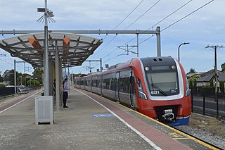
Ascot Park railway station is located on the Seaford line. Situated in the south-western Adelaide suburb of Ascot Park, it is 10.2 kilometres from Adelaide station.

<span class="mw-page-title-main">Outer Harbor and Port Dock lines</span> Railway line in Adelaide, South Australia

The Outer Harbor line is a suburban commuter service in Adelaide, South Australia, that runs from Adelaide station through the north western suburbs to Port Adelaide and Outer Harbor.

<span class="mw-page-title-main">Seaford line</span> Railway line in Adelaide, South Australia

The Seaford line is a commuter railway line in the city of Adelaide, South Australia. It is the city's second longest metropolitan railway line at 35.9 kilometres (22.3 mi).

<span class="mw-page-title-main">Flinders line</span> Railway line in Adelaide, South Australia

The Flinders line is a suburban commuter line in Adelaide, South Australia, that branches off the Seaford line at Mitchell Park, and ends opposite Science Park, close to the Flinders University and the Flinders Medical Centre. The line is single track for most of its length, from Celtic Avenue, near Mitchell Park station, to its terminus.

South Road and its southern section as Main South Road outside of Adelaide is a major north–south conduit connecting Adelaide and the Fleurieu Peninsula, in South Australia. It is one of Adelaide's most important arterial and bypass roads. As South Road, it is designated part of route A2 within suburban Adelaide. As Main South Road, it is designated part of routes A13 and B23.

<span class="mw-page-title-main">Woodlands Park railway station</span> Railway station in Adelaide, South Australia

Woodlands Park railway station is the junction station for the Seaford and Flinders lines. Situated in the inner south-western Adelaide suburb of Edwardstown, it is 9.1 kilometres from Adelaide station.
<span class="mw-page-title-main">Mitchell Park railway station</span> Railway station in Adelaide, South Australia

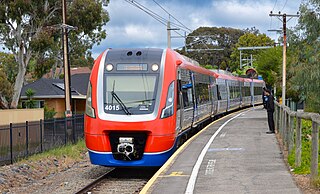
Mitchell Park railway station is located on the Flinders line. Situated in the south-western Adelaide suburb of Mitchell Park, it is 11.5 kilometres from Adelaide station.

<span class="mw-page-title-main">Clovelly Park railway station</span> Railway station in Adelaide, South Australia

Clovelly Park railway station was a railway station located on the Flinders line in the south-western Adelaide suburb of Mitchell Park.

<span class="mw-page-title-main">Marino Rocks railway station</span> Railway station in Adelaide, South Australia

Marino Rocks railway station is located on the Seaford line. Situated in the southern Adelaide suburb of Marino, it is 18.9 kilometres from Adelaide station and leads directly into Nimboya Road Reserve and park.
<span class="mw-page-title-main">Transport in Adelaide</span> Transportation network of Adelaide, Australia

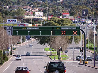
The metropolitan area of Adelaide, South Australia is served by a wide variety of transport. Being centrally located on the Australian mainland, it forms a hub for east–west and north–south routes. The road network includes major expressways such as the Southern Expressway, the South Eastern Freeway, the Port River Expressway, the Northern Expressway and the South Road Superway. The city also has a public transport system managed by Adelaide Metro, consisting of a contracted bus system including the O-Bahn Busway, six metropolitan railway lines, and the Glenelg-Adelaide-Hindmarsh Tram. According to a study conducted by the Australian Bureau of Statistics, Adelaide has the highest passenger vehicle travel to work (84%) and the second lowest proportion of people walking to work (2.9%)–something that is being combated by the South Australian government in an effort to increase citizen ridership and use of public transport.

<span class="mw-page-title-main">Seaford Meadows railway station</span> Railway station in Adelaide, South Australia

Seaford Meadows railway station is located on the Seaford line in South Australia. Situated in the southern Adelaide suburb of Seaford Meadows, it is 34.7 kilometres from Adelaide station.

<span class="mw-page-title-main">Seaford railway station, Adelaide</span> Railway station in Adelaide, South Australia

Seaford railway station is the terminus of the Seaford line in South Australia. Situated in the southern Adelaide suburb of Seaford, it is 35.9 kilometres from Adelaide station.

<span class="mw-page-title-main">Adelaide Metro 4000 class</span> Class of electric multiple unit trains

The Adelaide Metro 4000 class, also referred to as A-City trains, are electric multiple unit trains built by Bombardier Transportation in Dandenong, Victoria for the electrified Adelaide rail network. They are the only class of operational electric trains in South Australia, running services on the Gawler, Seaford and Flinders lines.

<span class="mw-page-title-main">Adelaide Showground railway station</span> Railway station in Adelaide, South Australia

Adelaide Showground railway station is located on the Belair, Flinders and Seaford lines, and is located in the inner western Adelaide suburb of Keswick. It is four kilometres from Adelaide station, and replaced Keswick station and the temporary Showground Central station.

<span class="mw-page-title-main">Flinders railway station</span> Railway station in Adelaide, South Australia

Flinders railway station is the terminus of the Flinders line in the southern Adelaide suburb of Bedford Park. It serves the adjacent Flinders Medical Centre precinct and Flinders University.

References

  1. Early Starts on SAR Industrial Spur and Standard Gauge Lime-Sand Line Railway Transportation September 1964 page 7
  2. New SAR Suburban Branch Opened Railway Transportation July 1966 page 5
  3. Focus Railway Gazette 5 August 1966 page 591
  4. Seaford & Tonsley timetable Adelaide Metro 20 July 2014
  5. 1 2 Keam, Patrick. (13 December 2017). "Fight to block station closure", CoastCity Weekly , p14.
  6. "Tonsley station closing". Adelaide Metro. Government of South Australia. 6 June 2019. Archived from the original on 6 June 2019. Retrieved 6 June 2019.
  7. "Flinders Link Project". Department of Planning, Transport and Infrastructure. Government of South Australia. Archived from the original on 26 September 2017. Retrieved 26 September 2017.
  8. "Darlington Upgrade Project". Department of Planning, Transport and Infrastructure. Government of South Australia. Archived from the original on 25 May 2016. Retrieved 13 May 2016.
  9. "Green light for $85.5m Flinders Link rail extension". Premier of South Australia. Government of South Australia. Archived from the original on 3 August 2017. Retrieved 3 August 2017.
  10. Etheridge, Michelle. (7 June 2017). "Uni’s village people", CoastCity Weekly , p1.
  11. Etheridge, Michelle. (28 February 2018). "New station on track", CoastCity Weekly , p5.
  12. "New Flinders Railway Line". Adelaide Metro. Archived from the original on 30 November 2020. Retrieved 17 November 2020.

Commons-logo.svg Media related to Tonsley railway station at Wikimedia Commons