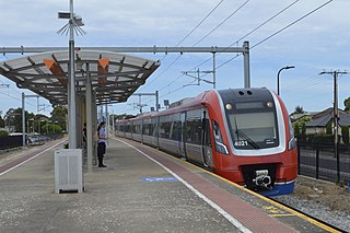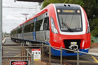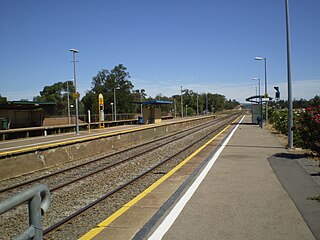
A level crossing is an intersection where a railway line crosses a road or path, or in rare situations an airport runway, at the same level, as opposed to the railway line crossing over or under using an overpass or tunnel. The term also applies when a light rail line with separate right-of-way or reserved track crosses a road in the same fashion. Other names include railway level crossing, railway crossing, grade crossing or railroad crossing, road through railroad, criss-cross, train crossing, and RXR (abbreviated).

Adelaide Railway Station is the central terminus of the Adelaide Metro railway system. All lines approach the station from the west, and it is a terminal station with no through lines, with most of the traffic on the metropolitan network either departing or terminating here. It has nine platforms, all using broad gauge track. It is located on the north side of North Terrace, west of Parliament House. The Adelaide Casino occupies part of the building that is no longer required for railway use. Until 1984, Adelaide station was also the terminus for regional and interstate passenger trains, but there are no longer any regular regional train services in South Australia, and all interstate services are now handled at Adelaide Parklands Terminal.

Goodwood railway station is the junction station for the Belair, Seaford and Flinders lines. The Belair line diverges south-east towards Millswood, while the Seaford and Flinders lines diverge south-west towards Clarence Park. The Glenelg tram line crosses over the railway lines at the south end of Goodwood station. The station services the Adelaide inner-southern suburb of Goodwood, and is 5.0 km from Adelaide station.

The rail network in Adelaide, South Australia, consists of four lines and 89 stations, totalling 132 km. It is operated by Keolis Downer under contract from the Government of South Australia, and is part of the citywide Adelaide Metro public transport system.

Oaklands railway station is located on the Seaford railway line in Adelaide, South Australia. It is in the south-western suburb of Oaklands Park, 13 kilometres from Adelaide station.

The first railway in colonial South Australia was a line from the port of Goolwa on the River Murray to an ocean harbour at Port Elliot, which first operated in December 1853, before its completion in May 1854.

Ascot Park railway station is located on the Seaford line. Situated in the south-western Adelaide suburb of Ascot Park, it is 10.2 kilometres from Adelaide station.

Alberton railway station is located on the Outer Harbor line. Situated in the north-western Adelaide suburb of Alberton, it is 10.2 kilometres from Adelaide station. The station is registered as a South Australian Heritage.

The Seaford railway line is a suburban commuter line in Adelaide, South Australia.

The Flinders railway line is a suburban commuter line in Adelaide, South Australia, that branches off the Seaford line at Mitchell Park, and ends opposite Science Park, close to the Flinders University and the Flinders Medical Centre. The line is single track for most of its length, from Celtic Avenue, near Mitchell Park station, to its terminus.

Marion railway station is located on the Seaford line. Situated in the south-western Adelaide suburb of Marion, it is 11.4 kilometres from Adelaide station.

Croydon railway station is located on the Grange and Outer Harbor lines. Situated in the western Adelaide suburb of Croydon, it is 4.2 kilometres from Adelaide station.

Mile End railway station is located on the Belair, Seaford and Flinders lines adjacent to the inner western Adelaide suburb of Mile End. It is located 2 kilometres (1.2 mi) from the Adelaide station. There is easy access from Ellis Park, Adelaide Park Lands, but access from Mile End is limited.

Marino Rocks railway station is located on the Seaford line. Situated in the southern Adelaide suburb of Marino, it's 18.9 kilometres from Adelaide station and leads directly into Nimboya Road Reserve and park.

Noarlunga Centre railway station is a railway station on the Seaford line, and for almost 36 years it was the terminus of the line. Situated in the southern Adelaide suburb of Noarlunga Centre, it is 30.2 kilometres from Adelaide station. The station has a bus interchange directly alongside and is adjacent to a large commuter park & ride facility.

The Willunga railway line ran through the southern Adelaide suburbs from Adelaide railway station to Willunga, over 45-kilometre (28 mi) long. The line was opened in Willunga by the Governor of South Australia Sir Henry Galway on 20 January 1915, and initially had 16 stopping places between Adelaide and Willunga. It closed beyond Hallett Cove in 1969 and was dismantled in 1972. The Seaford railway line continues from Hallett Cove along a different alignment before rejoining the route of the old line between Seaford Road and Griffiths Drive.
Moana is a closed railway station in Adelaide, South Australia. It was a ground level stopping place during the passenger transport days of this line, and a 1965 reference mentioned that it was no longer used at that date.
The Adelaide-Port Augusta railway line is the main route for northbound rail traffic out of Adelaide, South Australia. The line, 315 kilometres long, is part of the Adelaide–Darwin rail corridor and the Sydney–Perth rail corridor.

The North–South Motorway is a partially complete motorway traversing the inner western suburbs of Adelaide from Waterloo Corner in the north to Bedford Park in the south. Progressively constructed in stages since 2010, once complete it will replace the adjacent South Road as Adelaide's main north–south roadway and form the central section of the North–South Corridor, being flanked north and south by the Northern Expressway and Southern Expressway, respectively. It is designated part of route M2.


