The Mass Transit Railway (MTR) is a major public transport network serving Hong Kong. Operated by the MTR Corporation Limited (MTRCL), it consists of heavy rail, light rail, and feeder bus service centred on a 10-line rapid transit network serving the urbanised areas of Hong Kong Island, Kowloon, and the New Territories. The system included 240.6 km (149.5 mi) of rail as of 2022 with 167 stations, including 98 heavy rail stations, 68 light rail stops and one high-speed rail terminus.

Adelaide Metro is the public transport system of Adelaide, the capital city of South Australia. It is an intermodal system offering an integrated network of bus, tram, and train services throughout the metropolitan area. The network has an annual patronage of 79.9 million, of which 51 million journeys are by bus, 15.6 million by train, and 9.4 million by tram. The system has evolved heavily over the past fifteen years, and patronage increased dramatically during the 2014–15 period, a 5.5 percent increase on the 2013 figures due to electrification of frequented lines.

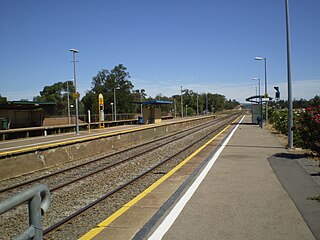
Goodwood railway station is the junction station for the Belair, Seaford and Flinders lines. The Belair line diverges south-east towards Millswood, while the Seaford and Flinders lines diverge south-west towards Clarence Park. The Glenelg tram line crosses over the railway lines at the south end of Goodwood station. The station services the Adelaide inner-southern suburb of Goodwood, and is 5.0 km from Adelaide station.

Chatswood is a railway station located in the Sydney suburb of Chatswood. It is served by Sydney Trains services; the T1 North Shore & Western Line and the T9 Northern Line, and the Sydney Metro's North West Line.

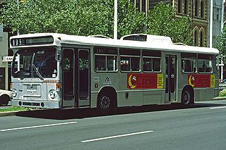
TransAdelaide was a publicly owned corporation established in July 1994, which provided suburban train, tram and bus services in Adelaide, South Australia, under contract to the Government of South Australia. It took over these responsibilities from the State Transport Authority.

Oaklands railway station is located on the Seaford railway line in Adelaide, South Australia. It is in the south-western suburb of Oaklands Park, 13 kilometres from Adelaide station.

Salford Crescent railway station is a railway station in Salford, Greater Manchester, England, opened by British Rail in 1987.

Ethelton station is located on the Outer Harbor line. Situated in the north-western Adelaide suburb of Ethelton, it is 13.1 kilometres from Adelaide station.

The Seaford railway line is a suburban commuter line in Adelaide, South Australia.

The Flinders railway line is a suburban commuter line in Adelaide, South Australia, that branches off the Seaford line at Mitchell Park, and ends opposite Science Park, close to the Flinders University and the Flinders Medical Centre. The line is single track for most of its length, from Celtic Avenue, near Mitchell Park station, to its terminus.

Mile End railway station is located on the Belair, Seaford and Flinders lines adjacent to the inner western Adelaide suburb of Mile End in South Australia. It is located 2 kilometres (1.2 mi) from the Adelaide station. There is easy access from Ellis Park, Adelaide Park Lands, but access from Mile End is limited.

The State Transport Authority (STA) was the government agency which controlled public transport in South Australia between 1974 and 1994.

Salisbury railway station is a railway station and bus interchange in the northern Adelaide suburb of Salisbury. It is on the Gawler line, 20.2 kilometres (12.6 mi) from Adelaide station. Adjoining it is a large park & ride carpark, making it one of the busiest stations on the Adelaide suburban rail system.

Transperth is the public transport system for Perth and surrounding areas in Western Australia. It is managed by the Public Transport Authority (PTA), a state government organisation, and consists of train, bus and ferry services. Bus operations are contracted out to Swan Transit, Path Transit and Transdev. Ferry operations are contracted out to Captain Cook Cruises. Train operations are done by the PTA through their Transperth Train Operations division.

Seaford Meadows railway station is located on the Seaford line in South Australia. Situated in the southern Adelaide suburb of Seaford Meadows, it is 34.7 kilometres from Adelaide station.

Seaford railway station is the terminus of the Seaford line in South Australia. Situated in the southern Adelaide suburb of Seaford, it is 35.9 kilometres from Adelaide station.

NSW TrainLink is a train and coach operator in Australia, providing services throughout New South Wales and the Australian Capital Territory, along with limited interstate services into Victoria, Queensland and South Australia. Its primary intercity and regional services are spread throughout five major rail lines, operating out of Sydney's Central railway station.

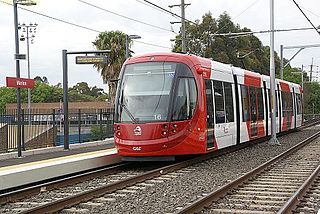
The Inner West Light Rail is a 12.8-kilometre (8.0 mi) light rail line in Sydney, New South Wales, Australia, running from Central railway station through the Inner West to Dulwich Hill and serving 23 stops. It is the original line of the Sydney light rail network, and was originally known as Sydney Light Rail. Light rail services on the line are now branded as the L1 Dulwich Hill Line.


