Unley Park | |||||||||||
|---|---|---|---|---|---|---|---|---|---|---|---|
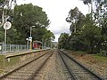
 Southbound view of the station platform, May 2020 | |||||||||||
| General information | |||||||||||
| Location | Wurilba Avenue, Hawthorn | ||||||||||
| Coordinates | 34°57′59″S138°35′52″E / 34.9665°S 138.5978°E | ||||||||||
| Owned by | Department for Infrastructure & Transport | ||||||||||
| Operated by | Adelaide Metro | ||||||||||
| Line(s) | Belair | ||||||||||
| Distance | 7 km from Adelaide | ||||||||||
| Platforms | 1 Side | ||||||||||
| Tracks | 2 (1 broad gauge, 1 standard gauge) | ||||||||||
| Connections | | ||||||||||
| Construction | |||||||||||
| Structure type | Ground | ||||||||||
| Parking | No | ||||||||||
| Bicycle facilities | No | ||||||||||
| Accessible | Yes | ||||||||||
| Other information | |||||||||||
| Station code | 16566 (to City) 18579 (to Belair) | ||||||||||
| Website | Adelaide Metro | ||||||||||
| History | |||||||||||
| Opened | 1910s | ||||||||||
| Rebuilt | 1980s and 2000s | ||||||||||
| Services | |||||||||||
| |||||||||||
| |||||||||||

Unley Park railway station is located on the Belair line in suburban Adelaide. [1] Situated seven kilometres from Adelaide station, it is on the boundary between Hawthorn and Westbourne Park, on the south side of Cross Road.