
Protected areas of South Australia consists of protected areas located within South Australia and its immediate onshore waters and which are managed by South Australian Government agencies. As of March 2018, South Australia contains 359 separate protected areas declared under the National Parks and Wildlife Act 1972, the Crown Land Management Act 2009 and the Wilderness Protection Act 1992 which have a total land area of 211,387.48 km2 (81,617.16 sq mi) or 21.5% of the state's area.

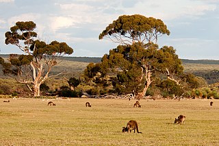
Flinders Chase National Park is a protected area in the Australian state of South Australia located at the west end of Kangaroo Island about 177 kilometres west-south west of the state capital of Adelaide and 110 kilometres west of the municipal seat of Kingscote. It is a sanctuary for endangered species and home to a few geological phenomena. It was the second national park to be declared in South Australia.

Lincoln National Park is a protected area in the Australian state of South Australia located about 249 kilometres (155 mi) west of the state capital of Adelaide and about 9.5 kilometres (5.9 mi) south of the municipal seat of Port Lincoln. It consists of a mainland area on the Jussieu Peninsula on the south eastern tip of Eyre Peninsula and a number of nearby islands. The national park contains significant sites of natural, indigenous and early European heritage.

Kangaroo Island, also known as Karta Pintingga, is Australia's third-largest island, after Tasmania and Melville Island. It lies in the state of South Australia, 112 km (70 mi) southwest of Adelaide. Its closest point to the mainland is Snapper Point in Backstairs Passage, which is 13.5 km (8.4 mi) from the Fleurieu Peninsula.
Ravine Des Casoars Wilderness Protection Area is a protected area located on the west end of Kangaroo Island in South Australia about 80 km (50 mi) west of Kingscote. It was established in 1993 on land previously part of the Flinders Chase National Park.
Cape du Couedic is a headland in the Australian state of South Australia located on the southwest tip of Kangaroo Island in the locality of Flinders Chase. It was named after a French naval officer, Charles Louis du Couëdic de Kergoualer, by the Baudin expedition to Australia during January 1803. It is the site for the Cape du Couedic Lighthouse. It is currently located within the Flinders Chase National Park.

Investigator Strait is a body of water in South Australia lying between the Yorke Peninsula, on the Australian mainland, and Kangaroo Island. It was named by Matthew Flinders after his ship, HMS Investigator, on his voyage of 1801–1802. It is bordered by the Gulf St Vincent in the northeast.

Cape Borda is a headland in the Australian state of South Australia located in the gazetted locality of Cape Borda on the north west tip of Kangaroo Island about 70 km (43 mi) west of the municipal seat of Kingscote. It was named after Jean-Charles de Borda (1733–1799), the French mathematician, physicist, naturalist and sailor, by the Baudin expedition to Australia during January 1803. It has been the site of an operating lighthouse since 1858 and is currently located within the Flinders Chase National Park.

The 2007 Kangaroo Island bushfires were a series of bushfires caused by lightning strikes on 6 December 2007 on Kangaroo Island, South Australia, resulting in the destruction of 95,000 hectares of national park and wilderness protection area. The fires occurred mainly across the western side of the island near Flinders Chase National Park, Vivonne Bay, D'Estrees Bay, Western River and Riverleas.

Loch Vennachar was an iron-hulled, three-masted clipper ship that was built in Scotland in 1875 and lost with all hands off the coast of South Australia in 1905. She spent her entire career with the Glasgow Shipping Company, trading between Britain and Australia. The company was familiarly called the "Loch Line", as all of its ships were named after Scottish lochs. The ship was named after Loch Venachar, in what was then Perthshire.
The Mount Lofty woodlands, or the Peppermint Box Grassy Woodland of South Australia, is an ecoregion in South Australia, which includes woodlands, shrublands, and grasslands in the Mount Lofty Ranges, Fleurieu Peninsula, and Kangaroo Island.
Cape Gantheaume is a headland located on the south coast of Kangaroo Island in South Australia. It was named after Vice admiral Honoré Joseph Antoine Ganteaume (1755–1818) by the Baudin expedition to Australia during 1803. It is currently located within the protected area known as the Cape Gantheaume Wilderness Protection Area.

The Casuarina Islets, also known as The Brothers, is a pair of islands located in the Great Australian Bight immediately off the south-west coast of Kangaroo Island in South Australia approximately 96 kilometres south-west of Kingscote. The pair is currently part of the Flinders Chase National Park.
Cape Bouguer Wilderness Protection Area is a protected area located on the south coast of Kangaroo Island in South Australia about 84 kilometres south-west of Kingscote. The wilderness protection area was proclaimed in October 1993 under the Wilderness Protection Act 1992 in order to ‘protect and preserve the outstandingly high wilderness qualities of the area.’ It was created on land excised from the Kelly Hill Conservation Park. It is classified as an IUCN Category Ib protected area.
The Rocky River is a stream in the Australian state of South Australia located on the west end of Kangaroo Island in the locality of Flinders Chase.
Maupertuis Bay is a bay in the Australian state of South Australia located on the south-west coastline of Kangaroo Island.
Cape Borda is a locality in the Australian state of South Australia located on Kangaroo Island about 192 kilometres south-west of the state capital of Adelaide.

Flinders Chase is a locality in the Australian state of South Australia located on the south-western coast of Kangaroo Island overlooking the body of water known in Australia as the Southern Ocean and by international authorities as the Great Australian Bight. It is located about 210 kilometres south-west of the state capital of Adelaide.
Karatta is a locality in the Australian state of South Australia located on the south coast of Kangaroo Island overlooking the body of water known in Australia as the Southern Ocean and by international authorities as the Great Australian Bight. Karatta is located about 191 kilometres south-west of the state capital of Adelaide.
Edith Mervinia Masterman (1901–1998) was an Australian writer, naturalist and illustrator, best known for her two illustrated books dedicated to the natural history of Kangaroo Island: Flinder's Chase, Kangaroo Island, South Australia: Place of enchantment for nature lovers (1950) and Flinder's Chase Revisited, Kangaroo Island, South Australia: Nature-lovers' sanctuary (1972). Masterman also gave public lectures on the subject. The Advertiser described her original 1950 work as "a charming book" and columnist Eleanor Barbour described her as "an artist of no mean calibre" with a talent for "fluent descriptive writing". The book was advertised and distributed nationally.


