Related Research Articles

Margaret River is a town in the South West of Western Australia, located in the valley of the eponymous Margaret River, 277 kilometres (172 mi) south of Perth, the state capital. Its Local Government Area is the Shire of Augusta-Margaret River.
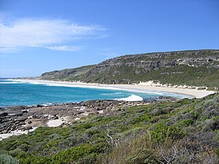
Leeuwin-Naturaliste National Park is a national park in the South West region of Western Australia, 267 km (166 mi) south of Perth. It is named after the two capes either end of the park, Cape Leeuwin and Cape Naturaliste. It is located in the Augusta-Margaret River and Busselton council areas, and is claimed to have the highest visiting numbers of any national park in Western Australia. The park received 2.33 million visitors through 2008–2009.

The Shire of Augusta Margaret River is a local government area in the south-west corner of the South West region of Western Australia, approximately 270 kilometres (168 mi) south of Perth. The shire covers an area of 2,243 square kilometres (866 sq mi) and had a population of over 14,000 at the 2016 Census, about half of whom live in the towns of Margaret River and Augusta.

Cape Leeuwin is the most south-westerly mainland point of the Australian continent, in the state of Western Australia.

Augusta is a town on the south-west coast of Western Australia, where the Blackwood River flows into Flinders Bay. It is the nearest town to Cape Leeuwin, on the furthest southwest corner of the Australian continent. In the 2001 census it had a population of 1,091; by 2016 the population of the town was 1,109.

Hamelin Bay is a bay and a locality on the southwest coast of Western Australia between Cape Leeuwin and Cape Naturaliste. It is named after French explorer Jacques Félix Emmanuel Hamelin, who sailed through the area in about 1801. It is south of Cape Freycinet.
St Alouarn Islands are a group of islands and rocks south-east of Cape Leeuwin in Western Australia, approximately 11 km south of Augusta in Flinders Bay.

Cape Naturaliste is a headland in the south western region of Western Australia at the western edge of the Geographe Bay. It is the northernmost point of the Leeuwin-Naturaliste Ridge which was named after the cape. Also the Leeuwin-Naturaliste National Park, Cape Naturaliste Lighthouse and the Cape to Cape hiking track were named after this location.

Cape Freycinet is a point on the coast between Cape Leeuwin and Cape Naturaliste in the south west of Western Australia.

King Sound is a large gulf in northern Western Australia. It expands from the mouth of the Fitzroy River, one of Australia's largest watercourses, and opens to the Indian Ocean. It is about 120 kilometres (75 mi) long, and averages about 50 kilometres (31 mi) in width. The port town of Derby lies near the mouth of the Fitzroy River on the eastern shore of King Sound. King Sound has the highest tides in Australia, and amongst the highest in the world, reaching a maximum tidal range of 11.8 metres (39 ft) at Derby. The tidal range and water dynamic were researched in 1997–1998.

Yallingup is a town in the South West region of Western Australia, 256 kilometres (159 mi) south of Perth. Yallingup is a popular tourist destination because of its beaches and limestone caves, and proximity to Leeuwin-Naturaliste National Park.
Western Australia has the longest coastline of any state or territory in Australia, at 10,194 km or 12,889 km. It is a significant portion of the coastline of Australia, which is 35,877 km.
Oakajee Port is a proposed deep water port to be built in the Mid West region of Western Australia, 24 kilometres (15 mi) north of Geraldton, to service the region's growing iron ore industry.

Boranup is a locality in the Shire of Augusta-Margaret River in the South West region of Western Australia. It is the site of a large coastal dune blow out known as the "Boranup sand patch" as part of the Boranup beach, and the site of a former M. C. Davies timber company mill. The sand patch area and sand blows affected the alignment of the Busselton to Flinders Bay railway.
Cape Mentelle is a limestone headland on the Indian Ocean coast of south-western Western Australia. It is within the Leeuwin-Naturaliste National Park, just north of the mouth of the Margaret River and 9 km (5.6 mi) west of the town of Margaret River. It lies on the Leeuwin-Naturaliste Ridge, halfway between Cape Naturaliste 50 km (31 mi) to the north, and Cape Leeuwin 50 km (31 mi) to the south, on the route of the Cape to Cape walking track.

Seal Island is located near Augusta, Western Australia in the South West region.

Many surfing locations are found along the coast of the Capes Region in Western Australia. The Capes Region, also known as Cape to Cape, is situated between Cape Naturaliste and Cape Leeuwin, within a larger region known as the South West. Despite their wide geographic range, most surf breaks in the Capes Region tend to be associated with Margaret River, situated roughly central to the stretch of coast along which they are located.
The Ngari Capes Marine Park is a marine protected area on the lower south west coast of Western Australia, located approximately 250 kilometres (160 mi) south of Perth. The 123,790-hectare (305,900-acre) marine park was gazetted on 12 June 2012 and the park's western and southern boundaries are the limit of coastal waters of Western Australia, abutting the South-west Corner Marine Park located within the Australian Commonwealth exclusive economic zone.

Favorite Island is an island near Jurien Bay in Western Australia.

Canal Rocks is a series of granite rocks in the Indian Ocean, just off the coast situated approximately 4 kilometres (2 mi) south of Yallingup in the South West region of Western Australia. The Noongar name for this place is Winjee Sam.
References
- ↑ Marchant, Leslie Ronald (1998). France Australe : the French search for the Southland and subsequent explorations and plans to found a penal colony and strategic base in south western Australia 1503-1826. Scott Four Colour Print. ISBN 978-0-9588487-1-8.
- ↑ Murray, Ian; Hercock, Marion; Murray, Ian; Hercock, Marion (2008). Where on the coast is that?. Hesperian Press. ISBN 978-0-85905-452-2.
- ↑ "Home". clairaultstreickerwines.com.au.
- ↑ "Cape Clairault Wines". truelocal.com.au. Retrieved 28 October 2023.
- ↑ "SLSA Beachsafe". Beachsafe.org.au. 27 April 2022. Retrieved 3 May 2022.
- ↑ Margaret River Region Map & Guide version 2013-1, Margaret River.com
- ↑ "Cape Clairault Swell Forecast, WA - WillyWeather". Swell.willyweather.com.au. Retrieved 3 May 2022.
- ↑ "Description of the lighthouse". Western Mail (Perth, WA : 1885 - 1954) . Perth, WA: National Library of Australia. 23 April 1904. p. 10. Retrieved 27 December 2013.
Australian places named by French explorers in the 18th and 19th centuries | ||
|---|---|---|
| South Australia |
|  |
| Western Australia | ||
Only places with the name still in use in either the original or anglicised version are listed above. Many names have been anglicised; for these the original French name appears in brackets. | ||