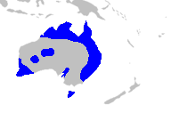
The Kanangra-Boyd National Park is a protected national park that is located in the Central Tablelands region, west of the Southern Highlands and Macarthur regions, in New South Wales, in eastern Australia. The 68,660-hectare (169,700-acre) national park is situated approximately 180 kilometres (110 mi) south-west of Sydney and is contiguous with the Blue Mountains National Park and the Nattai National Park. The park was established in 1969.

The Oxley Wild Rivers National Park is a protected national park that is located in the Northern Tablelands region of New South Wales, Australia. The 145,223-hectare (358,850-acre) park is situated 445 kilometres (277 mi) north of Sydney and is named in memory of the Australian explorer John Oxley, who passed through the area in 1818 and is one of the largest national parks in New South Wales.

Cape Le Grand National Park is a national park in Western Australia, 631 km (392 mi) south-east of Perth and 56 km (35 mi) east of Esperance. The park covers an area of 31,801 hectares The area is an ancient landscape which has been above sea level for well over 200 million years and remained unglaciated. As a result, the area is home to many primitive relict species. Established in 1966, the park is managed by the Department of Parks and Wildlife. The name Le Grand is from one of the officers on L'Espérance, one of the ships in the 1792 expedition of Bruni d'Entrecasteaux.

Gulf Islands National Park Reserve is the sixth of eight National Park Reserves in a system of 46 parks and park reserves across Canada. Located in British Columbia's Gulf Islands, it covers 36 square kilometres (14 sq mi) over 15 islands. It also includes numerous islets and reef areas.

The Virgin Islands National Park is an American national park preserving about 60% of the land area of Saint John in the United States Virgin Islands, as well as more than 5,500 acres of adjacent ocean, and nearly all of Hassel Island, just off the Charlotte Amalie, Saint Thomas harbor.

Cloudland Canyon State Park is a 3,485 acres (14.10 km2) Georgia state park located near Trenton and Cooper Heights on the western edge of Lookout Mountain. One of the largest and most scenic parks in Georgia, it contains rugged geology, and offers visitors a range of vistas across the deep gorge cut through the mountain by Sitton Gulch Creek, where the elevation varies from 800 to over 1,800 feet. Views of the canyon can be seen from the picnic area parking lot, in addition to additional views located along the rim trail. At the bottom of the gorge, two waterfalls cascade across layers of sandstone and shale, ending in small pools below.

Tettegouche State Park, in the United States, is a Minnesota state park on the north shore of Lake Superior 58 miles (93 km) northeast of Duluth in Lake County on scenic Minnesota Highway 61. The park's name stems from the Tettegouche Club, an association of local businessmen which purchased the park in 1910 from the Alger-Smith Lumber Company. The club's members protected the area until its sale in 1971 to the deLaittres family. In 1979, the state of Minnesota acquired 3,400 acres (1,400 ha) from the Nature Conservancy, including Tettegouche Camp. The land was added to Baptism River State Park, which was renamed Tettegouche State Park.

Manchester State Park is a state park of California, United States. It includes 18,000 feet (5,500 m) of protected beachfront on the Pacific Ocean in Northern California on State Route 1, 7 miles (11 km) north of Point Arena. The park features sand dunes, flat grasslands and five miles of gentle, sandy beachfront. The park is noted for steelhead and salmon fishing in the park's two streams, Brush Creek and Alder Creek, as well as the driftwood that collects in the catch basin created by the gently curved coastline. The 5,272-acre (2,134 ha) site was established as a California state park in 1955 and takes its name from Manchester, California, seven miles north of Point Arena.

Golden Ears Provincial Park is a Provincial Park in British Columbia, Canada at 555.9 km². It is named after the prominent twin peaks which are commonly referred to as Golden Ears. The park's southern end is located on the northern edge of the district municipality of Maple Ridge on the north side of the Fraser River.

Oswald West State Park is part of the state park system of the U.S. state of Oregon. It is located about 10 miles (16 km) south of the city of Cannon Beach, on the Pacific Ocean. The park covers 2,448 acres (9.91 km2), with many miles of hiking trails both inside the park grounds and linking to other parks and landmarks beyond.

Vogel State Park is a 233-acre (0.94 km2) or 94 hectares state park located at the base of Blood Mountain in the Chattahoochee National Forest. It became one of the first two parks in Georgia when it founded a state park system in 1931. Much of the park was constructed by the Civilian Conservation Corps during the 1930s.

Peninsula State Park is a 3,776-acre (1,528 ha) Wisconsin state park with eight miles of Green Bay shoreline in Door County. Peninsula is the third largest state park in Wisconsin, and is visited by an estimated one million visitors annually.

Mount Magnificent Conservation Park is a protected area in the Australian state of South Australia located in the Mount Lofty Ranges about 58 kilometres south of the state capital of Adelaide. It is located within the gazetted locality of Mount Magnificent.

Russian Gulch State Park is a California State Park in coastal Mendocino County, California, two miles north of Mendocino and seven miles south of Fort Bragg.

Horsnell Gully Conservation Park is a protected area in the Australian state of South Australia in the locality of Horsnell Gully located about 9 kilometres (5.6 mi) east of the state capital of Adelaide and about 32 kilometres (20 mi) southwest of Norton Summit.

Kirby Cove Camp is a campground and scenic area managed by the Golden Gate National Recreation Area (GGNRA) in the Marin Headlands, California. It is located at sea level below Conzelman Road, which leads from the north end of the Golden Gate Bridge up and along the Marin Headlands overlooking the Golden Gate strait that leads into San Francisco Bay. A road behind a locked gate leads to Kirby Cove from just beyond Battery Spencer, the first set of bunkers encountered from Highway 101 at the north end of the Golden Gate Bridge.

The Little North Santiam River is a 27-mile (43 km) tributary of the North Santiam River in western Oregon in the United States. It drains 113 square miles (290 km2) of the Cascade Range on the eastern side of the Willamette Valley east of Salem.

Newland Head Conservation Park is a protected area located in South Australia within the locality of Waitpinga on the southern coast of the Fleurieu Peninsula 91 km south of the centre of Adelaide, and 7 km southwest of Victor Harbor. Its name is taken from Newland Head that feature prominently at the eastern boundary of the park. The conservation park is classified as an IUCN Category III protected area.

Caroona Creek Conservation Park is a protected area located in the Australian state of South Australia in the localities of Collinsville and Mount Bryan East about 173 kilometres (107 mi) north-east of the state capital of Adelaide and about 19 kilometres (12 mi) east of the town of Hallett.