Coober Pedy is a town in northern South Australia, 846 km (526 mi) north of Adelaide on the Stuart Highway. In the 2016 Census, there were 1,762 people in Coober Pedy. Of these 962 were male and 801 were female. There were 302 Aboriginal and/or Torres Strait Islander people that made up 17.1% of the population. The town is sometimes referred to as the "opal capital of the world" because of the quantity of precious opals that are mined there. Coober Pedy is renowned for its below-ground residences, called "dugouts", which are built in this fashion due to the scorching daytime heat. The name "Coober Pedy" comes from the local Aboriginal term kupa-piti, which means "boys' waterhole".
Yankunytjatjara is an Australian Aboriginal language. It is one of the Wati languages, belonging to the large Pama–Nyungan family. It is one of the many varieties of the Western Desert Language, all of which are mutually intelligible.

The Anne Beadell Highway is an outback unsealed track linking Coober Pedy, South Australia, and Laverton, Western Australia, a total distance of 1,325 km (823 mi). The track was surveyed and built by Len Beadell, Australian surveyor, who named it after his wife. The track passes through remote arid deserts and scrub territory of South Australia and Western Australia, which often have summer temperatures as high as 50 degrees Celsius. Sand dunes predominate for most of the track.

The Far North is a large region of South Australia close to the Northern Territory border. Colloquial usage of the term in South Australia refers to that part of South Australia north of a line roughly from Ceduna through Port Augusta to Broken Hill. The South Australian Government defines the Far North region similarly with the exception of the Maralinga Tjarutja Lands. the Yalata Aboriginal Reserve and other unincorporated crown lands in the state's far west, which are officially considered part of the Eyre and Western region.

Aṉangu Pitjantjatjara Yankunytjatjara (APY) is a large Aboriginal local government area located in the remote north west of South Australia. It consists of the Pitjantjatjara, Yankunytjatjara and Ngaanyatjarra aṉangu, and has a population of around 2500 people.

Mintabie is an opal mining community in the Anangu Pitjantjatjara Yankunytjatjara or "APY" Lands in South Australia. It is unique in comparison to other communities situated in the APY Lands, in that its residents are largely not of Indigenous Australian origin, and significant mining activity is occurring.

Lake Gilles Conservation Park is a protected area in the Australian state of South Australia located in the north of the Eyre Peninsula about 20 kilometres (12 mi) east of Kimba in the gazetted locality of Lake Gilles.
Yumbarra Conservation Park is a protected area in the Australian state of South Australia located about 55 kilometres north of the town centre of Ceduna.
Point Bell Conservation Park is a protected area in the Australian state of South Australia located in the gazetted locality of Penong in the west of the state on the coastline of the Great Australian Bight on land including and adjoining the headland of Point Bell about 52 kilometres west of the town of Ceduna.

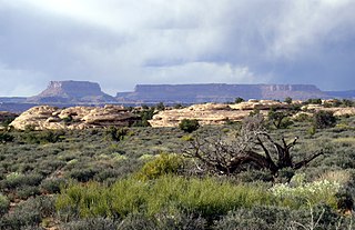
Tallaringa Conservation Park is a protected area located in the west of the Australian state of South Australia about 615 kilometres north west of the city of Port Augusta and about 90 kilometres west of the town of Coober Pedy. The conservation park was proclaimed under the National Parks and Wildlife Act 1972 in 1991.
Cocata Conservation Park is a protected area in the Australian state of South Australia located on the Eyre Peninsula in the gazetted localities of Cocata and Warramboo about 26 kilometres (16 mi) south-west of the town centre in Kyancutta.
Boondina Conservation Park is a protected area in the Australian state of South Australia located in the west of the state in the gazetted locality of Yellabinna about 38 kilometres (24 mi) north-east of the town centre in Fowlers Bay.
Mount Willoughby is a locality in the Australian state of South Australia located about 837 kilometres north-west of the capital city of Adelaide and about 84 kilometres north-west of the town of Coober Pedy.
Mount Willoughby Indigenous Protected Area is an indigenous protected area in the Australian state of South Australia located in the gazetted localities of Mount Willoughby and Evelyn Downs about 150 kilometres north-west of the town of Coober Pedy.
Bascombe Well Conservation Park, formerly known as Bascombe Well National Park, is a protected area in the Australian state of South Australia located on Eyre Peninsula in the gazetted localities of Kappawanta and Murdinga about 115 kilometres (71 mi) north of Port Lincoln and about 25 kilometres (16 mi) south-west of Lock.
Pureba Conservation Park is a protected area in the Australian state of South Australia located in the west of the state in the gazetted locality of Pureba about 74 kilometres (46 mi) east of the town centre in Ceduna.
Wiljani Conservation Park is a protected area in the Australian state of South Australia in the gazetted locality of Mount Pleasant located about 3.5 kilometres (2.2 mi) north-west of the town centre in Mount Pleasant.
Thidna Conservation Park is a protected area located in the Australian state of South Australia on the Yorke Peninsula about 45 kilometres (28 mi) west of the state capital of Adelaide and about 60 kilometres (37 mi) south-west of the municipal seat of Maitland.
Ramco Point Conservation Park is a protected area located in the Australian state of South Australia in the locality of Sunlands about 150 kilometres (93 mi) north-east of the state capital of Adelaide and about 7 kilometres (4.3 mi) north-west of the municipal seat of Waikerie.
Caroona Creek Conservation Park is a protected area located in the Australian state of South Australia in the localities of Collinsville and Mount Bryan East about 173 kilometres (107 mi) north-east of the state capital of Adelaide and about 19 kilometres (12 mi) east of the town of Hallett.