Cleland National Park

Last updated • 5 min readFrom Wikipedia, The Free Encyclopedia

Cleland National Park
South Australia
Cleland Wildlife park entrance.jpg
Entrance to Cleland Wildlife Park
Australia South Australia relief location map.png
Red pog.svg
Cleland National Park
Nearest town or city Adelaide city centre
Coordinates 34°58′03″S138°41′45″E / 34.96750°S 138.69583°E / -34.96750; 138.69583
Established1 January 1945 (1945-01-01) [2]
Area11.25 km2 (4.3 sq mi) [2]
Website Cleland National Park
See also Protected areas of South Australia
Map of the park Cleland-conservation-park.svg
Map of the park

Cleland National Park, formerly Cleland Conservation Park, is a protected area located in the Adelaide Hills, South Australia about 22 kilometres (14 mi) south-east of the Adelaide city centre. It conserves a significant area of natural bushland on the Adelaide Hills face, including Mount Lofty Summit and Waterfall Gully.

Contents

Formerly a conservation park, Cleland was combined with the bordering Eurilla Conservation Park in November 2021 when it was upgraded to the status of national park. The area includes Cleland Wildlife Park, a major tourist attraction, with the draft plan suggesting that the Wildlife Park will be a part of the new Cleland National Park, but this is open to public consultation until late January 2022.

The park is classified as an IUCN Category II protected area.

People with emus in the wildlife park Dromaius novaehollandiae -Cleland Wildlife Park, Australia-8a.jpg
People with emus in the wildlife park
Western grey kangaroos in the wildlife park Kangaroo Land in Cleland Wildlife Park.jpg
Western grey kangaroos in the wildlife park
Yellow-footed rock wallabies in the wildlife park CLELAND WILDLIFE PARK.jpg
Yellow-footed rock wallabies in the wildlife park
Cape Barren goose in the wildlife park CLELAND WILDLIFE PK.jpg
Cape Barren goose in the wildlife park

History

Cleland Conservation Park was established on 1 January 1945 [3] and classified as Category II [4] protected area in IUCN protected area management categories. [5] [6] The primary objective for Category II is "to protect natural biodiversity along with its underlying ecological structure and supporting environmental processes, and to promote education and recreation". [4]

The conservation park was named for Sir John Burton Cleland (1878–1971), a renowned naturalist, microbiologist, mycologist and ornithologist, and member of the Royal Society of South Australia. After a career in medicine and pathology, Cleland became keenly interested in wildlife conservation. [7]

In November 2017 a concept plan was announced by the Weatherill government to revamp the park, including a hotel and a cable car connection, [8] but the plan was described by critics as "pre-election glitter". [9] The Weatherill government was not returned at the subsequent election in March 2018.

On 26 November 2021 Cleland Conservation Park was combined with Eurilla Conservation Park, which was adjacent to it, and proclaimed a national park. [10] [11] The area includes the Cleland Wildlife Park precinct, with the draft plan suggesting that the Wildlife Park will be a part of the new Cleland National Park. [12] The executive director of the National Parks and Wildlife Service South Australia said that the decision was made of the collective conservation significance of both of the former conservation parks, with their ecologically significant flora and fauna. The draft management plan was developed in collaboration with technical specialists, Aboriginal representatives, park managers and other stakeholders, and is open to the public consultation for three months (25 October 2021 – 25 January 2022). The Wildlife Park requires different management from the rest of the park due to the number of visitors, needing to be managed as a commercial zone. The draft plan also includes possible tourist accommodation areas, on land currently within the Wildlife Park, but away from the animal enclosures. [13]

Location and description

The park is located in the Adelaide Hills, South Australia about 22 kilometres (14 mi) south-east of the Adelaide city centre. [14] The conservation park occupies land in the gazetted suburbs of Cleland, Crafers and Waterfall Gully. [15]

By far the largest part of the park consists of bushland, mostly woodland with some open spaces where clearing has taken place. [16]

There are a number of walking trails, including the Waterfall Gully – Mount Lofty summit trail, a popular and fairly challenging ascent of the west side of Mount Lofty, [17] and parts of the long distance Heysen and Yurrebilla Trails, which run north–south along the higher ground in the east of the park.

From December 2012, many trails in the park became shared-use, allowing mountain bikers to also make use of the trails. [18]

Legislation and management

All the reserves and parks in South Australia are proclaimed under the National Parks and Wildlife Act 1972 (NPW Act) and the Wilderness Protection Act 1992 (the WP Act). Conservation of reserves are committed to the Minister under the Crown Land Management Act 2009. [19] The NPW Act provides for the establishment and administration of reserves for conservation of wildlife in a natural environment, public benefit and pleasure and for other purposes. [3]

The Hills and Fleurieu Landscape Board, which replaced the Natural Resources Adelaide and Mt Lofty Ranges (AMLR) in November 2020, is responsible for managing the natural assets of Adelaide Hills and Fleurieu Peninsula regions. [20]

Cleland was formerly maintained by the South Australian Department for Environment & Water, and before that its predecessor, the Department for Water & Natural Resources. [21]

Cleland Wildlife Park

Cleland Wildlife Park is managed separately from the national park, [13] as a major tourist destination since 1967 [22] and as of 2021 attracting around 100,000 tourists every year. [13] It is a member of the South Australian Tourism Hall of Fame, having won the "Significant Tourism Attraction" category in 2007, 2008 and 2009 at the South Australian Tourism Awards, [22] and in 2021 won the Silver Award for South Australia's best tourist attraction. [23]

The park allows visitors to get close to the native animals in their natural environment, [22] and offers a number of experiences such as being photographed while holding a koala, interacting with reptiles every day of the week, observing and listening to the keepers at feeding times, meeting an short-beaked echidna, various guided day and night walks and children's experiences. [24] Wandering around the enclosures, some of the animals are able to be patted, such as the kangaroos (red and western grey) and swamp wallabies. Other animals at the park include Tasmanian devils, southern hairy-nosed wombats, western pygmy possums, bilbies, yellow-footed rock wallabies, dingoes and many native birds, and reptiles including snakes and goannas. [25]

It is accessible by sealed road from both the South Eastern Freeway and Greenhill Road, and on foot on a formed but steep track from Waterfall Gully or Mount Lofty. [17] A limited public bus service operates. [26]

Other locations

Mount Lofty summit

Mount Lofty summit is 727 metres (2,385 ft) above sea level. It provides sweeping vistas across the Adelaide Plains and Gulf St Vincent. Flinders Column, a white painted obelisk shaped like a lighthouse, is a landmark which can be seen from far away on a clear day. Car parking facilities are provided: charges are payable. Public bus route 823 serves the summit with three journeys a day (including weekends and most holidays). [26] Other facilities include an information centre/ souvenir shop, a cafe/restaurant (closed Mondays) and public toilets.

Waterfall Gully

Waterfall Gully, another popular part of the park, is located on its western edge. It can be accessed via the sealed Waterfall Gully Road. The main attraction is a waterfall, the largest of several in the park. The base is a short walk from the car park and the top can be reached by a formed but steep footpath, which continues to Cleland Wildlife Park and Mount Lofty summit. [17]

See also

Related Research Articles

<span class="mw-page-title-main">Protected areas of South Australia</span> Areas protected by legislation in South Australia

Protected areas of South Australia, consisting of protected areas located within South Australia and its immediate onshore waters and which are managed by South Australian Government agencies. As of 2018, South Australia contained 359 separate protected areas declared under the National Parks and Wildlife Act 1972, the Crown Land Management Act 2009 and the Wilderness Protection Act 1992. Together, they cover a total land area of 211,387.48 km2 (81,617.16 sq mi) or 21.5% of the state's area.

<span class="mw-page-title-main">Belair National Park</span> Protected area in South Australia

Belair National Park is a protected area in Belair, South Australia, 9 kilometres southeast of Adelaide city centre; it covers an area of 835 hectares. It was proclaimed in 1891 and was the first national park in South Australia, second in Australia and the tenth in the world. The national park lies within the Adelaide Hills and Mitcham council area, and forms part of a chain of protected areas located along the Adelaide Hills Face Zone. The national park is administered by the Department of Environment, Water and Natural Resources.

Deep Creek National Park, formerly the Deep Creek Conservation Park, is a protected area in the Australian state of South Australia located on the southern coast of Fleurieu Peninsula in the gazetted localities of Deep Creek and Delamere about 11 kilometres east of Cape Jervis.

Waterfall Gully is an eastern suburb of the South Australian capital city of Adelaide. It is located in the foothills of the Mount Lofty Ranges around 5 km (3.1 mi) east-south-east of the Adelaide city centre. For the most part, the suburb encompasses one long gully with First Creek at its centre and Waterfall Gully Road running adjacent to the creek. At the southern end of the gully is First Falls, the waterfall for which the suburb was named. Part of the City of Burnside, Waterfall Gully is bounded to the north by the suburb of Burnside, from the north-east to south-east by Cleland National Park, to the south by Crafers West, and to the west by Leawood Gardens and Mount Osmond.

<span class="mw-page-title-main">Mount Lofty</span> Mountain in South Australia

Mount Lofty is the highest point in the southern Mount Lofty Ranges. It is located about 15 km (9.3 mi) east of the Adelaide city centre, within the Cleland National Park in the Adelaide Hills area of South Australia.

<span class="mw-page-title-main">Mount Lofty Ranges</span> Mountain range in South Australia

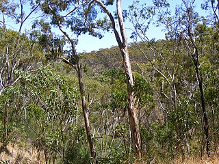
The Mount Lofty Ranges are a range of mountains in the Australian state of South Australia which for a small part of its length borders the east of Adelaide. The part of the range in the vicinity of Adelaide is called the Adelaide Hills and defines the eastern border of the Adelaide Plains.

<span class="mw-page-title-main">Yurrebilla Trail</span> Walking trail in South Australia

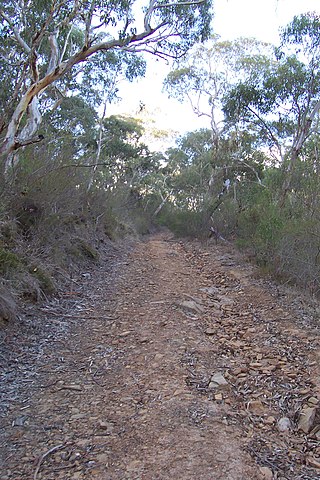
The Yurrebilla Trail is a walking trail passing through the Mount Lofty Ranges in the Adelaide hills area of Adelaide, South Australia, to the east of the Adelaide city centre.

<span class="mw-page-title-main">Mount Lofty Fire Tower</span>

The Mount Lofty Fire Tower sits on top of Mount Lofty in the Adelaide Hills just to the east of the city of Adelaide, South Australia. The 34m high tower has a commanding view over a huge area of the rural areas surrounding Adelaide, and on a clear day the view can extend to as far as Kangaroo Island to the southwest, Monarto to the east, the Fleurieu Peninsula to the south, and the grassy plains beyond Two Wells to the north. The tower is used to spot fires in the Adelaide Hills and surrounds on days of very high or extreme fire danger during summer. The spotting crew determine the location of a smoke sighting by taking a bearing and then calculating distance using topographic maps. Details of the sighting are then passed to the 'Adelaide Fire' Communications Centre who despatch the nearest fire brigade.

<span class="mw-page-title-main">Mount Magnificent Conservation Park</span> Protected area in South Australia

Mount Magnificent Conservation Park is a protected area in the Australian state of South Australia located in the Mount Lofty Ranges about 58 kilometres south of the state capital of Adelaide. It is located within the gazetted locality of Mount Magnificent.

<span class="mw-page-title-main">Finniss Conservation Park</span> Protected area in South Australia

Finniss Conservation Park is a protected area in the Australian state of South Australia located in the Mount Lofty Ranges about 43 kilometres south of the state capital of Adelaide and about 7 kilometres west of Ashbourne. It is located within the gazetted locality of Mount Magnificent.

<span class="mw-page-title-main">Horsnell Gully Conservation Park</span> Protected area in South Australia

Horsnell Gully Conservation Park is a protected area in the Australian state of South Australia in the locality of Horsnell Gully located about 9 kilometres (5.6 mi) east of the state capital of Adelaide and about 2.3 kilometres (1.4 mi) southwest of Norton Summit.

Giles Conservation Park is a protected area in the Australian state of South Australia located approximately 10 km (6.2 mi) east of the state capital of Adelaide. It was declared in 2007 and has an area of 109 ha. Previously, the land was the eastern portion of the Horsnell Gully Conservation Park. It was named after the family of Charles Giles who is reported as being a pioneer in the fields of horticulture and floriculture in South Australia.

Waitpinga Conservation Park is a protected area in the Australian state of South Australia located about 15 kilometres south of the town of the Yankalilla in the gazetted locality of Parawa.

<span class="mw-page-title-main">Cleland, South Australia</span> Suburb of Adelaide Hills Council, South Australia

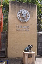
Cleland is a suburb in South Australia located in the Adelaide metropolitan area about 10 kilometres south-east of the Adelaide city centre. Its boundaries were created in October 2001, with additional land being added in 2010 from the adjoining suburb of Crafers. Its name is derived from the former Cleland Conservation Park.

Kinchina Conservation Park is a protected area in the Australian state of South Australia in the north of the Gifford Hill Range on the eastern flanks the localities of Rocky Gully and White Hill, west of Murray Bridge.

Mylor Conservation Park is a protected area located in the Australian state of South Australia in the suburb of Mylor in the Adelaide Hills state government region about 19 kilometres (12 mi) south-east of the state capital of Adelaide and about 1 kilometre (0.62 mi) north-east of the town of Mylor.

Cromer Conservation Park is a protected area located in the Australian state of South Australia in the locality of Cromer in the Adelaide Hills state government region about 38 kilometres (24 mi) north-east of the state capital of Adelaide and about 4 kilometres (2.5 mi) north of the town centre in Birdwood.

Eurilla Conservation Park was a protected area located in the Australian state of South Australia in the suburb of Crafers in the Adelaide Hills state government region about 11 kilometres (6.8 mi) south-east of the state capital of Adelaide and about 2.4 kilometres (1.5 mi) north of the town centre in Stirling. It was merged with the adjoining Cleland Conservation Park to become a national park called Cleland National Park on 26 November 2021.

Gum Tree Gully Conservation Park is a protected area in the Australian state of South Australia located in the locality of Hindmarsh Tiers about 55 kilometres (34 mi) south of the state capital of Adelaide and about 6 kilometres (3.7 mi) south-east of Myponga.

References

  1. "Terrestrial Protected Areas of South Australia (refer 'DETAIL' tab )". CAPAD 2016. Australian Government, Department of the Environment (DoE). 2016. Retrieved 21 February 2018.
  2. 1 2 "Protected Areas Information System - reserve list (as of 16 July 2015)" (PDF). Department of Environment Water and Natural Resources (DEWNR). Retrieved 3 August 2015.
  3. 1 2 "South Australia National Parks and Wildlife Act 1972" (PDF). www.legislation.sa.gov.au.
  4. 1 2 "Protected Areas Category II". iucn.org. Archived from the original on 7 April 2014. Retrieved 7 May 2014.
  5. "CAPAD 2014". environment.gov.au.
  6. "Priority Area 1: Protected areas .... conserving nature". iucn.org. Archived from the original on 28 September 2015.
  7. R. V. Southcott, 'Cleland, Sir John Burton (1878–1971)', Australian Dictionary of Biography, National Centre of Biography, Australian National University, , published in hardcopy 1981, accessed online 18 April 2014.
  8. Read, Charles (27 November 2017). "Hong Kong's LKF Group to lead AUD $150m transformation of Adelaide's Cleland Wildlife park". Blooloop. Retrieved 6 March 2019.
  9. Cleland Park proposal in Adelaide Hills is just 'pre-election glitter', former Democrat says ABC News, 28 November 2017. Retrieved 6 March 2018.
  10. Speirs, David (26 November 2021). "SA now home to Australia's biggest national park". Premier of South Australia . Archived from the original on 19 December 2021. Retrieved 20 December 2021. CC-BY icon.svg Text may have been copied from this source, which is available under a Attribution 3.0 Australia (CC BY 3.0 AU) licence.
  11. Gooch, Declan (26 November 2021). "Australia's biggest national park declared in South Australia's far north". ABC News. Australian Broadcasting Corporation . Retrieved 20 December 2021.
  12. "Share your views on the future of Cleland National Park". Department for Environment and Water . 25 October 2021. Retrieved 20 December 2021.
  13. 1 2 3 Birdjan, Tijana (25 November 2021). "National Park status for Cleland". Adelaide East Herald.
  14. "Cleland National Park". National Parks and Wildlife Service South Australia . Retrieved 20 December 2021.
  15. "Search result for " Cleland (Suburb)" (Record no SA0040499) with the following layers selected - "Suburbs and Localities" and "Local Government Areas"". Department of Planning, Transport and Infrastructure. Archived from the original on 12 October 2016. Retrieved 15 April 2016.
  16. Hardy, Anne (1989). The Nature of Cleland (2nd ed.). South Australian Government - State Print - State Publishing.
  17. 1 2 3 "Cleland CP - Waterfall Gully To Mount Lofty Hike". Archived from the original on 16 October 2016.
  18. "Mountain Biking in Cleland Conservation Park". ridemorebikes.com. 2 January 2013. Retrieved 13 January 2018.
  19. "Park management". Department for Environment and Water. Retrieved 20 December 2021.
  20. "Hills and Fleurieu Landscape Board – NRM Regions Australia". NRM Regions Australia – NRM Regions Australia is the national collaborative group for Australia’s 56 regional NRM organisations. Retrieved 19 December 2021.
  21. "Cleland Conservation Park". Department of Environment, Water and Natural Resources. Archived from the original on 15 November 2015. Retrieved 18 November 2015. This url now redicts to the National Parks web page for the new national park.
  22. 1 2 3 "Our approach". Cleland Wildlife Park. Retrieved 20 December 2021.
  23. "Home". Cleland Wildlife Park. 24 May 2021. Retrieved 20 December 2021.
  24. "Cleland experiences". Cleland Wildlife Park. 17 November 2014. Retrieved 20 December 2021.
  25. "What animals will I see?". Cleland Wildlife Park. Retrieved 20 December 2021.
  26. 1 2 "Opening hours & getting here". www.environment.sa.gov.au. Cleland Wildlife Park.

Further reading

Commons-logo.svg Media related to Cleland Wildlife Park at Wikimedia Commons