
The District Council of Robe is a local government area located in the Limestone Coast area of South Australia. The main offices are in Robe, the town after which the council is named. The district relies on a mix of agriculture, fisheries and tourism as major components of its economy.

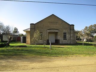
Binnum is a locality in the Australian state of South Australia.

Frances is a town in the Australian state of South Australia located about 291 kilometres (181 mi) south-east of the state capital, Adelaide and about 40 kilometres (25 mi) north-east of the municipal seat of Naracoorte in the state's Limestone Coast region and adjoining the border with the State of Victoria.
Greenways is a town and a locality in the Australian state of South Australia located in the state's south-east within the Limestone Coast region about 355 kilometres (221 mi) south east of the state capital of Adelaide and about 46 kilometres (29 mi) east of the municipal seat of Robe.
Kybybolite is a locality in the Australian state of South Australia located in the state's south-east within the Limestone Coast region on the border with the state of Victoria about 301 kilometres south east of the state capital of Adelaide and about 19 kilometres north-east of the municipal seat of Naracoorte.

Southend is a town and locality in the Australian state of South Australia located in the south-east of the state on the southern shore of Rivoli Bay about 324 kilometres (201 mi) south-east of the state capital of Adelaide.
Mount Benson is a 77-metre (253 ft) high hill located about 10 kilometres (6.2 mi) north north-east of Robe in the south east of South Australia. It was named in 1839 either by Governor Grey after a stockman employed by Charles Bonney or by Bonney himself. Mount Benson itself is located both within the locality of the same name and the wine region of the same name.
Wrattonbully is a locality located within the Naracoorte Lucindale Council in the Limestone Coast in the south east of South Australia about 327 kilometres south east of the Adelaide city centre. Wrattonbully gives its name to the wine region surrounding it, the Wrattonbully wine region.

Canunda is a locality in the Australian state of South Australia located on the state’s south-east coast overlooking the body of water known in Australia as the Southern Ocean and by international authorities as the Great Australian Bight. It is about 339 kilometres south-east of the state capital of Adelaide and 49 kilometres south of the centre of Mount Gambier.
Eight Mile Creek is a locality in the Australian state of South Australia located on the state's south-east coast overlooking the body of water known in Australia as the Southern Ocean and by international authorities as the Great Australian Bight. It is about 399 kilometres south-east of the state capital of Adelaide and about 24 kilometres south of the municipal seat of Mount Gambier in the south-east of the state.
Racecourse Bay is a locality in the Australian state of South Australia located on the state’s south-east coast overlooking the body of water known in Australia as the Southern Ocean and by international authorities as the Great Australian Bight. It is about 398 kilometres south-east of the state capital of Adelaide and 25 kilometres south of the municipal seat of Mount Gambier in the south-east of the state.
Nora Creina is a locality in the Australian state of South Australia located on the state’s south-east coast overlooking the Southern Ocean. It is about 99 kilometres to the north-west of the city of Mount Gambier and about 290 kilometres south-east of the state capital of Adelaide.
Wangolina is a locality in the Australian state of South Australia located on the state’s south-east coast overlooking the body of water known in Australia as the Southern Ocean and by international authorities as the Great Australian Bight. It is about 252 kilometres south-east of the Adelaide city centre and 144 kilometres south of the centre of Mount Gambier.
West Range is a locality in the Australian state of South Australia located on the state's south-east coast overlooking Lacepede Bay which is part of the body of water known in Australia as the Southern Ocean and by international authorities as the Great Australian Bight. It is about 232 kilometres south-east of the Adelaide city centre and 145 kilometres south of the centre of Mount Gambier.
Cadgee is a locality in the Australian state of South Australia located in the state's south-east within the Limestone Coast region about 280 kilometres south east of the state capital of Adelaide and about 18 kilometres north of the municipal seat of Naracoorte.
Custon is a locality in the Australian state of South Australia located in the state's south-east within the Limestone Coast region about 267 kilometres south east of the state capital of Adelaide, about 19.5 kilometres south-east of the municipal seat of Bordertown and adjoining the border with the State of Victoria.
Sherwood is a locality in the Australian state of South Australia located about 222 kilometres (138 mi) south-east of the state capital of Adelaide and about 30 kilometres (19 mi) north-west of the municipal seat of Bordertown.
Caroline is a locality in the Australian state of South Australia located about 389 kilometres (242 mi) south-east of the state capital of Adelaide and about 12 kilometres (7.5 mi) southeast of the municipal seat of Mount Gambier adjoining the border with the state of Victoria.
Joanna is a locality in the Australian state of South Australia located in the state's south-east within the state’s Limestone Coast region about 325 kilometres south east of the state capital of Adelaide, about 19.5 kilometres south-east of the municipal seat of Naracoorte.
Boatswain Point is a locality in the Australian state of South Australia located on the state’s south-east coast overlooking both Guichen Bay and the body of water known in Australia as the Southern Ocean and by international authorities as the Great Australian Bight about 260 kilometres (160 mi) south east of the state capital of Adelaide and about 11 kilometres (6.8 mi) north of the municipal seat of Robe.
