Mount Gambier railway line

Last updated

Mount Gambier railway line
Overview
StatusClosed, Dormant
Termini
Continues from Adelaide–Wolseley line
Continues as Mount Gambier–Heywood line
Service
System South Australian Railways
Operator(s) South Australian Railways
Australian National
History
Opened WolseleyTatiara: 18 April 1883
Tatiara–Naracoorte: 21 September 1881
Naracoorte–Mount Gambier: 14 June 1887
Closed12 April 1995
Technical
Line length183.2 km (113.8 mi)
Track gauge 1,600 mm (5 ft 3 in)
Old gauge1,067 mm (3 ft 6 in)
Route map

Contents

BSicon uCONTgq.svg
BSicon uemABZq+r.svg
BSicon uCONTfq.svg
Wolseley
BSicon exBHF.svg
Custon
BSicon exBHF.svg
Frances
BSicon exBHF.svg
Binnum
BSicon exBHF.svg
Kybybolite
BSicon exBHF.svg
Hynam
BSicon exBHF.svg
Naracoorte
BSicon exCONTgq.svg
BSicon exSTR.svg
BSicon exSTRr.svg
to Kingston SE
BSicon exSTR+l.svg
BSicon exSTR.svg
BSicon exSTRr.svg
BSicon exBHF.svg
BSicon exSTR.svg
Stewarts
BSicon exBHF.svg
BSicon exSTR.svg
Lucindale
BSicon exBHF.svg
BSicon exSTR.svg
Avenue
BSicon exBHF.svg
BSicon exSTR.svg
Bull Creek
BSicon exBHF.svg
BSicon exSTR.svg
Reedy Creek
BSicon fexKBHFe.svg
BSicon exSTR.svg
Kingston SE
BSicon exBHF.svg
Struan
BSicon exBHF.svg
Glenroy
BSicon exBHF.svg
Coonawarra
BSicon exBHF.svg
Penola
BSicon exBHF.svg
Krongart
BSicon exBHF.svg
Kalangadoo
BSicon exBHF.svg
Wepar
BSicon exBHF.svg
Suttons
BSicon fexCONTgq.svg
BSicon exSTR.svg
BSicon fexABZg+r.svg
to Glencoe
BSicon fexSTRl.svg
BSicon exSTR.svg
BSicon fexABZg+r.svg
BSicon exBHF.svg
Wandilo
BSicon exCONTgq.svg
BSicon exABZg+r.svg
to Beachport
BSicon fexBHF.svg
BSicon exSTR.svg
Rendelsham
BSicon exBHF.svg
BSicon exSTR.svg
Millicent
BSicon exBHF.svg
BSicon exSTR.svg
Cellulose
BSicon exBHF.svg
BSicon exSTR.svg
Tantanoola
BSicon exBHF.svg
BSicon exSTR.svg
Burrungule
BSicon exBHF.svg
BSicon exSTR.svg
Marte
BSicon exBHF.svg
BSicon exSTR.svg
Compton
BSicon exSTRl.svg
BSicon exABZg+r.svg
BSicon exBHF.svg
Mount Gambier
BSicon exCONTf.svg
to Heywood

BSicon STRq.svg
BSicon exSTRq.svg
BSicon uSTRq.svg
BSicon uexSTRq.svg
BSicon fSTRq.svg
BSicon fexSTRq.svg
[1]

The Mount Gambier railway line was a railway line on the South Australian Railways network. Opened in stages from 1881, it was built to narrow gauge and joined Mount Gambier railway station, which was at that time the eastern terminus of a line to Beachport. It connected at Naracoorte to another isolated narrow gauge line joining Naracoorte to Kingston SE, and to the broad gauge Adelaide-Wolseley line at Wolseley, at around the same time that was extended to Serviceton to become the South Australian part of the interstate Melbourne–Adelaide railway. Since its closure in 1995 following the standardisation of the interstate main line, there have been varying calls for standardisation of the railway between Wolseley and Heywood.[ citation needed ]

History

Kingston to Naracoorte

V class locomotive on display in Naracoorte Naracoorte V class.jpg
V class locomotive on display in Naracoorte

An isolated line was authorised by the South-Eastern Railway Act in 1871 and completed in 1876 from the port at Kingston SE inland via Lucindale to Naracoorte as narrow gauge. For the first six months after the line was completed, no locomotives were available, so wagons on the line were towed by horses. It was converted to broad gauge with a new terminus one kilometre east of Kingston, on the edge of the port township in 1957. It closed on 28 November 1987. [2]

Rivoli Bay to Mount Gambier

Another narrow gauge railway was built from the port on Rivoli Bay at what is now Beachport inland via Millicent to Mount Gambier in 1878. The line and jetty at Beachport provided the ability for farms in the district to export wool and grain. When the line was converted to broad gauge in 1957, it was cut back and no longer served Beachport, but only Mount Gambier to Millicent until it closed in April 1995.[ citation needed ]

Part of the line was used by the Limestone Coast Railway tourist service, until it ceased on 1 July 2006. [3] [4]

Mount Gambier to Wolseley

Former Kalangadoo railway station building Kalangadoo railway station 01.JPG
Former Kalangadoo railway station building
Coonawarra railway station Coonawarra railway station 2.JPG
Coonawarra railway station

The railway connecting Mount Gambier to Naracoorte was initially approved by the Parliament of South Australia in 1867 to be built to 5 ft 3 in (1,600 mm) gauge. [5] However it was not built at this time, and that act was repealed by a later authorisation in 1884 to build it on the same alignment to 3 ft 6 in (1,067 mm) gauge. [6]

On 21 September 1881, the first section of the line opened from Naracoorte to Tatiara. It was extended north to Wolseley on 18 April 1883 and south from Naracoorte to Mount Gambier on 14 June 1887. [7] [8]

The Mount Gambier line was gauge converted to broad gauge in 1953 being a dual gauge line then with the narrow gauge being completely removed by 1959 . [7]

Australian National passenger services ceased on 31 December 1990. [9]

When the Melbourne–Adelaide railway was converted to standard gauge, the Mount Gambier to Wolseley line was not converted and was closed on 12 April 1995. [7]

In 2001, expressions of interest were sought for a private operator to reopen the line with the state government offering financial assistance to gauge convert, but nothing came of it. If done so it would be the first in Australia to have all 3 gauges. [10]

Part of the line was used by the Limestone Coast Railway tourist service, until it ceased 1 July 2006. [3] On 13 February 2019 the South Australian Regional Rail Alliance (SARRA) called on the State Government to standardise the line for freight and possible passenger services but still nothing has come of this either. [11]

Glencoe branch

On 22 August 1904, a 14.2-kilometre narrow gauge branch-line was constructed from Wandilo, 13 kilometres north of Mount Gambier, to Glencoe. [12] The branch closed in June 1957 when the Mount Gambier Wolseley line was all converted to only broad gauge. [7] [13]

Victorian connection

On 28 November 1917, the Victorian Railways opened a broad gauge line from Heywood. [7] [14] This line was closed on 11 April 1995. Part of this line was used for Limestone Coast Railway tourist services to the border until it ceased 20 March 1999. [7] The Heywood line was permanently severed from the Wolseley line when the remains of Mount Gambier railway station was made into a public community space in 2015 with a two track easement left for right of way if standardised.[ citation needed ]

Stations

The stations and sidings included: [15]

Related Research Articles

<span class="mw-page-title-main">Naracoorte, South Australia</span> Town in South Australia

Naracoorte is a town in the Limestone Coast region of South Australia, approximately 336 kilometres south-east of Adelaide and 100 kilometres north of Mount Gambier on the Riddoch Highway (A66).

<span class="mw-page-title-main">Limestone Coast</span> Region in South Australia

The Limestone Coast is a name used since the early twenty-first century for a South Australian government region located in the south east of South Australia which immediately adjoins the continental coastline and the Victorian border. The name is also used for a tourist region and a wine zone both located in the same part of South Australia.

<span class="mw-page-title-main">Rail transport in South Australia</span>

The first railway in colonial South Australia was a line from the port of Goolwa on the River Murray to an ocean harbour at Port Elliot, which first operated in December 1853, before its completion in May 1854.

<span class="mw-page-title-main">Kingston SE</span> Town in South Australia

Kingston SE formerly Kingston is a town in the Australian state of South Australia located in the state's south-east coastline on the shores of Lacepede Bay. It is located about 240 kilometres southeast of the state capital of Adelaide and 138 kilometres north-west of the centre of the city of Mount Gambier. At the 2016 census, Kingston SE had a population of 1,648.

<span class="mw-page-title-main">Belair railway line</span> Rail line in Adelaide, South Australia

The Belair railway line is a suburban rail commuter route in the city of Adelaide, South Australia, that runs from the Adelaide station to Belair in the Adelaide Hills via the Adelaide-Wolseley line using diesel 3000/3100 class railcars. Prior to 1995, this part of Adelaide-Wolseley was a two-track broad gauge line. In 1995, Adelaide-Wolseley was converted to standard gauge meaning Adelaide to Belair is now effectively two separate single-track lines running in parallel: the Belair commuter line and the Adelaide-Wolseley standard gauge freight line.

<span class="mw-page-title-main">Kalangadoo, South Australia</span> Town in South Australia

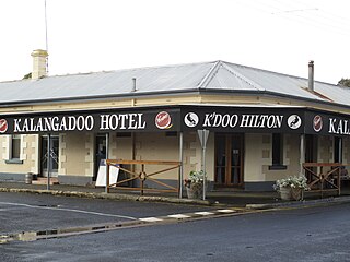
Kalangadoo, formerly Kalangadoo East, is a locality in the Australian state of South Australia located about 348 kilometres (216 mi) south-east of the state capital of Adelaide and about 31 kilometres (19 mi) north of the regional centre of Mount Gambier.

<span class="mw-page-title-main">Rail gauge in Australia</span> Narrow, standard and broad gauges of Australia

Rail gauges in Australia display significant variations, which has presented an extremely difficult problem for rail transport on the Australian continent for over 150 years. As of 2022, there are 11,914 kilometres (7,403 mi) of narrow-gauge railways, 18,007 kilometres (11,189 mi) of standard gauge railways and 2,685 kilometres (1,668 mi) of broad gauge railways. In the 19th century, each of the colonies of Australia adopted their own gauges. However, with Federation in 1901 and the removal of trade barriers, the short sightedness of three gauges became apparent. It would be 94 years before all mainland state capitals were joined by one standard gauge.

<span class="mw-page-title-main">Wolseley, South Australia</span> Town in South Australia

Wolseley is a small South Australian town near the Victorian border. It is five kilometres south of the Dukes Highway and 13 kilometres east of Bordertown. It was first proclaimed a town in 1884.

The Portland railway line is a railway line in south-western Victoria, Australia. It runs from the main Western standard gauge line at Maroona through Hamilton to the port town of Portland.

Glencoe is a town in South Australia, Australia, located 27 kilometres (17 mi) north-west of Mount Gambier. At June 2016, Glencoe had an estimated population of 661.

<span class="mw-page-title-main">Rendelsham, South Australia</span> Town in South Australia

Rendelsham is a town in the south-east of South Australia, 392 kilometres (244 mi) south east of the state capital, Adelaide. It is on the Southern Ports Highway between Beachport and Millicent.

Victoria was an electorate in the South Australian House of Assembly from 1857 until 1902 and from 1915 to 1993.

Wandilo is a north-western suburb of Mount Gambier in the Australian state of South Australia. It was named after the railway station on the Mount Gambier railway line, and is recorded to mean "a swamp where native companions resort".

Victoria and Albert was an electoral district in the South Australian House of Assembly from 1902 to 1915. The seat elected candidates of both major parties at various times. It merged the seats of Victoria and Albert, which were both recreated on its abolition.

<span class="mw-page-title-main">Pinnaroo railway line, South Australia</span>

The Pinnaroo railway line ran east from the Adelaide to Melbourne line at Tailem Bend to Pinnaroo near the South Australia / Victoria state border. The route continues into Victoria via the Victorian Railways line to Ouyen where it joined the Mildura line.

<span class="mw-page-title-main">Mount Gambier railway station</span> Former railway station in South Australia, Australia

Mount Gambier railway station was the junction station for the Naracoorte–Millicent and Mount Gambier-Heywood lines in the South Australian city of Mount Gambier. It was last used in 2006, and has since been transformed into a public community space.

Dismal Swamp is a locality in the Australian state of South Australia located about 361 kilometres (224 mi) south-east of the state capital of Adelaide and about 19 kilometres (12 mi) north-west of the municipal seat of Mount Gambier.

<span class="mw-page-title-main">Mount Gambier–Heywood railway line</span> Former railway in Victoria and South Australia

Mount Gambier–Heywood railway line is a 5 ft 3 in line located in Australia which operated from 27 November 1917 to 11 April 1995 between Mount Gambier in the state of South Australia and Heywood in the state of Victoria. It is one of two railway lines built by both state governments following an agreement in 1912 to connect to each other's railway networks. There has been calls for standardisation over the past two decades from Heywood to Wolseley since the Melbourne to Adelaide line was converted in 1995.

References

  1. Chief Engineer for Railways. "Map showing lines of railways in South Australia" (Map). Johnny's Pages. South Australian Railways. Archived from the original on 6 July 2017. Retrieved 25 November 2018.
  2. Bell, Peter; Marsden, Susan (29 September 2010). "Kingston SE – An Overview History". Professional Historians Australia (SA) Inc. p. 21. Retrieved 28 September 2019.
  3. 1 2 South Australia. Department for Transport, Energy and Infrastructure (2009), Green triangle region freight action plan, A Joint Initiative of the Victorian and South Australian Governments (PDF), Dept for Transport, Energy & Infrastructure : [Dept of Infrastructure], p. 51, retrieved 4 May 2017
  4. "Limestone Coast Railway". Johnny's Pages. Archived from the original on 9 March 2018. Retrieved 11 February 2020.
  5. Mount Gambier and Narracoorte Railway Act 1867 No. 19, Government Printer, 20 June 2008, retrieved 31 July 2015
  6. Mount Gambier and Naracoorte Railway 47 and 48 Vic., 1884, No. 327, Government Printer, 14 May 2009, retrieved 31 July 2015
  7. 1 2 3 4 5 6 Quinlan, Howard; Newland, John (2000). Australian Railway Routes 1854 – 2000. Redfern: Australian Railway Historical Society. pp. 53, 58, 59. ISBN   0-909650-49-7.
  8. "The Mount Gambier And Narracoorte Railway". South Australian Weekly Chronicle . Adelaide, SA: National Library of Australia. 18 June 1887. p. 11. Retrieved 31 July 2015.
  9. "Friday rewind – bus travel 1940s style". ABC South East SA. 16 January 2015. Retrieved 4 May 2017.
  10. "South East Rail Freight Operations" (PDF). Annual Report. Department for Transport, Urban Planning & the Arts, Government of South Australia. 30 June 2002. p. 21. Retrieved 4 May 2017.
  11. "South Australian group pushes for regional rail network return". 13 February 2019.
  12. "The Wandilo-Glencoe Railway". Adelaide Observer . SA: National Library of Australia. 27 August 1904. p. 4 Supplement: The Observer Country Supplement. Retrieved 31 July 2015.
  13. Wandilo and Glencoe Railway (discontinuance) Act, 1959. No. 27, Government Printer, 24 May 2011, retrieved 31 July 2015
  14. "Mount Gambier Line". Vicsig. Retrieved 4 May 2017.
  15. "Attachment 10 Photos of SE Railway line Wolseley to Kalangadoo" (PDF). Retrieved 29 July 2015.