Avenue Range, South Australia

Last updated

Avenue Range
South Australia
Avenue School 2.jpg
Former school building at Avenue Range
Australia South Australia location map.svg
Red pog.svg
Avenue Range
Coordinates 36°55′32″S140°10′34″E / 36.925470°S 140.176110°E / -36.925470; 140.176110 Coordinates: 36°55′32″S140°10′34″E / 36.925470°S 140.176110°E / -36.925470; 140.176110 [1]
Population112 (SAL 2021) [2]
Established3 December 1998 [3] [4]
Postcode(s) 5273 [5]
Time zone ACST (UTC+9:30)
 • Summer (DST) ACST (UTC+10:30)
Location
LGA(s) Kingston District Council
Naracoorte Lucindale Council [1]
State electorate(s) MacKillop [6]
Federal division(s) Barker [7]
Mean max tempMean min tempAnnual rainfall
21.2 °C
70 °F
8.4 °C
47 °F
601.7 mm
23.7 in
Localities around Avenue Range:
Blackford Keilira Woolumbool
Reedy Creek Avenue Range Lucindale
Reedy Creek Conmurra Lucindale
FootnotesCoordinates [1]
Locations [1]
Climate [8]
Adjoining localities [1]

Avenue Range (formerly Downer) is a locality in the Australian state of South Australia located in the state's south-east within the Limestone Coast region about 265 kilometres (165 miles) south east of the Adelaide city centre. [1]

Contents

The traditional owners of this region are the Bungandidj (Boandik) people.[ citation needed ]

In 1843 a pastoralist named John ‘Jacky’ White acquired a run of 134 square miles spanning Reedy Creek, Keilira, Crower and Lucindale. He was the first European settler in Avenue Range. [9]

Avenue Range was a stop on the Kingston-Naracoorte railway line. The first passenger train to travel on the line from Kingston to Naracoorte was on 1 September 1876 until the last on 28 November 1987 spanning 111 years. [10]

The first Avenue school, named Downer School, was built south of the railway line and operated from 1890 to 1901. A new school, built on Council of Education land opened in 1901 and operated until 1955. [11]

The locality includes the Cairnbank Homestead and Shearing Shed, which is listed on the South Australian Heritage Register. [12]

Land within the locality is used exclusively for agriculture. [13] [14]

Avenue Range is located within the federal Division of Barker, the state electoral district of MacKillop, and the local government areas of the Kingston District Council and the Naracoorte Lucindale Council. [1] [6] [7]

See also

Related Research Articles

<span class="mw-page-title-main">Electoral district of MacKillop</span> State electoral district of South Australia

MacKillop is a single-member electoral district for the South Australian House of Assembly. It was named in 1991 after Sister Mary MacKillop who served the local area, and later became the first Australian to be canonised as a Roman Catholic saint. MacKillop is a 25,313 km² rural electorate in the south-east of the state, stretching south and west from the mouth of the Murray River to the Victorian State border, but excluding the far-southern point of the state,. It contains the Kingston District Council, Naracoorte Lucindale Council, District Council of Robe, Tatiara District Council, Wattle Range Council, as well as parts of The Coorong District Council. The main population centres are Bordertown, Keith, Kingston SE, Meningie, Millicent, Naracoorte, Penola and Robe.

<span class="mw-page-title-main">Naracoorte Lucindale Council</span> Local government area in South Australia

The Naracoorte Lucindale Council is a local government area in the Australian state of South Australia located in the Limestone Coast region in the south-east of the state adjacent to the Victorian border.

<span class="mw-page-title-main">Lucindale, South Australia</span> Town in South Australia

Lucindale is a small town in the south-east of South Australia. The town is located 345 kilometres (214 mi) south east of the state capital, Adelaide. At the 2006 census, Lucindale had a population of 301. The town is best known for hosting the annual South East Field Days, attracting over 26,000 visitors every March.

<span class="mw-page-title-main">Binnum, South Australia</span> Town in South Australia

Binnum is a locality in the Australian state of South Australia.

<span class="mw-page-title-main">Frances, South Australia</span> Town in South Australia

Frances is a town in the Australian state of South Australia located about 291 kilometres (181 mi) south-east of the state capital, Adelaide and about 40 kilometres (25 mi) north-east of the municipal seat of Naracoorte in the state's Limestone Coast region and adjoining the border with the State of Victoria.

Hynam is a town and locality in the Australian state of South Australia located in the state's south-east within the Limestone Coast region on the border with the state of Victoria about 302 kilometres south east of the state capital of Adelaide and about 11 kilometres east of the municipal seat of Naracoorte.

<span class="mw-page-title-main">Kybybolite</span> Town in South Australia

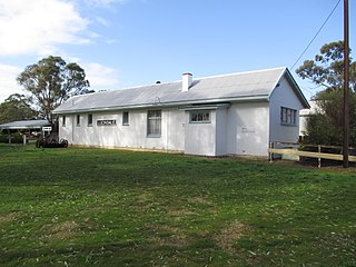
Kybybolite is a locality in the Australian state of South Australia located in the state's south-east within the Limestone Coast region on the border with the state of Victoria about 301 kilometres south east of the state capital of Adelaide and about 19 kilometres north-east of the municipal seat of Naracoorte.

Wrattonbully is a locality located within the Naracoorte Lucindale Council in the Limestone Coast in the south east of South Australia about 327 kilometres south east of the Adelaide city centre. Wrattonbully gives its name to the wine region surrounding it, the Wrattonbully wine region.

<span class="mw-page-title-main">Bool Lagoon, South Australia</span> Suburb of Naracoorte Lucindale Council, Wattle Range Council, South Australia

Bool Lagoon is a locality in the Australian state of South Australia located in the south-east of the state in the Limestone Coast region about 311 kilometres south east of the state capital of Adelaide.

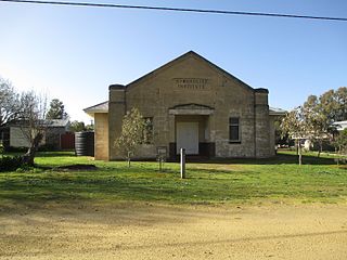
Keppoch is a locality in the Australian state of South Australia located in the state's south-east within the Limestone Coast region about 269 kilometres south east of the state capital of Adelaide and about 29 kilometres north-east of the municipal seat of Naracoorte.

Cadgee is a locality in the Australian state of South Australia located in the state's south-east within the Limestone Coast region about 280 kilometres south east of the state capital of Adelaide and about 18 kilometres north of the municipal seat of Naracoorte.

Stewart Range is a locality in the Australian state of South Australia located about 289 kilometres (180 mi) south-east of the state capital of Adelaide and about 12 kilometres (7.5 mi) west of the municipal seat of Naracoorte.

<span class="mw-page-title-main">Joanna, South Australia</span> Town in South Australia

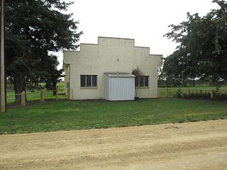
Joanna is a locality in the Australian state of South Australia located in the state's south-east within the state’s Limestone Coast region about 325 kilometres south east of the state capital of Adelaide, about 19.5 kilometres south-east of the municipal seat of Naracoorte.

Coles is a locality in the Australian state of South Australia located in the state's south-east within the Limestone Coast region about 316 kilometres (196 mi) south east of the state capital of Adelaide and about 39 kilometres (24 mi) south-west of the municipal seat of Naracoorte.

Fox is a locality in the Australian state of South Australia located in the state's south-east within the Limestone Coast region about 298 kilometres (185 mi) south east of the state capital of Adelaide and about 45 kilometres (28 mi) south-west of the municipal seat of Naracoorte.

Laurie Park is a locality located within the Naracoorte Lucindale Council in the Limestone Coast region of South Australia.

<span class="mw-page-title-main">Lochaber, South Australia</span> Suburb of Naracoorte Lucindale Council, South Australia

Lochaber is a locality located within the Naracoorte Lucindale Council in the Limestone Coast region of South Australia.

Woolumbool is a locality in the Australian state of South Australia located about 260 kilometres (160 mi) south-east of the state capital of Adelaide and about 39 kilometres (24 mi) west of the municipal seat in Naracoorte.

<span class="mw-page-title-main">Hundred of Townsend</span> Cadastral in South Australia

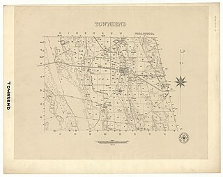
The Hundred of Townsend is a cadastral unit of hundred located in the Limestone Coast region in the south-east of South Australia.

Clay Wells is a locality in the Australian state of South Australia located in the state's south-east within the Limestone Coast region about 300 kilometres (190 mi) south east of the state capital of Adelaide, and about 39 kilometres (24 mi) south-east and about 35 kilometres (22 mi) north-west respectively of the municipal seats of Robe and Millicent.

References

  1. 1 2 3 4 5 6 7 "Search result for "Avenue Range (Locality Bounded)" (Record no SA0054134) with the following layers selected - "Suburbs and Localities", "Government Towns", and "Local Government Areas"". Department of Planning, Transport and Infrastructure. Archived from the original on 12 October 2016. Retrieved 12 April 2016.
  2. Australian Bureau of Statistics (28 June 2022). "Avenue Range (Suburb and Locality)". Australian Census 2021 QuickStats. Retrieved 28 June 2022.  OOjs UI icon edit-ltr-progressive.svg
  3. "GEOGRAPHICAL NAMES ACT 1991 Notice to Assign Boundaries and Names to Places (in the District Council of Lacepede)" (PDF). The South Australian Government Gazette. Government of South Australia. 3 December 1998. p. 1711. Retrieved 4 December 2018.
  4. "GEOGRAPHICAL NAMES ACT 1991 Notice to Assign Boundaries and Names to Places (in the District Council of Lucindale)" (PDF). The South Australian Government Gazette. Government of South Australia. 3 December 1998. p. 1711. Retrieved 4 December 2018.
  5. "Find a post - search result for Avenue Range, South Australia". postcodes-australia.com. Retrieved 12 April 2016.
  6. 1 2 "District of MacKillop Background Profile". Electoral Commission SA. Retrieved 12 April 2016.
  7. 1 2 "Federal electoral division of Barker" (PDF). Australian Electoral Commission. Retrieved 28 March 2016.
  8. "Monthly climate statistics: Summary statistics LUCINDALE POST OFFICE (nearest station)". Commonwealth of Australia , Bureau of Meteorology. Retrieved 12 April 2016.
  9. "Avenue Range - John Jacky White". Avenue Range.
  10. Hensel, Brenda; McDowell, Phyllis; Mugford, Judith (1986). Life on the Range. Naracoorte, South Australia: Hansen Print. p. 25. ISBN   0 9588265 0 1.
  11. Brenda, Hensel; McDowall, Phyllis; Mugford, Judith (1986). Life on the Range. Naracoorte, South Australia: Hansen Print. p. 31. ISBN   0 9588265 0 1.
  12. "Cairnbank Homestead & Shearing Shed". South Australian Heritage Register. Department of Environment, Water and Natural Resources. 10 April 1997. Retrieved 12 April 2016.
  13. Development Plan- Naracoorte Lucindale Council, Consolidated – 29 November 2012 (PDF). Department of Planning, Transport and Infrastructure. 2012. pp. 10, 179 & 181.
  14. "NEW TOWN NAMES APPROVED". The Advertiser (Adelaide) . South Australia. 26 July 1940. p. 10. Retrieved 5 September 2016 via National Library of Australia.